- MOUNTAIN TIME
- ¡Hablamos español!

H1 Heading Not Displayed

Disclaimer
The difficulty of this ride ranges anywhere from paved roads to technical, rocky, steep terrain. If possible, the most difficult sections of these rides will have a bypass (which is indicated in our maps if they are available), but the availability of the less difficult bypass is not guaranteed, and on occasion, the only way forward may be through a difficult section. While we try to highlight the difficult sections in the videos, specific trail conditions vary from year to year and storm to storm. We recommend that anyone attempting these rides get the most up-to-date road and trail conditions from local state, county, or land use agencies where available. If you notice any trail conditions that are different from what is shown in these videos, please send those trail condition updates to [email protected].
Battle Born South Nevada Adventure Motorcycle Ride
Admin // July 7, 2022
About
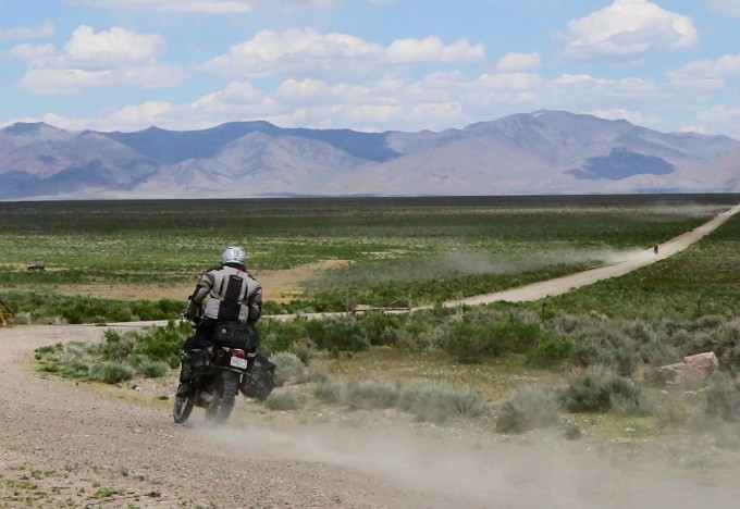
As the seventh largest state in the United States, Nevada covers an area of 110,567 square miles. Yet, 90% of the state’s population lives within the greater Las Vegas and Reno areas. Although the government claims a fair chunk of space for test sites and training ranges, and a few towns dot the terrain here and there, Nevada has nearly 90,000 square miles of remote, uninhabited land just begging to be explored.
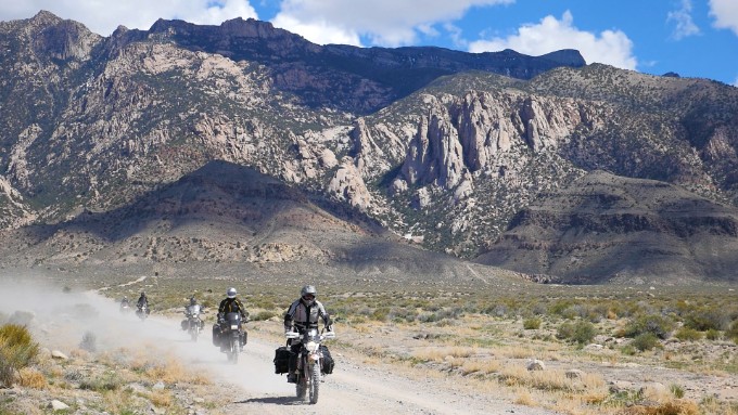
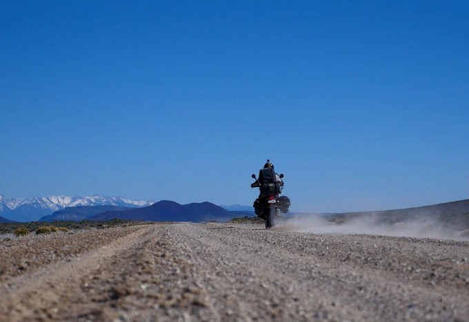
Welcome to the Battle Born South motorcycle adventure ride, a journey where you can ride for hours through the vast mountain ranges and miles of open space before ever seeing another living soul. Though Nevada may seem primitive and harsh, for those who brave a ride through this immense western landscape, you’ll be rewarded with discoveries of mining ghost towns, glimpses of wild horses, countless geological wonders and much more.
As another ride in our RM Rides Series, we’ve documented our journey and compiled it in a video series and companion blog post, making it easy for you to plan your own Battle Born South adventure. We’ve provided the GPS files below so you can follow our same route or start at any point along the route that works best for you.
Over the last three years, we’ve put together an adventure route in the Nevada desert that shows the varied beauty the state has to offer. To make it more manageable, we’ve split it up into more than one ride. This is the north part of it – a route that travels past old mining communities, out to Battle Mountain, up to the Idaho border and back down to the Bonneville Salt Flats. It takes your breath away on multiple occasions. We call it the Battle Born North ride after Nevada’s nickname: the “Battle Born State.”
As part of our RM Rides series, we’ve documented the ride and put it together in a video series and companion blog post, making it easy for you to plan your own Battle Born North adventure with your friends. We’ve provided the GPS files below so you can follow our same route.

Preparation
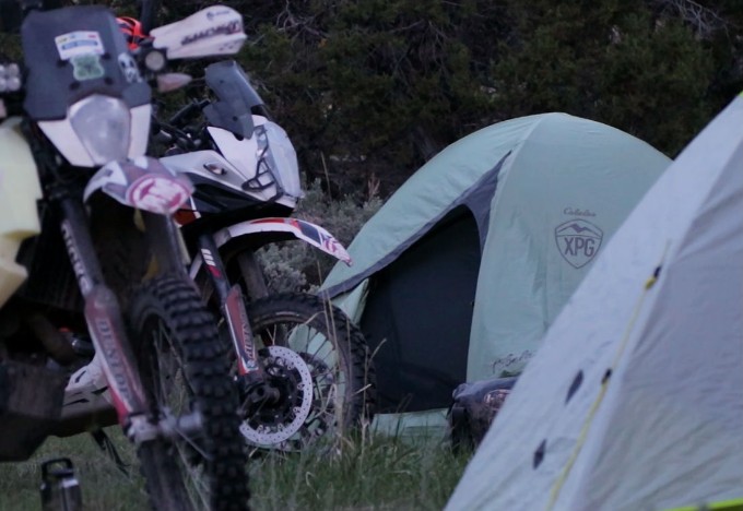
In preparation for any adventure ride, it is critical you take time to carefully plan. Not only do you need to plan routes, food and time, but you need to make sure that your bike is ready and that you have the right tools, riding gear, camping gear and emergency equipment.
Don’t forget to always watch the forecast prior to your trip. The Battle Born ride goes over mountains that are impassable during the winter and early spring when snow is on the road, and it also goes through the semi-arid desert climates of Utah and Nevada, which can be unforgiving during the peak of summer. Our recommendation is to tackle the Battle Born South loop during the late spring or early fall. Make sure that you adequately prepare for the ride. Do not travel the route by yourself.
| Section Mileage | Elevation Range |
|---|---|
| Approx. 305 Miles | 4,458 ft - 8,153 ft |
GPS File Name: Payson to Ely
GPS File Name: Ely to Lund
Payson
Next Gas Stop: 107 Miles in Delta, UT.
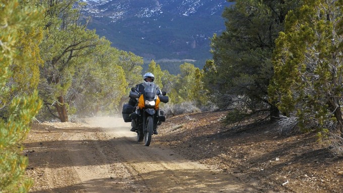
The ride kicks off at our headquarters in Payson, Utah. If you would like to start your own Battle Born South ride from our headquarters, get with us, and we would be glad to make room in our parking lot.
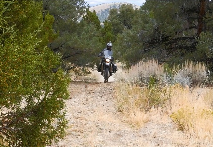
The goal for the day is to make it to camp #1, which is about 20 miles outside of Ely on the way to Lund, Nevada. You’ll start out by heading south on I-15 to Santaquin. From Santaquin, you’ll head west through town and on through the small agricultural communities of the Goshen Valley. Just before the ascent into the canyon leading to Eureka, you’ll veer left off of the highway to get your first taste of dirt for the ride.
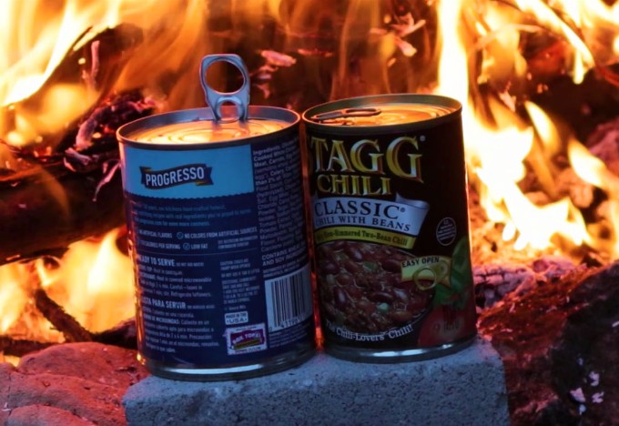
Silver Pass Road, your first dirt section, will take you southwest around Mammoth Peak through a juniper and sage covered mountain landscape before jumping across Highway 6 onto another dirt stretch, Cherry Creek Road. From here, you’ll make your way out towards Delta, which will be your first fuel stop. The Delta area is also about the last real stop for food and supplies until you get into Ely (about roughly 170 miles), so make sure you have stocked up on any water and snacks you’ll need.
Delta
Next Gas Stop: 168 Miles in Ely, NV.
For the next leg of the journey, you’ll take the slab on highway 50 until just outside of Hinkley before transferring on to the old 6 and 50 dirt road. From here, you’ll make your way west towards the House Mountain Range and Notch Peak. As the second highest vertical drop in the continental U.S. (next to Yosemite’s El Capitan), Notch Peak is a sight to behold and definitely worth a little detour down Tule Valley Road to stop and see.
After checking out Notch Peak, you’ll continue down some windy, fast dirt roads until making it back to Highway 6 and 50. This is a great place to stop, stretch, and grab a drink or snack. From there you’ll follow the pavement across the Nevada border to Osceola, where a windmill farm spreads across the valley and offers some pretty spectacular views that will leave you feeling small.
After crossing the windmill farm, you’ll find your way back to the dirt and eventually onto a tighter road that narrowly works its way up onto Cave Mountain. This section is definitely a highlight of the day with amazing views, tight single-track trails, and the highest elevation point yet as you climb over the mountain between Cooper Summit and Taylor Peak. This section does have some steep ascents and descents, which can be challenging on some of the bigger, heavier bikes.
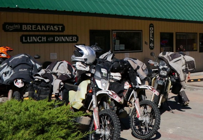
The trail off of the mountain will lead you back to the highway and into Ely, which is the next gas stop and the last stop before heading to camp #1. You’ll find plenty of great places in Ely to grab a warm meal, as well as to stock up on water or snacks for the night and for the next leg of the journey.
Ely
Next Gas Stop: 47 Miles in Lund, NV.
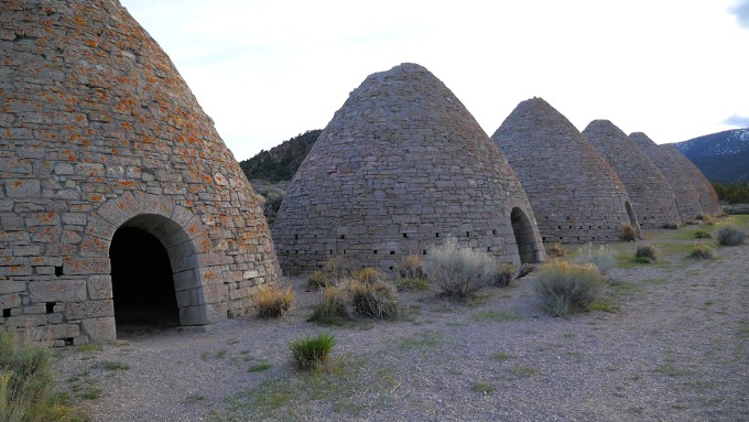
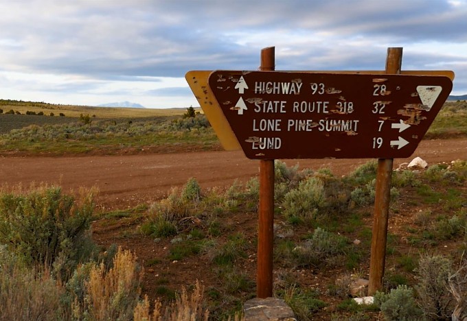
For the last stretch to camp, you’ll backtrack slightly on Highway 6 until you get to White Pine County Road 45 (Cave Valley Road) and head back out on the dirt. The Ward Charcoal Ovens State Historic Park is located down this road and is a cool place to stop and look around. The late 19th century kilns that once prepared charcoal for the smelters in the small mining town of Ward, Nevada, still stand tall today.

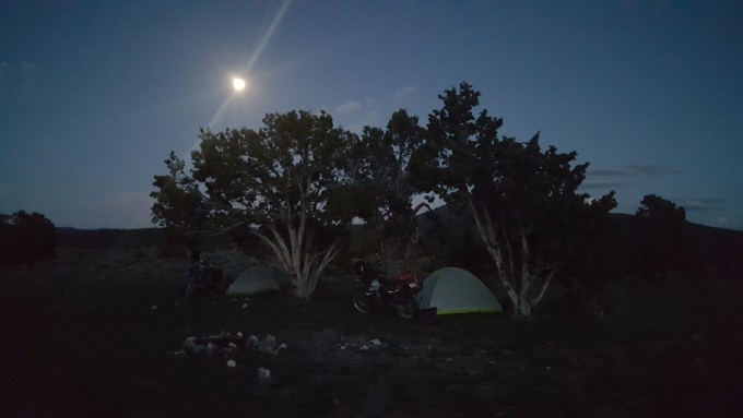
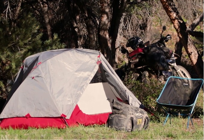
After leaving the Ward Charcoal Ovens, continue to head south on White Pine County Road 45. We continued down the road about five miles before turning towards Lone Pine Summit and finding a spot to camp towards the base of the mountains. Once you find a spot to set up camp, kick back, relax, and log a good night’s sleep to gear up for the adventures awaiting in Day 2!
Did you know that after Bob Stinson’s vehicle broke down through Marjum Pass, he sought shelter in a nearby cave and eventually turned it into his permanent residence? Interesting facts and trivia can be found by clicking the drop-down links below.
Topaz Japanese Internment Camp
During World War II and after the attack on Pearl Harbor, the US Government relocated over 110,000 men, women and children of Japanese descent from the west coast to 10 internment camps. The Topaz Japanese Internment Camp outside of Delta, UT, was one such camp. While the camp was in operation (September 11, 1942 – October 31, 1945), Topaz processed over 11,000 internees and housed around 8,300 internees at any given time. The camp consisted of 42 blocks, with 12 barracks, latrines, a recreation hall and mess hall in each. Barracks were split into apartments varying in size and were heated by coal stoves. Two elementary schools, a combined junior/senior high school, a hospital, and administration buildings were also part of the camp. Internees were often employed around camp holding positions such as farmers or teachers or doctors, and received wages ranging from between $14-$19 per month. As the internees were never tried with any crimes, many people strived to live as normally as was possible during their time at Topaz. The camp was not a forced labor or death camp, and the people could roam beyond the fences into nearby Delta or the desert to work and to shop, but they were not allowed to return to their homes on the west coast until the camp was closed.
After the closing of the camp and the internees were able to return to their homes, the buildings in the camp were either torn down or sold and relocated to other sites in the surrounding area. Some homes in the Delta area today are standing remnants from the Topaz camp. A monument currently stands near the site of the camp where footing of buildings and other camp remnants stand. Visitors are instructed not to remove any artifacts from the Topaz Camp site.
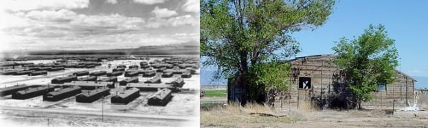
Courtesy of the Topaz Museum
Fort Deseret State Park
During the Black Hawk Indian War (1865-1872), tensions ran high between the Mormon settlers and the Native Americans who lived in the region. In July of 1865, the Mormon settlers worked for 18 days to erect a fort that would provide shelter against the Pahvant Indians for both them and their livestock. Approximately 98 men were split into two teams to see who could complete one half of the fort the fastest. The losing team would be responsible for throwing a dinner/dance for the winning team. At 550-feet square with bastions in the southwest and northeast corners, and with doors and windows on either side, Fort Deseret was constructed of adobe mud, water and straw mixed together by the feet of oxen. Sitting atop a stone foundation, the walls were originally 10-feet high, 3-feet thick at the base and 1 ½-feet thick at the top. Pieces of straw can still be seen in the standing walls today.
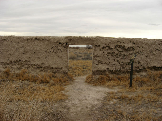
Fort Deseret, Utah by Ken Lund (CC BY-SA 2.0)
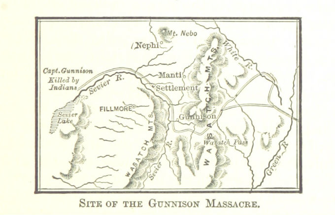
Gunnison Massacre Site
In 1853, Captain John W. Gunnison, an engineering graduate from West Point Military Academy, was leading an expedition to find and survey a transcontinental railroad route as he made his way through the Utah Territory. Following the Old Spanish Trail through Salina Canyon, Gunnison stopped in Fillmore to visit a friend, Anson V. Call. Call warned Gunnison of Indians in the surrounding area and tensions caused due to an older Indian brave of the Kanosh Tribe being killed by a California-bound wagon train. The Indian brave’s son had sworn to avenge his father. Gunnison had previously met the brave and his son and considered them friends. However, on the evening of October 28th, the party drew attention to themselves as they camped near the Sevier River and were surrounded by Indians by the following morning. Unrecognized by the Indians, Gunnison and his party were attacked and he and seven of his men were killed by guns and arrows. Four men escaped, but the Gunnison Massacre Site remains the final resting place for six of the slain men. A marker identifies the site, however, the plaque with the explanation has been moved to the Great Basin Museum in Delta for safe-keeping due to vandalism.
U-Dig Fossils: Quarry
The geologic face of the state of Utah has changed significantly throughout the history of time. Over 500 million years ago during the Cambrian Period, the first period of the Paleozoic Era, Utah was once a tropical climate and marked the western edge of North America. Nearly half of the current state lay submerged under the sea and evidence of the prehistoric marine life can still be found today in Utah’s west desert.
The Wheeler Shale Formation lies at the foothills of the House Mountain Range, forming over hundreds of millions of years as sand and sediment covered the ocean floor and colliding tectonic plates raised the land to its current position. Comprised of numerous paper-thin layers of compressed sediments, the shale is world-famous for the host of Cambrian fossils it contains – especially trilobites.
U-Dig Fossils is a quarry located approximately 52 miles west of Delta, Utah, in the Wheeler Shale Formation. For a reasonable fee, visitors are welcome to come and learn how to split the rocks and search for their own fossils. All necessary tools are provided and with a little instruction, finding fossils is easy enough for small children and exciting for the whole family. Visitors get to keep everything they find – which, depending on the time spent splitting rocks, is usually quite a haul.
Hermit's Cave - Bob Stinson's House
In 1929, Bob Stinson (a World War I veteran) was traveling to see his brother in Delta, Utah, when his vehicle broke down on the old 6 and 50 through Marjum Pass. Still 45 miles outside of Delta, Stinson sought out shelter and came upon a cave in the side of the hill. As the cave already offered three walls and a ceiling, Stinson found it easy to enclose the front of the cave with rock he extracted from the area. The resulting structure has come to be known as Hermit’s Cave.
Stinson ended up living in the cave for over 20 years. He secured a job with the government keeping Marjum Pass clear for travelers heading back and forth from Delta to Nevada. He also made an extra living by trapping bobcats and coyotes, raising sheep, growing a garden, and another skill he’d become quite notable for: brewing his own beer. Stinson was well-known and had many visitors, always offering them some of his signature brews and often receiving goods like groceries or other supplies in return. Stinson moved to Delta when he was in his 70’s after the new paved highway 6 and 50 made his job keeping the pass clean irrelevant. He died at the age of 80 and was cremated. His ashes were scattered at the base of his cave.
Notch Peak
Located in the House Range mountain range in Millard County, Utah, Notch Peak is well known as one of the highest vertical drops in the United States, second only to Yosemite’s El Capitan. Reaching 9,658 ft above sea level at the summit and 4,450 ft above the Tule Valley floor to the west, Notch Peak features a cliff on the northwest face that has an uninterrupted vertical rise of 2,200 ft. The peak is a popular destination for adventuresome hikers looking for a breathtaking, 360° panoramic view of Utah’s west desert, and for daring rock climbers seeking a challenging climb. The ridges leading up to and surrounding Notch Peak are also covered in Bristlecone pines that are estimated to be between 3,000-4,000 years old, which makes them some of the oldest-living organisms on the planet.
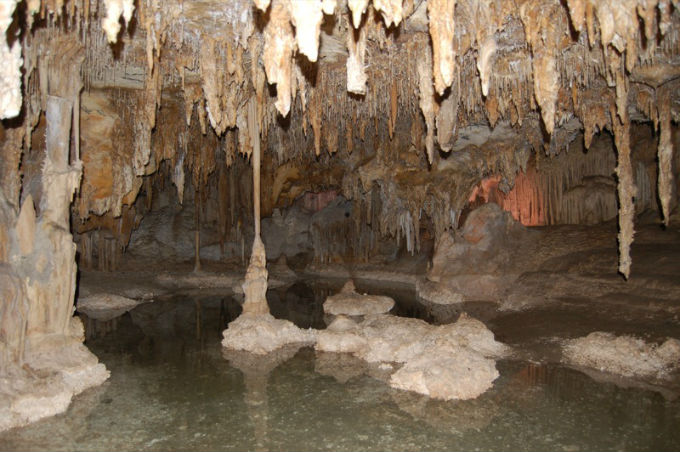
Lehman Caves
Located in Great Basin National Park, Lehman Caves are a limestone solution cavern whose beginnings can be traced back to 550-600 million years ago. Over millions of years, a mixture of carbon dioxide gasses, rain and melting snow, and limestone filtered through cracks in the ground into the caverns to create beautiful formations of stalactites, columns, draperies, flowstone, helicites, and rare shield formations. Tours of the caverns by National Park Rangers are available to book year round. Tickets can be bought at the visitor’s center, or online in advance.
Nevada Northern Railway
Ely, Nevada, and the surrounding area has been an active mining area for over 150 years. Constructed in the first decade of the 20th century, the Nevada Northern Railway served as a means to connect some of the largest copper and other ore mines in North America with the transcontinental routes to the north. The railway was also used for passengers commuting back and forth between the mining districts and the towns in the area. Daily passenger trains ran from Ely to Veteran and McGill, and school trains even transported McGill children to Ely High School. A daily passenger line also ran from Ely to the Southern Pacific Railroad connecting station on the Overland Route in Cobre until 1941.
As ore reserves began to decline over the years and the economy began to change, the combination of mines closing or freight being transported by truck eventually caused the railway to cease operation in 1983. However, beginning in 1986, the Northern Nevada Railway came to life once again after Kennecott donated all of the buildings, equipment, track lines and even company records to the White Pine Historical Railroad for preservation. Currently listed on the National Register of Historic Places, the Nevada Northern Railway Museum offers tourists the opportunity to view the operations of the rail yard and steam engines just as they were in the 20th century and to enjoy rides in the historic passenger train cars along the railway.
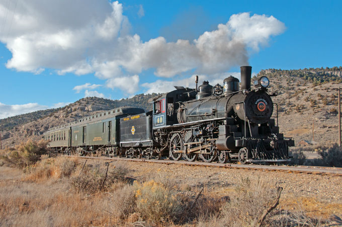
Nevada Northern Steam Locomotive 40 in Keystone Canyon by Drew Jacksich (CC BY 2.0)
Ward Charcoal Ovens
Ward Charcoal Ovens State Historic Park, located 20 minutes south of Ely, NV, is the site of six beehive-shaped charcoal ovens that have been standing for over 140 years. Rising 30 feet high and 27 feet in diameter with two-foot thick walls at the base, the ovens were built in the 1870’s out of volcanic rock called quartz latite by Italian masons referred to as Carbonari (Italian for “charcoal makers”). The ovens were used from 1876-1879 to prepare charcoal from locally harvested timber for use in the smelters that prepared silver ore in the mining town of Ward, NV.
Discontinued from use after the discovery of charcoal and shortage of available timber in the area, the ovens took on other uses such as sheltering travelers, and are even rumored to have been known as hideouts for stagecoach bandits. Though the town of Ward, NV, was made extinct after the mines closed (and after later fires and flash floods destroyed any remaining structures), the ovens remain open for touring.
| Section Mileage | Elevation Range |
|---|---|
| Approx. 290 Miles | 4,758 ft - 8,519 ft |
GPS File Name: Ely to Lund
GPS File Name: Lund to Moon Craters
GPS File Name: Lunar craters back door
GPS File Name: Moot Craters to Round Mtn
GPS File Name: Project Faultless to Austin
GPS File Name: Project Faultless to Potts Hot Springs
Day 2 of the Battle Born South ride will take you even deeper into the heart of the Nevada wilderness, rewarding you with a variety amazing views and interesting sites to stop and see along the way.
After getting a good night’s rest and eating a hearty breakfast, you’ll jump back on the dirt and make your way towards Lund. Though it’s a short 18-19 miles to Lund, depending on where you set up your campsite, you’ll be climbing over a mountain to get into town. Make sure to follow the signs and your GPS files.
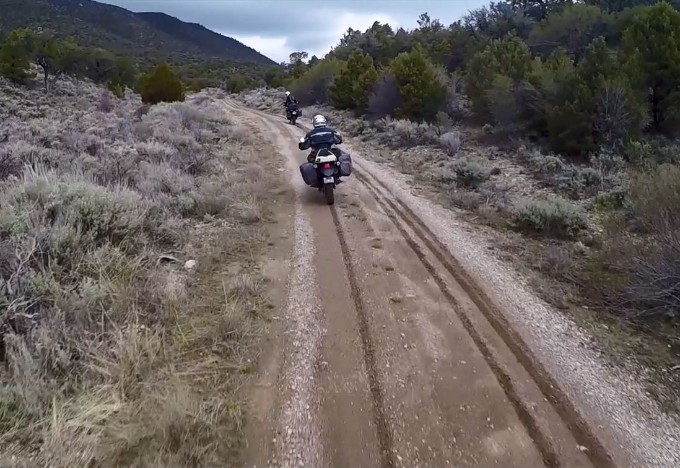
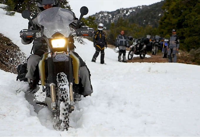
The route into Lund is lined with some beautiful views and (generally) smooth trails. If you planned the trip somewhere in between late spring and early fall, the dirt road through the high mountain passes should be traversable. However, don’t be terribly surprised if you come upon a snow drift or two, like we did!
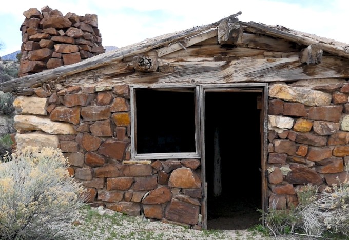
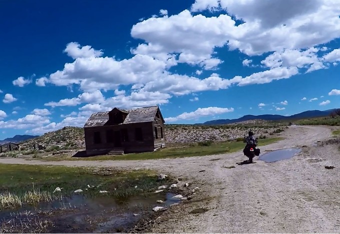
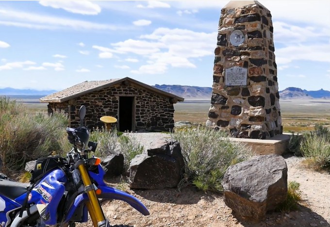
Partway down the canyon, you’ll come across an old, abandoned cabin that still boasts a few pieces of history from days gone by. Past the cabin, you’ll find yourself riding through a few rock-wall passages on your way to the the valley floor before you come out the other side. The road opens back up and heads west, leading you towards the highway. You’ll cross a cattleguard onto Sawmill Road and pop out on Highway 318 (Main Street). Turn left onto the pavement to head into town to fuel up before the next leg of the journey.
Lund
Next Gas Stop: 220 Miles in Carvers, NV.
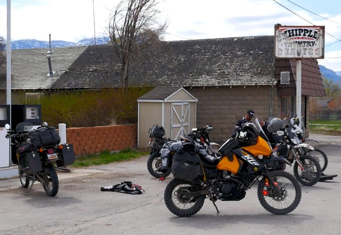
As we mentioned in day 1, fuel capacity is a big deal when you are doing an adventure ride through Nevada. The next stretch of the journey illustrates this as it’s the longest section between gas stops on the Battle Born South ride, coming in at about 220 miles. We stopped off at Whipple’s Country Store to fill up and grab any drinks or snacks we wanted to have for the ride to our next fuel stop in Carvers. Gas is only available during store hours, so plan accordingly.
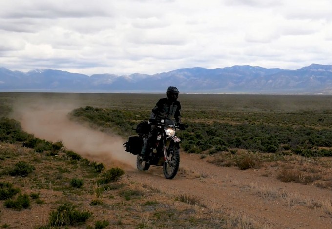
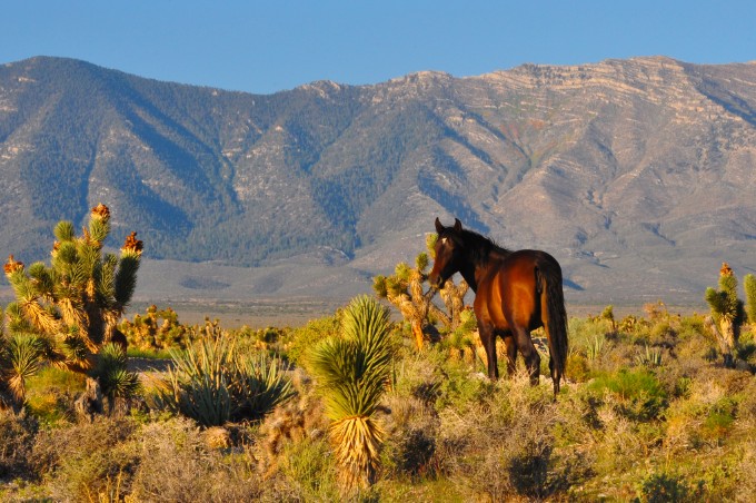
After leaving Whipple’s Country Store in Lund, you’ll head west on 1st N. Street, which quickly passes from pavement to dirt as you make your way out into the open. The remote, vast landscape of Nevada has tons of awesome things to see, some of which include wild horses. Keep your eyes peeled on this ride and you’ll likely run across a band or two of the thousands of horses that run free across the state.
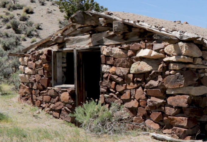
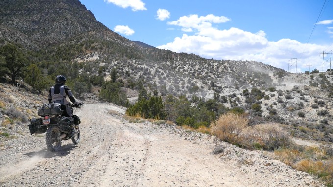
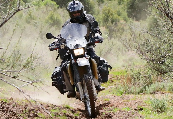
After about a 25-mile stretch across the arid terrain, you’ll come to a pretty cool rock cabin at the northeast side of Blue Eagle Mountain. This once-inhabited structure has long since had residency taken over by lizards, but it is a great place to stop and rest while you explore and chat about the ride. You’ll head south after you leave the rock cabin, and the trail will begin to morph into a more tight, rugged, and winding off-road ride that will have you grinning from ear to ear. This is where your handguards will definitely come in handy!
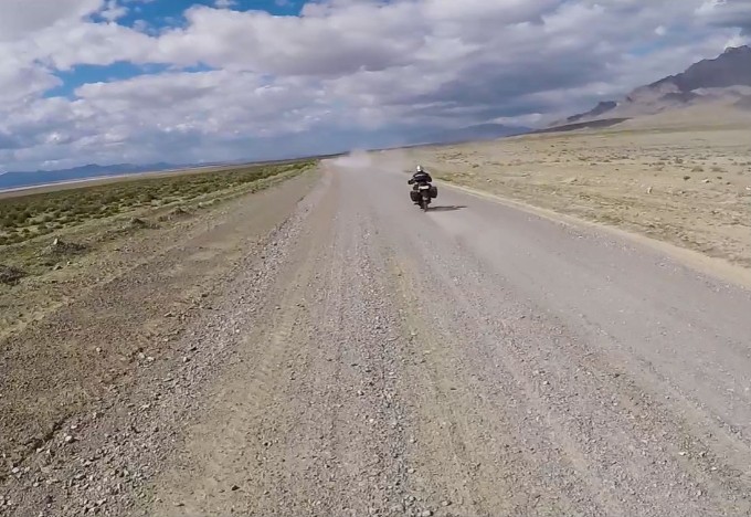
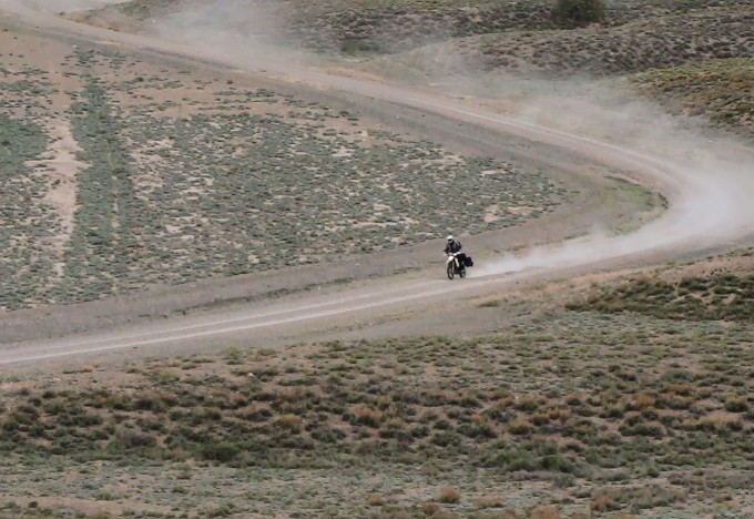
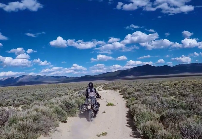
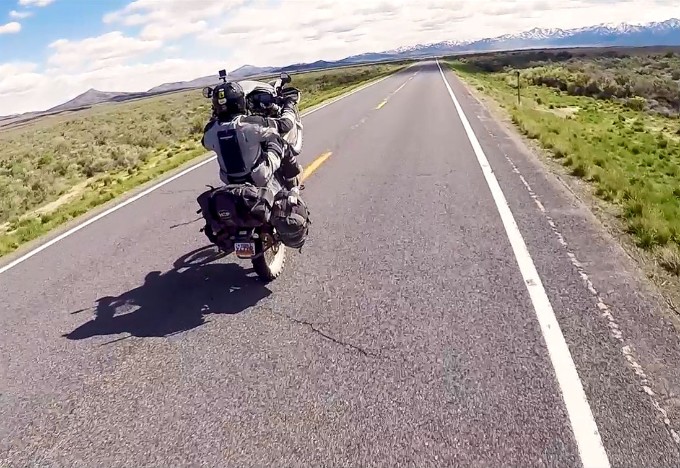
When the trail opens back up, you will soon find yourself riding on what we’ve coined as the “Super Dirt Highway.” You can sit back, stretch out, and relax as you make your way down the road. You might even be lucky to see more wild horses on the run as they parallel your ride. The dirt highway will lead back to Highway 6, which you’ll jump on and use to head southwest.
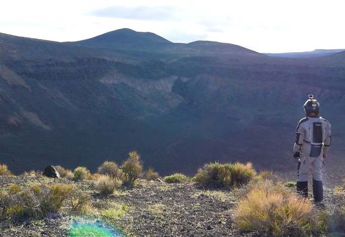
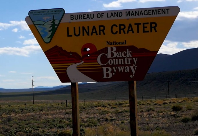
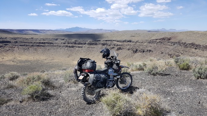
About 25 miles down Highway 6, you’ll come upon a sign marking the turnoff for the Lunar Crater Back Country Byway. This will lead you out across some sand flats and onto a massive volcanic field that boasts some pretty amazing sights.
The Lunar Crater is definitely a sight to behold. This massive landmark drops 430 vertical feet down to the bottom and is a great place to snap some pictures.
From Lunar Crater you’ll continue to follow the Back Country Byway as it loops back around to Highway 6. After a quick two and a half miles on the pavement, you’ll jump back off onto the dirt and head north towards another impressive site, Project Faultless.
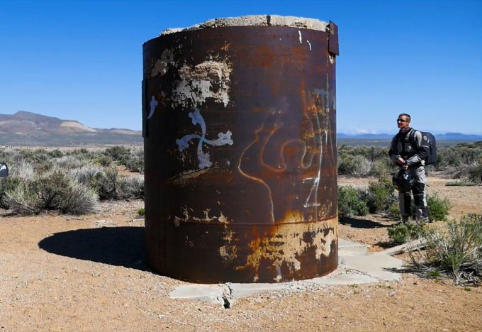
Project Faultless was an experiment done by the US government in 1968 where they drilled a massive hole in the earth, lowered an atomic bomb down a steel shaft, and detonated it in order to view the geological impacts. The resulting blast was equivalent to 1 megaton, which equates to 67 times the energy of the bomb that was dropped on Hiroshima. The explosion caused the ground to collapse in a radius of several miles, and left the steel pipe the bomb was lowered into (which previously sat flush with the ground) sticking nine feet out of the ground. The effects of the bomb can still be seen on the surrounding area today.
After leaving the old nuclear test site, you’ll head southwest towards Hot Creek Canyon. Living up to the rest of the views seen during day 2, Hot Creek Canyon follows a trail that winds through the bottom of the canyon while showcasing colorful mountains on either side. If you keep a look out, you’ll most likely see more wild horses or big horn sheep through these picturesque passes.

Even if you don’t end up spotting the herds, the beautiful rock formations through this canyon are plenty to keep your eyes busy while you make your way towards Manhattan.
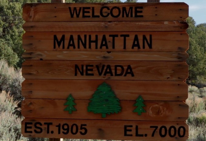
Manhattan is the last town you will come to before the next gas stop. You’ll keep heading west until you hit State Road 376, which you’ll follow a few miles north into Carvers. We stopped off at the Rebel gas station to fuel up. Carvers is the last gas stop of the day and your last chance to refill on any snacks or water before heading towards camp.
Carvers
Next Gas Stop: 60 Miles in Austin, NV.
Once you leave Carvers, you’ll head north on State Road 376 for a small stretch until you come to the Lincoln Highway. You’ll head northwest for about three and a half miles before coming to a turnoff that will lead to camp #2. From there, find a good spot where you can settle in for the night. Make sure to relax, unwind, and get some rest for Day 3!
Did you know that a nuclear bomb was detonated 3,200 feet below ground in the Nevada desert, causing the ground within a several-mile radius to collapse? Interesting facts and trivia can be found by clicking the drop-down links below.
Rock Cabin
Not much is known about the lone rock cabin that sits at the northeast side of Blue Eagle Mountain. Except for the small cabin, an old wooden corral, and a windmill that still spins in the wind, there isn’t much around besides desert wildlife. Visitors are left with only their imaginations to fill in the missing pieces.
Wild Horses
Most of the nation’s population of wild horses and burros can be found roaming across the open Nevada landscape. The Bureau of Land Management (BLM) has over 100 herd management areas across the state, and combined with the state-managed Virginia Range, tens of thousands of wild horses and burros roam free, giving travelers a taste of the legacy of the Wild West. These wild mustangs and burros were originally brought to the Americas by the Spanish, and due to descending from those domesticated animals and others released into the wild by ranchers and farmers over the years, these wild horses and burros are known as “feral” animals. Most herds of horses are broken into smaller groups of 10-12 (referred to as “bands”) and typically consist of a stallion, his mares and foals.
In the Wild Free-Roaming Horses and Burros Act of 1971, Congress declared wild horses and burros to be “living symbols of the historic and pioneer spirit of the West” and protected them from being captured, sold, or killed illegally. However, in order to keep the horse population sustainable and prevent over-population and crowding, the BLM gathers about 10,000 horses each year to be gentled, trained, and adopted. Wild horses can be adopted directly through the BLM or through several other horse rescue facilities.
Lunar Crater
The Lunar Crater is one of Nevada’s six National Natural Landmarks, and is part of a large volcanic field that covers over 100 square miles at the southwestern end of the Pancake Mountain Range. The crater sits 430 feet deep, and although it looks similar to craters found on the moon, the crater is actually a maar—a large, shallow crater that was caused by a volcanic explosion when magma and groundwater collided. In addition to the Lunar Crater, the volcanic field also features another maar called Easy Chair Crater along with several cinder cones, lava flows, fissures, and ash hills.
Project Faultless
Project Faultless was an underground thermonuclear test by the Atomic Energy Commission (AEC, or Department of Energy today) that took place in the Central Nevada Test Area. Project Faultless was originally planned to take place at the Nevada Test Site, however, the uneasiness of the nearby Las Vegas residents resulted in the project being diverted to the new testing grounds. The explosion was scheduled to be set off on January 19, 1968. A hole was drilled to a detonation depth of 3,200 feet and the bomb was lowered down through a steel pipe. The purpose of the project was to run a calibration test to determine the geological impact of underground nuclear testing in the area. Yielding an estimated 1.0 megatons, the bomb was rated at 67 times more powerful than the nuclear bomb dropped on Hiroshima.
The effects of the bomb were tremendous. After an initial ground swell of approximately 15 feet, the ground within a several-mile radius of the drop site collapsed, with great fault lines emerging all throughout the region. The steel pipe the bomb had been dropped into for detonation, previously flush with the ground, sat nine feet above the dirt once the ground had settled. An enormous underground cavity was created measuring approximately 2,460 feet high and 820 feet in diameter. Littered with more than 500,000 metric tons of radioactive rubble, the cavern will be highly contaminated for thousands of years. Fortunately, the steel pipe was sealed with cement to trap the radiation particles from emerging, and all future underground nuclear tests for the area were cancelled due to the devastating geological effects. A plaque now hangs on the pipe to mark the site as a memorial and historical landmark. Though the surface appears to be radiation-free, picking up any materials found on the ground at the site is strictly prohibited.

| Section Mileage | Elevation Range |
|---|---|
| Approx. 246 Miles | 5,651 ft - 8,607 ft |
GPS File Name: Project Faultless to Austin
GPS File Name: Austin to Eureka
GPS File Name: Eureka to Fort Ruby
GPS File Name: Ft Ruby to Ely
The start of day 3 marks the halfway point of our Battle Born South adventure ride, with two full days of riding behind us and two still to come. Most of the miles covered during today’s stretch are off-road, providing you with more great trails to ride and awesome sights to see.
After packing up camp and getting the bikes ready to go, a quick ride into Austin will give you the option of a nice, warm breakfast to start your day off right. You’ll also want to fuel up your bike and grab some snacks to prepare for the next leg of the journey. The next stop with amenities won’t be until Eureka, 117 miles away.
Austin
Next Gas Stop: 117 Miles in Eureka, NV.
After topping off your tank and refilling your water and snacks, jump on the Lincoln Highway and head east out of Austin. You’ll follow the Lincoln Highway back through the mountains, and once you come out the other side, you’ll jump off onto the dirt road to your right. You’ll follow the dirt across State Road 376 as you make your way towards the first point of interest for the day, Spencer Hot Springs.
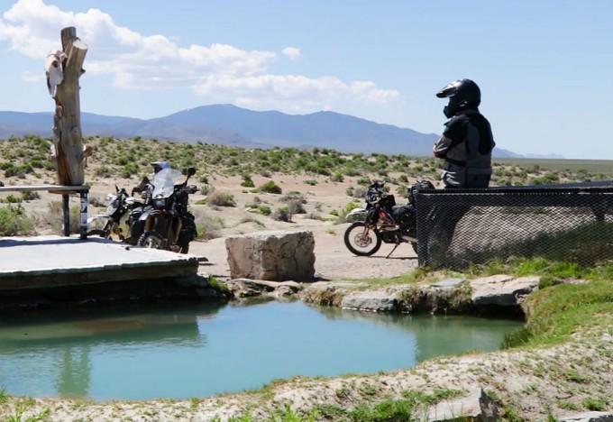
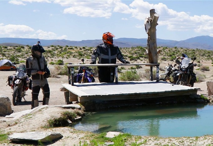
Spencer Hot Springs is just one of the many geothermal hot spring sites found throughout Nevada. With three different pools to choose from, it is definitely a cool place to stop and check out. The springs are warm all year long, which makes them a pretty popular destination for travelers and locals alike. Don’t be surprised if you stumble upon others already using the springs when you arrive.
Continuing southeast down the road from the hot springs, you’ll follow the trail into the hills. Toquima Cave, a sacred cave with deep spiritual meaning to local Native Americans, sits back in these hills. Though the majority of the cave is closed off to the public, the walls of the cave are visible and are lined with pictographs from ancient inhabitants. We didn’t stop off at the cave, but continued on to pass through Potts Ranch.
After Potts Ranch, you’ll climb your way back up out of the valley and wind around Horse Heaven Mountain. This section is tons of fun as the landscape is continually changing and the elevation varies along the way. You’ll pop out into the desert where the big skies and wide open spaces offer the perfect setting for an adventure ride.
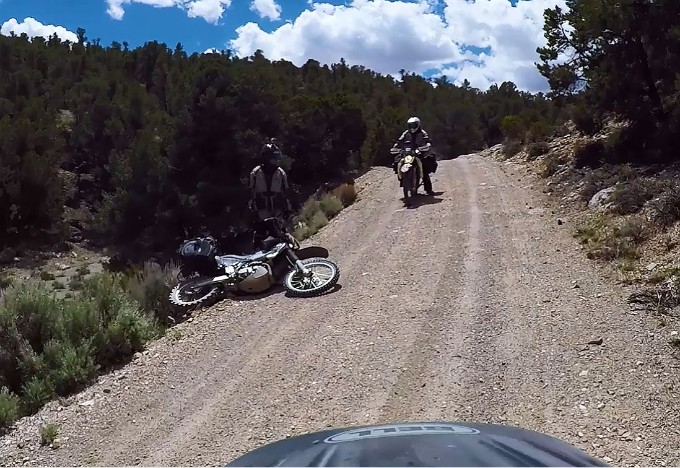
As you make your way around the base of Dave Keane Mountain, there are plenty of fast gravel roads to ride. However, if you don’t navigate these roads carefully, you might find yourself going a little too fast for your circumstances. An off-camber turn taken a little too quickly can result in going off the road or dumping the bike. We got a little taste of this on our ride, but luckily no one got hurt.

You’ll continue to follow the smooth gravel roads through the hills and into the valley with beautiful views on every side, eventually meeting up with State Road 379. The road will then meet up with the Lincoln Highway (Highway 50) and lead you into Eureka for your next gas stop of the day.

Eureka
Next Gas Stop: 161 Miles in Ely, NV
Eureka is a cool little mining town on the Lincoln Highway that is rich in history and small town character. We spent the time in town resting up, refilling our fuel tanks and stocking up once again on water and snacks before we jumped back on the highway.
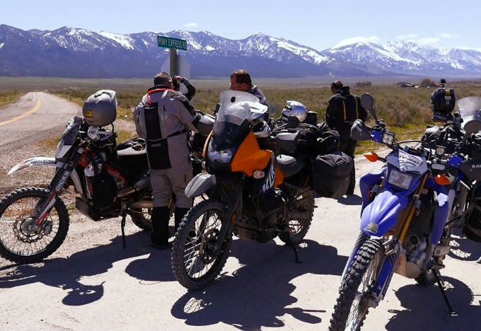
Heading north out of Eureka, you’ll connect with the Pony Express route before cutting west across Diamond Valley towards Telegraph Canyon. This route will take you up and over the mountains between Diamond and Christina Peaks.
The road through the canyon tightens up fast and turns into a fun two-track trail that will test your skills. This trail will lead you to the summit, where you will find a couple of different course markers—one for the Pony Express route, and one marking the Overland Trail.
After reaching the summit, you’ll make your way down the other side of the mountain and across the flat valley floor toward the Ruby Mountains. After passing between Sherman and Big Bald Mountains, you’ll make your way over to Fort Ruby. Once home to hundreds of soldiers who longed to fight in the Civil War, the men and their families had been stationed at the post while waiting for further instructions. Long since abandoned, several of the buildings have been refurbished and can be viewed by taking an interactive tour onsite.

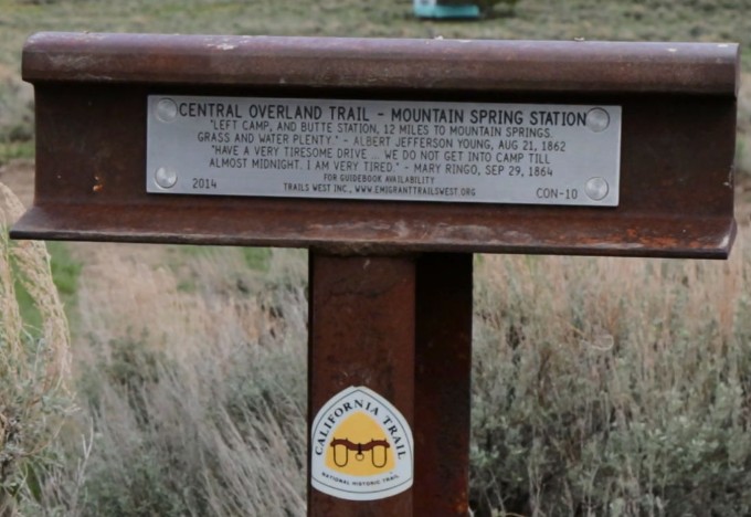
When you leave Fort Ruby, you’ll jump on the Overland Road and ride towards Mountain Spring, an old station along the Central Overland Trail.
You’ll continue east from Mountain Spring on Overland Road and travel through another twisty canyon pass before coming out onto a large, open flat. Sandwiched in between two mountain ranges, the beautiful views on this stretch span for miles in every direction.
After crossing another small pass as well as another large flat, you’ll head south on White Pine County Road 19 alongside Black Mountain before heading east and jumping back onto some two-track canyon trails. This canyon is beautiful with its tall grass, numerous trees, and colorful hills in every direction. The trail is fast and easy, and it’s a fun section to ride. After exiting this canyon, you’ll head south towards Telegraph Peak and find a place to camp in the hills.
Rest up, grab some grub, and get ready for your final day of the Battle Born South Adventure ride!
Did you know US Highway 50 was named “The Loneliest Road in America” by Life Magazine in 1986? Interesting facts and trivia can be found by clicking the drop-down links below.
Stokes Castle
Located just outside the western end of Austin, Nevada, the Stokes Castle sits on a hill overlooking the Reese River Valley for as far as the eye can see. Built as a summer home for his family and friends, Anson Phelps Stokes (a wealthy mining and railroad man during the silver mining boom in Austin) constructed the castle to mirror one he had seen while in Italy. Local workers began building the tower in 1896 using native granite for the stone blocks and hoisting them into place with a hand-cranked winch.
The tower is three stories tall and consisted of a kitchen and dining area on the bottom floor, a living room on the second floor, and two luxurious bedrooms on the third. The top two levels also had wooden decks, and the roof was also a terrace. Construction was completed in 1897. The Stokes family used it a number of times during 1897 and 1898, but Stokes sold the castle in 1898, along with his shares in the mine. The family left Austin soon after. The castle has remained empty ever since. One of Stokes’ cousins purchased the tower in 1956 to keep the building from being moved to Las Vegas. Instead, the cousin eventually gave the structure to a local Austin resident to care for. In 1996, the site was listed on the National Register of Historic Places in 2003.
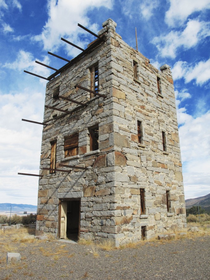
Stokes Castle, Austin, NV by Helen Gordon (CC BY 2.0)
Hickison Petroglyphs
Located about 25 miles east of Austin just off of the Lincoln Highway, the Hickison Petroglyph Recreation Area is a great place to stop and get a look at ancient rock engravings (petroglyphs) that date all the way back to 10,000 BC. Easy walking/hiking trails and a BLM-provided brochure will let you take a self-guided tour of several rock faces where a prehistoric people left their story. The site also includes several campsites and picnic areas, and even offers pit toilets. There is no water or other amenities on site.
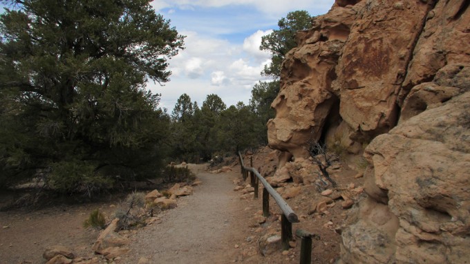
Hickison Petroglyphs by Jeff Moser (CC BY-ND 2.0)
Spencer Hot Springs
Truly a wonder of the West, geothermal hot springs can be found in numerous locations throughout the region, from Mexico all the way to Alaska. Spencer Hot Springs is remotely located about 32 miles southeast of Austin and is an excellent stop for soaking in some warm pools – especially in the cooler months. Warmed from beneath the earth’s surface, three springs flow into primitive tubs and pools (both man-made and natural), offering visitors a range of temperatures and locations to choose from. Several of the pools even have a school of goldfish ready to greet you! The location has become quite well known and has several camping spots to choose from, so chances are good that you might encounter other visitors during your stay. A word of caution; hot springs tend to attract visitors who like to enjoy the water sans clothing, so approach an occupied pool at your own discretion.
Toquima Cave
Located near the dead center of Nevada within the Toquima Mountain Range lies Toquima Cave. This shallow cave is rich in history as well as in cultural and spiritual significance for Native Americans–especially the Western Shoshone. Lining the walls of the cave are colorful, hand-painted pictures (pictographs) that date back to 1,000 BC to 500 AD in origin. Specific meaning of the drawings is not known, and although the cave is fenced off, over 300 drawings in red, white, black and yellow colors can be seen through the barricade. The cave can be reached after a half-mile hike up to Pete’s Summit from the Toquima Cave Campground.
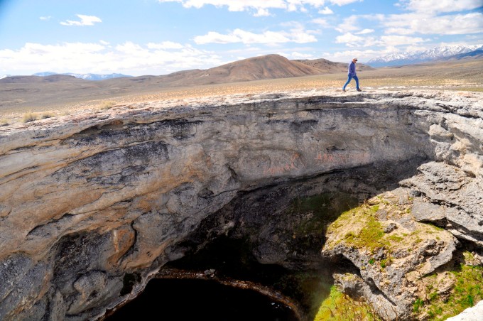
Diana's Punchbowl
Another of Nevada’s many geothermal hot springs, Diana’s Punchbowl (a.k.a. the Devil’s Cauldron) is a different experience than the rest and definitely worth a visit. What initially seems to be an ordinary mound of dirt from a distance is actually a steep-walled bowl in the ground that drops about 75 feet down into a travertine depression. At the bottom of the bowl sits a steaming pool that generally ranges in temperature from around 140-180 degrees Fahrenheit – making this pool much too hot to soak in! The sheer walls of Diana’s Punchbowl are nature’s way of protecting spectators from being tempted to take a dip the water since, if you fall in, there isn’t really a way to climb back out. There is a stream that flows water out from the pool at the south side of the mound. The stream is shallow and has generally cooled off enough not to burn visitors who might want to test the water. The feature is located on private property, so spectators are asked to treat the location with respect and care.
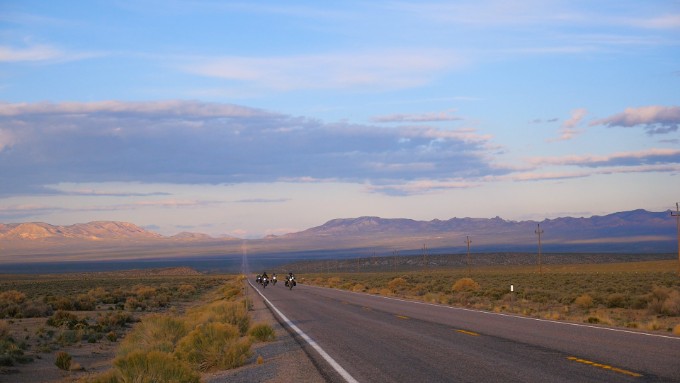
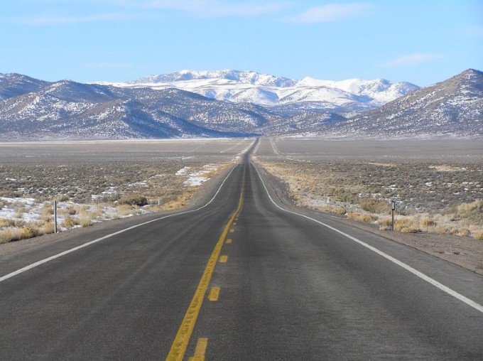
Loneliest Road in America (US Highway 50)
US Highway 50 is a transcontinental highway that spans across the USA from Ocean City, Maryland, to Sacramento, California. In 1986, Life Magazine named the Nevada portion of Highway 50 “The Loneliest Road in America.” As part of the Lincoln Transcontinental Highway, the Overland Route, and the Pony Express, the road boasts plenty of history. However, it’s easy to see why the section of highway that spans from Fernley to Ely might be deemed lonely—there are only a handful of stops and towns along the 287 mile stretch with any sort of civilization.
Though dubbing the road with the title of “The Loneliest Road in America” was meant to be a jab, locals embraced the title, and motorists have been taking the challenge ever since to see if they can tackle this lonely stretch of highway. A survival guide has even been created that allows you to get your “passport” stamped at certain stops along the road. If you receive the required amount of stamps and mail in the corresponding page of your survival guide, you receive a souvenir and certificate naming you as an official Highway 50 Survivor.
Hwy 50 by Clark Weber (CC BY-ND 2.0)
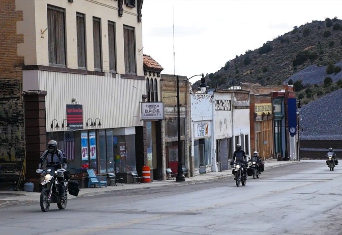
Eureka, NV
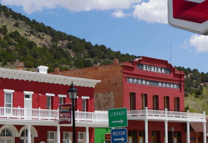
Proudly boasting the motto of “The Friendliest Town on the Loneliest Road in America,” Eureka is one of the oldest and best-preserved mining towns in Nevada. Rising to its peak population in the 1870s and 1880s, the town was home to over 9,000 people who were capitalizing on the rich ore deposits in the surrounding hills. The town had all the amenities of a thriving mining town in the old west—saloons, banks, breweries, and plenty of entertainment to go around. Though by the 1890’s most of the mining had died down and the people had moved on, the character and spirit of the town remained.
Over 100 years later, many of the structures in town still remain and have been renovated for the enjoyment of the public. Eureka’s famed Opera House is the city’s main attraction, and currently hosts all kinds of events, from conventions, to performances, and even dinner theater. Other buildings have been refurbished as well, such as the Eureka Sentinel Building and the Jackson House. As one of the only civilized stops along Nevada’s Highway 50, Eureka is a great place to stop for lodging, gas, food and a general taste of the Old West.

Fort Ruby
Located almost exactly in between Salt Lake City, UT, and Carson City, NV, Fort Ruby once was the home to hundreds of military troops and their families. Known as the “worst post in the West,” soldiers stationed at Fort Ruby were assigned to guard and protect the Overland Stage Line and Mail Company routes from Austin, NV, to the Utah—Nevada border. Constructed in 1860, soldiers worked hard to get the camp ready by winter. Though the soldiers longed to go serve in the Civil War, many of them would spend the next several years at Fort Ruby (or Camp Ruby) instead. The camp officially closed on September 20, 1869. Railroads had made their way west, making the Overland Stage Line obsolete. The soldiers abandoned the fort soon after. After over a century of private ownership, Fort Ruby underwent a massive archaeological project to see if any original artifacts could be found and preserved. The remaining buildings have been refurbished, and an interactive trail can now be taken if you’re visiting the site.
| Section Mileage | Elevation Range |
|---|---|
| Approx. 301 Miles | 4,292 ft - 9,075 ft |
GPS File Name: Ft Ruby to Ely
GPS File Name: Ely NV Pony Express to Vernon
GPS File Name: Vernon to Payson
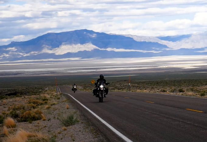
The fourth and final day of the Battle Born South adventure ride is here! After three full days of riding, it is time to head back across the Nevada–Utah border and make your way home. But just like every other day so far, there are plenty of sights to see and awesome roads to ride before the day is done.
It’s just over a 40-mile ride into Ely to start the day off, so you will probably want to prepare some breakfast before jumping back on the bikes. Once you eat and clean up camp for the final time, you’ll hop back on the dirt and begin the ascent towards Telegraph Peak.

The trail is full of switchbacks and winding turns as you make your way up and over the mountain, providing an exciting start to your day. After cresting the mountain, the trail begins its decent and changes scenery by entering into a narrow rock canyon. After coming out of the canyon, you’ll follow Mountem Neva Road until it connects up with the Lincoln Highway. You’ll then follow the highway south for a few miles through McGill and into Ely for the first gas stop of day 4.
Ely
Next Gas Stop: 210 Miles in Vernon, UT
Gas used to be available in McGill, but as the gas station has since been shut down, Ely is the next option. Take a break if you need, and restock your snacks and water. The next gas stop won’t be until Vernon, UT, 210 miles down the route.
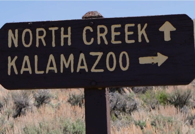
When you are all gassed up and ready to roll, jump back on the Lincoln Highway and head north. You’ll retrace your steps until just outside of McGill, where you’ll take a right on White Pine County Road 29. You’ll follow the road through a small pass and then hook a left back into the dirt on NF-427. This road turns into a fun, winding trail that leads you up and over the Kalamazoo Summit.
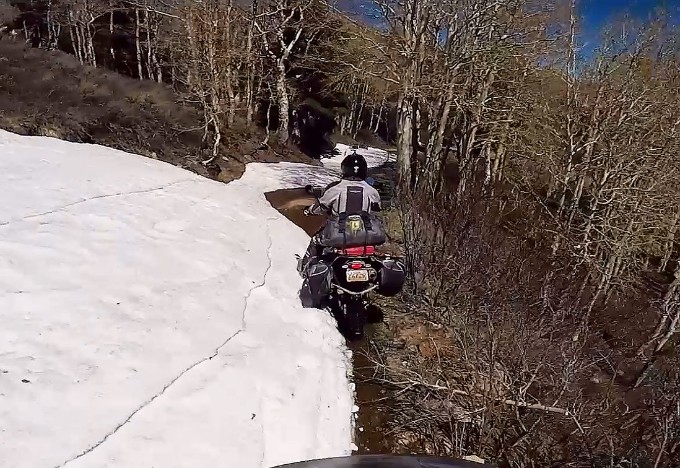
We got our second taste of the snow on the backside of the mountain as we made our way down. Some passes were much clearer than others, and though it would have probably been faster to take a different route, the scenery along this route can’t be beat. With a little bit of patience and persistence, we made it back to clear trail.
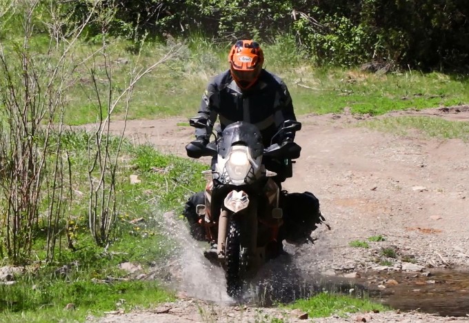
As you continue down the canyon, you’ll find your ride surrounded with tall pines. This is a fun, winding section through trees and over little streams that eventually leads you back to the pavement.
Heading north on White Pine County Road 31, the pavement quickly gives way to dirt. You’ll take a right onto White Pine County Road 32, an old section of the Lincoln Highway that leads you towards the Utah state line.
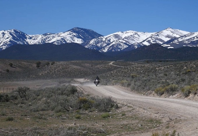
The roads between Kalamazoo and the Utah state line are wide, open gravel roads where you can sit back, relax, and pick up some speed as you ride.
Ibapah is a tiny town on the very western edge of Utah. It was originally established by Mormon missionaries to help teach local Native Americans how to farm. Over half of the current population is Native American to this day. Ibapah also served as a stop along the Pony Express. We used it as a place to take a break as well.
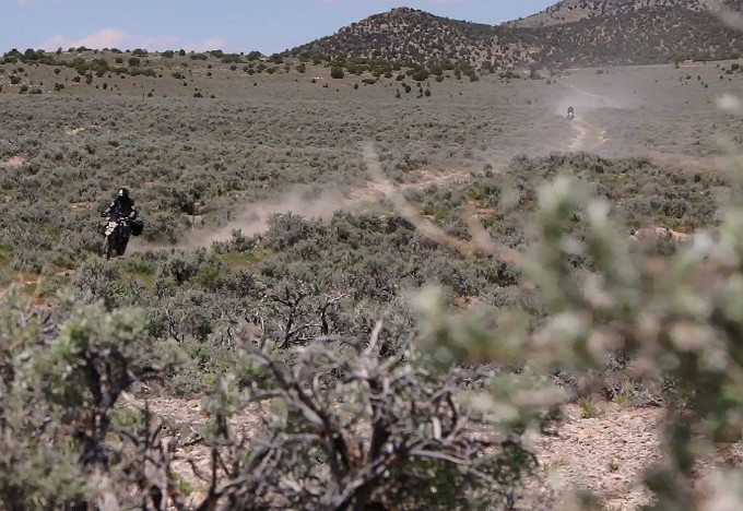
After leaving Ibapah, you’ll follow the Pony Express and Overland Trail on your way towards Blood Mountain.
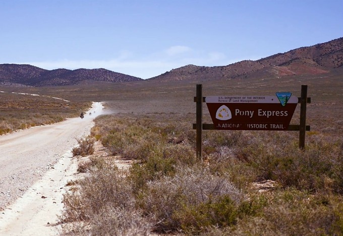
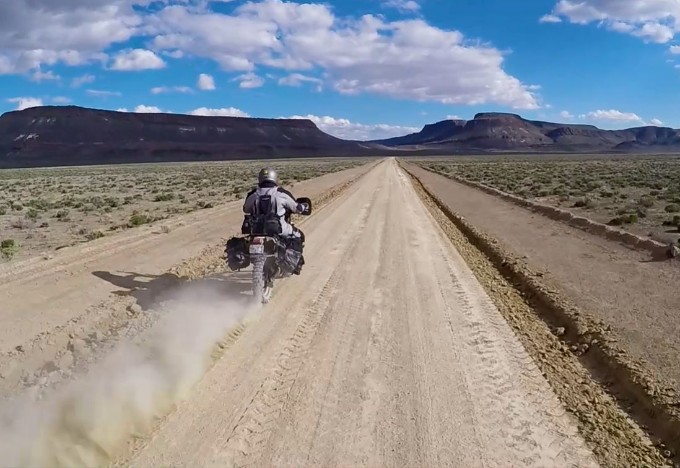
You’ll find yourself riding along an original section of the Pony Express and Overland Trails, a two-track route that early pioneers and settlers traveled using horses, stagecoaches, and wagons. It is definitely a piece of history that will cause you to think of those who came before and the hardships they faced as they crossed the desert plains.
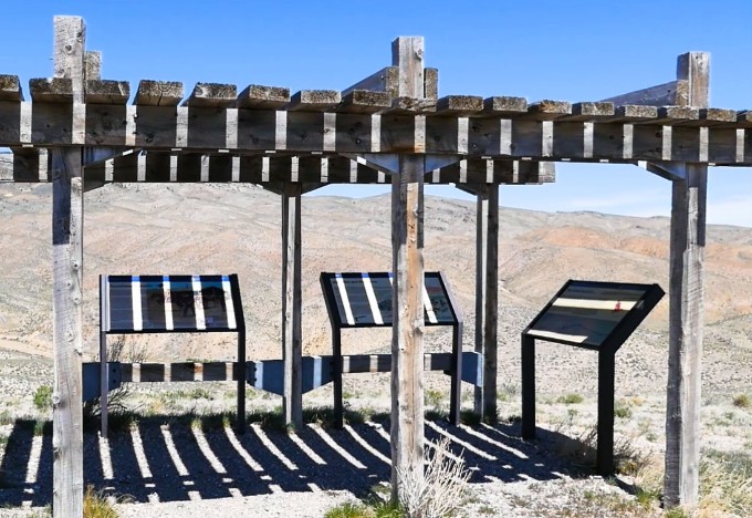
The two track eventually opens up again to a wide, fast gravel road. You’ll find another cool piece of history along this route—the old Pony Express Canyon Station. The original station burned down during an Indian attack, but has been rebuilt and stands as a monument today. We took a break at Canyon Station to rest up and ponder on the history of this place.
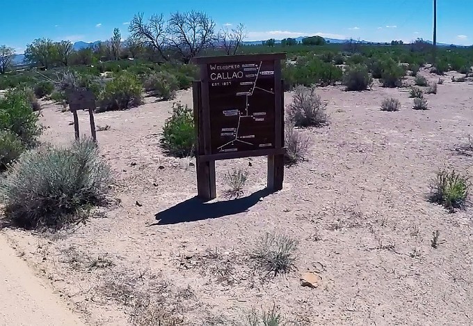
The Pony Express trail will lead you from Canyon Station down into Callao, another tiny Utah community in the middle of nowhere. This town also served as a stop along the Pony Express and Overland Trails. There are no services or paved roads in Callao, but the small farming and ranching community is rich in history.
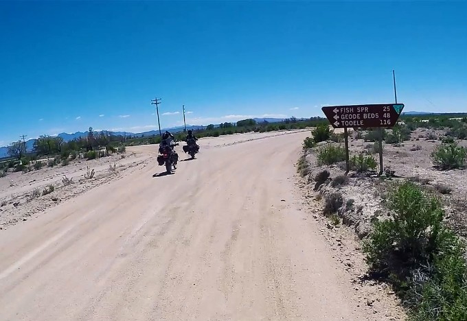
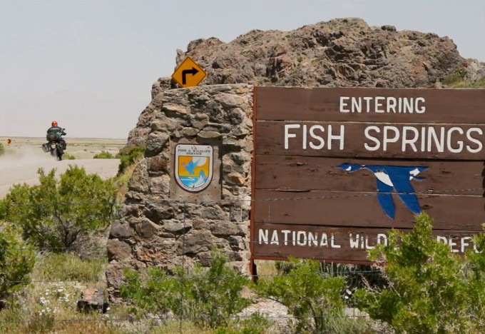
From Callao, you’ll follow the Pony Express and Overland Trail east where you come to the Fish Springs National Wildlife Refuge. Fish Springs was especially popular for travelers of the Pony Express, Overland Trail, and Lincoln Highway due to its year-round supply of water—not a common occurrence in the west desert. In the late 1950s, the refuge was established to protect migratory birds within the Pacific Flyway. Today, birdwatchers and travelers frequent the refuge to see the diverse population of birds and plants the refuge houses.
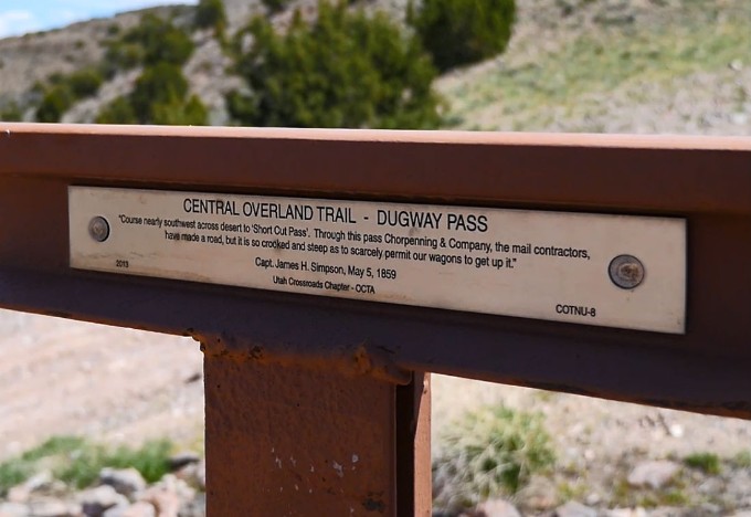
From Fish Springs, you’ll continue east along the desert landscape. Many monuments marking significant points for the Pony Express route are found along this ride. The road will lead you up to Dugway Pass, an excellent place to stretch your legs and take a look at the beautiful view that extends out before you.
The road opens up into a wide valley after leaving Dugway Pass, and the gravel roads once again give you the opportunity to open up the throttle and cruise.
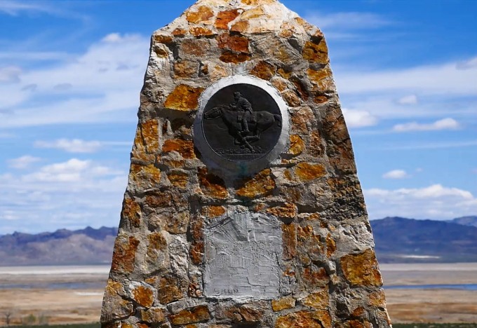
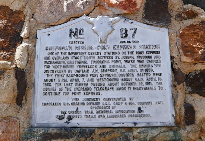
Waiting at the other end of the valley is Simpson Springs, another important stop along the Pony Express trail. Water from the spring was incredibly important to travelers making their way both east and west. For modern travelers, a luxury like a pit toilet is also a welcome sight. Simpson Springs is a cool place to read up on the history of the Pony Express trail while you take a little break.
After leaving Simpson Springs, your next destination will be Vernon in order to fill up on gas for the second, and final, time of the day. You’ll follow the Pony Express along the fast gravel roads until you meet back up with the pavement of Silver Sage Road.
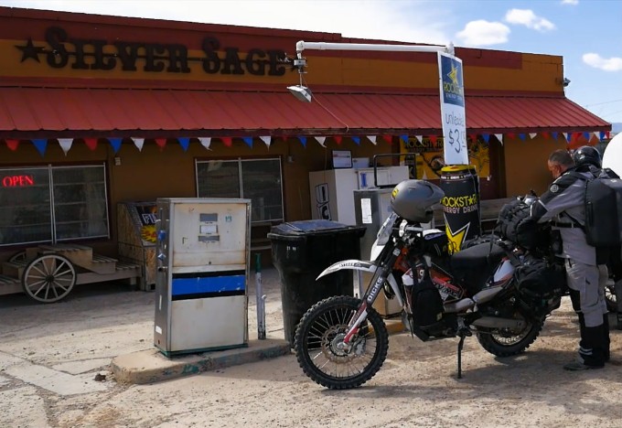
Vernon
Final Gas Stop
It’s a quick couple of miles into Vernon once you reach the pavement. The Silver Sage gas station is a tiny place along the side of the highway. It offers primitive gas pumps which are only available during store hours—10:00 AM to 8:00 PM every day. If you’re hungry, the Silver Sage has a grill that offers a great burger. Otherwise, you can find a nice selection of snacks in the store to give you energy for the rest of the ride.
After leaving Silver Sage, you’ll follow the pavement for about 23 miles and slab it back into Eureka, an old mining community in the Tintic mining district. From Eureka, you’ll take an easy ride through the canyon, across the Goshen Valley, and back the rest of the way into Payson to our RMATV/MC warehouse once again—about a 24-mile ride.
This marks the end of our 1200-mile Battle Born South adventure ride, one of our favorite rides to do as ADV and dual-sport riders. We hope that our journey has inspired you to plan your own adventure ride, to get out and explore the vast wilderness and rich history that Nevada has to offer. Make sure to download the GPS files so you can follow the route yourself. If you have any questions concerning the route or how to plan your own ride, email us at [email protected] and we’ll be happy to help you out. If you do plan your own Battle
Born South adventure ride, make sure to let us know how it goes in the comments below!
Though this ride is done, the adventure isn’t over! Check out our Battle Born North adventure ride, a companion ride to Battle Born South with tons of awesome trails that traverse the northern section of Nevada. Don’t forget to subscribe to our YouTube channel to check out our awesome rides and stay up to date on future adventures in the RM Rides Series!
Did you know the Pony Express offered a way to transport mail from Missouri to California in 1860 in only 10 days instead of the normal 25? Interesting facts and trivia can be found by clicking the drop-down links below.
Canyon Station (Pony Express)
Located several miles west of Ibapah, Utah, Canyon Station was one of the 27 Pony Express stations that served as waypoints for riders as they carried information across the American West. Built in 1863, Canyon Station was actually the second station to be built in the area. The original station was located up the nearby canyon and consisted of a stable and a dugout—a shelter/cabin built into the surrounding terrain. This original station was built in 1861 but was destroyed and burned to the ground when Native Americans attacked the outpost in 1863. Canyon Station was built later that same year. The previous station became known as Burnt Station, and the canyon was renamed Blood Canyon in light of the attack and the men that had been killed. The constant threat of attack lead the new Canyon Station to be built high above the mouth of Overland Canyon. Canyon Station was locally known as Round Station due to the only visible remains of the station being a round, stone fortification that featured visible gun ports. Excavations indicated little use of the station after 1870, but the BLM has stabilized the remains and built a parking lot and viewing area for visitors.
Callao
Callao is a tiny farming and ranching town on the far western end of Juab County near the Utah/Nevada border. While the town has no services and it’s a 90-mile drive to the north just for fuel, it’s a town that has preserved its rich role in history. Once known as Willow Springs, Callao sits on the old Overland and Pony Express routes and served as a station and waypoint for riders. The old station is still intact and can be viewed once you get permission from the land owner. Tucked up against the picturesque Deep Creek Range, the town is home to about 70 or so residents whose residencies can be located on the map greeting you as you come into town.
Fish Springs National Wildlife Refuge
The Fish Springs National Wildlife Refuge is a naturally occurring oasis located at the far southern end of the Great Salt Lake Desert. The refuge’s 17,992 acres are dominated by wetlands which are fed by a series of underground springs found along the base of the Fish Springs Mountain Range. The springs naturally force water to the surface through geological faults and permeable rock, and this water has served as a critical resource to the surrounding wildlife for thousands of years. In more modern times, travelers of the Overland Trail and Pony Express valued Fish Springs as resting point. As a true oasis, the area provided rest, water, and food in the form of fish. In fact, these fish are believed to be left over from the ancient Lake Bonneville after it receded over 14,000 years ago. The area was designated as a National Wildlife Refuge in 1959 and has been appreciated for its natural beauty in the years since. With over 290 rare and unique species of bird being recorded at the refuge, it is a hidden gem for wildlife observation.
Pony Express Trail
The Pony Express was started in April 1860 as a way to quickly deliver mail from Missouri to California, bridging the communication gap between the west and east coasts of the United States. Young men (often teenagers) who weighed less than 125 pounds rode for 10-hour shifts at top speed, switching horses at a station every 10 miles. Mail was delivered in only 10 days, compared to the normal 25 days by stagecoach, an unprecedented feat at the time (and something many had considered impossible). The initial price to send a half-ounce letter was $5 ($143 in today’s dollars after adjusting for inflation), making it a service that wasn’t affordable for most people. The opening of the transcontinental telegraph in October 1861 shut down the Pony Express only 18 months after it started. Although a financial failure, its memory has endured as an important part of the Old West.
Overland Trail
Also known as the Overland Stage Line, the Overland Trail was a critical wagon route through the American West. The trail stretched from Atchison, Kansas, all the way to Salt Lake City, Utah. Trappers and early explorers used the trail since the early 1820s, but the trails saw its heaviest use during the gold rush of 1848 and in the years up to the early 1860s. The route began to be officially recognized around 1851 when Howard Stansbury, a United States Army Topographical Engineer Captain, was looking for a safer route westward. The previous trail was further north but grew unsafe as soldiers were reassigned to fight in the Civil War and Native Americans began attacking the trail more frequently. Once the Overland Trail was established further south, mail services were run back and forth across the West by famous companies like the Overland Stage Company and Wells Fargo. Coaches and wagons pulled by large teams of horses carried mail, valuables, and passengers on the Overland Trail for several years. Eventually, the displacement of Native Americans forced their territory to overlap portions of the trail, and the frequency of attacks increased. Wagon trains continued operations, but hostilities continued despite the creation of several forts along the trail designed to protect travelers—one being modern-day Fort Collins, Colorado. The Native Americans were eventually forced east to reservations in Oklahoma after the Colorado War, but a few short years later, the Transcontinental Railroad was completed and traveling the Overland Trail became unnecessary.
Simspon Springs
Simpson Springs was originally established by the explorer Captain James H. Simpson while he was making his way west to establish an overland mail route between Salt Lake City, Utah, and California. During the period of the Pony Express and Overland Trail, the site was well known for being one of the most reliable sources of water in the deserts of Utah. Native Americans and early travelers used the springs for years, but the stop wasn’t officially named until 1858. Later that same year, George Chorpenning, an early pioneer of the mail and transportation system in the West, established a mail station at Simpson Springs. The station would be used by both the Pony Express and the Overland Trail. The area became popular for gold mining in 1893 and remained that way until the 1920s. Today visitors can enjoy the area by staying at the nearby campground, exploring the surrounding rocky terrain, and visiting the replica building and marker that commemorate the history of Simpson Springs.
Eureka, UT
Eureka, Utah, is a small town located in the central portion of the state in Juab county. Originally known as Ruby Hollow, the town quickly grew into a popular mining town through the 1890s and into the 20th century. The city was officially incorporated in 1892, at which time it was known as Eureka—taken from the Greek word meaning “I have found it!” As the name suggests, Eureka has a rich history of mining and became one of Utah’s top mineral-producing areas. During its heyday, Eureka was established as the financial center for the Tintic Mining District, an area in Juab and Utah counties known for its rich gold and silver mining. The area housed four large mines and their success ensured the town’s continuation. Population declined beginning in the 1930s and dwindled to just under 700 in 2016. Despite the town’s decreased size, it still houses a rich history that was officially recognized in 1979 when Eureka was placed on the National Register of Historic Places. The importance of Eureka during its mining days is illustrated by the fact that it was home to the second-ever JCPenney store, then called the Golden Rule Store. Also noteworthy, Frank Zamboni, inventor of the modern ice resurfacer or “Zamboni”, was born in Eureka in 1901 as the town’s population began to boom.
Disclaimer
Route information and GPS files are provided to you "as is". Rocky Mountain ATV/MC and RM Rides makes no warranty that the information contained therein is accurate or the information is fit for any particular use. Furthermore, Rocky Mountain ATV/MC and RM Rides disclaim all liability from any damages which may arise (directly or indirectly) from your access and use of the information or files. By accessing the route information or GPS files, you acknowledge that you take full responsibility for your actions (or lack of action) in relation to them. The information and details supplied are not a substitute for proper planning. Check with the official representatives of the agency or organization that governs or operates a particular riding location, gas station, campsite, or point of interest to determine current accessibility, special rules, hours of operation, or exact boundaries that are appropriate for powersport vehicle use.
Disclaimer
Riding any type of powersports vehicle can be a dangerous activity and is done at your own risk. The riding tips, techniques, videos, and photos that Rocky Mountain ATV/MC posts on this site feature both professional and experienced riders and may cause serious injury or even death. Riding at high speeds or participating in stunt riding is inherently dangerous. Rocky Mountain ATV/MC disclaims all liability from any and all losses, damages, injuries, paralysis, or death that may occur by trying any of the riding tips, techniques, stunts, photos, videos, or content found on this website, either posted by Rocky Mountain ATV/MC or visitors of the site. Furthermore, we recommend you always wear a helmet and the appropriate safety gear when riding and that you assess your own capabilities and skill level before attempting any rid, terrain, stunt, or technique. Some of the content, videos, and photos presented on this site have been sent to us by our customers. All information presented in the content, videos, and photos, including tricks, views, opinions, or positions of Rocky Mountain ATV/MC or their affiliates.