- MOUNTAIN TIME
- ¡Hablamos español!

H1 Heading Not Displayed
Disclaimer
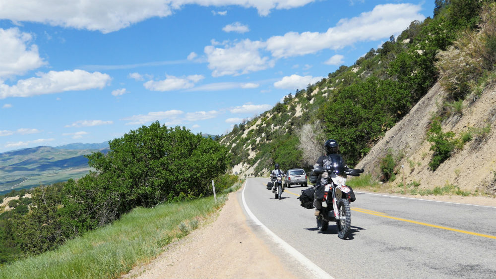
The difficulty of this ride ranges anywhere from paved roads to technical, rocky, steep terrain. If possible, the most difficult sections of these rides will have a bypass (which is indicated in our maps if they are available), but the availability of the less difficult bypass is not guaranteed, and on occasion, the only way forward may be through a difficult section. While we try to highlight the difficult sections in the videos, specific trail conditions vary from year to year and storm to storm. We recommend that anyone attempting these rides get the most up-to-date road and trail conditions from local state, county, or land use agencies where available. If you notice any trail conditions that are different from what is shown in these videos, please send those trail condition updates to info@rmrides.com.
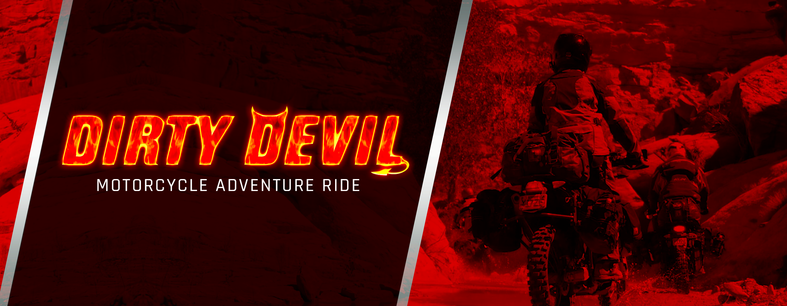
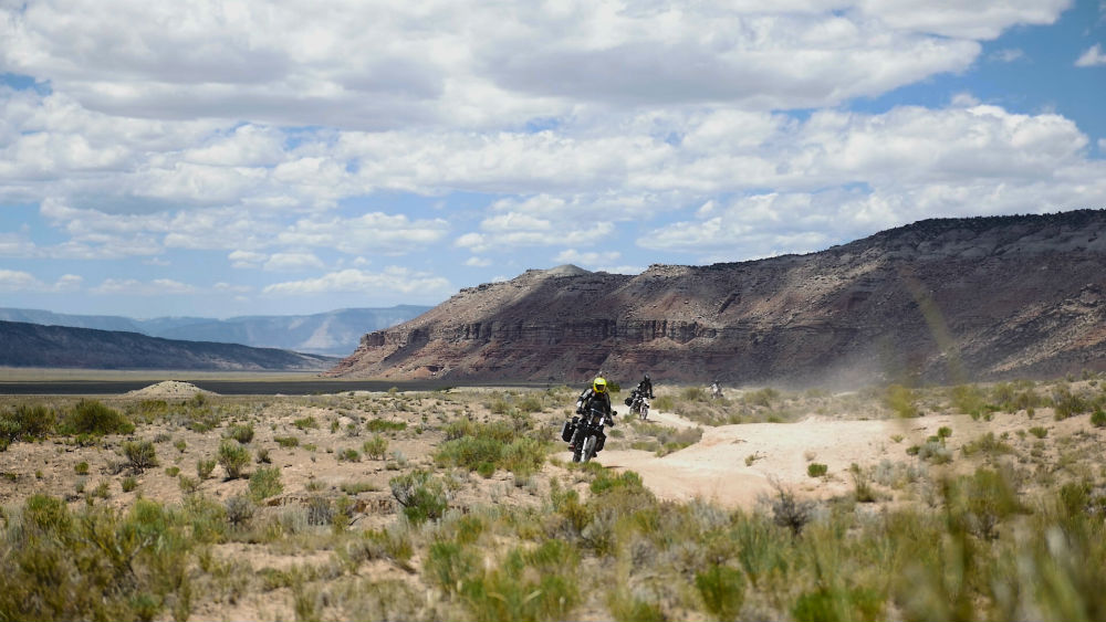
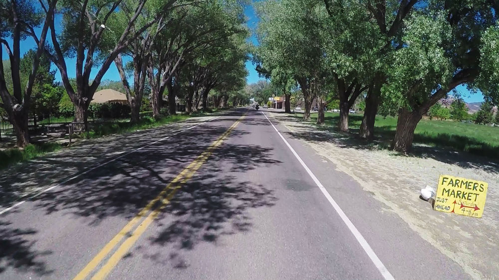
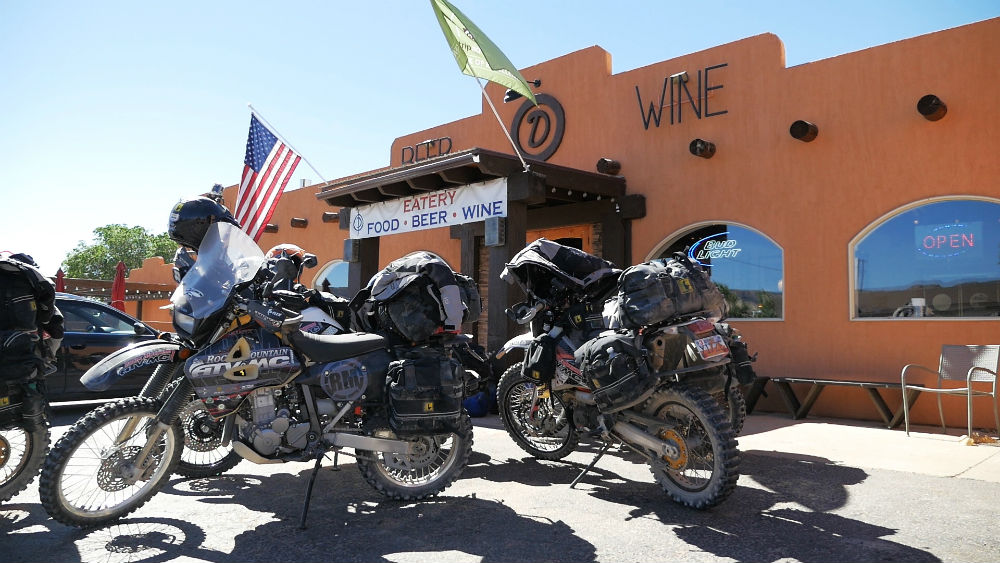
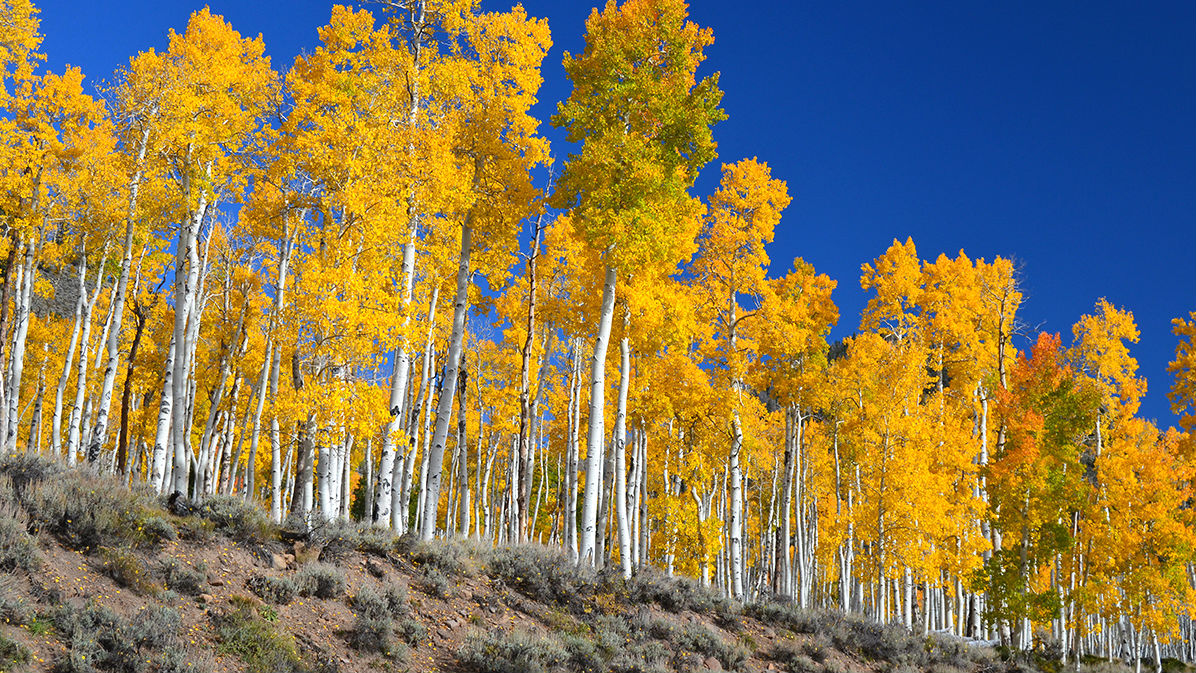
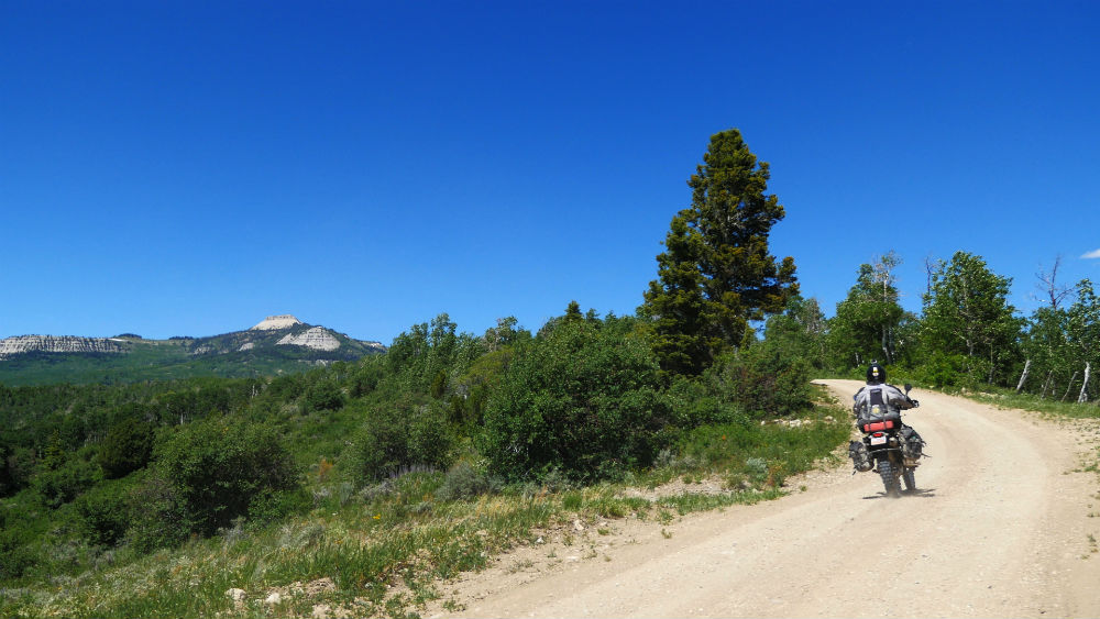
Dirty Devil Adventure Motorcycle Ride
Admin // October 28, 2016
Have questions about this ride? Shoot us an email:
About
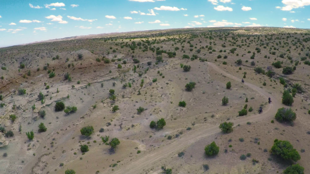
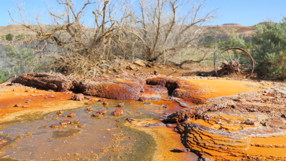
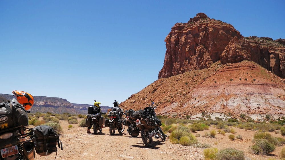
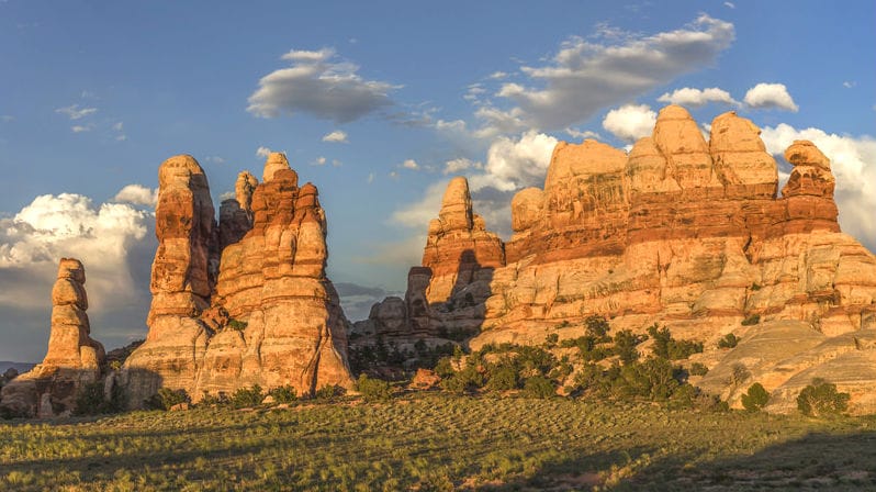
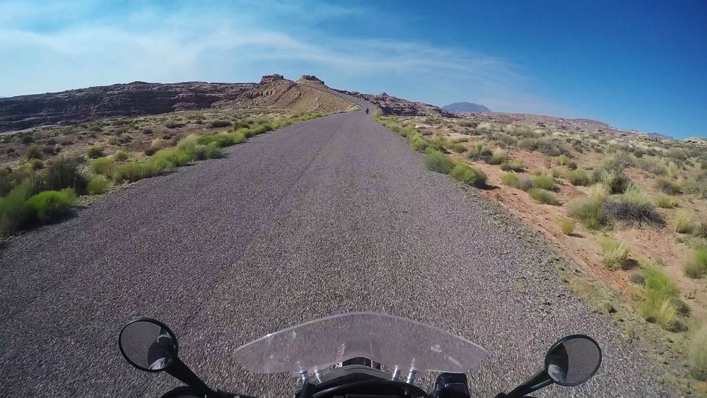
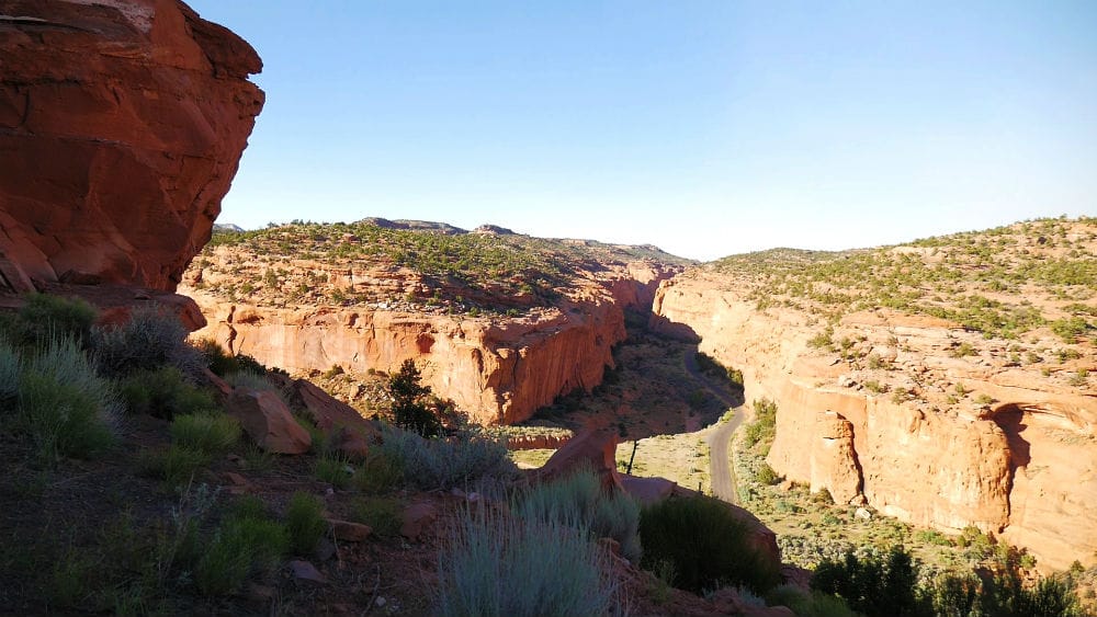
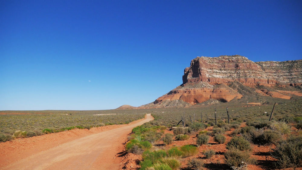
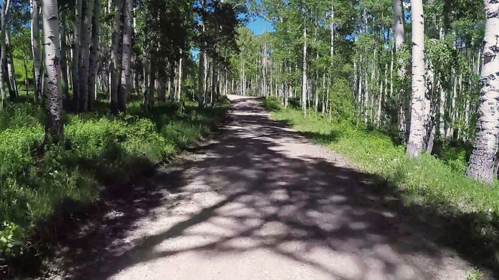
After traveling 13 miles up a dirt road so treacherous it was named Hell’s Backbone, we reach a bridged crossing with 1,500-foot drops on either side. The surrounding area is called Death Hollow for a reason. Welcome to the Dirty Devil motorcycle adventure ride.
Rocky Mountain ATV/MC is headquartered in Utah, so as you might imagine, we do a lot of riding in the state. We’ve had a lot of opportunities to see some of the most majestic vistas Utah has to offer. We’ve put together a ride that begins in Payson and heads on a loop through the southeast section of the state, traversing everything from mountains to slickrock. We call it the Dirty Devil, named for the Dirty Devil River that the route crosses several times.
As part of our RM Rides series, we’ve documented the ride and put it together in a video series and companion blog post, making it easy for you to plan your own Dirty Devil adventure with your friends.
This is a four-day ride that encompasses nearly 1,000 miles. It includes numerous scenic mountain passes, heads through the San Rafael Swell, and hits Lake Powell, Hole-in-the-Rock, Boulder Mountain and more. Every location is beautiful and shows some of the best scenery of our home state.
This article is designed as a resource to help you plan your own Dirty Devil ride. It also includes interesting facts and trivia about locations you will pass through or nearby.
Preparation
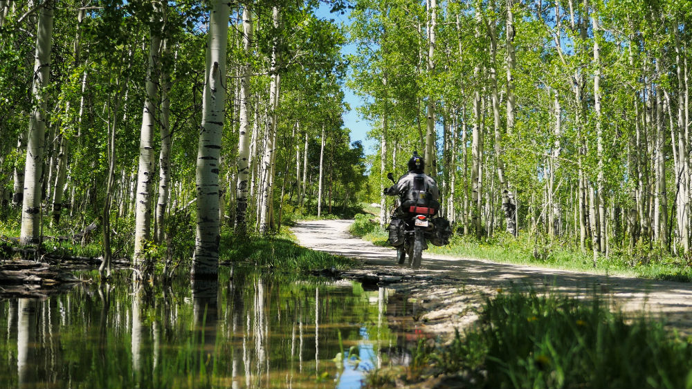
In preparation for any adventure ride, it is critical you take time to carefully plan. Not only do you need to plan routes, food and time, but you need to make sure that your bike is ready and that you have the right tools, riding gear, camping gear and emergency equipment.
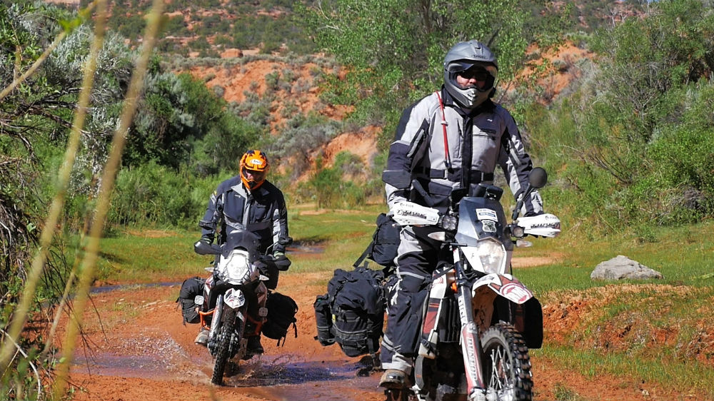
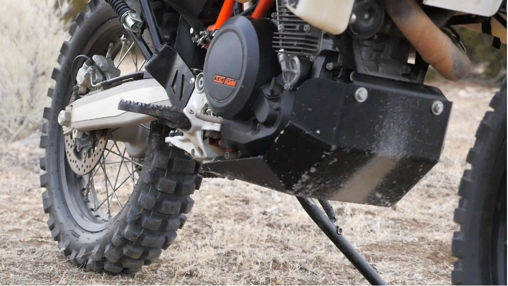
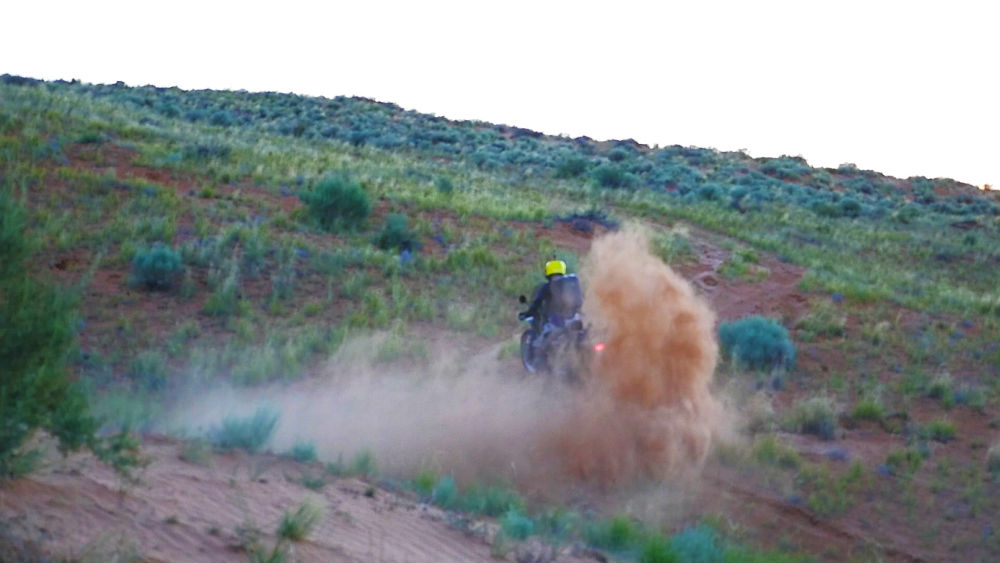
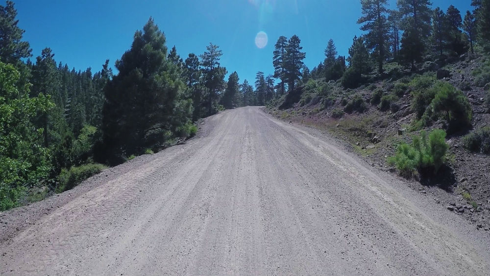
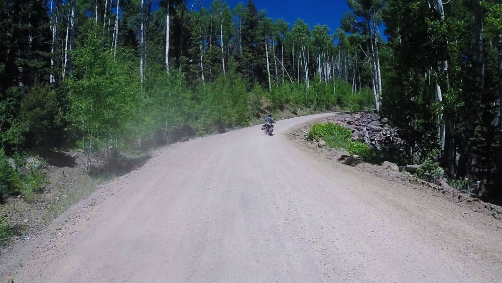
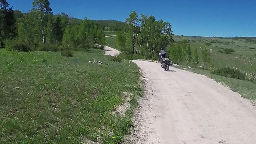
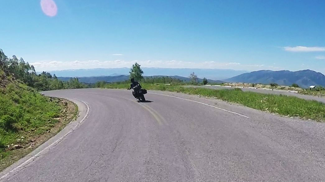
This ride hits all kinds of terrain. Some of it is on slab; however, there is a lot of off-road riding on this route, including sandy and rocky technical sections. Because of this, it’s essential that your bike is set up for off-road. You’re going to want things like a skid plate and knobby tires. If you really want to enjoy this adventure ride, you’ll want to be prepared for the technical sections.
Don’t forget to always watch the forecast prior to your trip. The Dirty Devil ride goes over mountains that are impassable during the winter and early spring when snow is on the road. It also goes through the Southern Utah desert, which can be hot and unforgiving during the peak of summer. Our recommendation is to tackle the Dirty Devil during the late spring or early fall. Make sure that you adequately prepare for the ride. Do not travel the route by yourself.
We’ve split the Dirty Devil into 12 sections across four days. If you want, you can do the sections on exactly the same days that we’ve outlined here, but you don’t need to feel constrained to it if you want to move sections around to different days. You can also expand the trip, adding in additional stops or taking time to check out some of the things that you otherwise might only see in passing. For example, we don’t pass through Bryce Canyon National Park on our trip, but we do pass close to it. You could easily modify the Dirty Devil to include a stop at it if you wanted.
Once you have the right gear and planning in place, you are ready for adventure!
| Section Mileage | Terrain |
|---|---|
| Approx. 115 Miles | Pavement |
GPS File Name: Payson to Huntington
Payson
Next Gas Stop: 115 Miles in Huntington
The route starts out at our headquarters in Payson, Utah. If you want to start your adventure here, get with us, and we would be glad to provide room in our parking lot.
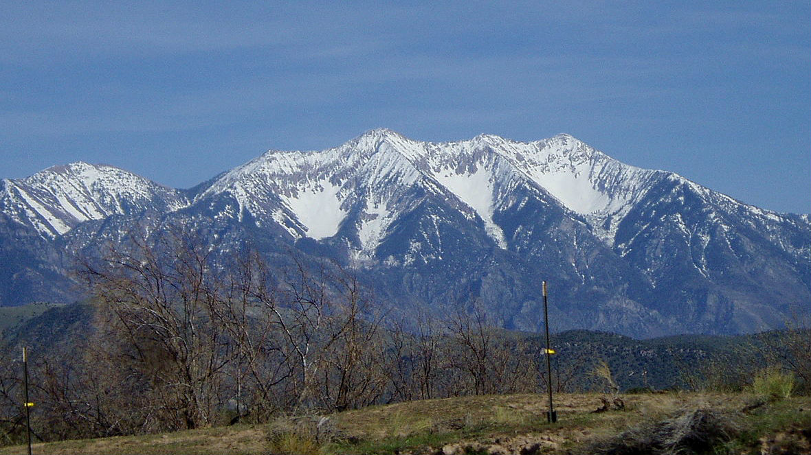
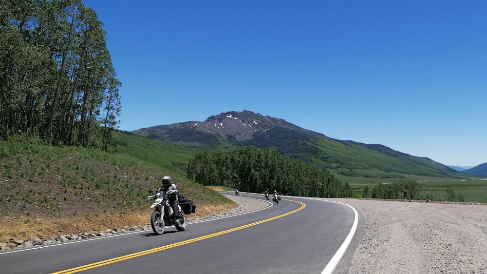
Your goal on the first day is to make it just outside of Hanksville, which is about 300 miles on the route we’ve created. To start, take the Nebo Loop Scenic Byway between Payson and Nephi. This is an awesome mountain pass that reaches over 9,000 feet and provides great views of Utah Valley and the surrounding mountain peaks. It is also home to Mount Nebo, which is the highest peak in the Wasatch Mountains, reaching almost 12,000 feet.
Once through the Nebo Loop, head across the farm and grazing lands until you reach the small town of Mount Pleasant and later Fairview.
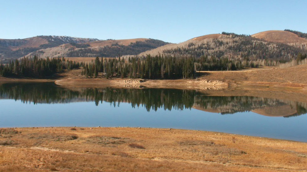
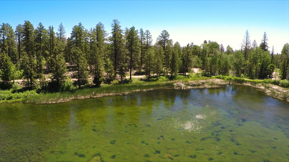
From Fairview, it’s on to the second scenic byway of the route, the Energy Loop. This byway rises up to 10,000 feet and travels through the Manti-La Sal National Forest. It offers tons of great views and lakes, where you can take a break and rest. Taking the south fork of the scenic byway eventually drops you down into Huntington, where the first gas stop is.
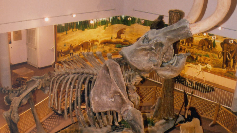
Did you know that a Colombian mammoth skeleton was discovered at Huntington Reservoir, an elevation that was thousands of feet higher than any previous mammoth discovery, leading paleontologists to reconsider what they know about mammoths? Interesting facts and trivia can be found below.
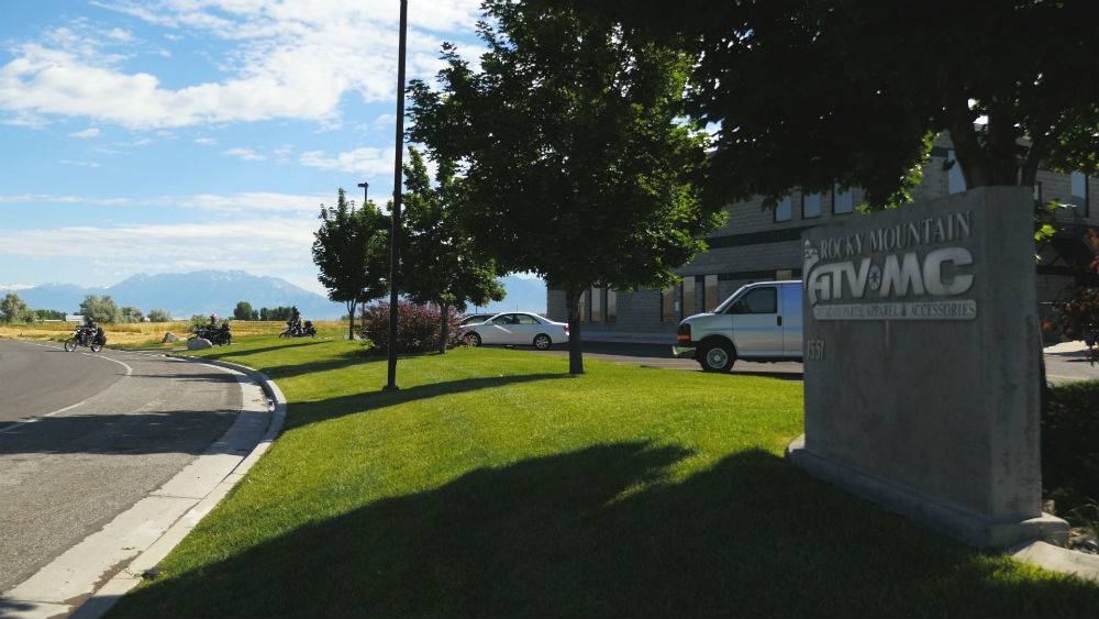
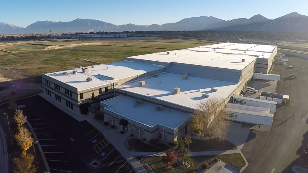
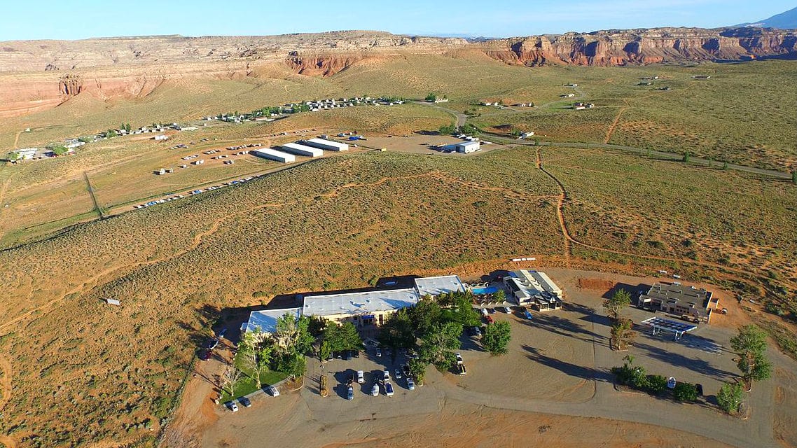
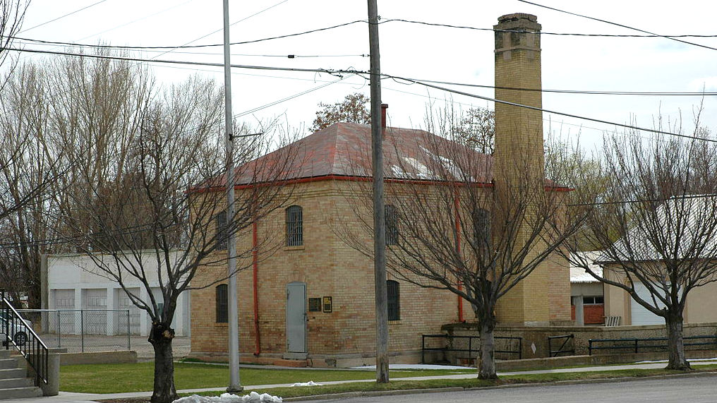
Rocky Mountain ATV/MC Headquarters
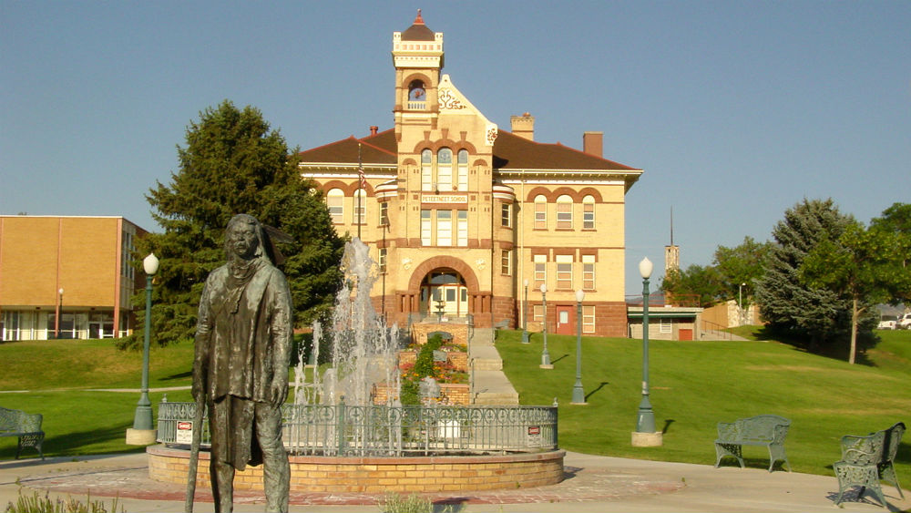
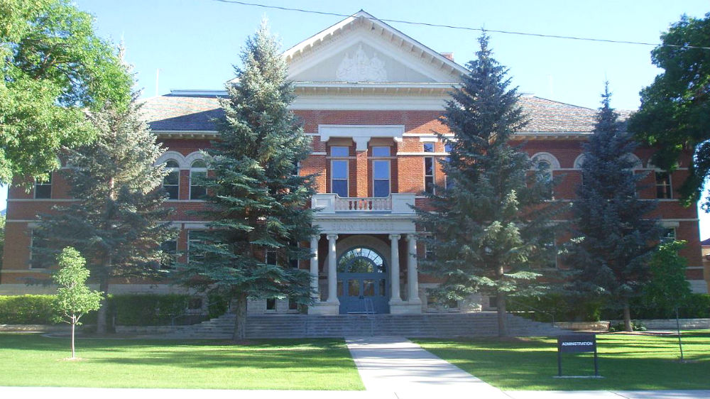
Ever since the company’s founding in 1985, Rocky Mountain ATV/MC has been headquartered in the southern end of Utah Valley. The original building at our current location in Payson was built in 2000. Since then, several additions have greatly expanded it as our business has grown. Although we have small-town roots, we are the premier off-road powersport source for gear, parts and accessories in the entire nation. Our headquarters currently house a showroom, call center, office space, warehouse with state-of-the-art conveyer system, video production studio, manufacturing facility and more.
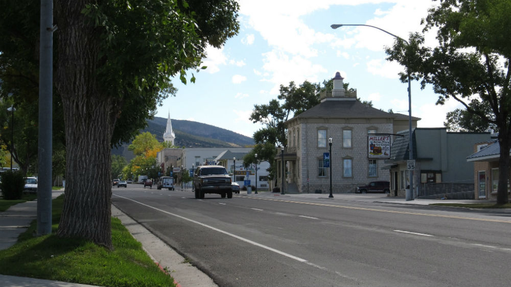
Payson
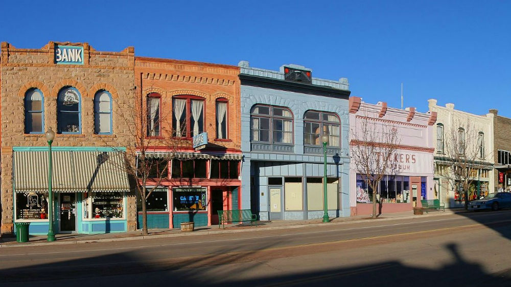
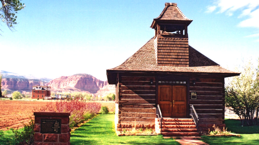
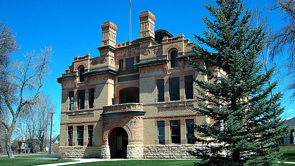
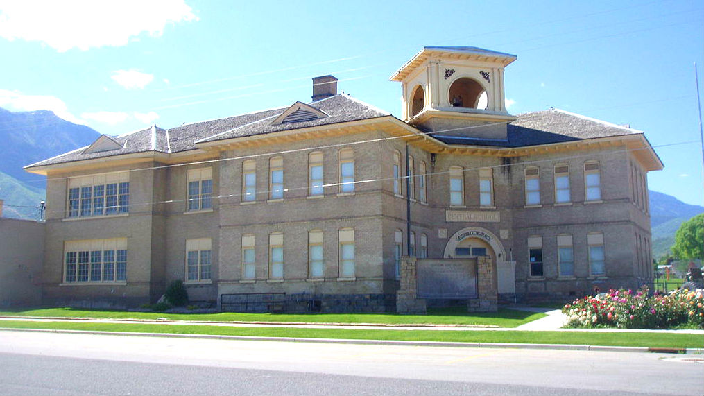
Payson was founded in 1850 and was originally called Peteetneet Creek after an Indian chief from the area. However, due to Peteetneet’s difficult spelling and pronunciation, it was changed to Pacen (later spelt Payson) after one of the original Mormon settlers, James Pace. Payson housed the first high school in Utah south of Salt Lake City, established in 1873. A large school building was built in 1897. Today, it is the location of the Peteeneet Museum. A number of old buildings can still be seen in downtown Payson; the area is designated as a historic district.
Hillside Letters
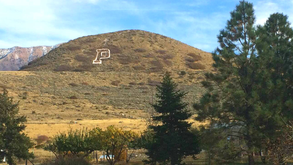
From several places in Payson (including the beginning of the Nebo Loop), a large “P” is visible on a nearby hill. Hillside letters (also called mountain monograms) such as this exist in hundreds of locations, the majority of which are in the Western United States. Utah has among the most and contains one of the densest regions for them. Hillside letters have a history spanning over a century and are often the source of pride for nearby schools and communities. Without any deviation from the Dirty Devil ride, you can see five hillside letters as you ride. If you take the alternate route in section 12, you see four more. The “P” is the first hillside letter of the trip.
Hillside Letters on the Dirty Devil Adventure Ride:
- FG for Fountain Green (Section 1)
- G for Green River (Section 3)
Nebo Loop
The Mount Nebo Scenic Byway is known for its beautiful mountainous scenery in a in a 35-mile loop that is accessed just out of Payson in Utah Valley. It circles around Mount Nebo, the tallest mountain in the Wasatch Range, named after the biblical Mount Nebo.
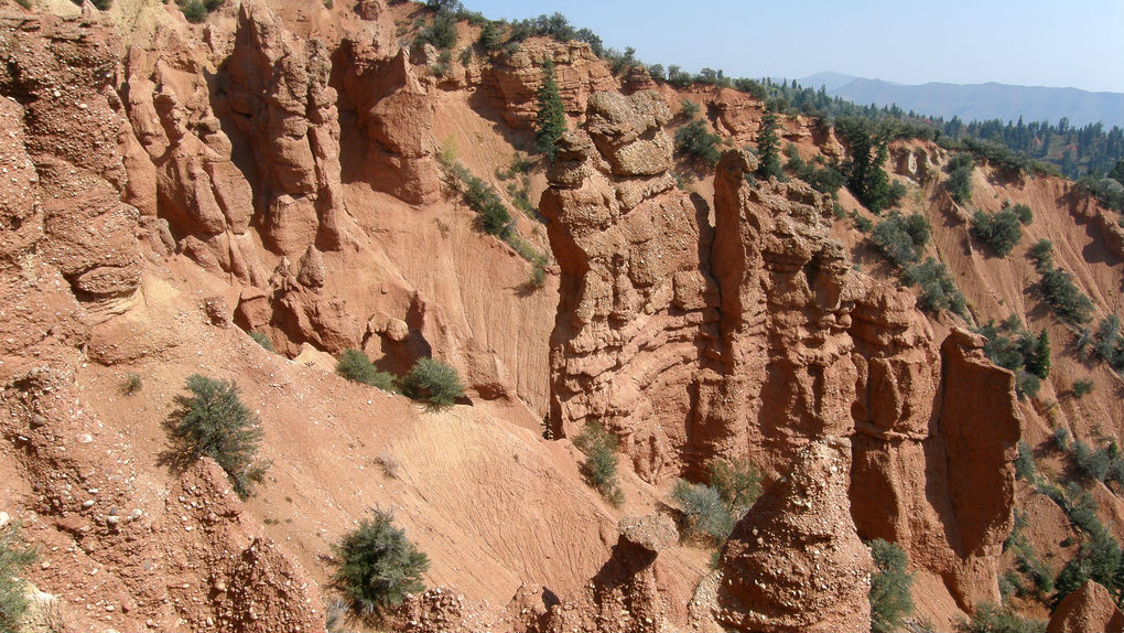
Devil's Kitchen
Devil’s Kitchen resides along the Nebo Loop. You can see red hoodoo rocks that are reminiscent of Southern Utah scenery, something very unusual for this area. An overlook is built that provides an excellent view of the area.
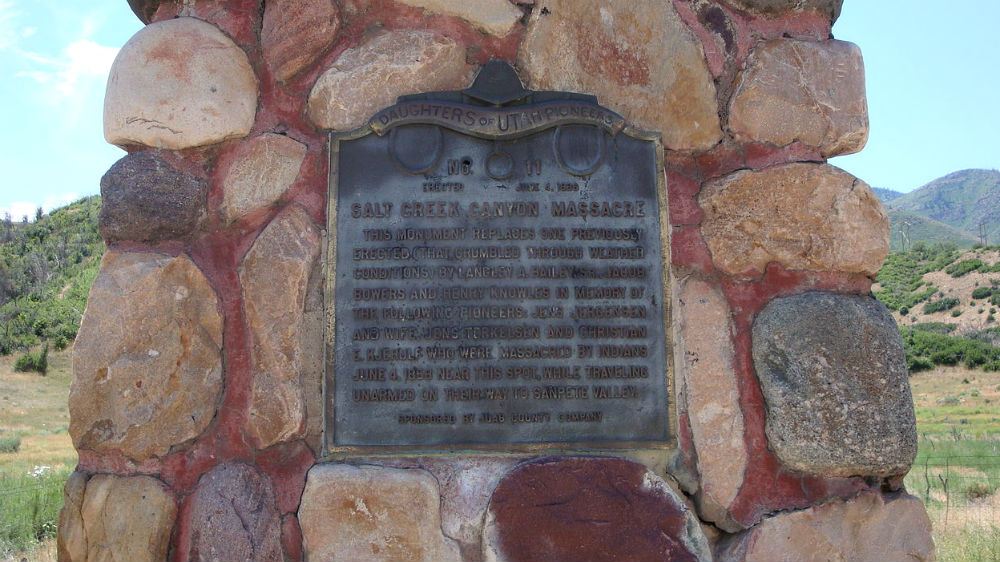
Salt Creek Canyon Massacre
The early Mormon settlers and the Native Americans in Utah often had disagreements and skirmishes, and one incident of violence occurred in 1858 when four Danish immigrants were ambushed and killed. A monument was erected along the road in 1936, where it still stands.
Sanpete County
A couple of miles off of the Nebo Loop on SR-132, you’ll enter Sanpete County. The county gets its name for the Ute chief Sanpitch, who was the brother of Walkara (an influential chief in the 1800s) and one of the primary Indian chiefs of the valley in the mid-1800s. Sanpitch was also known by a variant of his name, Sanpete. Many locations in the area utilize spelling variations of his name.

San Pitch Mountains, Manti Mountains, and Sanpete Valley from Flight to Salt Lake from Las Vegas by Ken Lund (CC BY-SA 2.0)
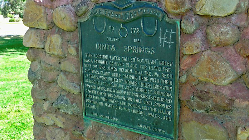
Fountain Green
The route passes through the town of Fountain Green. Before it was settled, it was commonly used as a camping spot for travelers, and it is notable for being the location of one of the skirmishes of the Walker War, a conflict between the early Mormon settlers and the local Native Americans, led by Chief Walkara. A settlement was established in the area several years later. A monument can be seen in the town’s city park as tribute for the settlers who lost their lives.
DOP Uinta Springs Camp by Trevor Stacy Luke (GFDL 1.2)
Mount Pleasant
The area around Mount Pleasant was settled in 1852, but the settlement wouldn’t become permanent until 1859 due to Indian raids. The town served many important roles commercially and culturally over the years. The home of William Seely (local Mormon bishop and town mayor) served as the location where the Black Hawk War treaty was signed. Today, the building is referred to as the “Relic House” and operates as a museum. The town is also home to Wasatch Academy, a school started in 1875 by Reverend Duncan McMillan, a Presbyterian minister, and it remains the oldest continually operating secondary school in Utah. Today, it functions as a private boarding school and serves students from dozens of states and even some foreign countries.
Fairview
Fairview was founded in the mid-1800s and was named because of its “fair view.” The Fairview Museum of History and Art contains a number of interesting artifacts and pictures, but it is particularly notable due to housing a Columbian mammoth skeleton that was discovered nearby at Huntington Reservoir – a record elevation (9,600 feet) for a mammoth. Fairview is also the beginning of the Energy Loop, a National Scenic Byway, which you will follow into Huntington as part of the Dirty Devil route.
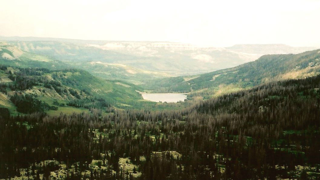
Electric Lake
The route takes you past several lakes in the Manti-La Sal National Forest, such as Cleveland Reservoir. Electric Lake is another, a reservoir created in 1974. The site was originally home to the ghost town of Connellsville, a mining settlement inhabited for a few years in the 1870s. It is now under water.
Cleveland Reservoir by Mike Nielsen (CC BY-SA 2.0)
Crandall Canyon Mine
The Crandall Canyon Mine lies just over a mile away from the route down Huntington Canyon. The mine was the site of a collapse in 2007 that resulted in the tragic deaths of six miners and three rescue workers. Memorials exist for the victims at the mine site and in Huntington.
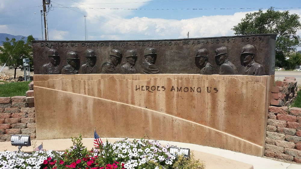
Mine disaster memorial by Jacob Barlow (CC BY-ND 3.0)
Huntington
Huntington’s name derives from the Huntington brothers who explored the area in the 1850s. The town’s first settler was Leander Lemmon, and while his original 1876 cabin was destroyed, his 1901 house still exists. Historically, the town’s economy has been supported by coal mining and more recently by a nearby power plant. Huntington State Park is located to the northwest and includes Huntington Lake, making it a popular recreation area among locals.
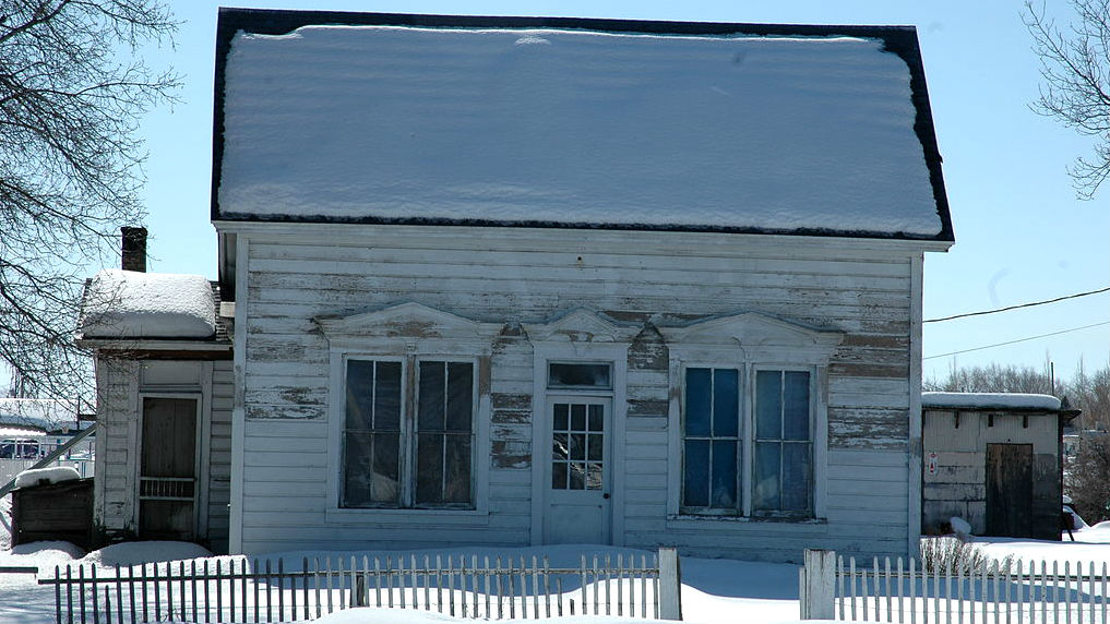
Lemmon House, Huntington, Utah by Tricia Simpson (CC BY-SA 3.0)
Section 2: Huntington to Green River
| Section Mileage | Terrain |
|---|---|
| Approx. 72 Miles | Dirt Road, Dirt Two Track, Pavement |
GPS File Name: Huntington to Green River
Huntington
Next Gas Stop: 72 Miles in Green River
Head east out of Huntington towards the first dirt segment, which leads you into Green River for lunch. This segment brings you along the north end of the San Rafael Swell and offers easy dirt roads that tighten up into a nice, scenic dirt two track. Most of this two track is on the old historic Spirit Railroad grade from 1881 that was never completed. All that is left now are small hill cutouts and remnants of old mines and ranches.
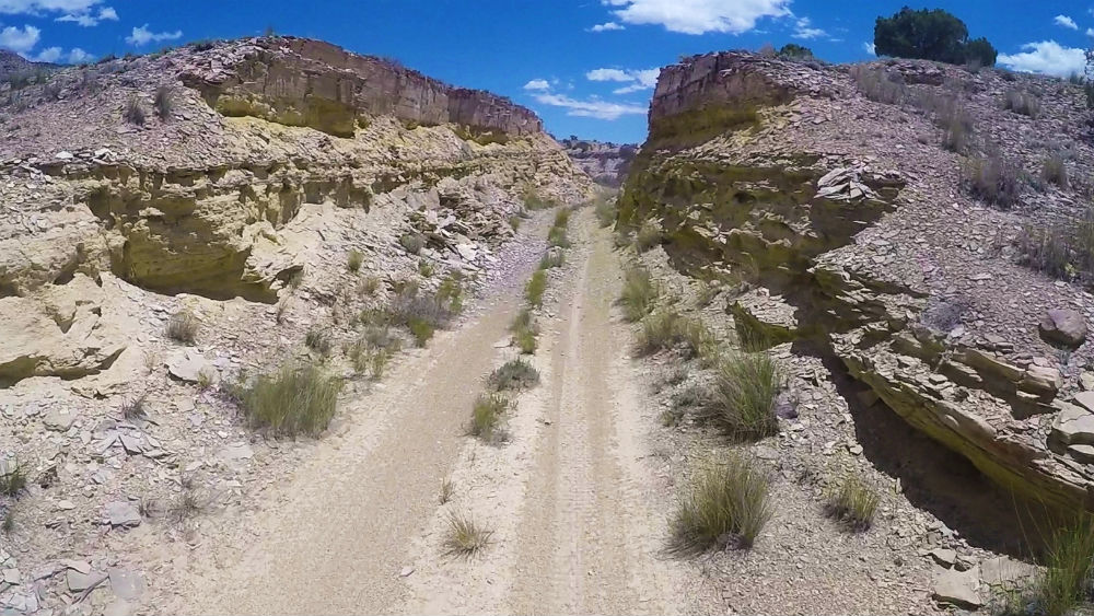
This track eventually leads you back onto the dirt road where you can continue to make your way towards Green River. Take your time to soak in some of the amazing views that the San Rafael Swell has to offer.
Did you know that the San Rafael Swell’s exotic scenery has led to its representation as extraterrestrial planets in science fiction films? Interesting facts and trivia can be found below.
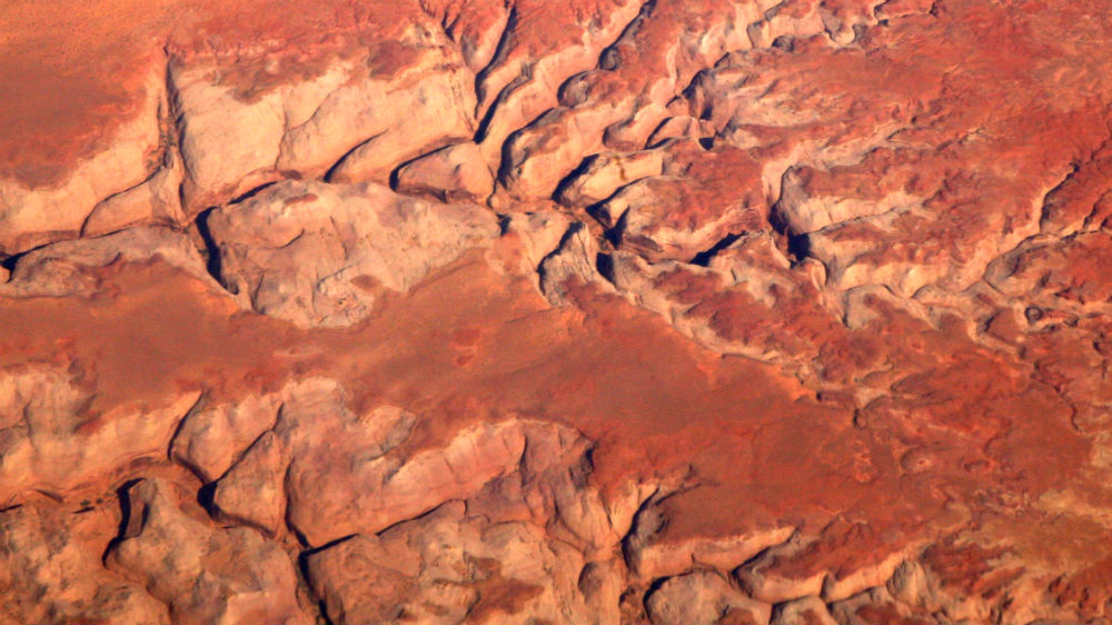
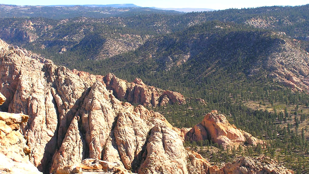
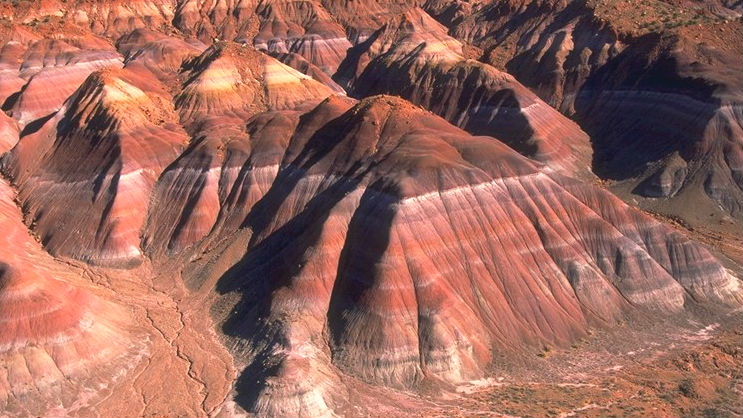
San Rafael Swell
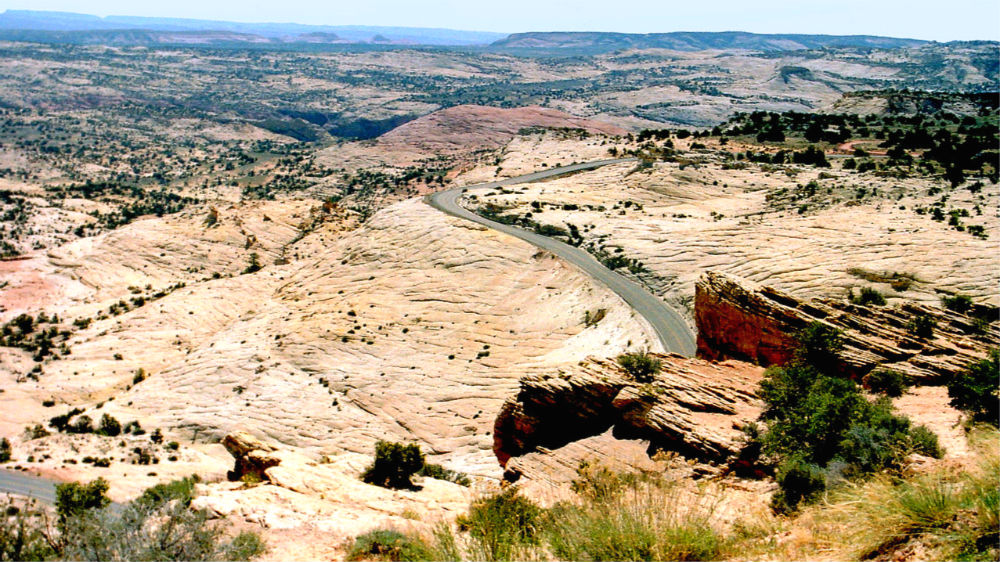
The San Rafael Swell is a huge geological feature called an anticline, which basically refers to layers of rock that have been pushed upward like a dome (hence the “swell”). You can see various layers of rock, often slanted at angles. This unique geology has led to its representation as alien environments in films such as Star Trek and Galaxy Quest. During this section of the ride, you can see the steep rock slopes on the eastern edge of the Swell, commonly known as the San Rafael Reef. The name San Rafael comes from Franciscan friars who traveled the area and named it after the archangel Raphael.
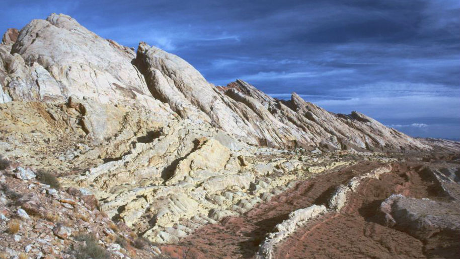
The San Rafael Swell encompasses about 217,000 acres, and there are many things to see within its area. If you’re willing to take the time for detours, popular tourist sites like the Buckhorn Draw Pictograph Panel or the Cleveland-Lloyd Dinosaur Quarry are accessible with some deviation from the Dirty Devil route.
Spirit Railroad
In the late 1800s, the Denver and Rio Grande Western Railway came up with two proposals to extend their railroad west of Green River. The northern route would eventually reach Ogden (where it would connect with the First Transcontinental Railroad), while the southern route would extend westward towards Los Angeles. Both proposals were begun, but the southern route through the San Rafael Swell was eventually abandoned – though not before $217,470 was spent on the project (equivalent to $5.6 million in 2016 dollars). The railroad grade and some ruins from worker camps can still be seen. The name Spirit Railroad comes from the fact that it was never completed.
Lower Cedar Mountain and Green River Cutoff Roads
This section travels along the Lower Cedar Mountain Road and Green River Cutoff Road. Along these roads, you’ll travel the Spirit Railroad grade as well as part of the Old Spanish Trail. There are some interesting mine worker ruins and petroglyphs that are nearby the road at various points. Cedar Mountain (also referred to as Cedar Mesa) borders Green River Cutoff Road to the north.
Smith Camp
Although it is desolate, there are remnants across the San Rafael Swell that show signs of human habitation, from railroad worker ruins to Native American petroglyphs. One such location is the remains of Smith Camp, an old ranch. It lies just to west of where you turn onto Smith Camp Road from Cottonwood Wash Road.
Interstate 70
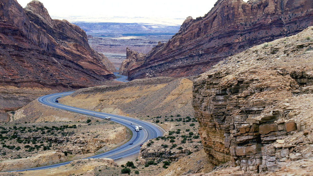
This section travels on I-70 for about 10 miles, the first of two brief routes on the freeway on the Dirty Devil ride. I-70’s construction through the San Rafael Swell was difficult (particularly the portion through Spotted Wolf Canyon) and considered “one of the most significant highway construction feats of its time.” A small part of I-70 runs concurrently with U.S. Route 6, also known as the Grand Army of the Republic Highway to honor Civil War veterans.
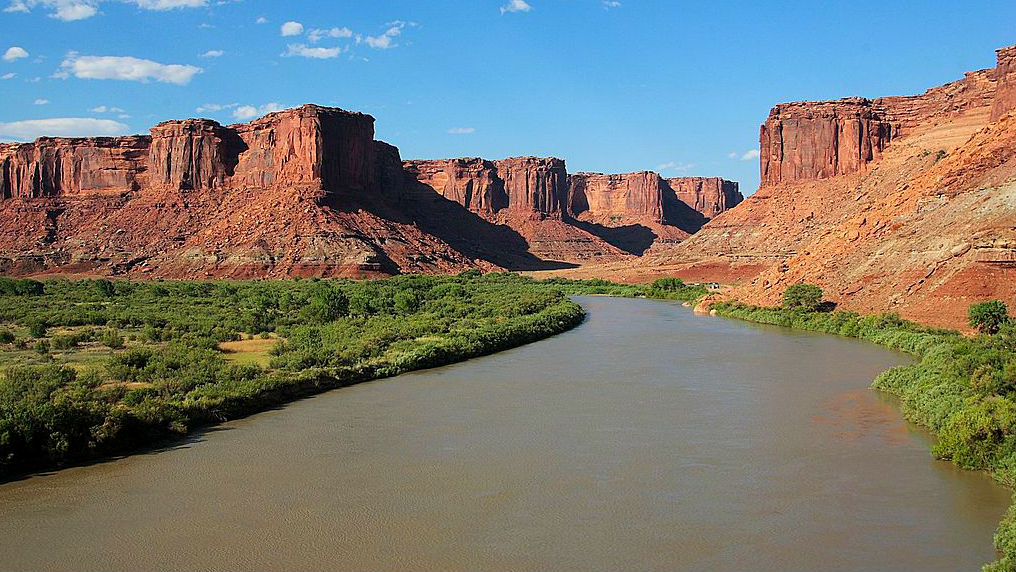
Green River
The Green River was historically known by several names, including the Seedskeedee (from a Shoshone word meaning Prairie Hen) and the Buenaventura (from a Spanish word meaning fortune). Eventually it became known as Rio Verde, and the English translation Green River eventually stuck. It is unknown why the river was labelled as “green,” though several theories exist. The river begins in Wyoming and carves its way through Utah until it merges with the Colorado River.
City of Green River
The city Green River began as a stopover for travelers heading west at a crossing of the Green River. Although crossing the river no longer requires a ferry, Green River continues to serve as a stopover for travelers as the last stop with motorist services for westward I-70 drivers in over 100 miles. The Green River Launch Complex used to exist to the southeast, and while it is no longer operative, a rocket can still be seen in the city park.
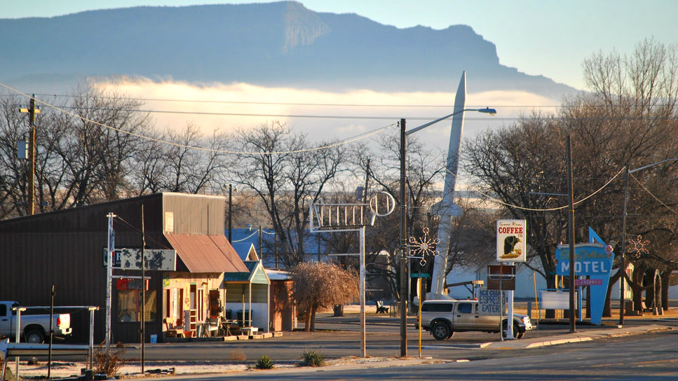
Green River is famous in the state for its watermelons. If you stop by in August or September, be sure to try one out. The town is also home to the John Wesley Powell River Museum, which has exhibits about local history (including the museum’s namesake, a one-armed Illinois professor who explored the region in the 1860s-1870s).
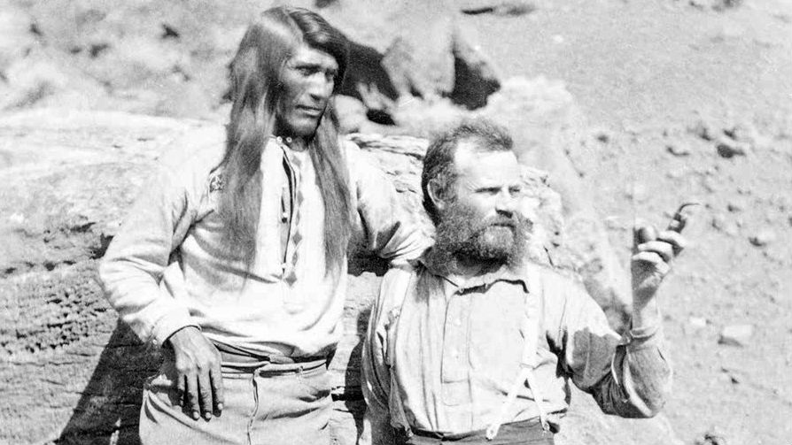
John Wesley Powell with Tau-gu (a Paiute Chief)
Section 3: Green River to Poison Springs Road
| Section Mileage | Terrain |
|---|---|
| Approx. 102 Miles | Dirt Road, Sand, Sand Two Track |
GPS File Name: Green River to Poison Springs Road
Alternate: Chaffin Ranch Geyser
Alternate: Big Hill ALT HARDER
Green River
Next Gas Stop:84 Miles in Hanksville
Hanksville
Next Gas Stop:144 Miles in Ticaboo
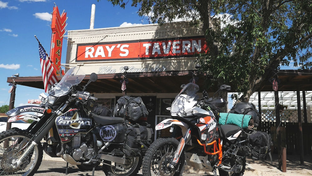
Green River is a great place to refuel your bike and your body. On our most recent ride on the Dirty Devil route, we had lunch at Ray’s Tavern. This is a nice local restaurant that has some great burgers.
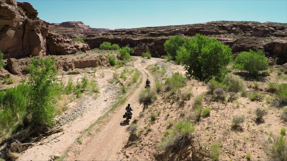
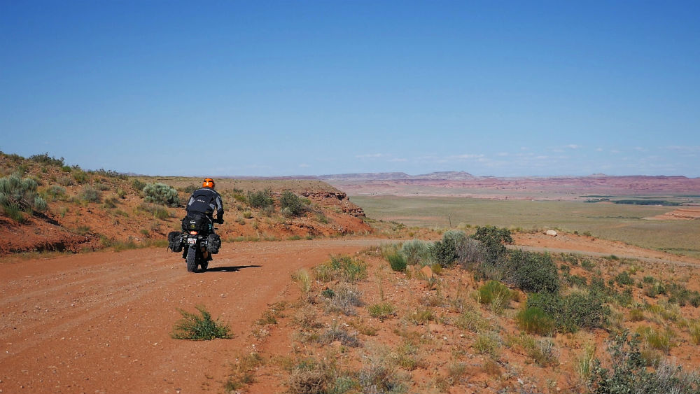
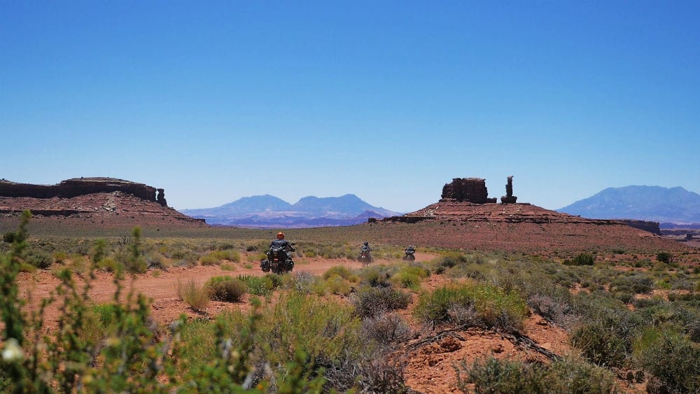
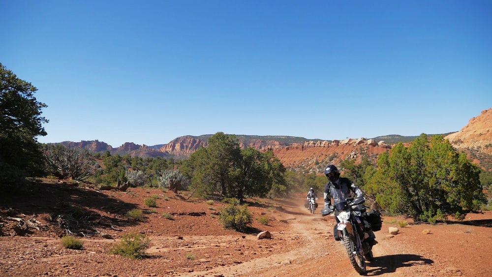
Head south from Green River towards your next segment. This section of the ride takes you by Robbers’ Roost, an old outlaw hideout used by Butch Cassidy and the Sundance Kid. This is a very desolate but scenic country that provides a variety of dirt roads and sandy two track.
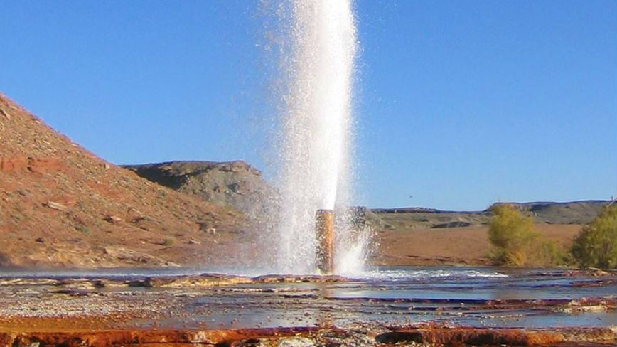
After about 20 miles, you can take a quick detour to check out the Chaffin Geyser. This is one of the few cold-water geysers in the nation and was created by drilling operations in the area decades ago. The Chaffin Geyser is said to shoot as high as 30 feet in the air and typically erupts every 2-4 hours. Even if you arrive at a time when the geyser is dormant, the surrounding area is still interesting to check out.
As you head south, the sand and desert landscapes start to become more and more widespread. The trail then slowly tightens up and turns into a sandy two track with pockets of deep sand. This is where things get interesting. This section has a daunting hill covered in deep sand. When we traveled through it, our bikes packed with gear struggled (especially the bigger bikes). You may need to push and wrestle your bike through the sand, but eventually you meet back up with a dirt road. Note that the GPS files include a way around this sandy hill, but if you’re up for a challenge, you might consider taking the harder alternate route as we did.
As you roll into Hanksville, it’s a good idea to check the level of the Dirty Devil River since you’ll be crossing it later in the ride. This will give you a good idea of how deep the water is and how the crossing might go for you later on. In Hanksville, it’s important to gas up and restock your water and anything else you need as it’s the last stop before camp.
Take the highway south about 17 miles, where you turn onto dirt at Poison Springs Wash Road. This is a rocky sand wash surrounded by high red rock cliffs. Check our GPS files to see some nice, open flat spots we found to set up camp for the night.
Did you know that after getting his hand trapped by a falling boulder, Aron Ralston amputated his own arm with a dull pocket knife in order to escape? Interesting facts and trivia can be found below.
Cold-Water Geysers
Cold-water geysers are unusual compared to most geysers as they rely on built-up carbon dioxide rather than geothermal activity. Cold-water geysers are also exceptionally rare. There are two cold-water geysers south of Green River, both accidentally created due to drilling many decades ago. Crystal Geyser has historically been more impressive, though in recent years its eruption height has significantly decreased. Chaffin Ranch Geyser doesn’t have eruptions as high, but it does erupt more frequently, particularly during the spring and summer months. Chaffin Ranch Geyser is also closer to the Dirty Devil route than the Crystal Geyser, making it more convenient to see during your ride.
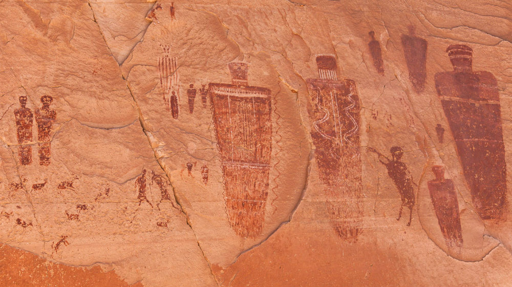
Horseshoe Canyon
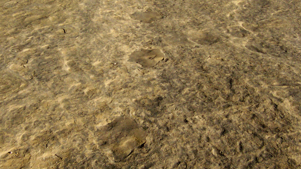
Horseshoe Canyon is part of Canyonlands National Park and is well known for its numerous pictographs and petroglyphs. Although the trailhead is not far from the Dirty Devil route, if you want to fully experience the archeological significance of the area, you should plan on a strenuous hike lasting 4-6 hours to see the “Great Gallery,” the canyon’s most famous rock art panel. If you know where to look, you can also find dinosaur tracks along the way which are circled with rocks to identify them.
Blue John Canyon lies to the southwest and is a tributary of Horseshoe Canyon. It was the site where outdoorsman Aron Ralston had his hand pinned by a falling boulder while he was climbing alone, forcing him to amputate his own arm with a dull pocket knife on a multi-tool. This experience was later chronicled in Between a Rock and Hard Place and turned into the critically acclaimed film 127 Hours.
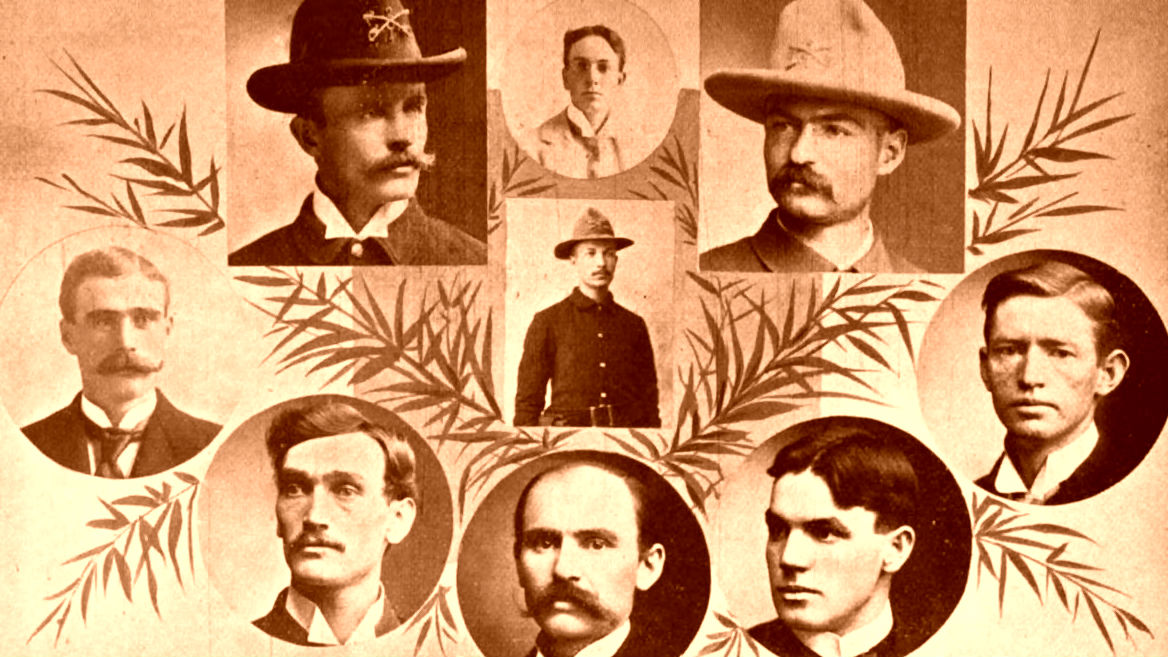
Robbers' Roost
Robbers’ Roost was an outlaw hideout in the late 1800s and early 1900s, notably used by Butch Cassidy and his Wild Bunch gang. The area is marked by steep-walled canyons with dozens of hiding spots. It was difficult to penetrate and easy to defend, so much that authorities never managed to infiltrate it during its years in use.
Cassidy’s daring and lucrative robberies, code of ethics that prohibited him from killing anyone, and supposed survival after being “killed” in Bolivia led to him achieving legendary status as an outlaw (and something of a folk hero as well), helping perpetuate Robbers’ Roost’s fame into the modern day.
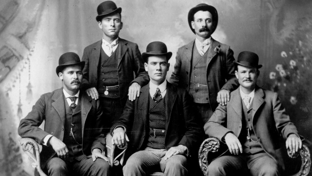
The Wild Bunch (Butch Cassidy on the Front Right)
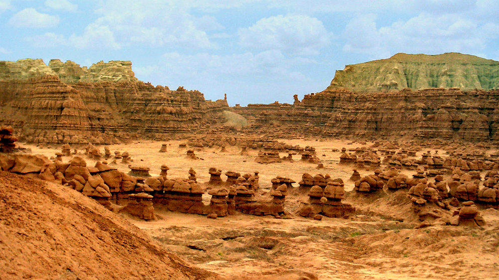
Goblin Valley
To the north of Hanksville is Goblin Valley, an area known for its numerous hoodoo rocks. It requires a detour from the Dirty Devil route, but it’s worth it if you’re looking for extra things to see to extend your ride.
Hanksville
Hanksville is a small town with a history dating back to 1882, when it was originally called Graves Valley. There are a few interesting sites to see, including metal art at an abandoned motel and Hollow Mountain, a convenience store built into a rock.
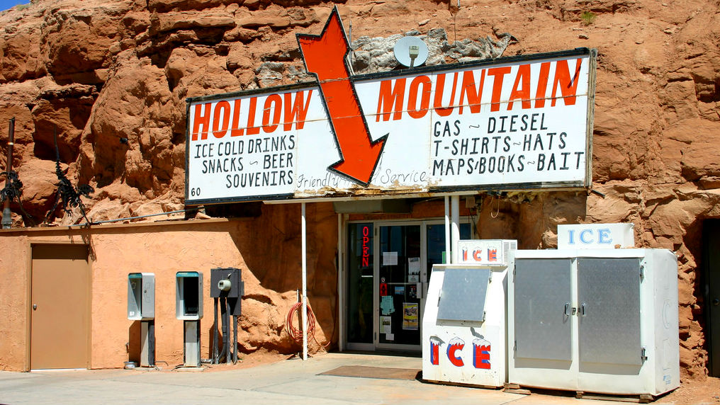
Hollow Mountain by Timothy Boscarino (CC BY 2.0)
Poison Springs Road
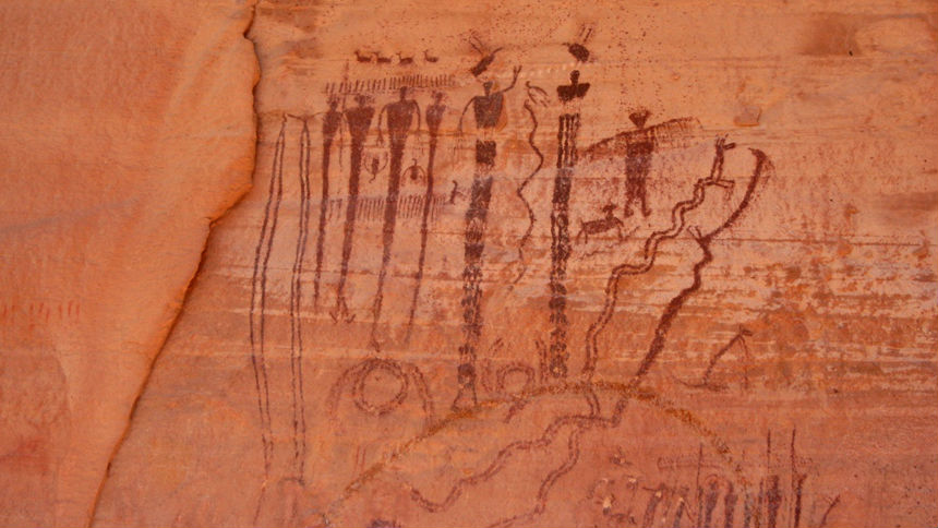
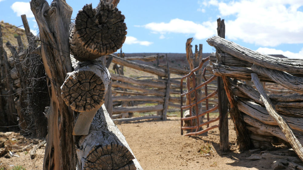
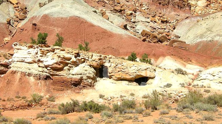
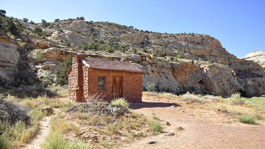
Poison Springs Road travels down towards Poison Springs Canyon. It is a popular OHV trail with multiple side canyons that offer interesting views, including Native American rock art panels and breathtaking sandstone formations. This route was part of the Outlaw Trail used in the late 1800s, and there is even a cave up one canyon that is believed to have served as shelter for outlaws of the Old West.
| Section Mileage | Terrain |
|---|---|
| Approx. 72 Miles | Rock Sand Mix, Rocky Two Track, Dirt Road |
GPS File Name: Poison Springs Road to Hite
Alternate: Doll House out n back ALT
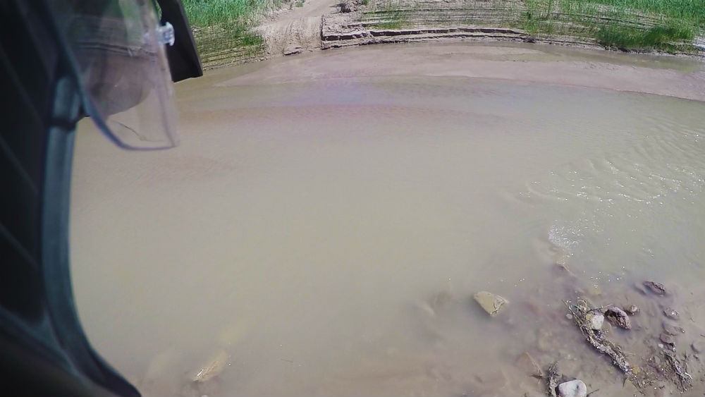
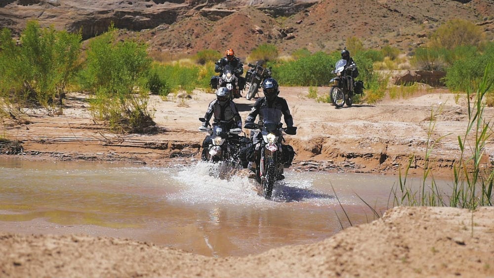
This segment offers a wide variety of terrains and landscapes. There are spots of loose sand, puddles, and a rocky mix of dirt and sand. Eventually, you make it to the Dirty Devil River. The overlooks of the river are extremely scenic and make a great place to stop and take in the views that this ride has to offer.

Head down to the Dirty Devil where you make the crossing. Just remember that with any trip, you want to keep a close eye on weather. A storm can make any dirt road impassable, but especially in washes like this, a flash flood is extremely dangerous. Check out the historical data provided by the U.S. Geological Survey to give you an idea of what to expect for a specific time of the year.
After crossing, head back up onto the ridge along the river. This ridgeline trail is a nice, curvy dirt trail with more great views, but it does have some rocky spots to look out for as you ride. As you make your way down into the valley, you are surrounded by tons of towering buttes and mesas. Following the sand washes takes you to a couple rockier passes, where you can take a break before heading down to your next turnoff.
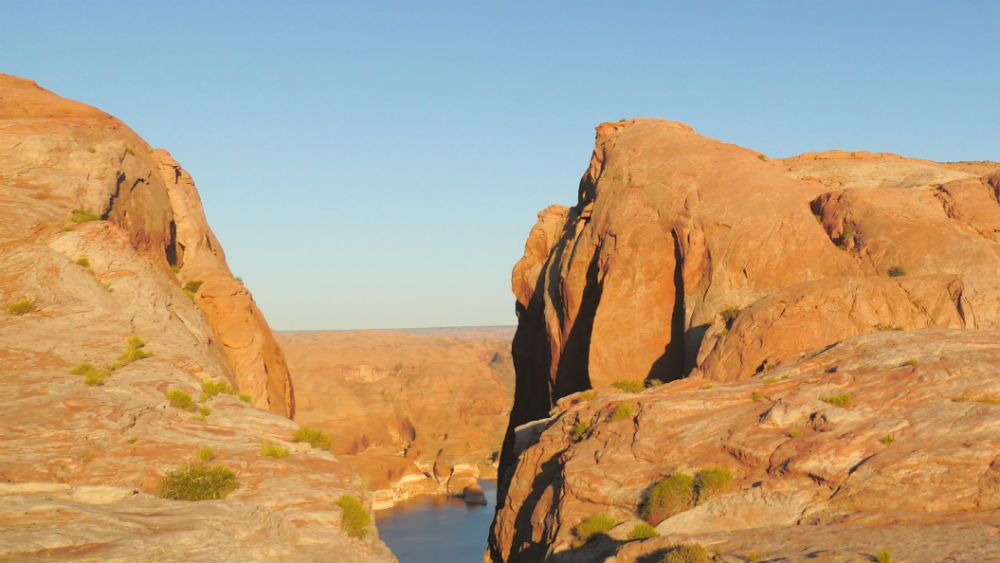
As you come down out of the hills, you make it to a four-way crossing where you head south towards Hite. (Note: If you want to check out the Doll House, you should head east at this crossing. The route is marked in the GPS files.) The route south opens up and is a great area to relax on the bike and take in the scenery of southern Utah. Make your way back onto pavement and pass over the Dirty Devil River for the third and final time as you head towards Hite Marina on the north end of Lake Powell.
Did you know that only California and Alaska outrank Utah by number of national parks? Interesting facts and trivia can be found below.
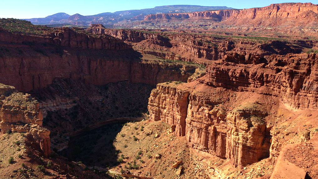
Dirty Devil River
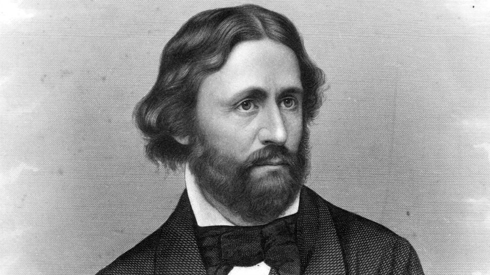
The Dirty Devil River forms at the junction of the Fremont River and Muddy Creek. It runs for 80 miles until it empties into the larger Colorado River, nearly at the point where Lake Powell begins. The river received its name during John Wesley Powell’s expedition in 1869. When one member of the group made an inquiry about the river, the response was “she’s a dirty devil.” The name stuck. We named our Dirty Devil adventure ride after the river. The ride’s route crosses the river three times, one of which actually goes through the river (instead of over bridges).
Fiddler Butte
Shortly after crossing the Dirty Devil, Fiddler Butte is visible to the south. The butte is tall and stands out from the rest of the landscape. It got its name from a sheepherder who was a fiddler and who tended his sheep nearby. Today, it is a reminder of the everyday folk who lived in this remote area.
Canyonlands National Park
Utah has the third-most national parks at five, behind only California (nine) and Alaska (eight). Canyonlands National Park is one of those. It is split up into four districts: the Island in the Sky, the Needles, the Maze, and the rivers (Colorado and Green). This section of the Dirty Devil ride will take you into the Maze district. In the original proposal to create the park, it was explained that “nowhere is the relationship between earth’s framework and the forces that shape it more dramatic.”
Doll House
The Doll House is an area of the Maze district of Canyonlands National Park. It features large, vertical rocks with white and red layers, known as hoodoos or dolls. Although it requires a bit of a detour, it’s worth it if time allows. There are numerous rock formations worth seeing along the way as well, including Mother and Child Rock, Standing Rock and Chimney Rock. The route to the Doll House is provided in our GPS files.
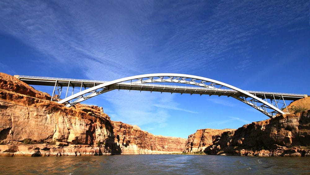
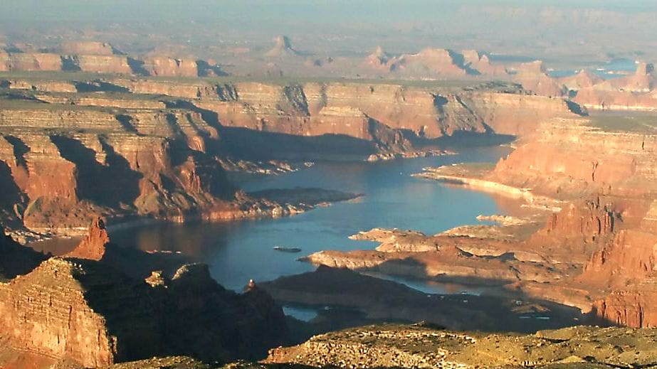
Hite
Cass Hite was a prospector who found gold along the Colorado River in Glen Canyon in the 1880s. He also discovered a good spot to cross the river and named it Dandy Crossing. The area was later renamed Hite City as a settlement grew near the crossing. The town survived until the 1950s, when it became a ghost town, largely thanks to the creation of Lake Powell. The Hite Crossing Bridge now spans the river as part of Highway 95.
Section 5: Hite to Burr Trail
| Section Mileage | Terrain |
|---|---|
| Approx. 55 Miles | Pavement |
GPS File Name: Hite to Burr Trail
Ticaboo
Next Gas Stop: 130 Miles in Torrey
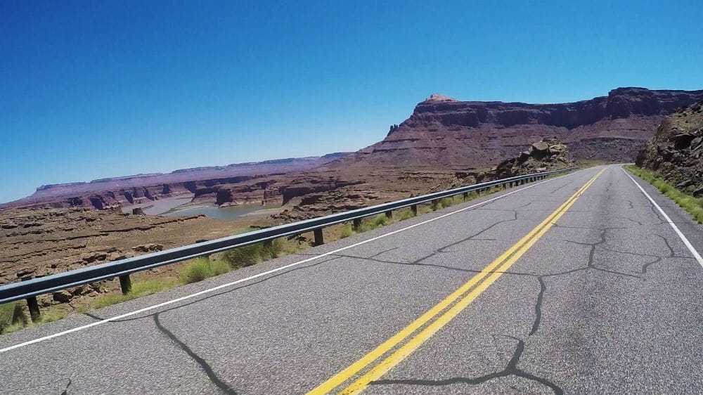
The road past Hite rises up and gives some great overlooks into the marina and the Colorado River. It then heads northwest and winds through the high cliffs before you take the turnoff south to head towards Lake Powell. This is a good place to stop for gas and lunch. Make sure you load up on water here because this area of Southern Utah can get extremely hot. Next, head back into the dry heat, and make your way towards your next segment of the ride: the Burr Trail.
Did you know that Henry Mountains were the last major mountain range mapped in the contiguous United States? Interesting facts and trivia can be found below.
Utah State Route 95
Highway 95 begins in Hanksville and extends south past Lake Powell to Blanding. The road was paved and dedicated as a highway in 1976 – America’s Bicentennial. Because of this, it received the nickname Bicentennial Highway. The Dirty Devil adventure ride takes Highway 95 twice – once when leaving Hanksville and again near Hite.
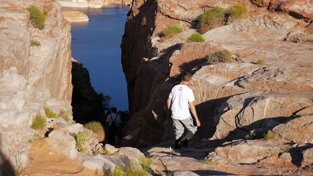
Lake Powell
Lake Powell was formed in the 1950s when the Glen Canyon Dam was built, backing up the Colorado River and flooding Glen Canyon. It was named after John Wesley Powell, an explorer who went on several expeditions in the area. Today, Lake Powell is a popular recreation destination, receiving two million visitors every year.
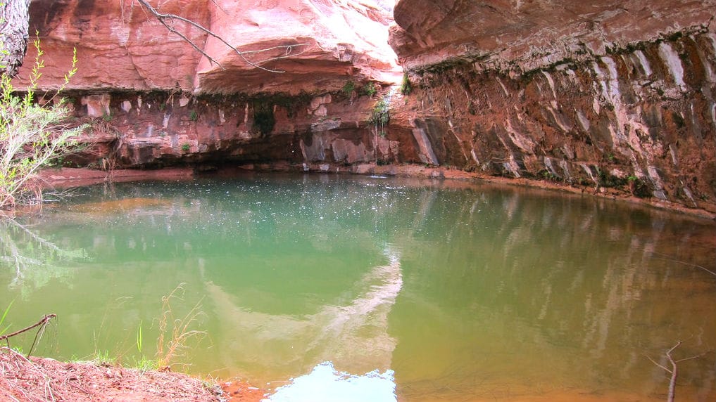
Hog Springs
Hog Springs is a stop just off Highway 95. A short hike will take you up to a pristine waterfall and pool. There is also some Native American rock art nearby, including the Moki Queen.
Henry Mountains
Highway 276 passes right through the Henry Mountains, home to one of the only free-roaming purebred herds of American Bison. The Henry Mountains were the last major mountain range mapped in the contiguous United States. The historical record never notes a name given to the mountain range either by Indians or by white explorers, and perhaps because of this, John Wesley Powell called them the Unknown Mountains during his first expedition in 1869.
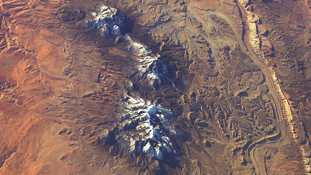
During Powell’s second expedition several years later, Powell’s brother-in-law and second-in-command, Almon Thompson, named the mountains after Joseph Henry, Powell’s supporter and the first Secretary of the Smithsonian Institution. Thompson named the highest peak Mount Ellen after his wife, Ellen. There is a formation on Mount Ellsworth (the southernmost peak) that looks like a frog, which provided the name for the community Bullfrog to the south.
Ticaboo
Ticaboo is a small community along Highway 276. Its name derives from the nearby Ticaboo Creek, which in turn was named by Cass Hite for a Paiute word meaning friendly. The town primarily serves Lake Powell tourists. Native American burial ruins were excavated just to the west of Ticaboo in the 1980s.
Burr Trail
The Burr Trail is known for its spectacular views as it connects up to Boulder. It named after John Atlantic Burr, who was born in 1846 on the Ship Brooklyn while it was in the Atlantic Ocean on its course from New York to San Francisco. When Burr was about 30, he moved with his family and helped establish the town of Burrville. He later developed a cattle trail across difficult terrain such as Waterpocket Fold. This trail came to be known as Burr Trail.
Section 6: Burr Trail to Boulder Town
| Section Mileage | Terrain |
|---|---|
| Approx. 66 Miles | Pavement, Gravel, Dirt Road |
GPS File Name: Burr Trail to Boulder Town
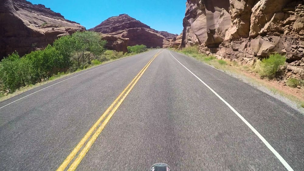
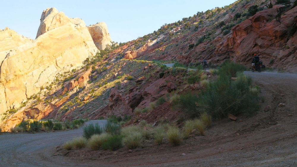
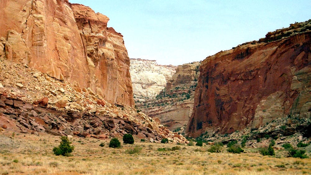
After a few miles towards Lake Powell, you make it to your start of the Burr Trail Scenic Backway. The Burr Trail is an incredible byway that connects Boulder town, Capitol Reef National Park, and Glen Canyon National Recreation Area. Most of the Burr Trail is paved, but it also has graded dirt roads through a good portion of the route. Be warned that the clay in some sections of the Burr Trail can make it very difficult to traverse when wet.
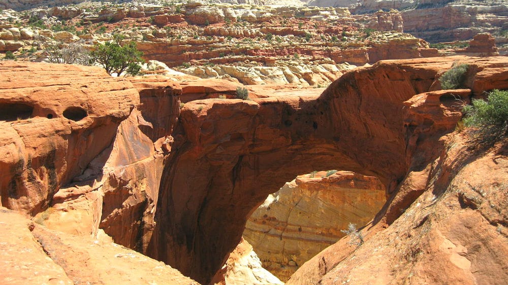
About halfway through the route, you get to the Burr Trail Switchbacks, which are one of the few passages through this section of Capitol Reef National Park. This is an incredible road that has a very rewarding view from the top.
Once to the top, continue down the road where it eventually turns back to pavement. Then head towards Long Canyon. Long Canyon is a definite standout of the Burr Trail. This canyon is home to many hikes, slot canyons and places to explore. You also can’t beat the views.
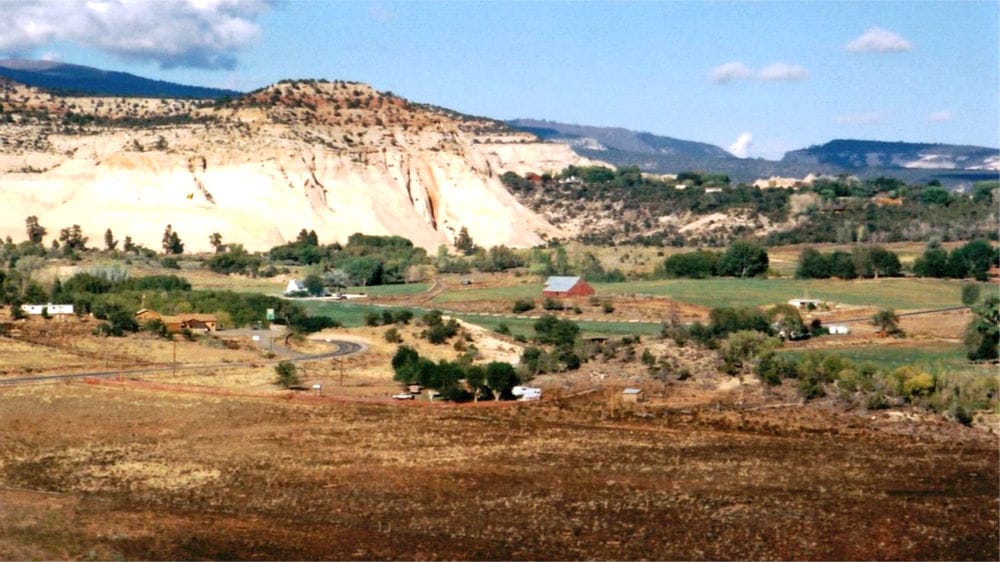
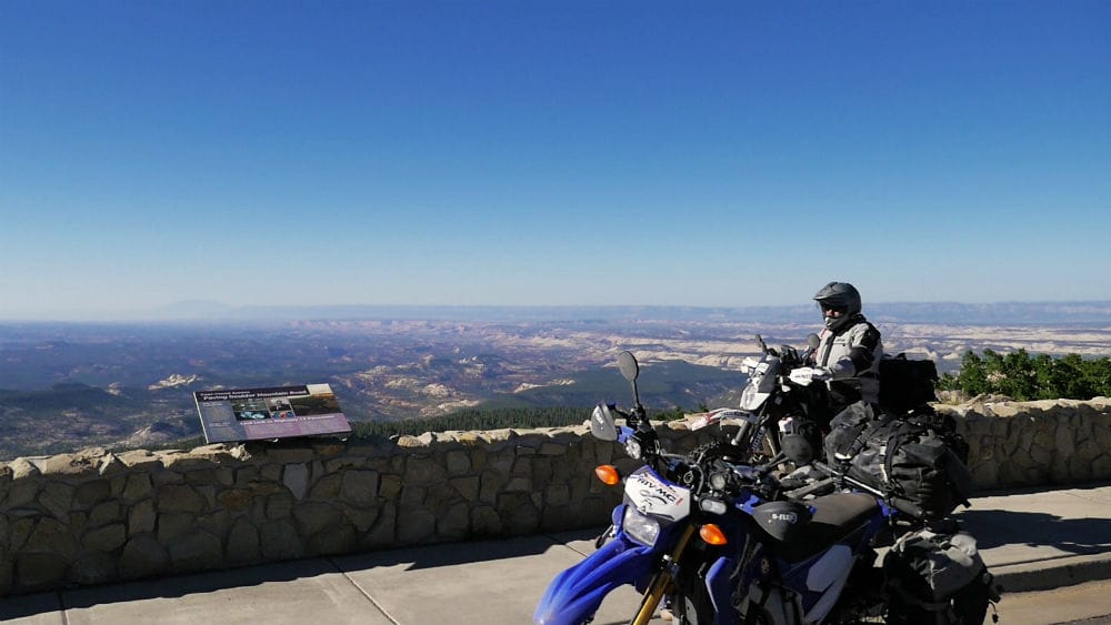
As you come up out of the canyon, it’s on to Boulder town where you can take a quick break. From there, get back on the road towards Boulder Mountain, where you camp for the night.
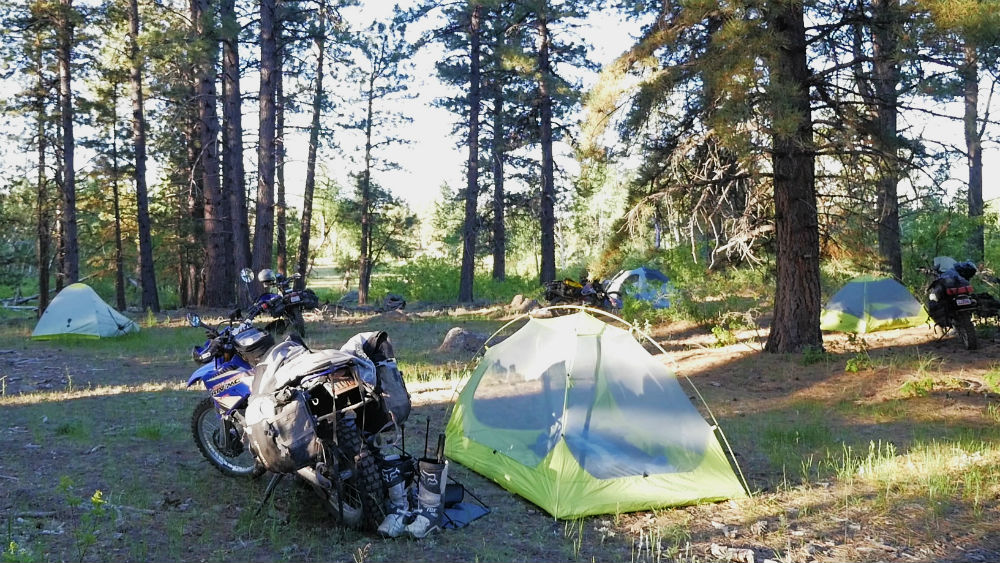
The location marked in the GPS files for camp 2 is a beautiful spot where you can enjoy a campfire while surrounded by trees. There is also a stream nearby where you can place your drinks to keep them cold.

Did you know that Capitol Reef National Park was once called Wayne Wonderland? Interesting facts and trivia can be found below.
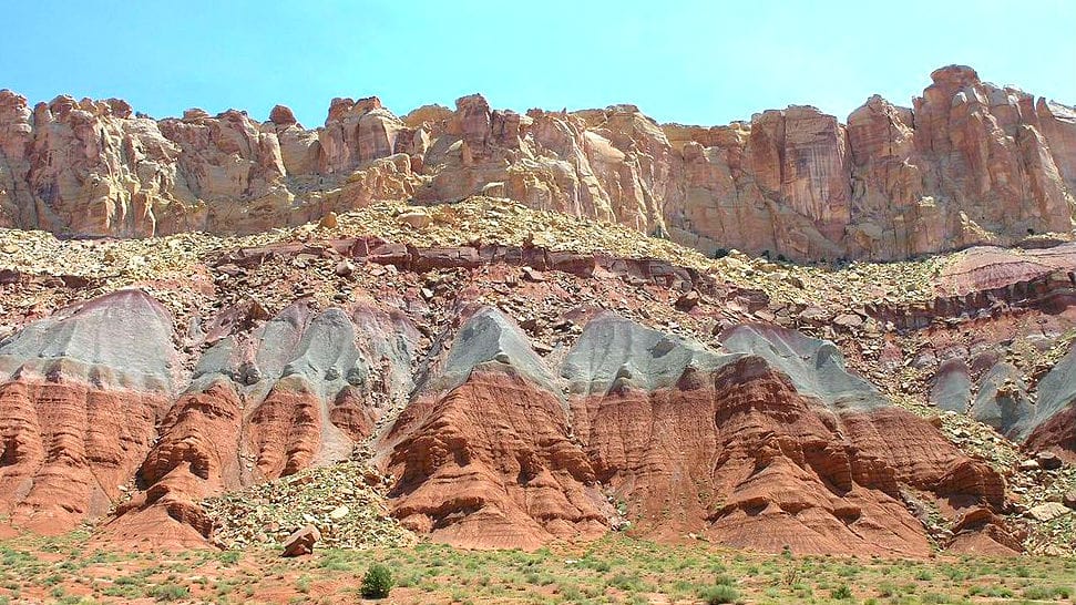
Capital Reef
The Burr Trail Switchbacks run through the Waterpocket Fold, part of Capitol Reef National Park. The name Capitol Reef has two parts – capitol referring to the white dome rocks (which look like the domes that cap many capitol buildings) and reef referring to a rock structure that serves as an obstacle to crossing (land in this case, unlike traditional sea reefs). The area was originally called Wayne Wonderland as it is partially located in Wayne County.
Muley Twist Canyon
On the west side of the Waterpocket Fold are the Upper and Lower Muley Twist Canyons, so named because they were narrow enough to “twist a mule.” The upper trail in particular has many natural arches that are visible.

Wolverine Petrified Forest
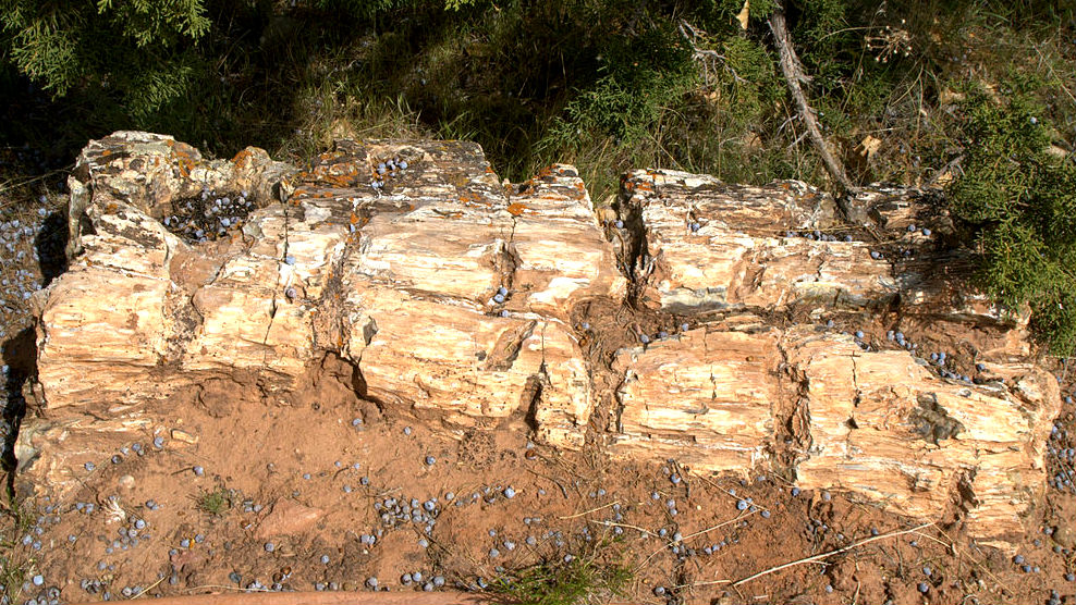
To the south of the Burr Trail on the west side of Waterpocket Fold is the Wolverine Petrified Forest, the second-largest Late Triassic petrified forest in North America. Although it requires a bit of a detour through rugged terrain, it is an interesting excursion if you enjoy fossils. (Please note that collecting the petrified wood is prohibited.)
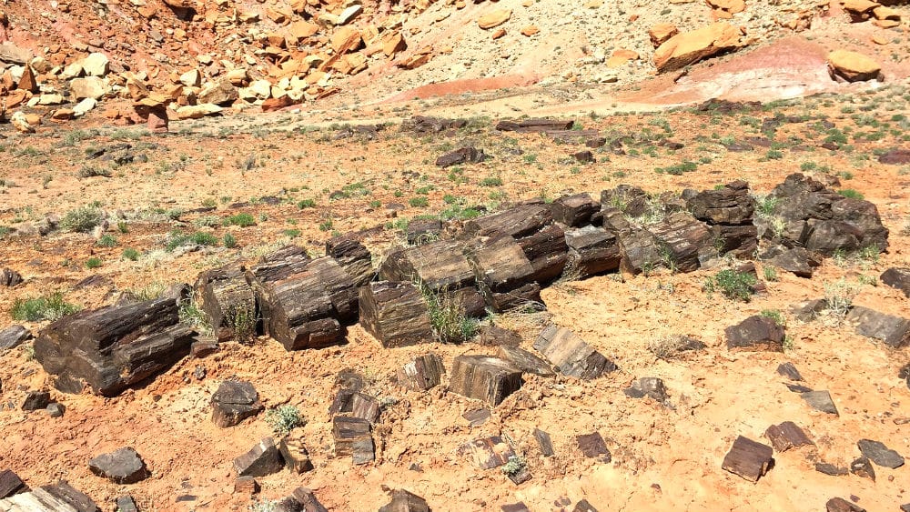
Petrified tree trunk in Wolverine Petrified Wood Area by The Greater Southwestern Exploration Company (CC BY 2.0)
Long Canyon
The Burr Trail runs through Long Canyon for about seven miles. During this stretch of the route, you’ll enjoy a breathtaking ride as sheer sandstone cliffs line both sides of the road. If you’re looking for an excuse to stop and explore a little bit, there is a slot canyon that provides a hike that is easy and short – but rewarding. At the end of Long Canyon is the Gulch.
Boulder Town
Boulder was first settled in 1889. The remote town was difficult to access due to the many canyons in the vicinity. Although roads were built, there was no bridge across the Escalante River until 1935, making Boulder one of the last communities in the United States to get automobile access. Highway 12 was finished in 1940, and the town finally got electric power in 1947. Boulder remains a small town with fewer than 300 inhabitants. The Anasazi State Park Museum is within the town’s boundaries.
| Section Mileage | Terrain |
|---|---|
| Approx. 36 Miles | Pavement, Dirt Road, Rock Sand Mix |
GPS File Name: Boulder Town to Fruita
After a short ride up the mountain, you get to some amazing overlooks of the terrain that you covered the day before. Continuing along Boulder Mountain, you get to your dirt turnoff that will lead you down to your first destination of the day in Fruita and the Capitol Reef National park.
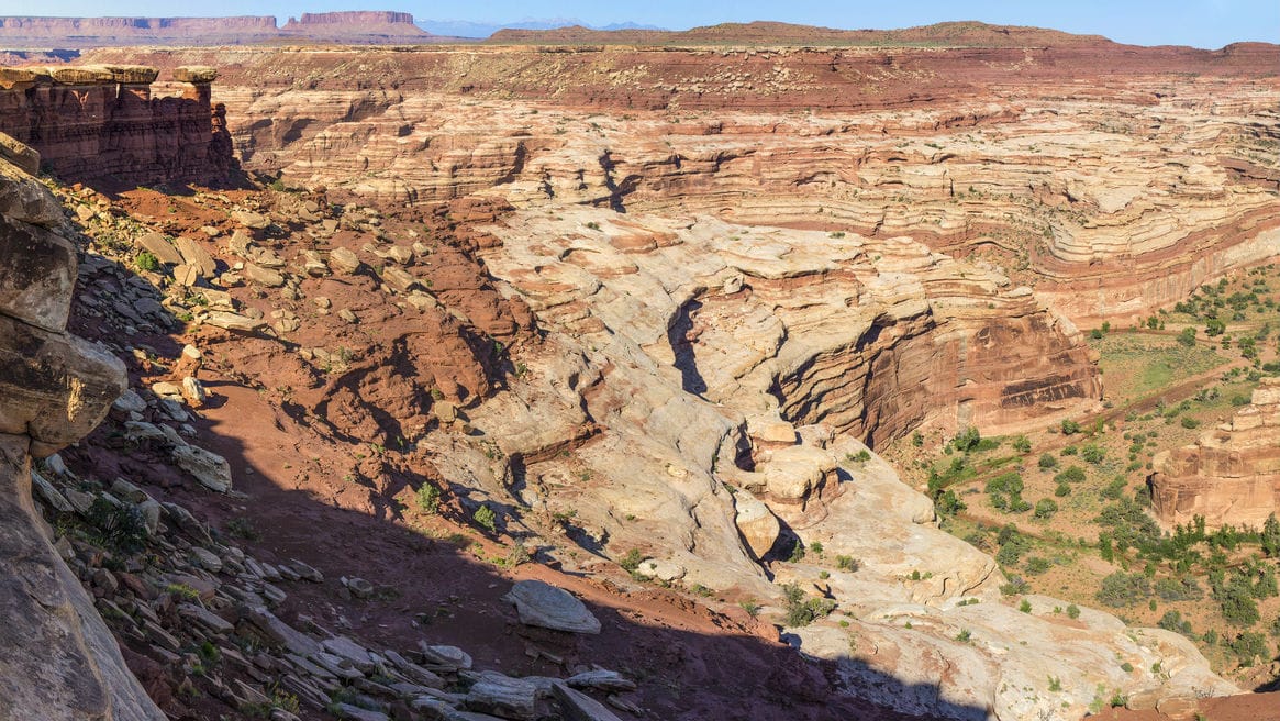
This segment is another route with a variety of terrains. You start out on gravel dirt roads, which slowly start to get sandy. You also get into rocky technical sections as well as a sandy wash. Along with the changing terrain, this section gives some amazing views of the mountains of Capitol Reef National Park. Once into the park, don’t forget to take some time to check out the beautiful Capitol Gorge Canyon.
Did you know that uranium mining took place within Capitol Reef National Park after the Atomic Energy Commission’s agenda won out over the National Park Service’s interests? Interesting facts and trivia can be found below.
Hanks' Dugouts
When settlers would first enter an area to farm it, they would often build temporary shelters until they were certain the land would yield enough to warrant a permanent residence. Such was the case with the dugouts built by Ephraim Hanks and his family in the 1880s. Although the Floral Ranch was successful enough for them to build a house, evidence of the dugouts remain to this day and are accessible just off of Pleasant Creek Road.
Capitol Gorge
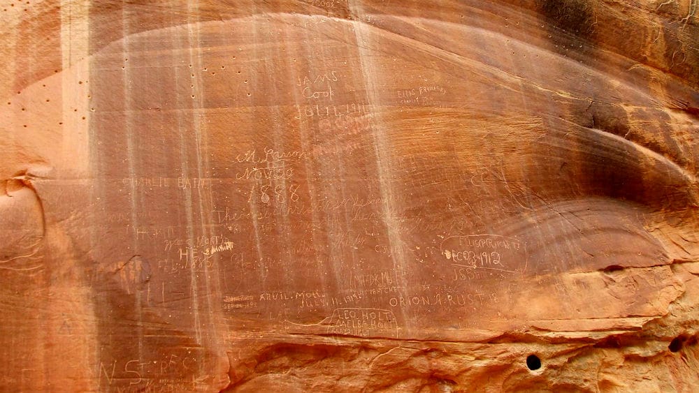
Capitol Gorge is a canyon cutting through the Waterpocket Fold. You can ride your bike up the road a couple of miles and hike the rest of the way if you’d like. Along the way, you can see the inspiring Golden Throne mountain, the Pioneer Register with hundreds of names of early travelers carved into rock, Native American petroglyphs and pockets of water known as “tanks.”
Scenic Drive
The last leg of this section travels a road only known as Scenic Drive, so named because of its variety of rocky formations and scenery.
Grand Wash
Grand Wash is another gorge cutting through the Waterpocket Fold of Capitol Reef National Park. It features a hiking trail that is characterized by its 800-feet high walls and narrow path (only 15 feet wide in some locations). One of the best natural arches in the area, Cassidy Arch (named after Butch Cassidy), is visible from this trail.
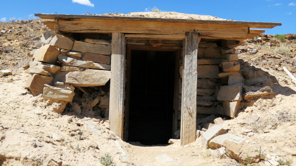
Oyler Mine
Near the entrance to the Grand Wash lies the Oyler Mine. At the onset of the Atomic Age and the Cold War, Utah saw an initial uranium mining boom. Although many old uranium mines exist in Southern Utah, the Oyler Mine is the closest to the Dirty Devil adventure ride route. It is of particular historical interest as it served as a battleground between two federal agencies with opposing agendas: the National Park Service and the Atomic Energy Commission. The AEC temporarily won, and uranium mining took place in Capitol Reef until 1956.
Civilian Conservation Corps Powder Magazine
Utah was among the hardest hit states during the Great Depression, and consequentially, New Deal programs like the Civilian Conservation Corps (CCC) had an extensive presence in the region. One CCC camp was located near Fruita, and a powder magazine was built nearby to store explosives used in CCC construction projects.
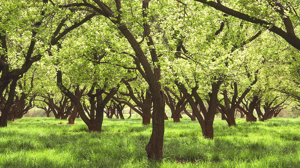
Fruita
The small town of Junction was established in 1880 at the junction of the Fremont River and Sulphur Creek. The town became known for its orchards and was nicknamed “the Eden of Wayne County.” In 1902, it officially changed its name to Fruita. The town was never very large (only about 10 families), with its largest building being a one-room schoolhouse. The town’s remoteness led to an economy based more on barter than cash. As a result, it was not affected much by the Great Depression, unlike many other areas in Utah.
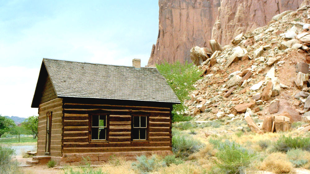
Fruita was part of the Capitol Reef National Monument when it was established in 1937. The National Park Service eventually purchased all private property in the town, with the last resident leaving in 1969. Today, the NPS still maintains the historic orchards. Visitors are welcome to sample ripe fruit for free or purchase the fruit if taking it out of the park.
Section 8: Fruita to Hell’s Backbone
| Section Mileage | Terrain |
|---|---|
| Approx. 49 Miles | Pavement |
GPS File Name: Fruita to Hells Backbone
Torrey
Next Gas Stop: 78 Miles in Escalante
Your next destination is Torrey, where you can gas up and get some lunch. To get there, you pass through the historic town of Fruita inside Capitol Reef, which was established in 1880 and was known for its orchards. Once all gassed up, you might consider heading over to the Capitol Reef Inn & Cafe, which is a nice little restaurant that is surrounded by petrified-wood walls and fixtures.
After lunch, take Highway 12 south. That loops back over the high scenic Boulder Mountain, where you’ll meet up with your next segment just past Boulder Town. Shortly after Boulder along Highway 12, turn off at your next mountain pass, taking you up over Hell’s Backbone.

Did you know that local legend claims that the rocky Thousand Lake Mountain and the lake-filled Boulder Mountain had their names mismatched by a cartographer who didn’t catch the mistake until it was too late? Interesting facts and trivia can be found below.
Capital Reef Country Scenic Byway
You’ll get on Highway 24 at Fruita. This section of the highway is also a state-designated scenic byway, the Capitol Reef Country Scenic Byway. If you’re willing to take a detour east before you head west, you can catch several interesting sites, including some petroglyphs, the Hickman Bridge (natural arch), the capitol dome rocks and the Behunin Cabin.
Along the westward route which is part of the Dirty Devil ride, you can see several interesting rock formations such as the Castle, Mummy Cliffs, Chimney Rock and Twin Rocks. Goosenecks Overlook provides a breathtaking view of the landscape.
View west-northwest from Goosenecks Overlook in Capitol Reef National Park by Famartin (CC BY-SA 3.0)
Torrey
Torrey was initially settled in the 1880s as Youngtown but was renamed Torrey, reportedly in honor of Jay L. Torrey, a Wyoming legislator who proposed the creation of frontiersmen troops and who later became colonel of the Rocky Mountain Calvary (which had many Utahns enlisted in it).
Colonel Torrey’s Rough Riders
One of the early important edifices of the town was a Mormon church built in 1898, which served many religious, social and civic purposes in the community. The LDS (Mormon) church donated it to the Daughter of Utah Pioneers organization for preservation in 1991 with the stipulation that the building be moved off of church property. The building now stands on property adjacent to the modern church building and is the only original log meetinghouse in Utah still in existence.
Scenic Byway 12
Scenic Byway 12 (also known as Highway 12 or State Road 12) is a road that begins at a junction south of Panguitch and takes an eastern route to Escalante, where it begins to turn north through Boulder and up to Torrey. Aside from the numerous points of interest along the route, Scenic Byway 12 is also notable for being Utah’s only designated All-American Road.
Grover
Just south of Torrey is Grover. The town is named for President Grover Cleveland, under whose presidency Utah was granted statehood after nearly 50 years of attempting. The tiny town benefitted from a Works Progress Administration (WPA) project that built a school in 1936. However, the school board didn’t feel like the town’s size was worth keeping the school running, and it was closed in 1941.
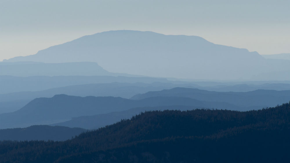
Thousand Lake and Boulder Mountains
This section travels to the southeast of Thousand Lake Mountain and follows the entire eastern side of Boulder Mountain, which comprises about half of the Aquarius Plateau. Boulder is the highest forested plateau in all of North America and is the only place in the world where the Angell cinquefoil grows. Boulder is known for its many lakes, excellent for fishing. This is opposed to Thousand Lake Mountain, which is known for its rocky terrain. Local stories claim that a cartographer mislabeled the mountains with the wrong names, but by the time the error had been caught, it was too late to correct.

Section 9: Hell’s Backbone to Escalante
| Section Mileage | Terrain |
|---|---|
| Approx. 39 Miles | Gravel Dirt Road |
GPS File Name: Hells Backbone to Escalante
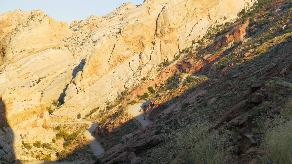
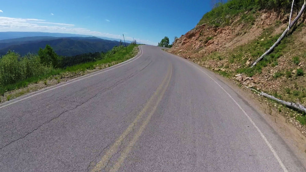
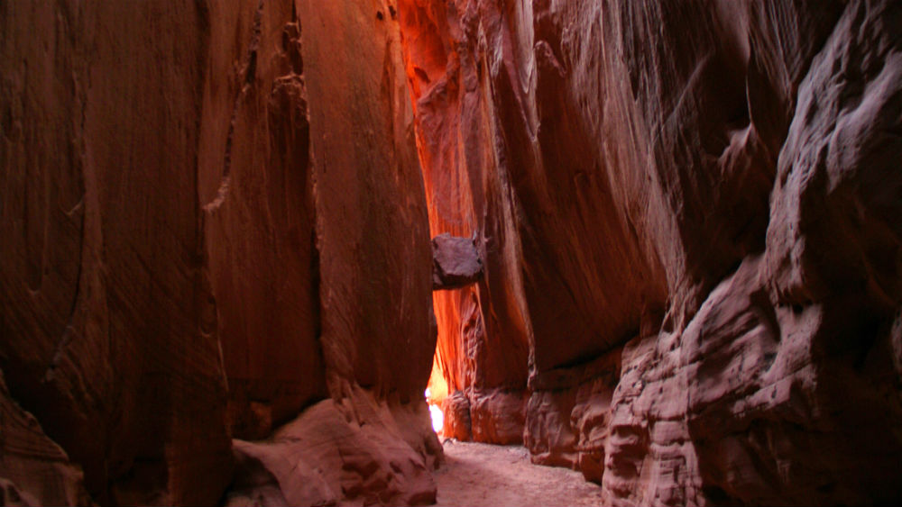
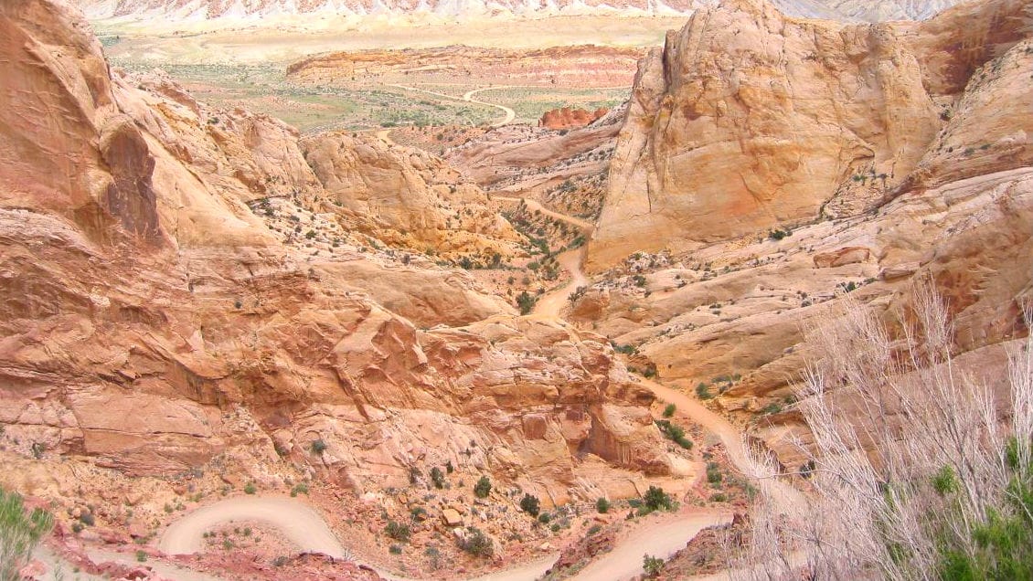
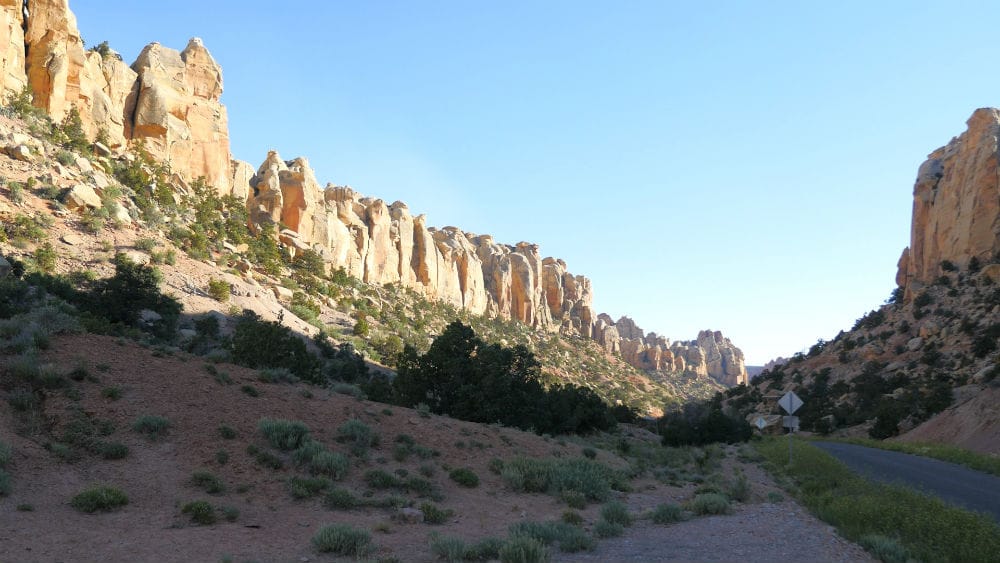
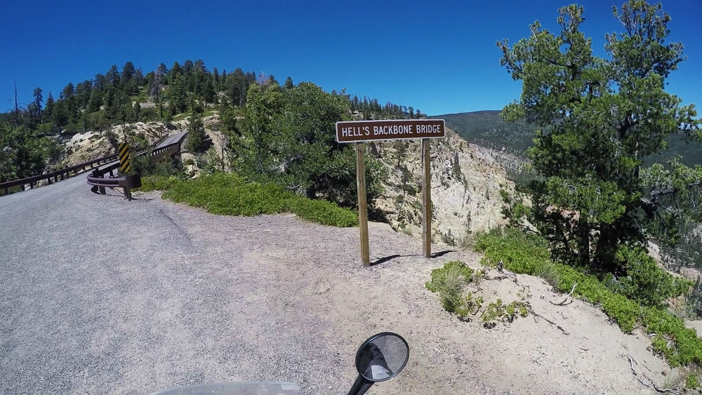
This route is a graded gravel dirt road that climbs over 9,000 feet and is a good section to take it easy and enjoy the forest landscapes. Once near the top, you get to Hell’s Backbone Bridge. This bridge takes you across the mountain’s ridge where you have a 1,500-foot drop on either side. This is a great spot to take a break and enjoy the scenery of the surrounding Box-Death Hollow Wilderness.
Continuing on, you make your way through the trees and then drop down into the town of Escalante. While in Escalante, gas up your bike, and make sure to grab any essentials that you might need since this will be your last stop before camp tonight.
Did you know that the park manager at the Escalante Petrified Forest State Park receives up to a dozen packages per year from past visitors who are trying to lift a curse after illegally taking petrified wood from the park? Interesting facts and trivia can be found below.
Hell's Backbone
Hell’s Backbone is a road that follows a ridge. Although the gravel road is not technical, it offers a thrill due to its narrow and winding nature, especially due to the steep hills on either side. At the top of the ridge is the Hell’s Backbone Bridge. Although most modern traffic from Boulder to Escalante opts for the gentler Highway 12, when Hell’s Backbone Road was first completed in 1933, it was the only road between the two settlements.
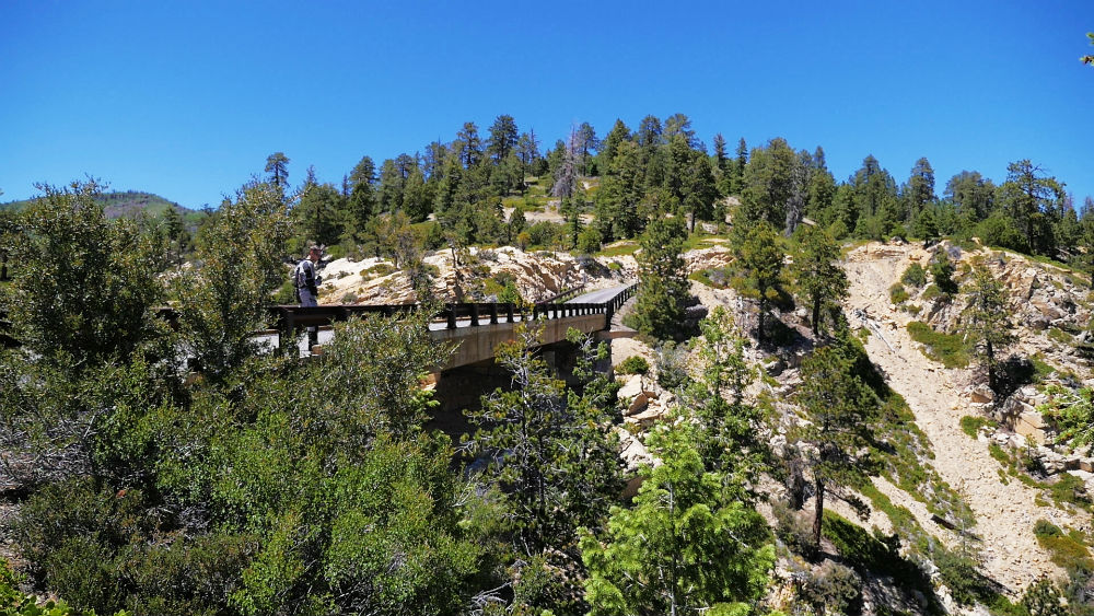
Box-Death Hollow Wilderness
Hell’s Backbone lies in the northern edge of the Box-Death Hollow Wilderness. Its name derives from a box canyon called The Box. The second part of its name, Death Hollow, refers to the many livestock that fell and died while trying to cross the canyon.
Escalante
The name Escalante comes from Silvestre Velez de Escalante, a Spanish missionary who was part of the first known European expedition through Utah in 1776. Although Escalante didn’t pass through the valley where the town of Escalante sits, John Wesley Powell recommended his name to the first settlers of the town.
Most of the town’s boundary sits within the Escalante Historic District, so designated because a large number of the existing buildings and landmarks reflect the community’s change “from isolated settlement to thriving agricultural center to remote, economically challenged community” throughout its history. Some of the settlement’s original buildings still stand.

Escalante Petrified Forest State Park
To the north of Escalante is the Escalante Petrified Forest State Park, which offers access to Wide Hollow Reservoir, a visitor’s center with fossils, and hiking trails that pass by petrified wood. Taking fossils from the park is illegal, and a local legend says that anyone who does so is cursed with bad luck. The park manager receives up to a dozen packages per year of returned petrified wood from tourists who ignored the warnings and were subsequently beset with misfortune. The fossils are returned with the hopes of lifting the curse.
Large piece of petrified wood in Escalante Petrified Forest State Park in Utah, USA by Aneta Kaluzna Qbek (CC BY-SA 3.0)
Section 10: Escalante to Hole-in-the-Rock – Out N Back
| Section Mileage | Terrain |
|---|---|
| Approx. 110 Miles | Dirt Road, Sand, Rocky Sections |
GPS File Name: Hole in the Rock Out N Back
Alternate: Devils Garden POI
Alternate: Spooky and Peek a Boo slot canyons POI
Phoenix
Next Gas Stop: 120 Miles in Escalante
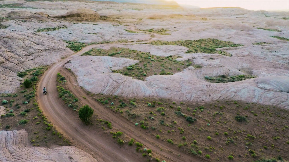
From Escalante, the next segment takes you down to the historic Hole-in-the-Rock. To get there, head southeast for a short distance, where you find the dirt turnoff at Hole-in-the-Rock Road. This road is roughly 110 miles out and back. It is primarily a dirt road, but it does encompass sandy sections, slow rocky areas and sections of sandstone slabs as you get further south. At the beginning, this section can feel long and desolate, but the further you get, the more beautiful and scenic it is.
This section’s destination, Hole-in-the-Rock, is a landmark that is remarkable to see and carries historical significance for the area as well. The story of Hole-in-the-Rock dates back to 1879 when Brigham Young sent some pioneers over to settle what is now Bluff. There was no easy way to get across the Colorado River gorge, so they did some scouting. They went to Arizona, but they decided not to take that route because of the Indians in the area. Instead, they took a more direct path and ended up at Hole-in-the-Rock. The area is high on a plateau with steep drops over cliffs down to the river. There was already a pretty good crack at the spot to begin with, and since many of the pioneers had some mining background, they were able to chisel and blast the rock to work their way down the crack. At one point, they even drilled holes into the rock and placed posts in them, building a road on the side of the cliff. It is a very interesting landmark and story.
After experiencing the amazing views and spectacle of Hole-in-the-Rock, it’s time to head back and look for camp for the night.
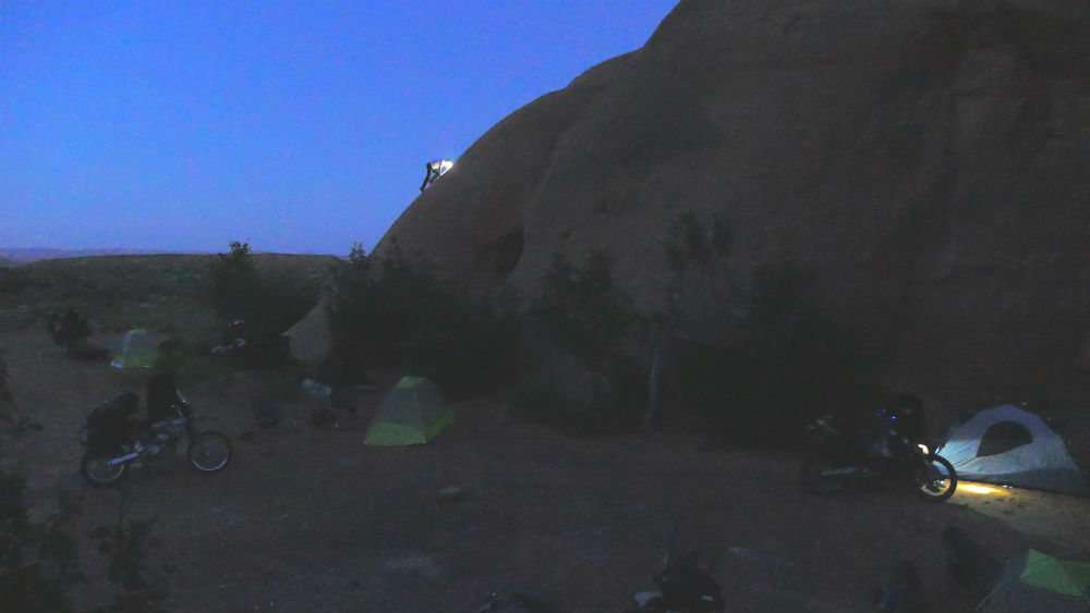
There are great spots along Hole-in-the-Rock Road where you can camp. (Be sure to pick up a free camping permit in advance from the visitor center in Escalante as most of Hole-in-the-Rock Road is within the Grand Staircase-Escalante National Monument.) We found a good location that is surrounded by rocks. It is a great spot to enjoy the warm desert night. You can see where we camped in our GPS files.
After camp, you will start the final day. Start by taking Hole-in-the-Rock Road back to Escalante. Be sure to gas up and get some breakfast while you’re there. On our last Dirty Devil ride, we ate breakfast at the Circle D Eatery.
Did you know that two brothers lived south of Escalante in caves that they created with dynamite? Interesting facts and trivia can be found below.
Grand Staircase-Escalante National Monument
The majority of the Hole-in-the-Rock Road travels through the Grand Staircase-Escalante National Monument. The Grand Staircase, on the west of the monument, is a series of large cliffs from distinct geological time periods, positioned apart and escalated like giant stairs. On the east is the Escalante River along with its associated canyons. Hole-in-the-Rock Road runs through the middle section of the monument, the Kaiporowits Plateau. The name Kaiporowits comes from a Paiute word meaning “big mountain’s little brother.”
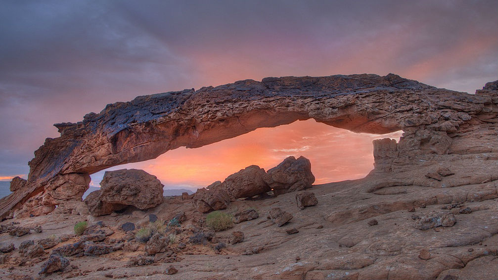
Natural Arches
A number of popular natural arches are accessible along Hole-in-the-Rock Road. The Cedar Wash Arch and Covered Wagon Natural Bridge only require a detour down a side road, but if you want to see the more scenic Sunset Arch and Sunrise Arch, these require a more lengthy hike to see.
Canyon Hikes
Hole-in-the-Rock Road passes near some popular canyons, though you will need to set aside dedicated hiking time to them to fully see and appreciate them. These include the Zebra Slot Canyon, Tunnel Slot Canyon, Peek-a-Boo Gulch and Spooky Gulch.

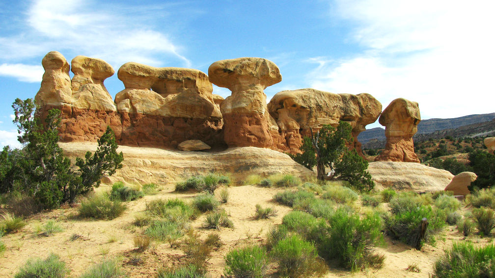
Devil's Garden
Devil’s Garden is a spectacular example of the kind of scenery available in the area. What makes it even better is how accessible it is, just off of Hole-in-the-Rock Road. Devil’s Garden is home to numerous hoodoos and features two popular natural arches: Metate Arch and Mano Arch (named after the Native American tools).
Dinosour Tracks
Although they can be difficult to see, a set of dinosaur tracks is accessible in Left Hand Collet Canyon. The site only requires a three-mile detour, and you can park close to the large rock that the tracks are on.
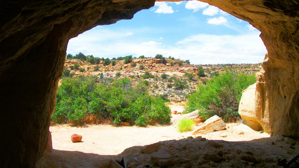
Batty Pass Caves
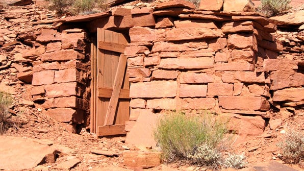
Brothers Bill and Cliff Lichtenhan came to the area from Colorado in the 1950s prospecting for Uranium. Rather that fix a leaky tent to deal with the rain, they blasted a cliff with dynamite, creating a cave. Eventually, they made it their permanent home despite little luck with mining, and they created two more caves to serve as workshops for inventions and handicrafts. Their home, now called Batty Pass Caves (after the nearby mountain pass), is still accessible, though it is apparent that no one has lived there in decades.
Dance Hall Rock
Dance Hall Rock is a huge sandstone mound peppered with potholes ranging in width from a few inches to 50 feet. The Mormon Pioneers used the rock as a landmark and recreation stop (reportedly for dances) as they traveled the trail to the Hole-in-the-Rock.
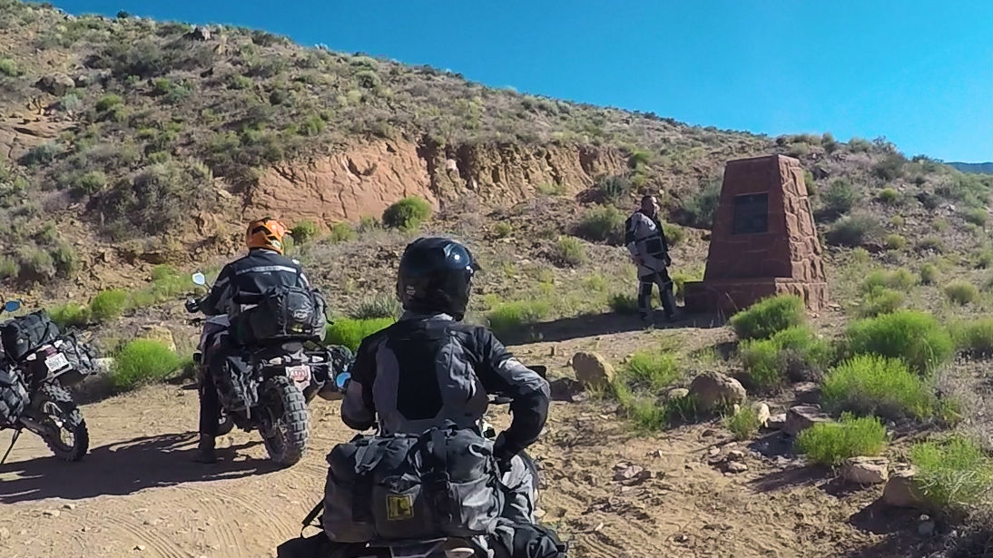
Boy Scout Monument
Hole-in-the-Rock Road passes over Carcass Wash, which was a difficult obstacle to traverse for early travelers. In 1963, it became the site of tragedy as a large truck filled with boy scouts and equipment had a brake failure and rolled. Seven scouts and six adults died. A monument was erected near the road in 1993 and can still be seen today.
Hole-in-the-Rock
In 1879, 250 Mormon pioneers set off on an expedition into Southeastern Utah with 83 wagons and over 1000 head of livestock. Their purpose was to establish a settlement on the east side of the Colorado River. There was not a good, direct route to the area, so the group created their own path directly to the edge of Glen Canyon. The problem was that the canyon bordered the Colorado River with large cliffs, and there was not a good way down in order to cross the river. The pioneers found a narrow crevice, and they chiseled and blasted it until it would be traversable by the group and its wagons – a process which took six weeks. They named this crevice Hole-in-the-Rock. The expedition managed to safely navigate down and across the river, and they eventually settled Bluff.
The Hole-in-the-Rock Road (which follows part of the original expedition’s trail) goes nearly all the way to the Hole-in-the-Rock. From the parking area, you can walk the short distance to the actual Hole-in-the-Rock, which is accessible and an interesting piece of the geology and history of the area.
Navajo Mountain
From Hole-in-the-Rock Road, you can see Navajo Mountain to the south (on the other side of Lake Powell). It is the highest point in the region, displaying prominently. The mountain is held sacred in Navajo beliefs, and traditional Navajos would not climb above its lower elevations.
| Section Mileage | Terrain |
|---|---|
| Approx. 112 Miles | Gravel Dirt Road, Pavement |
GPS File Name: Escalante to Skyline Drive
Escalante
Next Gas Stop: 52 Miles in Loa
Loa
Next Gas Stop: 160+ Miles in Payson
From Escalante, backtrack towards Hell’s Backbone. Before you get there, turn off on a road that’ll take you high up into the mountains and eventually drop you down into Loa, which is a good place to fuel up. This gravel dirt road offers views of lots of lakes and wide open meadows between the masses of trees. Posey Lake is a great place to stop for a quick, scenic break.
Make your way into Loa. From there, continue north to get yourself right back into the high mountain canyon roads in Fishlake National Forest with nice, windy road sections. The mountain pass hooks you onto I-70, where you head east for a short stretch before getting off to start your route along Skyline Drive.
Did you know that Pando, a quaking aspen clonal colony, may be the most massive organism in the world? Interesting facts and trivia can be found below.
Posey Lake
Posey Lake is a nice reservoir with an associated campground, making it a great place to stop for a break. The area was largely made possible thanks to work by the Civilian Conservation Corps in the 1930s. Although the origins of the name of the lake are unknown, it may come from Chief Posey, the leader of the last American Indian war, which took place in 1923 about 120 miles to the southeast of the lake.
Loa
Loa is a small town, but it serves as the county seat for Wayne County. It was established in the late 1870s by families who were already scattered throughout the valley but were encouraged to centralize. The town was named after the Hawaiian volcano Mauna Loa by Franklin W. Young, who had served as a missionary in Hawaii. In Hawaiian, loa means tall or high – an appropriate description, given Loa’s high altitude (over 7,000 feet), even when compared to many other cities in Utah. (As an example, Salt Lake City is 4,200 feet above sea level.)
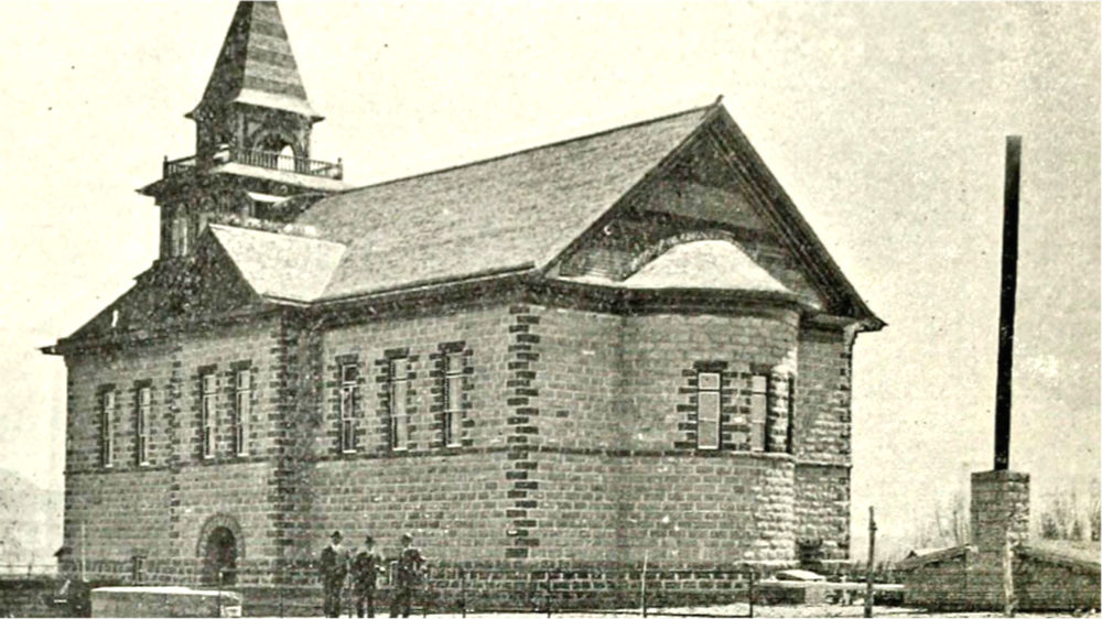
Tabernacle in Loa, 1914
Fremont
The town of Fremont as well as the Fremont River (which runs through the town) were both named after John C. Fremont. Fremont led several expeditions across the American West in the 1840s, and his reports inspired many to settle in the West – including the Mormons, who eventually settled in Utah. Fremont’s other endeavors involved military and political leadership (including acting as the first presidential candidate of the newly formed Republican Party in 1856). The ancient Fremont culture gains its name from the Fremont River.
Johnson Valley Reservoir
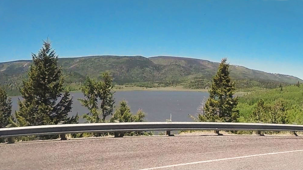
The Johnson Valley Reservoir is where the Fremont River begins. The reservoir was originally created in 1899, and while it is not as preferred as the popular Fish Lake nearby, it still remains a great recreation spot and a good place to take a break if you need one.
Pando
Pando is a single male quaking aspen located about a mile to the southwest of Fish Lake. Aspen roots can send up new stems at various points; thus, while it appears that multiple trunks are individual trees, they are actually part of a single plant that is established as a root. Pando has over 40,000 trunks, weighs nearly 6,000 tons and is spread out over 106 acres, and it is estimated to be over 80,000 years old – making it possibly the most massive and the oldest organism in the world. The unusual vitality of a quaking aspen’s root system is partly what motivated Utah’s legislators to make it the new state tree in 2014.
Section 12: Skyline Drive to Payson
| Section Mileage | Terrain |
|---|---|
| Approx. 148 Miles | Pavement, Dirt Road, Dirt Two Track |
GPS File Name: Skyline Drive to Payson
Alternate: Willow Creek Road ALT
GPS File Name: Beaver Creek-12 mile to Payson ALT
The Utah Skyline Drive is a route that runs approximately 100 miles along the top plateau of the Wasatch Mountains through the Manti-La Sal National Forest. This drive ranges from 9,000 to 11,000 feet, making it one of the highest roads in the United States. It is also home to many lakes, meadows, and amazing forest landscapes.
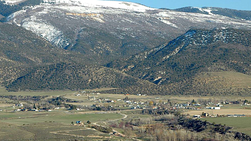
Because this road is so high in elevation, there are few times during the year when you can travel the entire route because of snow. If timed right, you can travel Skyline Drive as far north as Tucker. Because we were a little early in the year, we ended up dropping out of Skyline Drive just above Mayfield to avoid hitting snow. You can follow our same route, or you can continue north along Skyline Drive depending on the time of year you go.
If you take the alternate route, head north from Mayfield and up in Sterling (a good place to fuel up if you need to), and then take the country roads through the historic towns of Manti and Ephraim. Heading west from here takes you across more grazing and farm lands, which take you to Nephi Canyon. From there, you can hop back over on the Nebo Loop, which drops you back down into Payson.
Did you know that a juniper tree that saw and symbolized an agreement of friendship between Chief Black Hawk and Canute Peterson still stands to this day? Interesting facts and trivia can be found below.
Skyline Drive
Sections of Skyline Drive originally began in the 1880s as roads used by loggers seeking timber in the area. Due to flooding caused by deforestation, officials in nearby towns requested the United States government to take over management of the forest, and Teddy Roosevelt created the Manti Forest Reserve in 1903. The Civilian Conservation Corps eventually connected the preexisting trails into what is now Skyline Drive.
Manti-La Sal National Forest
Skyline Drive travels through the Manti-La Sal National Forest, specifically the Ferron/Price Sanpete Recreation Area. If you take the longer route along Skyline Drive, you are rewarded with magnificent forest scenery, and you can see several prominent mountains, such as Baldy, Horseshoe, North Tent and South Tent. The Manti La-Sal National Forest is home to the popular Arapeen OHV Trail System.
Axtell
One of the alternate routes runs through Axtell, a community founded in 1870. It was originally called Willowcreek, but it was later changed. According to some accounts, the name change was in honor of Samuel Beach Axtell, who served as the territorial governor of Utah for several months in 1875. Another story suggests the name came from Axel Innerson, an early settler.

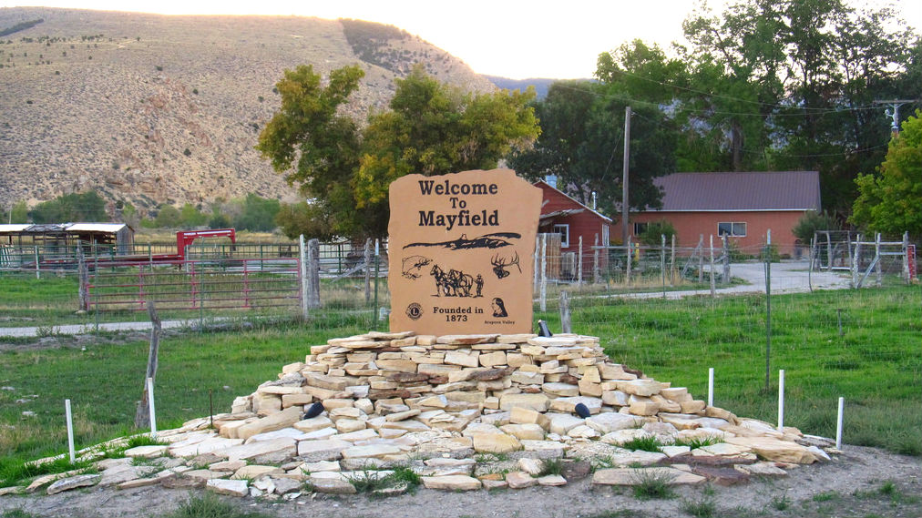
Mayfield
Mayfield was settled in 1873 on the north side of Twelve-Mile Creek (so named as it ran through Twelve-Mile Canyon, which was twelve miles south of Manti, the first community settled in Utah outside of the Wasatch Front). While the town was originally named Arapeen after an Indian chief who had lived in the area, its name was later changed to Mayfield because of its natural beauty during May. Another community was begun on the south side of the creek in 1875, called New London, but the two communities combined after only a few years.
Sterling
Sterling was settled in 1873 and was originally called Pettyville for William G. Petty, one of the town’s founders. The final name of the town was determined by a contest with a $5.00 prize. The word sterling refers to something excellent or valuable. The nearby Palisade State Park got an even earlier start, when it was created as a resort by Daniel B. Funk in the 1860s.
Manti
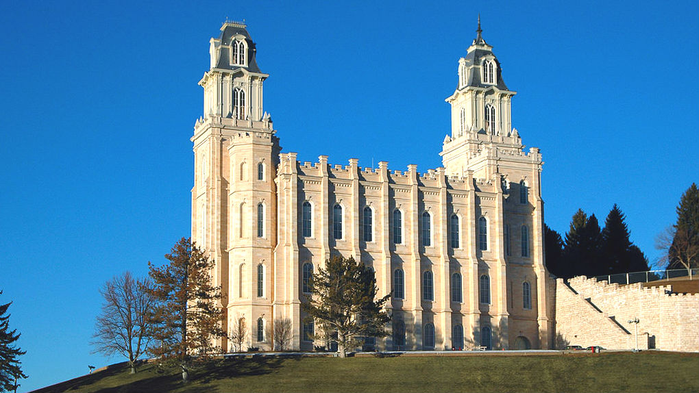
In 1849 (only two years after the Mormon Pioneers first arrived in the Salt Lake Valley) Chief Wakara invited the Mormons to settle in the Sanpete Valley, partly to teach the natives how to farm. Isaac Morley, one of the early settlers in the area, named the community Manti after a city in the Book of Mormon. Manti became a hub city for additional settlements in the area. Although it is no longer the largest city in the area, it continues to serve as the county seat of Sanpete County.
Numerous buildings in the town are listed on the National Register of Historic Places, two of which in particular give light on the historical religious climate of the area. The Manti Temple’s construction began in 1877 and was built using local oolitic limestone. When completed a decade later, the building’s cost was estimated at $1 million ($27 million in 2016 dollars), demonstrating the populace’s dedication to their faith. It became the third LDS temple in Utah at its dedication, serving the area’s primarily Mormon population.
The Manti Utah Temple of The Church of Jesus Christ of Latter-day Saints by Cory Maylett (CC BY-SA 3.0)
The Manti Presbyterian Church, built in 1881, is representative of early efforts to convert Mormons to Presbyterianism (or other Protestant sects). This was performed partly through providing schools to local communities, which were a major benefit to the settlements at a time before effective government-sponsored education existed. Reverend G. W. Martin, despite representing a contrasting ideology from the predominant religion of the area, became highly esteemed in Manti for his “commitment to civic affairs” and his “consistently friendly and broad-minded attitude toward Mormonism.”
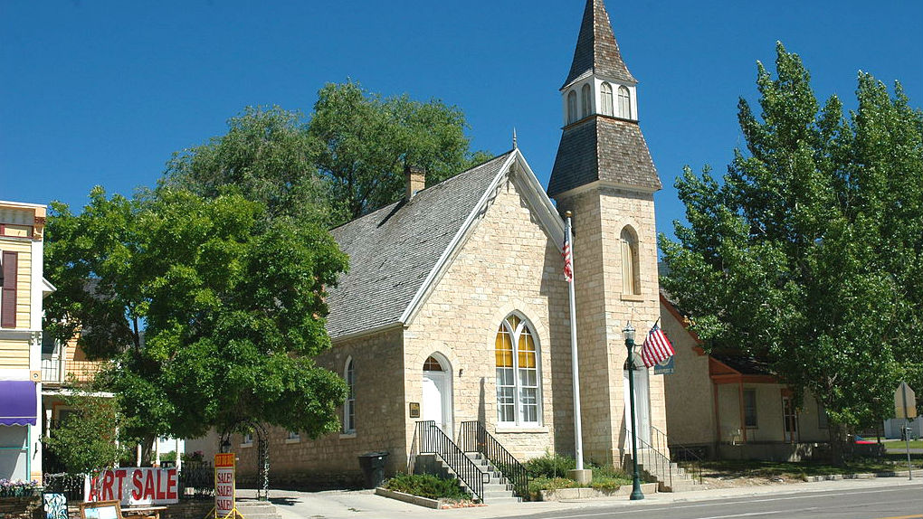
Manti Presbyterian Church, a historic church in Manti, Utah, United States by Tricia Simpson (CC BY-SA 3.0)
Ephraim
Ephraim was settled in 1854, named after the Biblical figure. There are several historical points of interest in town, including the Carnegie library, which still serves as the city library today. A few monuments exist in the city in memory of events related to the Black Hawk War. Canute Peterson and Chief Black Hawk made a pact of friendship and peace under a juniper tree in town, agreeing that they would not fight as long as water ran through the creek behind the tree. Both the tree and the creek are still present.
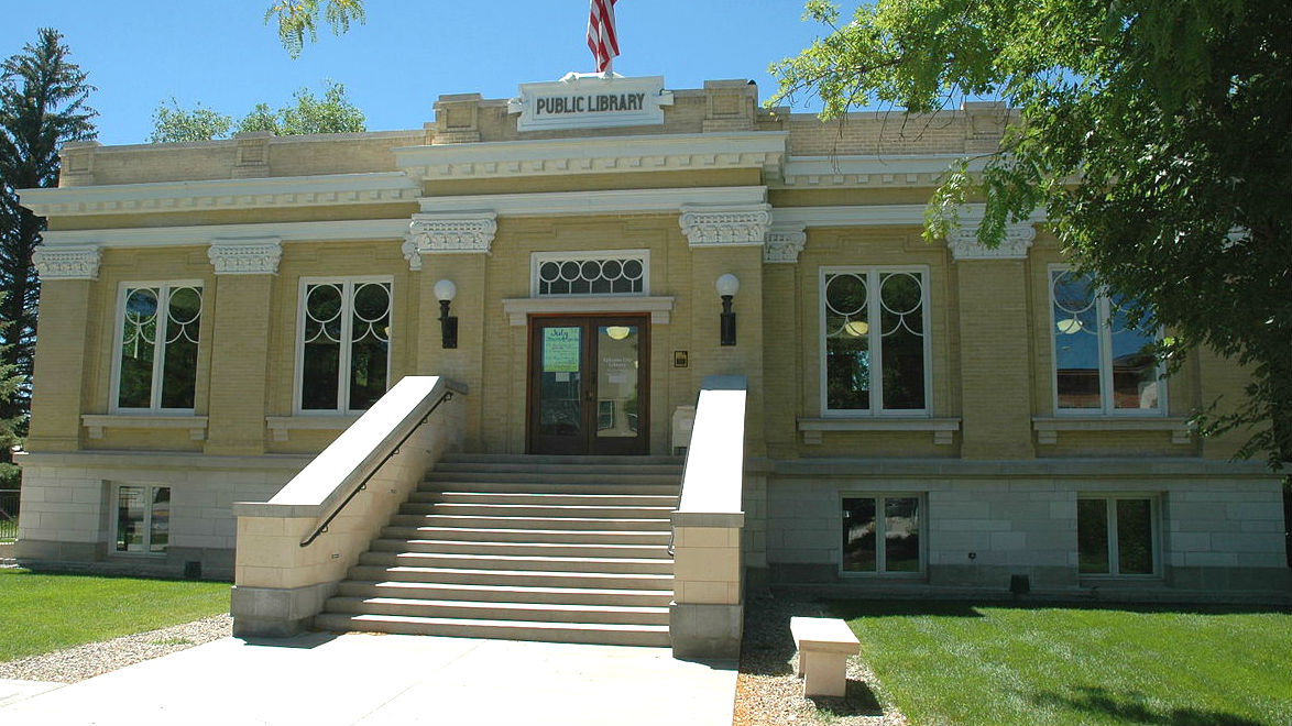
Ephraim is home to Snow College, a junior college that began as the Sanpete Stake Academy in 1888, one of 11 Utah academies founded by the LDS Church, in part as a countermeasure against protestant schools that were appearing throughout Utah. It eventually evolved into a junior college, and ownership was transferred to the State of Utah in 1933. The Noyes administration building on campus is the original building that was in use when the school’s name was changed to Snow in 1902. Named after early principal Newton E. Noyes, the building is on the National Register of Historic Places.
Geographic Center of Utah
It’s difficult to determine the geographic center of a state that doesn’t have perfectly square boundaries. Local legend suggests that the name of Levan in Sanpete County is merely navel spelled backwards. However, when a boy scout inquired with the United States Geological Survey, they provided coordinates that are about five miles west of Ephraim (39°23’12?N 111°41’6?W). The scout put a marker on the spot and established a trail leading to it.
Chester
Chester was settled in the 1870s by Hans Christian Hansen Beck and David Candland. Originally, the town was called Canal Creek. However, Candland changed the name to Chesterfield after his English hometown. The name was later shortened just to Chester.
Spring City
Spring City lies off the Dirty Devil route, but it is accessible with a small detour. The entire community has been classified as a historic district for exemplifying the Mormon village settlement plan, with buildings centralized in town and farms lying outside of the town (as opposed to homesteading, which was popular in other areas of the United States). Dozens of sites within town contribute to this status. In 2010, Forbes listed Spring City as one of America’s prettiest towns.
Moroni
The city of Moroni was settled in 1859. It went through a slew of names, including Sanpitch, Mego, Little Rome and Duck Springs. Finally the county’s probate judge named it Moroni, a name found in the Book of Mormon. An opera house was built in 1891 and continued operating until 1915. The building still stands (one of only two surviving opera houses in Utah from the 19th century), though today it is used for social and cultural events. Moroni is also notable for being the headquarters of Norbest, a turkey marketing cooperative.
Juab County
This final section of the route passes through Juab County, which gains its name from a Ute word meaning flat or level plain. The county was formed in 1852, though its current borders weren’t finalized until several years later. In the late 1800s, the county became one of the most important mining districts in the nation. Over the course of the next century, mining’s importance lessened in the area.
Nephi
The city of Nephi began in 1851 as Salt Creek. It gained its current name in 1882 after a figure in the Book of Mormon. It enjoyed an economic boom thanks to its strategic location with the railroad in the late 1800s, and it came to be known for a short time as “Little Chicago.” Nephi serves as the county seat for Juab County, and the county jail built in 1888 still stands (though unused since the 1970s).
The old Juab County Jail, a historic building in Nephi, Utah, United States by Tricia Simpson (CC BY-SA 3.0)
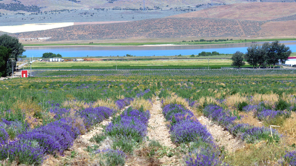
Mona
The city of Mona went through several names (including Clover Creek, Willow Creek and Starr) before it was called Mona after the Latin name for the Isle of Man, where one of its early residents was from. Mona is known for the Burraston Ponds to the south and the Young Living lavender fields to the north.
Rocky Ridge
Unlike most communities along the Dirty Devil route, Rocky Ridge is a relatively new community, with property first being developed for the town in 1971. Its name comes from the nearby mountainous terrain.
Santaquin
Santaquin was originally called Summit City as it straddled the line between the Utah and Juab valleys. A local chief named Guffich made friends with the Mormon settlers there and warned them on one occasion of an impending Indian attack. When the community decided to rename the town in honor of Guffich, the chief declined, instead suggesting the name of his son, Santaquin.
Chieftain Museum (Originally Santaquin Elementary School)
Spring Lake
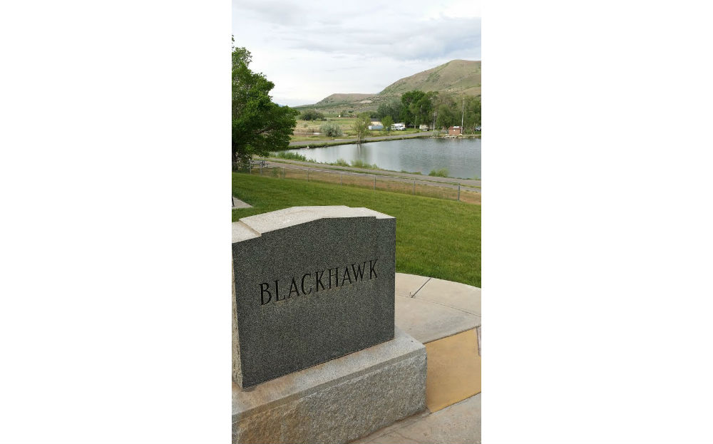
Spring Lake was settled in 1850, named after a lake in the area. However, before its settlement by Mormon Pioneers, it was the birthplace of Chief Black Hawk. The chief also died and was buried in the area. Miners dug up his remains, which were relocated to a museum in Salt Lake City. In 1996, the remains were returned to Spring Lake, where they were reburied. A monument marking his burial is located in a park in town. Spring Lake is also notable for being the location of the first newspaper in Utah outside of Salt Lake City.
Conclusion
When it comes to adventure rides, the Dirty Devil has a little bit of nearly everything that Utah has to offer. The scenery is incredible, and the history of the areas it travels through is among the lesser known of the state. The riding is great, covering a variety of terrains and difficulties. We’re excited to share this ride with you.
Don’t forget to subscribe to our YouTube channel to stay updated on future rides!
Disclaimer
Route information and GPS files are provided to you "as is". Rocky Mountain ATV/MC and RM Rides makes no warranty that the information contained therein is accurate or the information is fit for any particular use. Furthermore, Rocky Mountain ATV/MC and RM Rides disclaim all liability from any damages which may arise (directly or indirectly) from your access and use of the information or files. By accessing the route information or GPS files, you acknowledge that you take full responsibility for your actions (or lack of action) in relation to them. The information and details supplied are not a substitute for proper planning. Check with the official representatives of the agency or organization that governs or operates a particular riding location, gas station, campsite, or point of interest to determine current accessibility, special rules, hours of operation, or exact boundaries that are appropriate for powersport vehicle use.
Disclaimer
Riding any type of powersports vehicle can be a dangerous activity and is done at your own risk. The riding tips, techniques, videos, and photos that Rocky Mountain ATV/MC posts on this site feature both professional and experienced riders and may cause serious injury or even death. Riding at high speeds or participating in stunt riding is inherently dangerous. Rocky Mountain ATV/MC disclaims all liability from any and all losses, damages, injuries, paralysis, or death that may occur by trying any of the riding tips, techniques, stunts, photos, videos, or content found on this website, either posted by Rocky Mountain ATV/MC or visitors of the site. Furthermore, we recommend you always wear a helmet and the appropriate safety gear when riding and that you assess your own capabilities and skill level before attempting any rid, terrain, stunt, or technique. Some of the content, videos, and photos presented on this site have been sent to us by our customers. All information presented in the content, videos, and photos, including tricks, views, opinions, or positions of Rocky Mountain ATV/MC or their affiliates.