- MOUNTAIN TIME
- ¡Hablamos español!

H1 Heading Not Displayed
Disclaimer
The difficulty of this ride ranges anywhere from paved roads to technical, rocky, steep terrain. If possible, the most difficult sections of these rides will have a bypass (which is indicated in our maps if they are available), but the availability of the less difficult bypass is not guaranteed, and on occasion, the only way forward may be through a difficult section. While we try to highlight the difficult sections in the videos, specific trail conditions vary from year to year and storm to storm. We recommend that anyone attempting these rides get the most up-to-date road and trail conditions from local state, county, or land use agencies where available. If you notice any trail conditions that are different from what is shown in these videos, please send those trail condition updates to [email protected].
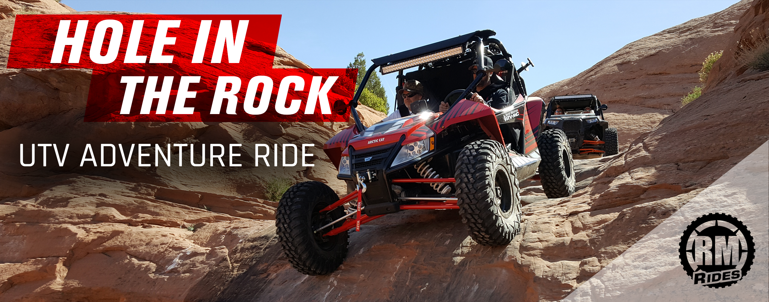
Hole-in-the-Rock East UTV Ride
Admin // August 30, 2017
Have questions about this ride? Shoot us an email:
About
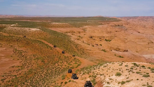
Imagine tackling rugged terrain that puts your UTV driving skills to the test – all while knowing that pioneers crossed the same terrain in wagons over a century earlier. This describes the Hole-in-the-Rock East UTV Adventure Ride exactly.
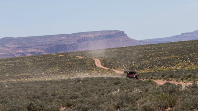
The ride encompasses multiple days and offers plenty of beautiful Southern Utah scenery. There are a number of fun, challenging spots throughout: slickrock, sand, steep climbs and sharp descents.
As part of our RM Rides series, we’ve documented the route, making it easy for you to plan your own UTV adventure ride. The video above shows how the trip went for us and gives a great overview of what you can expect.
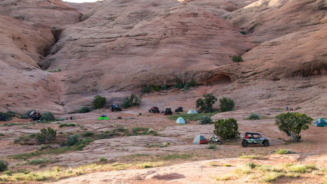
We’ve set up the ride as four days with a single base camp. You ride in on the first day. On the next two days, you take two different trails, returning to base camp each day. On the last day, you ride back out. If you want to be flexible, you can cut out the second day altogether or move around your camping spot as needed. Just be sure to stay on the designated trails to ensure this area continues to stay open for everyone to enjoy.
The ride tackles several technical sections, but it should be manageable for any experienced driver in a properly equipped UTV. Be sure to use our GPS files so you don’t get lost. This trip can be done on ATVs as well.
This article is designed as a resource to help you plan your own Hole-in-the-Rock East ride. It also includes interesting facts and trivia about locations you will pass through or nearby. Links are usually provided that can direct you to resources for even more information.
Preparation
In preparation for any adventure ride, it is critical you take time to carefully plan. Not only do you need to plan routes, food and time, but you need to make sure that your bike is ready and that you have the right tools, camping gear and emergency equipment.
One thing that you absolutely should not forget is fuel. You’ll be out for several days without a gas station in sight. The entire trip is nearly 100 miles in and out, and that doesn’t leave a lot of wiggle room for many machines (or any wiggle room for some).
Weather is an important consideration with this ride. In the summer, it’s way too hot. In the winter, there might be snow on the trail – and snow on this terrain is not going to make for a very fun ride. We planned our ride for Easter weekend, and it was perfect. The weather was beautiful and made for a great trip. In order to fully enjoy the outdoors, don’t forget essentials like plenty of cold water, sunscreen and bug spray.
One of the great things about this ride is its pioneer history. We’ve included some highlights in this article, but if you want to dig in and immerse yourself in the full history of the expedition before you tackle the ride, check out David E. Miller’s Hole in the Rock: An Epic in the Colonization of the Great American West.
Once you have the right gear and planning in place, you are ready for adventure!
Section 1: Parking to Camp
| Section Mileage | Terrain |
|---|---|
| Approx. 22.7 Miles | Dirt Roads, Some Slickrock |
GPS File Name: HITR Trail section 1
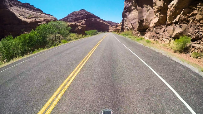
To begin the Hole-in-the-Rock East ride, you need to trailer in from Highway 276. Regardless of which direction you’re coming from, you need to get on Highway 95, which has two junctions with Highway 276. Be aware that if you get on Highway 276 at the north junction, you’ll have to take a ferry at Bullfrog. From Highway 276, take the turnoff for the Hole-in-the-Rock road (three and a half miles east of Cal Black Memorial Airport, named in honor of San Juan County’s champion of economic growth). Half a mile down the road, there is a pullout large enough for trailer an a good staging point where you can park your vehicle and unload your UTV. Then it’s time to hit the trail!
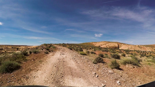
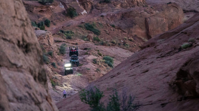
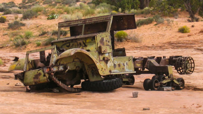
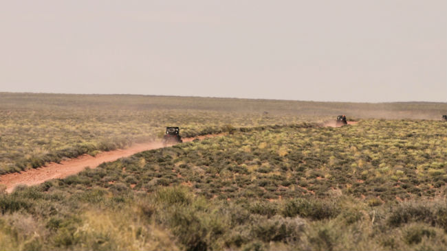
The first part of the route is mostly open road, easy to navigate. You know you’re still on the right path when you pass an old half-track. Once you hit slickrock, it’s a lot harder to follow the trail by sight alone, but the GPS files make it easy. There are a few technical sections before you reach camp, and they offer great opportunities to get warmed up for the rest of the trip.
The place we selected for camp is just off the main trail and offers plenty of sandy areas that are perfect for tents.
Did you know that Utah’s only automobile ferry crossing is located in the same spot that a ferry was established in the 1880s? Interesting facts and trivia can be found below.
Utah State Route 95
Highway 95 runs from Hanksville to Blanding, crossing over Lake Powell near Hite. This road was dedicated as a highway in 1976 – America’s Bicentennial. As a result, it received the nickname Bicentennial Highway. Regardless of which direction you come from to get to the Hole-in-the-Rock East ride, you will need to take Highway 95.
Utah State Route 276
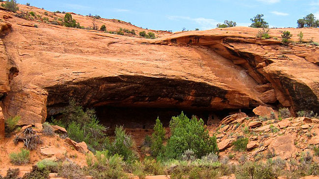
Highway 276 meets Highway 95 at its north and south end, with Utah’s only automobile ferry connecting the two halves of the road across Lake Powell. In the 1880s, Charles Hall set up a ferry crossing at this same location, and for this reason, the area is sometimes referred to as Hall’s Crossing. If you take the northern route, before you reach the ferry, you’ll pass through the Henry Mountains, home to one of the only free-roaming purebred herds of American Bison and the last major mountain range to be mapped in the contiguous United States. If you approach the Hole-in-the-Rock trail from the southern route on Highway 276, watch for old Native American ruins off the road along the way.
Hole-in-the-Rock Road
An older Hole-in-the-Rock Road used to take a different route through Lake Canyon, but a 2006 flood made it impassable, and the route now travels along the Nokai Dome Road (named for a nearby rock dome). Why a rusty M3 military half-track remains on this road has been lost to history, though one possible explanation is that miners may have picked it up after WWII as surplus, later abandoning it when it broke down. About five miles from camp, Nokai Dome Road connects to the trail taken by the pioneers. Most of the rest of the route follows this original trail.
Section 2: Camp to Rincon Overlook
| Section Mileage | Terrain |
|---|---|
| Approx. 22.6 Miles | Technical Slickrock, Dirt Roads |
GPS File Name: HITR Trail section 2, Rincon
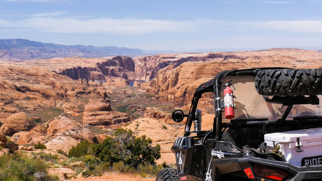
You’re in for a treat when the sun creeps over the red rock and you get to experience the sounds and feel of a Southern Utah morning in the spring. The route on the second day takes you to the Rincon Overlook along the shores of Lake Powell.
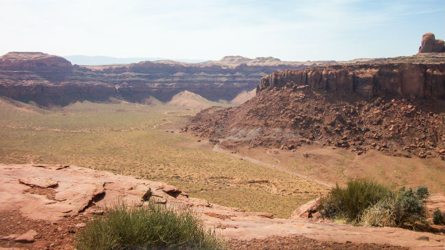
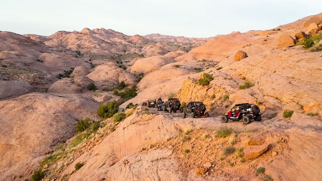
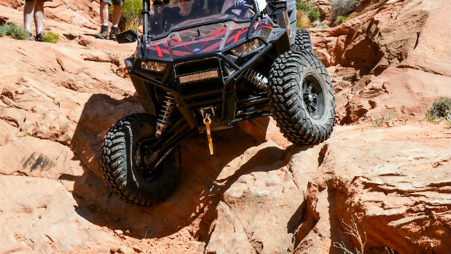
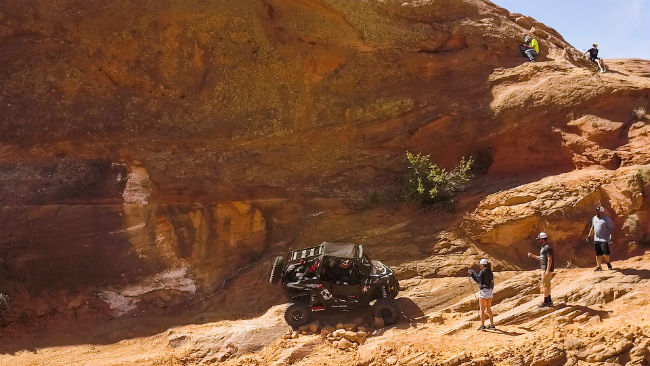
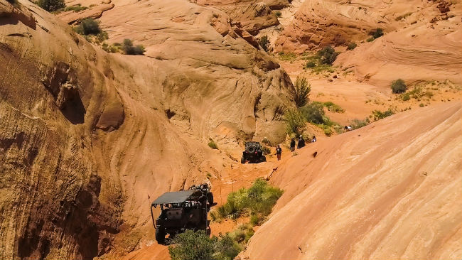
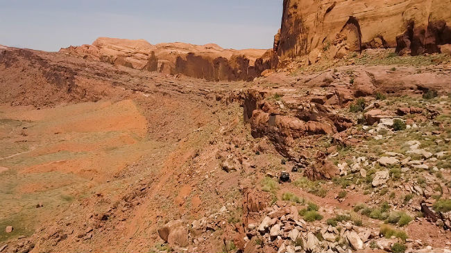
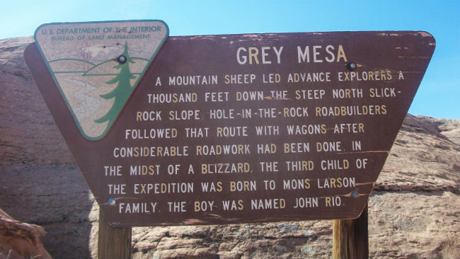
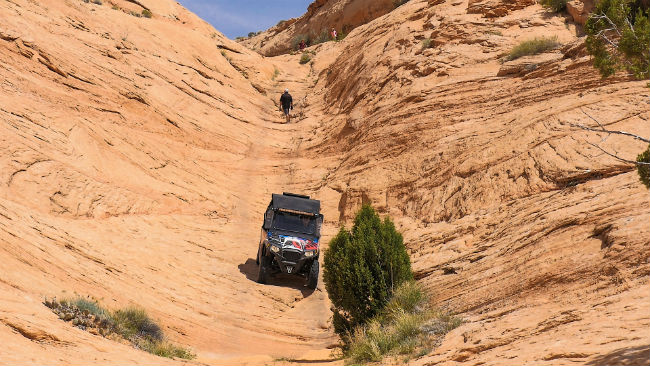
To start off, you first need to climb to the top of the Grey Mesa that overshadows the camp. This route south starts the excitement early on with some of the gnarliest technical sections along the edge of the mesa. Some solid spotting and good throttle control can make a big difference here – don’t hesitate to pull out a spotting rope in this section.
Once on top of the Grey Mesa, the trail turns to wide open dirt roads with beautiful scenery in every direction, a transition that can be a bit surprising. Be sure to stop at the San Juan River Overlook for an absolutely stunning view.
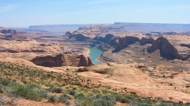
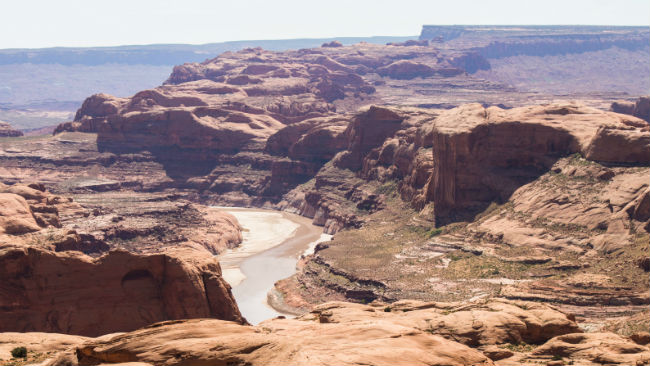
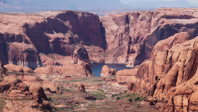
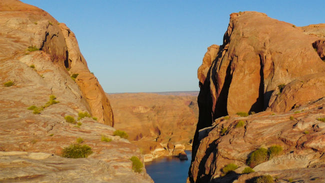
When you start coming down off the Grey Mesa, the route takes a turn to the northwest. The flat, open surroundings begin to transform into large slickrock canyons. This is a good time to find a nice shaded area for a lunch break. Afterwards, you can continue on your way to the Rincon Overlook. The Rincon is an area where the Colorado River used to flow around a huge butte, but after time, the river eroded through a different route, bypassing the butte and leaving it high and dry.
If you are feeling particularly adventurous, you can continue down the cliff on a very technical old road that includes steep grades, sheer drops and loose boulders. It reaches the shore of Lake Powell, offering amazing scenery as well as lakeside fun. When you’re done, just reverse your route back to camp.

Did you know that the San Juan River is one of America’s muddiest rivers? Interesting facts and trivia can be found below.
San Juan River
The San Juan River begins in the San Juan Mountains and travels over 380 miles through Colorado, New Mexico and Utah before joining Lake Powell. It is an important water source in the area, bringing moisture from the snow-filled Rockies to the desert region. It is also one of the muddiest rivers in North America.
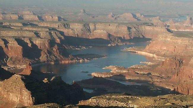
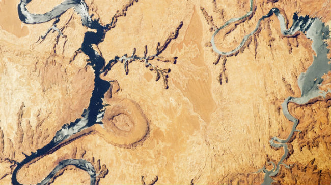
Lake Powell
Lake Powell was formed as a result of the construction of the Glen Canyon Dam in the 1950s. The dam backed up the Colorado River and flooded Glen Canyon. The newly formed lake was named in honor of John Wesley Powell, an explorer who took part in several expeditions in the area. Lake Powell is a popular modern recreation destination, receiving two million visitors every year.
The Rincon
The word rincón means corner in Spanish. In the American Southwest, the word is applied when a meandering river loses one of its corners and takes a more direct path, leaving land that was once wrapped by the river. The Rincon is a prominent example of this type of geography, so much that it isn’t only known as a rincon but as the Rincon.
Section 3: Camp to Little Hole-in-the-Rock
| Section Mileage | Terrain |
|---|---|
| Approx. 23.7 Miles | Technical Slickrock, Dirt Roads |
GPS File Name: HITR Trail section 2, HITR Trail section 3
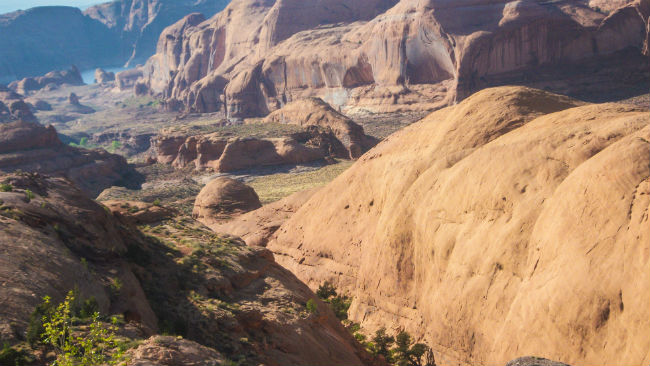
Section 3 takes you to the end of the motorized trail at Little Hole-in-the-Rock, where you can gaze across Lake Powell to see the Hole-in-the-Rock landmark, a rock formation that originated naturally but was expanded by pioneers to allow for wagons to descend off the plateau so they could cross the Colorado River on their way to form a new settlement.
Right out of camp is a marker indicating the original path that the pioneers used to descend off the Grey Mesa. (This is the one section of the route where the modern motorized trail doesn’t follow the original pioneer trail.) The pioneers sent an exploratory party of four men to scout ahead and determine if there was a fully passable route to their destination (which would become Bluff). The four got stuck on the Grey Mesa and couldn’t discover a way down. When a mountain sheep came near their camp, George Hobbs (one of the explorers) tried to lasso it. The animal proved elusive, and Hobbs followed it for about half a mile trying to catch it. As it turned out, the mountain sheep had led Hobbs off of the Grey Mesa, and the exploratory party was able to continue and eventually confirmed that there was indeed a passable route.
On our trip, half our group chose to hike this section while the others brought the machines around to meet them on top. This hike certainly gives you a better understanding of the sheer determination that allowed these pioneers to traverse such desolate country. You can still see where they chiseled and blasted steps for the teams. The effort that went into taking wagons down this trail is astonishing.

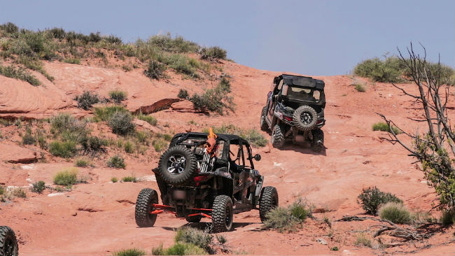
Continuing on the Grey Mesa past the turnoff to the Rincon, you get to an area known as the Chute. It’s a narrow canyon that was used by the pioneers to gain access to the Grey Mesa (coming from the west). This area is another very technical section and must be taken with caution. We used a spotter and checked all the brakes on our machines before dropping down the Chute. The next portion of the trail is slickrock as far as the eye can see. This is a great section to test out your machine and grab some cool pictures as well.
The motorized trail ends at the top of the Little Hole-in-the-Rock. From there, you have an amazing view of Lake Powell and the main Hole-in-the-Rock in the distance. It’s a great place to stop, have lunch and enjoy the scenery. When you’re done, follow the trail back the way you came until you reach camp. The next day, just reverse section 1’s route to finish the ride.
Did you know that it took the pioneers six weeks to make the Hole-in-the-Rock suitable (barely) for the wagons to descend through it? Interesting facts and trivia can be found below.
Hole-in-the-Rock
In the late 1800s, Mormon Pioneers had spread to many areas of what would eventually become the state of Utah. However, the area to the southeast of the Colorado River hadn’t been colonized yet, so in 1879, a group of pioneers set off with 83 wagons and over 1,000 head of livestock to form a new settlement. There wasn’t a direct route to the area, so the group created a new path that led directly to the edge of Glen Canyon. However, there was not a good way down to the river so they could cross it. The pioneers found a narrow crevice, and they chiseled and blasted it over a six-week period until it became traversable by wagon. They named this crevice Hole-in-the-Rock. Since it is on the west side of Lake Powell, it is only visible in the distance from this ride.
Grey Mesa
Safely taking the wagons down the perilous Hole-in-the-Rock was a major task, but wasn’t the end of the pioneers’ journey. After crossing the Colorado River, they made their way on the Grey Mesa, gaining access to it by ascending a water drainage path (which they called the Chute). The traveling was relatively easy on the Grey Mesa, but at the end of it, they faced a problem of descent that was surpassed only by their previous trouble at the Hole-in-the-Rock. Even with the miraculous discovery of a route off the Grey Mesa, the group had to spend a week cutting a series of steps to allow the wagons to handle the steep descent.
Cheese Camp
While the group camped after climbing Cottonwood Hill and before arriving at the Grey Mesa, some men from Panguitch arrived with 200 pounds of pork and 40 pounds of cheese. Since there wasn’t enough cheese to distribute among so many people, an auction was held instead, an event that gave the location a permanent name: Cheese Camp.
Cottonwood Hill
After crossing the Colorado River and before arriving at the Grey Mesa, the pioneers had the daunting task of traveling through Cottonwood Canyon and climbing Cottonwood Hill. Three notable locations of this climb included the Sand Hill, the Dugway, and the Little Hole-in-the-Rock. The Little Hole-in-the-Rock received its name because it is a rock formation similar to the primary Hole-in-the-Rock that the pioneers had already passed through. The motorized trail ends at the top of Cottonwood Hill, and the Little Hole-in-the-Rock is only a couple hundred yards farther.
Navajo Mountain
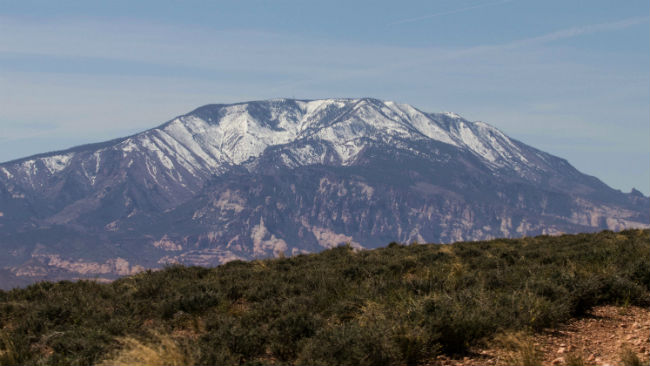
To the south, you can see Navajo Mountain – the highest point in the region, displaying prominently. The mountain is considered sacred according to Navajo beliefs, and traditional Navajos would not climb above its lower elevations.
Conclusion
The Hole-in-the-Rock East UTV ride offers everything you might want from a UTV adventure ride: technical slickrock, amazing scenery and a unique history. Although the western route to the Hole-in-the-Rock is better known (largely thanks to a more easily traversable dirt road), the eastern route is not one to miss. It’s been one of our favorites for years, and now you can enjoy it too.
Don’t forget to subscribe to our YouTube channel to stay updated on future rides!
Disclaimer
Route information and GPS files are provided to you "as is". Rocky Mountain ATV/MC and RM Rides makes no warranty that the information contained therein is accurate or the information is fit for any particular use. Furthermore, Rocky Mountain ATV/MC and RM Rides disclaim all liability from any damages which may arise (directly or indirectly) from your access and use of the information or files. By accessing the route information or GPS files, you acknowledge that you take full responsibility for your actions (or lack of action) in relation to them. The information and details supplied are not a substitute for proper planning. Check with the official representatives of the agency or organization that governs or operates a particular riding location, gas station, campsite, or point of interest to determine current accessibility, special rules, hours of operation, or exact boundaries that are appropriate for powersport vehicle use.
Disclaimer
Riding any type of powersports vehicle can be a dangerous activity and is done at your own risk. The riding tips, techniques, videos, and photos that Rocky Mountain ATV/MC posts on this site feature both professional and experienced riders and may cause serious injury or even death. Riding at high speeds or participating in stunt riding is inherently dangerous. Rocky Mountain ATV/MC disclaims all liability from any and all losses, damages, injuries, paralysis, or death that may occur by trying any of the riding tips, techniques, stunts, photos, videos, or content found on this website, either posted by Rocky Mountain ATV/MC or visitors of the site. Furthermore, we recommend you always wear a helmet and the appropriate safety gear when riding and that you assess your own capabilities and skill level before attempting any rid, terrain, stunt, or technique. Some of the content, videos, and photos presented on this site have been sent to us by our customers. All information presented in the content, videos, and photos, including tricks, views, opinions, or positions of Rocky Mountain ATV/MC or their affiliates.