- MOUNTAIN TIME
- ¡Hablamos español!


H1 Heading Not Displayed
Disclaimer
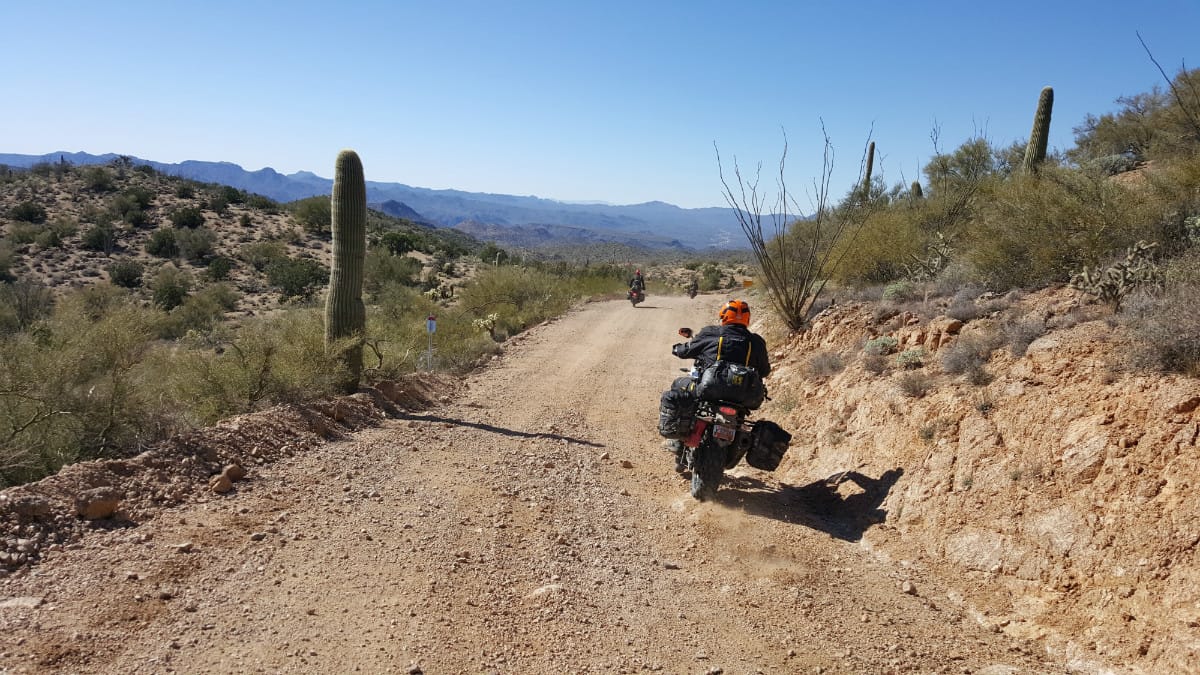
The difficulty of this ride ranges anywhere from paved roads to technical, rocky, steep terrain. If possible, the most difficult sections of these rides will have a bypass (which is indicated in our maps if they are available), but the availability of the less difficult bypass is not guaranteed, and on occasion, the only way forward may be through a difficult section. While we try to highlight the difficult sections in the videos, specific trail conditions vary from year to year and storm to storm. We recommend that anyone attempting these rides get the most up-to-date road and trail conditions from local state, county, or land use agencies where available. If you notice any trail conditions that are different from what is shown in these videos, please send those trail condition updates to [email protected].
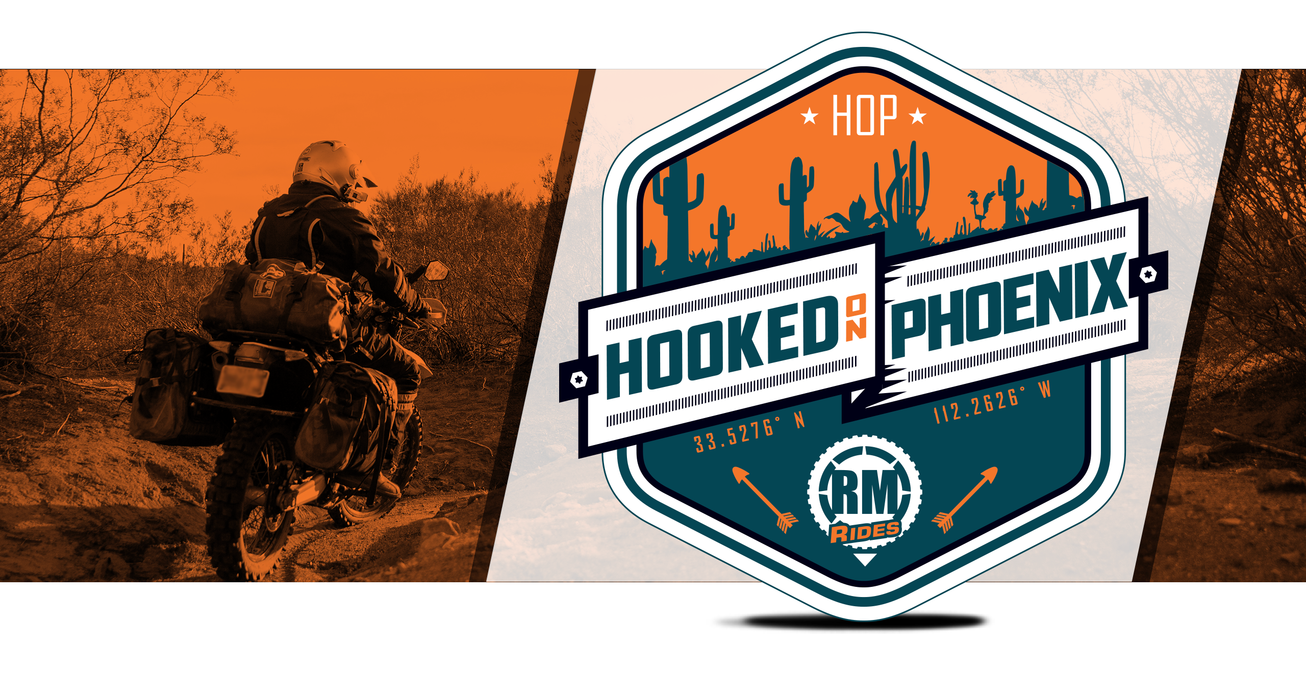
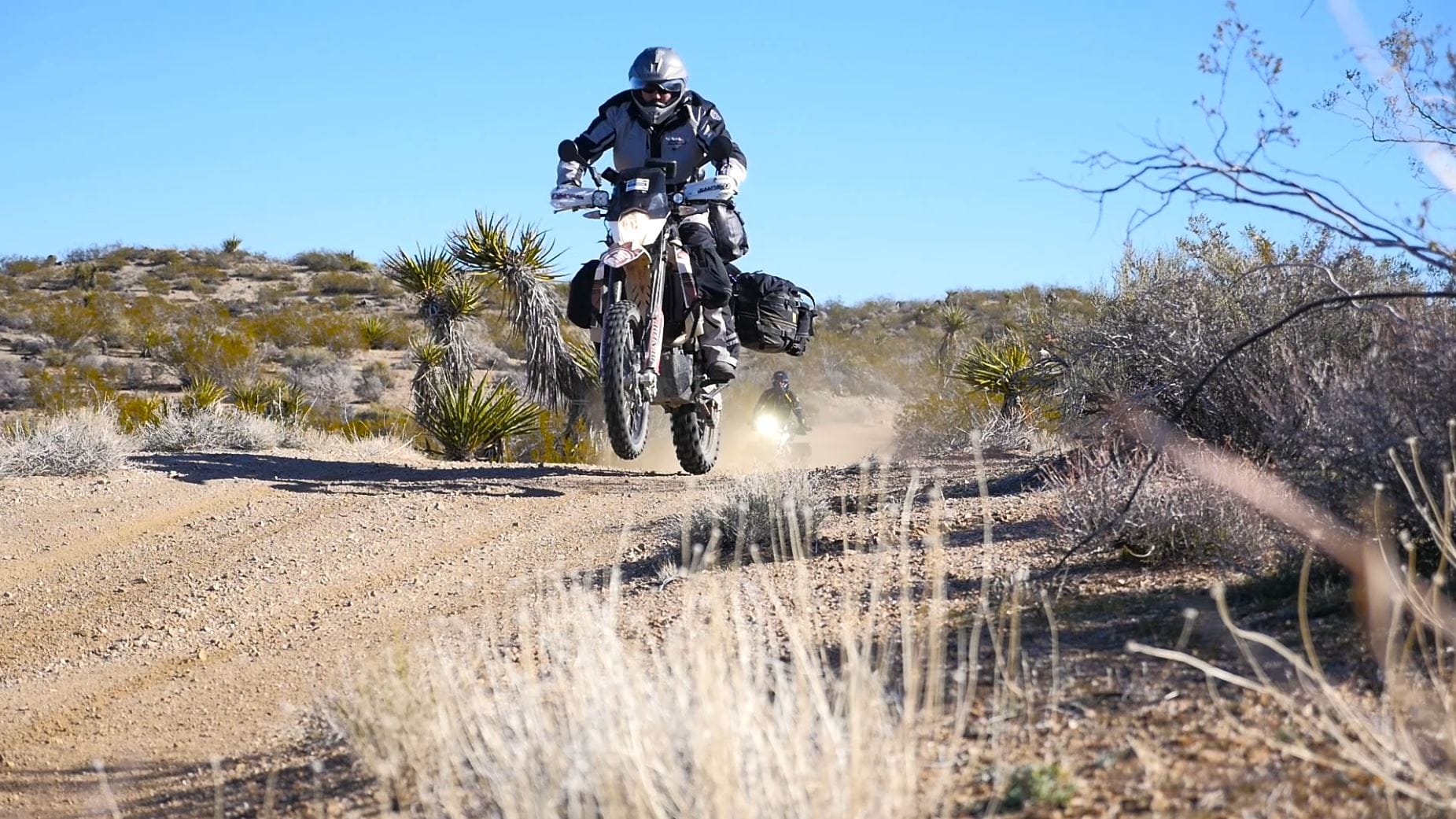
Hooked on Phoenix Adventure Motorcycle Ride
Admin // July 22, 2016
Have questions about this ride? Shoot us an email:
About
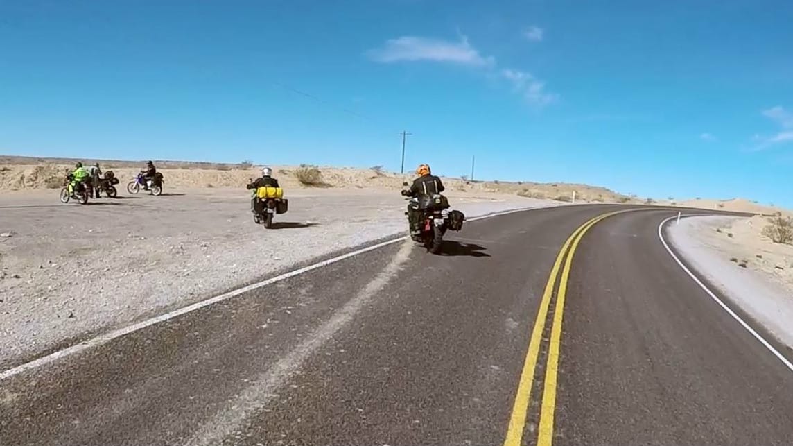
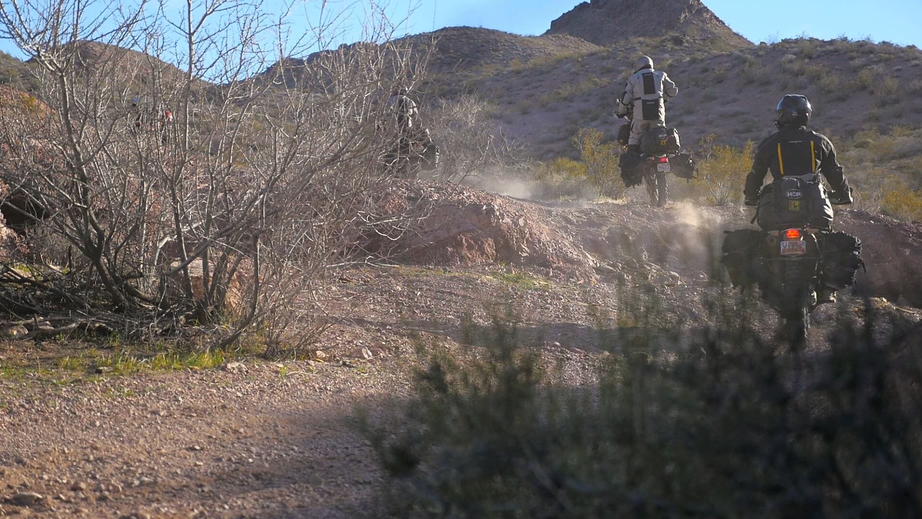
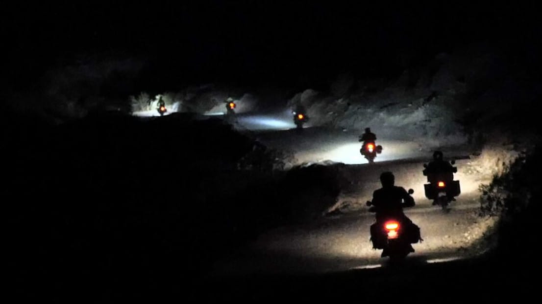
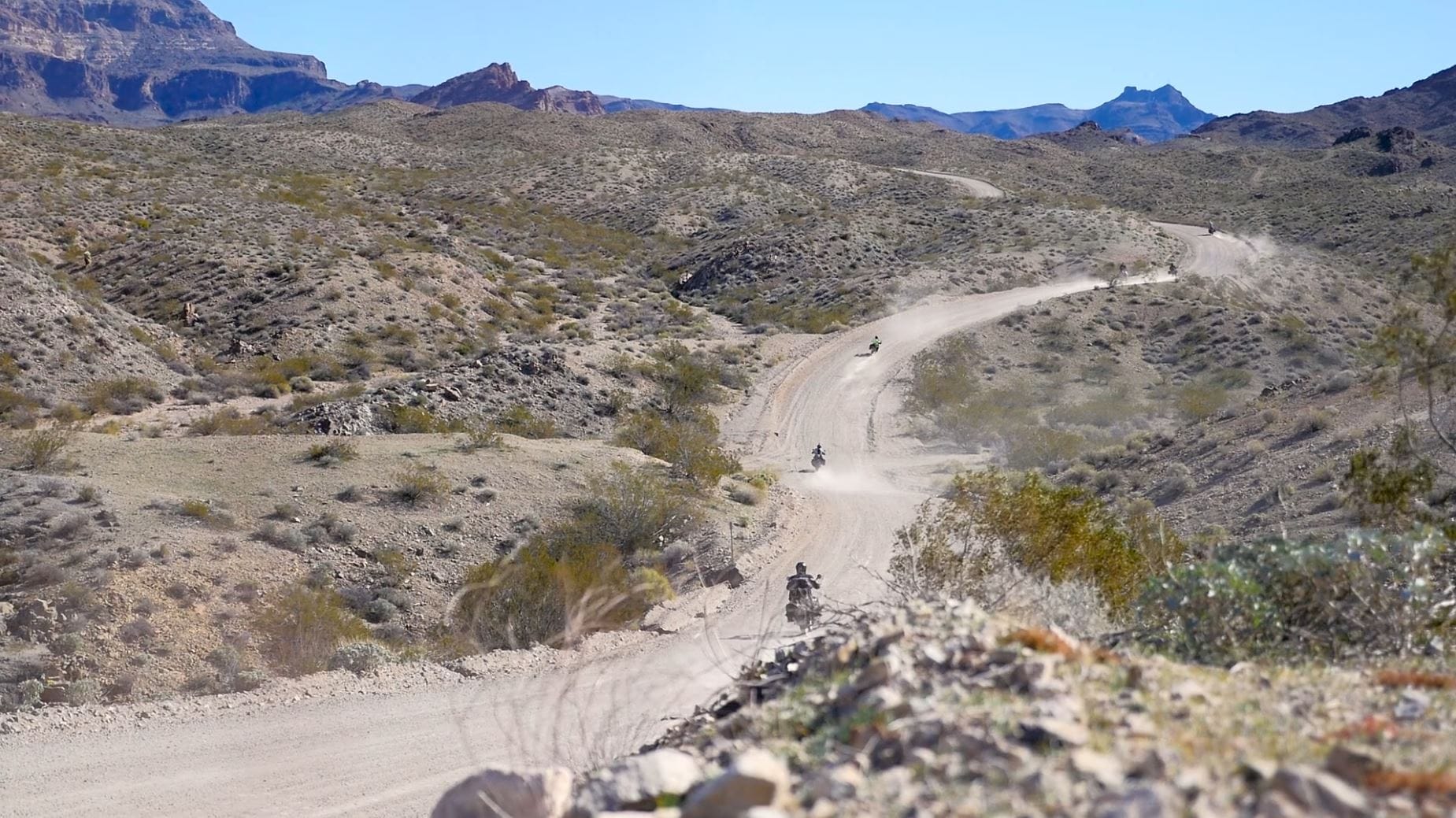
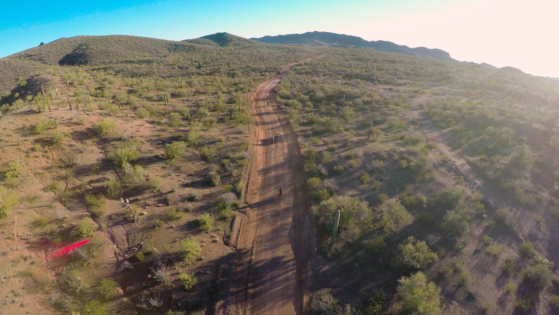
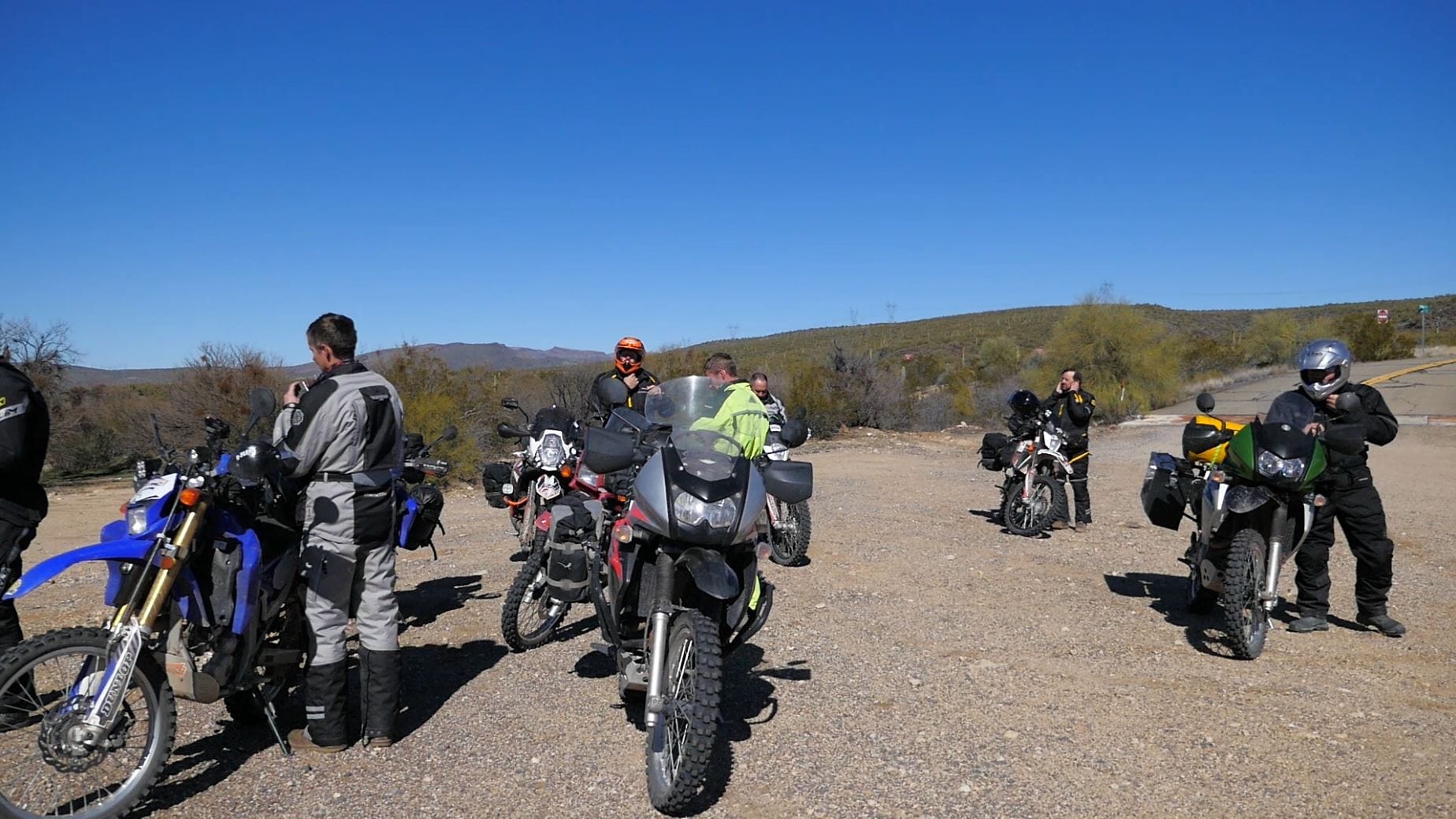
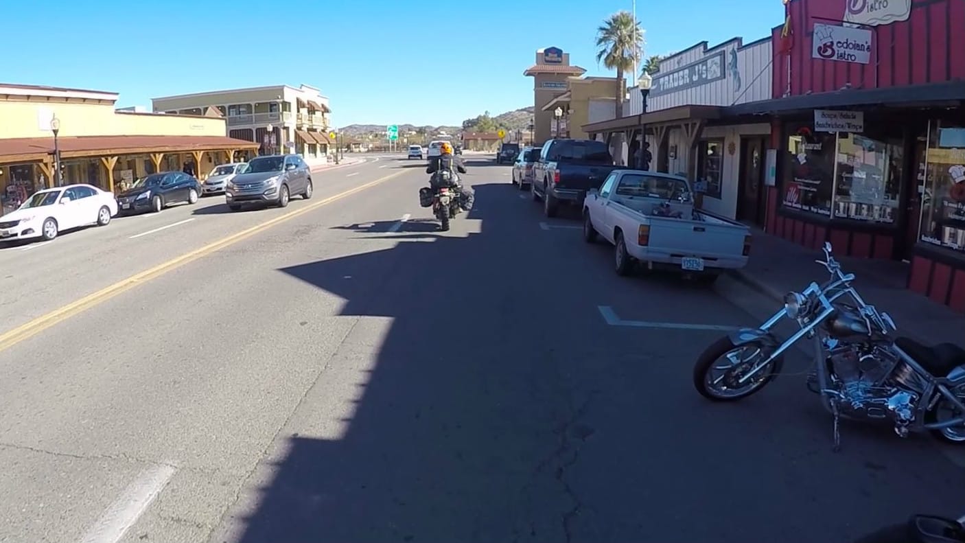
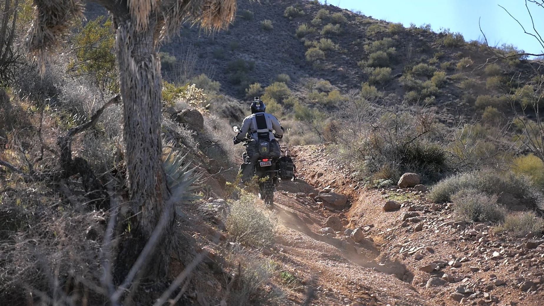
We love nothing more than getting out and riding our motorcycles. We have gotten really involved in dual sport / adventure riding, and one of our favorite rides that we’ve put together is the HOP (Hooked on Phoenix) ride. It’s a 900-mile ride from Mesquite, NV, to Phoenix, AZ, and back again. We usually plan it to coincide with the Phoenix round of supercross, giving us a great opportunity to escape the winter snow of Utah and go on an adventure through the beautiful deserts of Nevada and Arizona.
Now we’ve documented the entire ride to make it easy for you and your buddies to plan your own HOP adventure. Be sure to check out our video above, which gives you an accurate perspective of what the trip is all about. We’ve provided our GPS files below so you can follow our same path. You’ll also find the GPS files include a few alternate routes that allow you to decide how technical of riding you want to tackle.
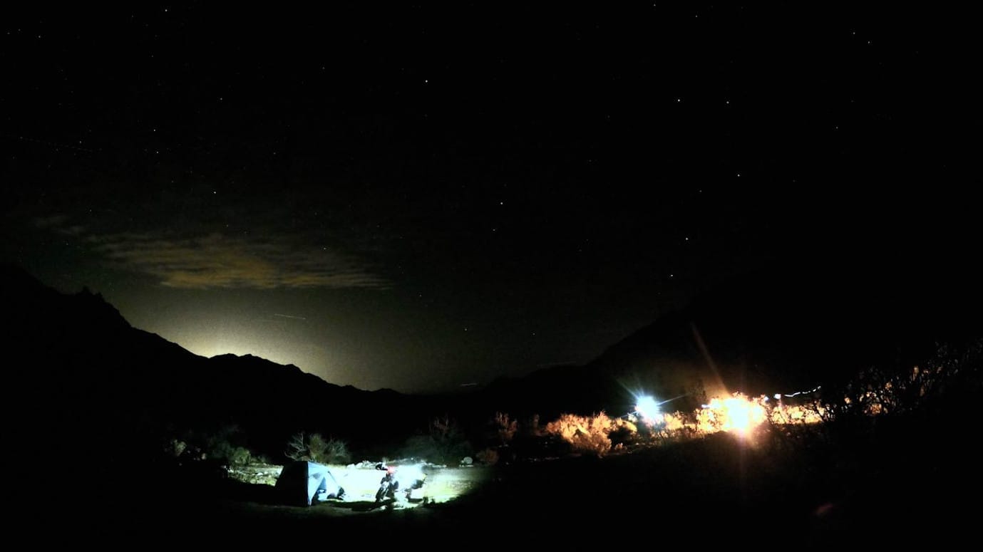
We have done this ride five years in a row, and it never disappoints. If you love a good mix of dirt roads, technical sand and rocks, and even slab, you will love this ride! It’s designed for three nights camping in the desert and one night staying in a hotel in Phoenix. Any capable dual sport or adventure bike can tackle this trip.
This article is designed as a resource to help you plan your own Hooked on Phoenix ride. It also includes interesting facts and trivia about locations you will pass through or nearby.
Preparation
In preparation for any adventure ride, it is critical you take time to carefully plan. Not only do you need to plan routes, food and time, but you need to make sure that your bike is ready and that you have the right tools, riding gear, camping gear and emergency equipment.
Always watch the forecast prior to and during your trip. The Nevada and Arizona deserts can be brutally hot in the summer and fiercely cold in the winter. We highly suggest avoiding the heat of the summer, but you should also be careful if you plan in the winter. Our trip was in February, and on one of our nights camping, the temperature dropped into the 20s (F). Because the temperatures can be extreme, make sure that you adequately prepare, and do not travel the route by yourself.
We’ve split the HOP into 18 sections across five days. If you want, you can do the sections on exactly the same days that we’ve outlined here, but you don’t need to feel constrained to it if you want to move sections around to different days. You can also expand the trip, adding in additional stops or taking time to check out some of the things that you otherwise might only see in passing. For example, we don’t pass through Las Vegas on our trip, but we do pass right next to it. You could easily modify the HOP to include a stop in Las Vegas if you wanted.
Once you have the right gear and planning in place, you are ready for adventure!
| Section Mileage | Terrain |
|---|---|
| Approx. 35 Miles | Sand Spots, Mild Rocks, Mild Hills |
GPS File Name: Section 1 & 16
EZ BYPASS File Name: Section 1 & 16 BYPASS EZ Overton to Mesquite
Mesquite
Next Gas Stop: 110 Miles in Boulder City
Situated on I-15, Mesquite is a great place to start out the ride. As a town with a local economy benefited by casinos, it features numerous hotels with relatively inexpensive rooms. What makes it better is that many of them (such as the Virgin River Hotel and Casino) have parking where you can leave your vehicle during the ride.
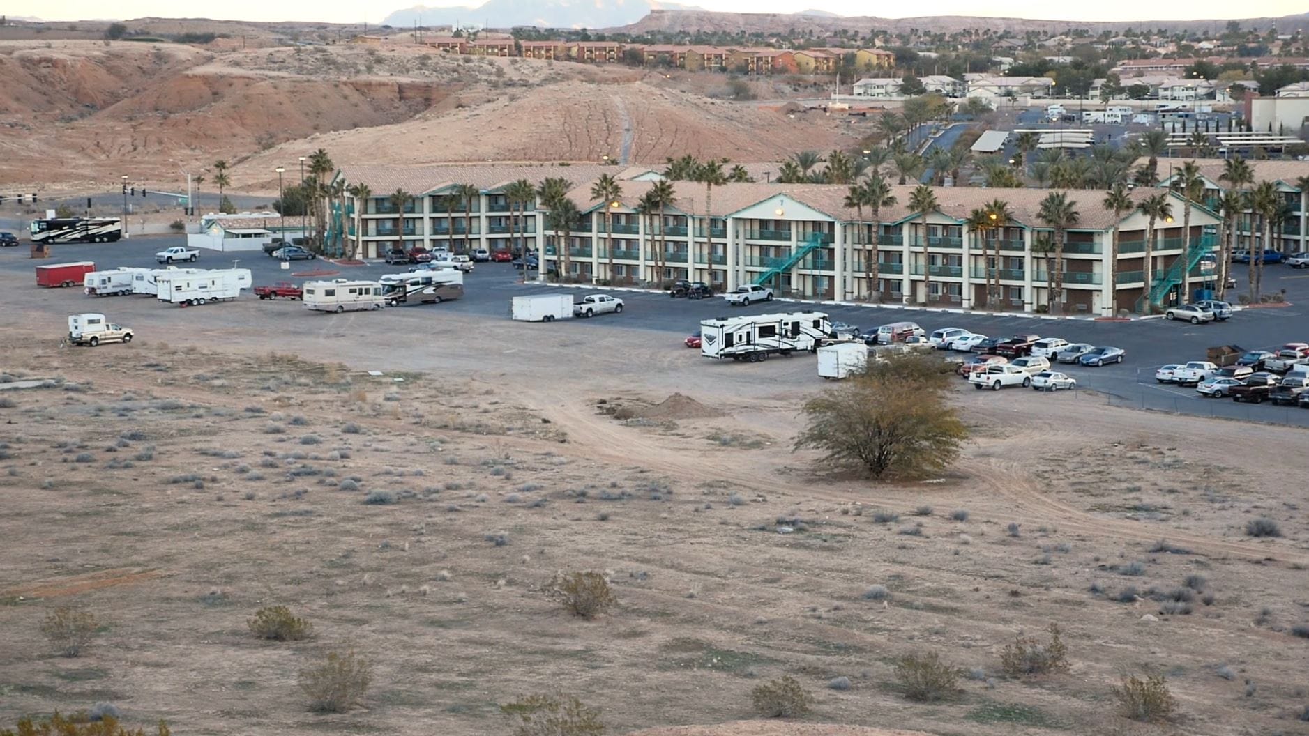
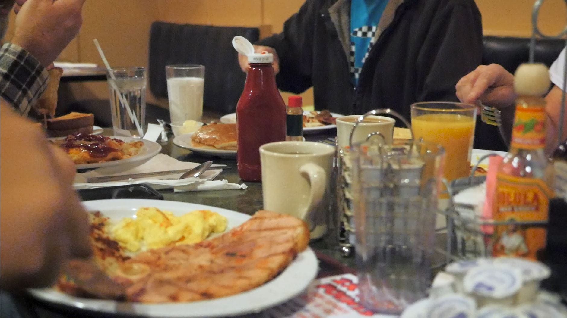
We recommend spending the night before the trip in Mesquite. This allows you to start the ride early in the morning feeling refreshed. Get a good breakfast before you go. It’s a great way to kick off the ride, and you can’t beat the price eating at a place like the Virgin River.
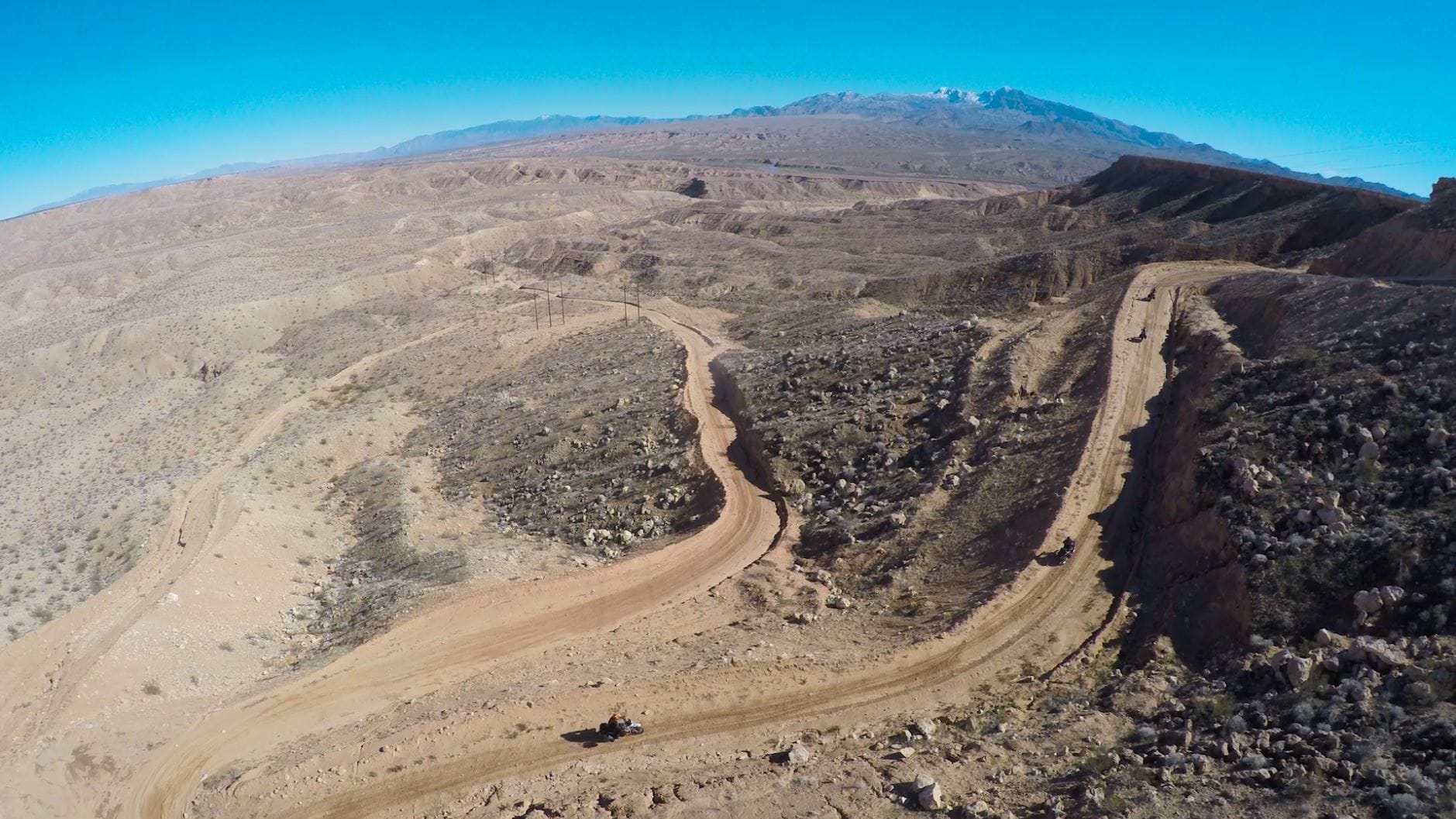
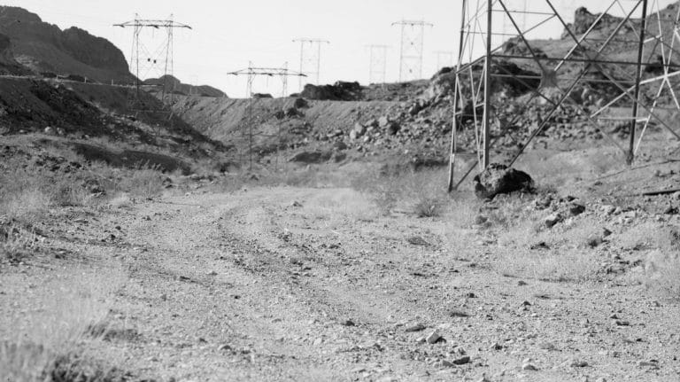
The first section heads south from Mesquite on Highway 170 (Bunkerville Road) for about 10 miles. Just past Riverside, you’ll turn off into dirt on a powerline road.
This road provides a lot of fun – loose dirt, sand sections, mild rocky spots and several hills. There’s a lot of variety as well as some great twists and turns. Aside from being a great way to begin the ride, it’s also a good gauge for how the rest of the trip will go. If you struggle through this area, you can opt for some of the easier, alternate routes later. Keep an eye out for rain ruts on this dirt road. They have a tendency to sneak up on you.
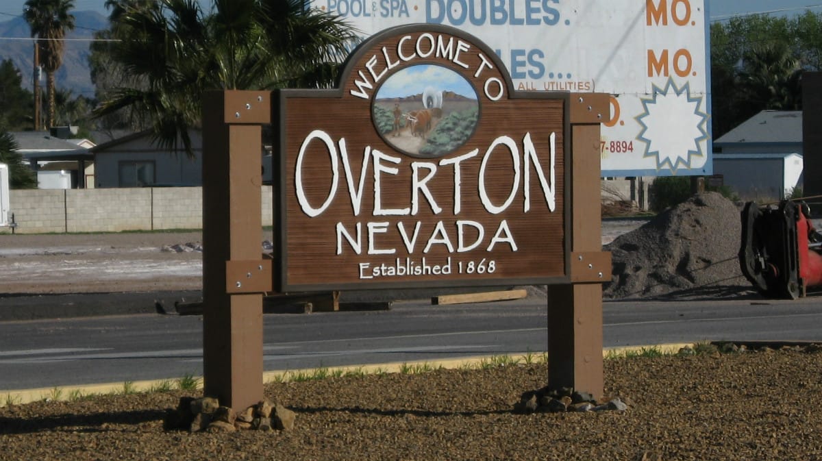
Overton is part of the larger Moapa Valley area. If you forgot anything before you started the trip, there are several stores and gas stations available.
About 30 miles into the trip, you’ll turn off the powerline road and onto Mormon Mesa Road. This dirt road turns to asphalt and drops right into Overton.
Interesting facts and trivia can be found below.
Mesquite
The first casino opened in Mesquite in the 1970s, leading to large economic and population growth in the subsequent decades. It has become a golf destination and retirement community since. However, Mesquite has an extensive history that extends back to the late 1880s as a farming community settled by Mormon pioneers. The name comes from the Mesquite tree, which is native to the region.
Virgin River
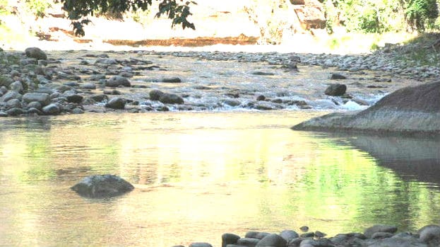
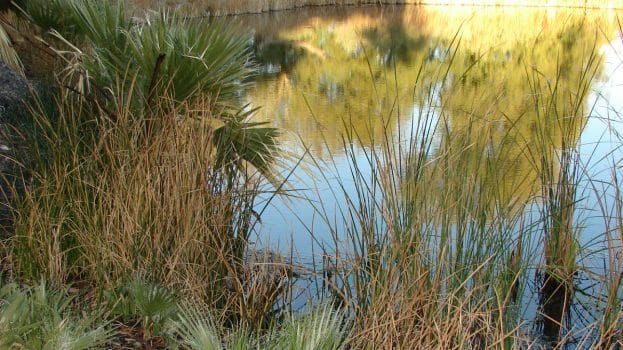
You’ll cross the Virgin River right before turning off Highway 170. The Virgin River is a tributary of the Colorado River and passes through a small portion of Utah, Arizona and Nevada. The river has a unique ecology and features numerous species of wildlife. For example, the Woundfin fish is only found in the Virgin River.
Double Negative
A good portion of this section takes place on the Mormon Mesa. If you’re interested in land art, you can take a small detour to see Double Negative, a negative-space sculpture that is carved into the rock.
Double Negative north trench by Thure Johnson (CC BY 2.0)
Overton
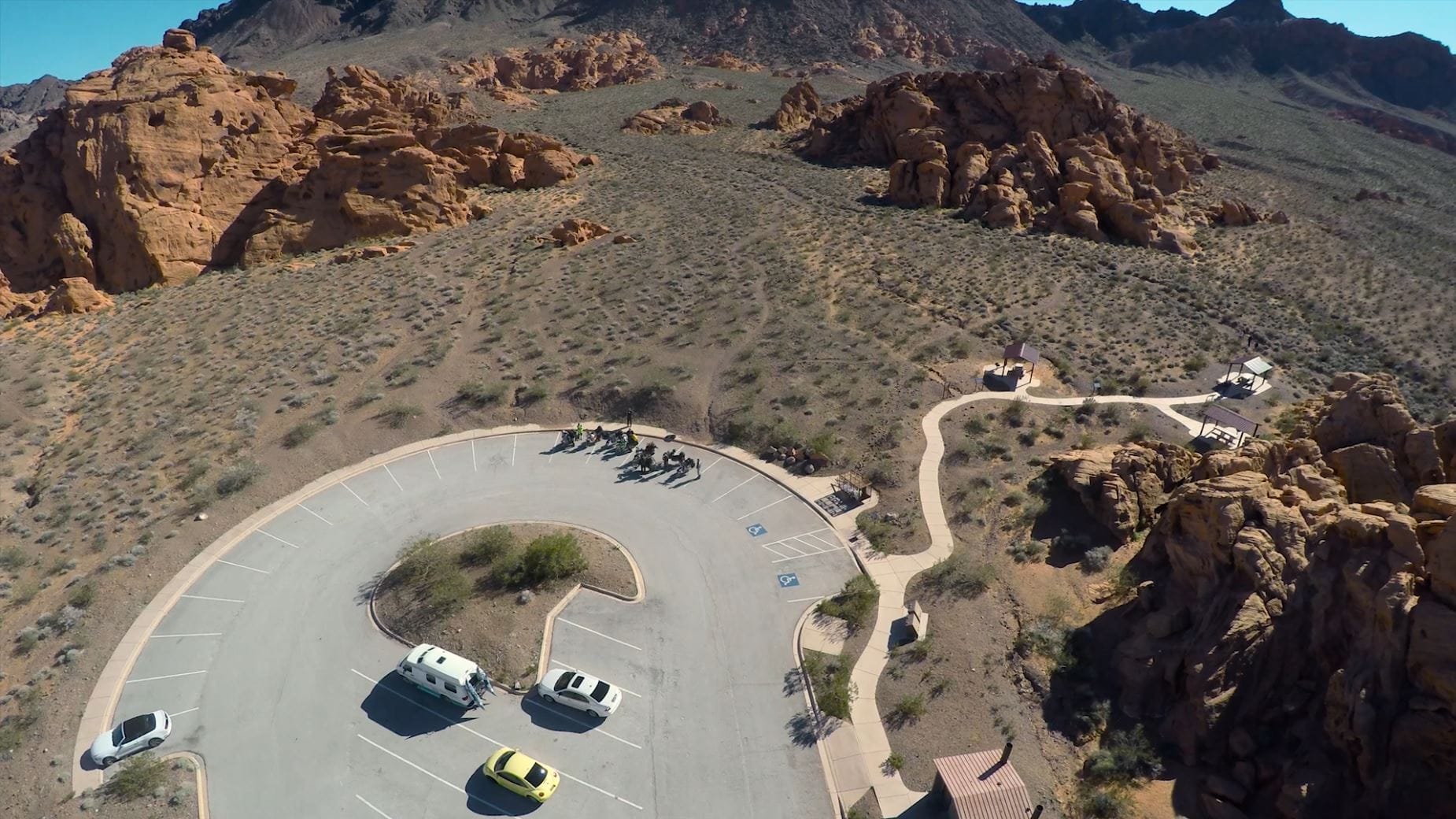
Soon after entering Overton, you’ll pass the Muddy River. (Moapa means “muddy” in the Southern Paiute language.) Several miles southeast of Overton, a village complex of the Anasazi people used to exist along the Muddy River (called the Pueblo Grande de Nevada). Artifacts from the site can be seen in the Lost City Museum on the south end of Overton.
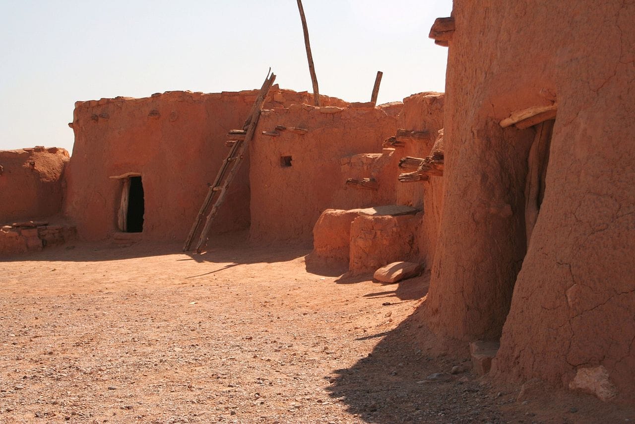
Reconstructed Anasazi Pueblos in Lost City Museum in Overton, Nevada, USA by Tadam (CC BY-SA 4.0)
Section 2: Overton to Lake Las Vegas
| Section Mileage | Terrain |
|---|---|
| Approx. 57 Miles | Curvy Scenic Pavement |
GPS File Name: Section 2 & 17 Overton to Lake Las Vegas
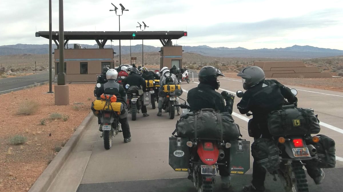
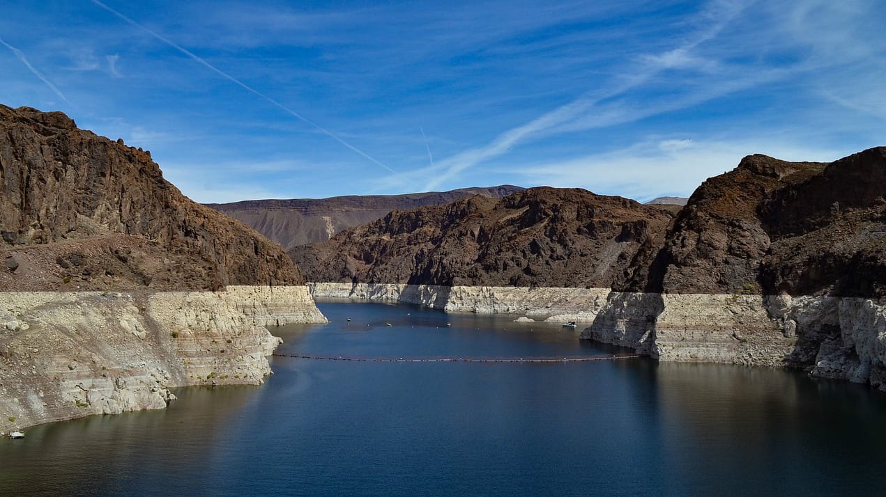
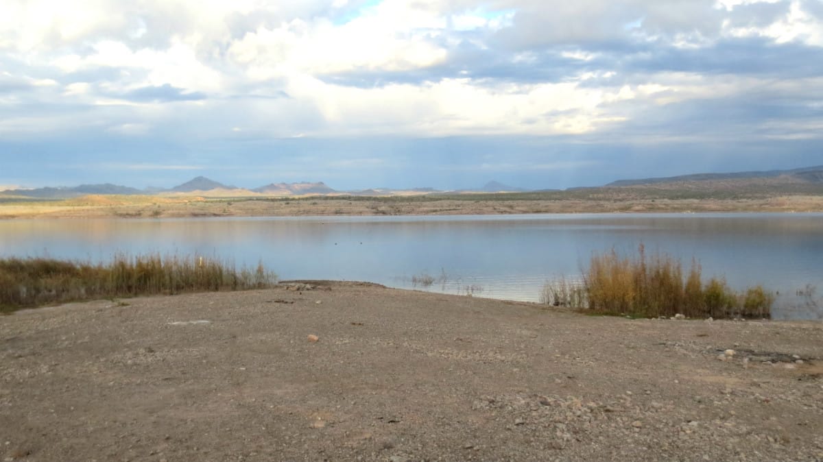
Heading out of Overton, you’ll take Highway 169, which later turns into Highway 167 (Northshore Road). This road gives a great overlook of Lake Mead, which separates Nevada from Arizona. The highway runs through the Lake Mead National Recreation Area, so you’ll need to pay the entrance fee. Hang on to the receipt as you’ll use it when you reenter the area on the return trip. This 57-mile stretch of highway offers amazing scenery all the way through. It is a great part of the ride to relax and enjoy the view.
Highway 167 passes by several springs, Blue Point and Rogers, the latter of which has a rest stop if you’d like to take a break. About halfway through this section, we usually stop at the Redstone rest stop. It is surrounded by giant red rock vistas and also provides a nice chance to stretch and have a snack. You can also take a 15-minute walk on the Redstone Dune Trail. Highway 167 will take you right to Lake Las Vegas.
Interesting facts and trivia can be found below.
Lake Mead
Lake Mead was formed due to the creation of the Hoover Dam in 1936. The lake is a popular recreation destination and also serves water to nearly 20 million people (as well as farmland) in Arizona, Nevada and California. The Colorado River, Virgin River and Muddy River all feed into Lake Mead.
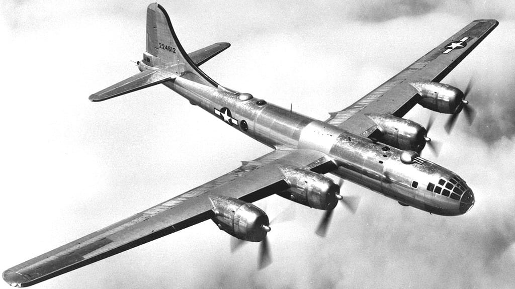
At the dawn of the Cold War in 1948, the military used a B-29 to conduct a test over Lake Mead for a missile guidance system. Due to pilot error, the B-29 contacted the surface of the lake, causing the plane to skip across the surface, ripping off three engines and lighting the fourth on fire. The crew was safe, but the plane sunk. The classified nature of the mission kept the sunken bomber a secret for half a century.
St. Thomas
When Lake Mead was first formed, the community of St. Thomas (to the southeast of Overton) was completely submerged, forcing the town’s abandonment. Hugh Lord was the last resident to leave, departing on June 11, 1938. The town was completely submerged; however, decreasing water levels in recent years have left the town partially visible again.
Blue Point and Rogers Springs
In 1903, an effort was made to build a canal from the Blue Point and Rogers springs to farmland south of St. Thomas. The workmen drank spring water, which served as a laxative. These men lost weight as a result, and the name Slim Creek was applied to the water discharging from Blue Point Spring as a result.
Washingtonia filifera (saplings) by Forest & Kim Starr (CC BY 3.0)
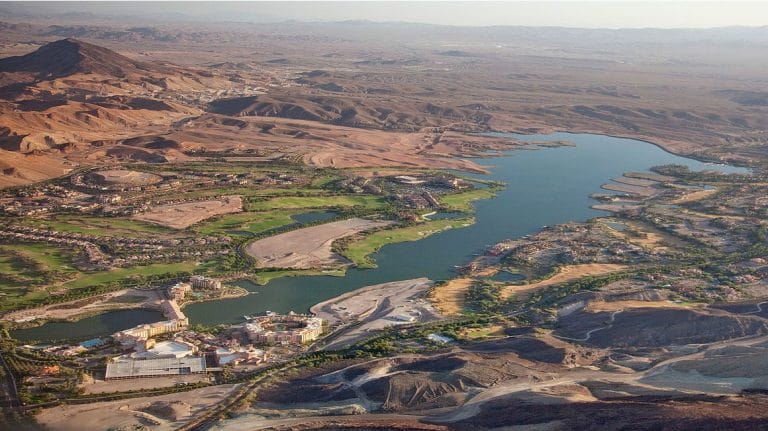
Lake Las Vegas
Lake Las Vegas is an artificial lake created in the 1990s. A community exists around the lake along with several resorts. Lake Las Vegas is considered part of Henderson.
Section 3: Lake Las Vegas to Boulder City
| Section Mileage | Terrain |
|---|---|
| Approx. 20 Miles | Sand, Loose Gravel, Rocky Two Track |
GPS File Name: Section 3 & 16 Lake Las Vegas to Boulder
EZ BYPASS File Name: Section 3 & 16 EZ Lake Las Vegas to Boulder
After Lake Las Vegas you’ll have two options: a challenging but fun gravel/loose rock section or an easy scenic route.
If you take the harder option, you’ll hit more dirt as you work down to Boulder City. This section features plenty of sand and also has some rocky hills and loose gravel. If this is the type of riding you enjoy, you’ll love this section.
Interesting facts and trivia can be found below.
Henderson
Henderson was built up in World War II with a magnesium plant, supplying the United States military with the metal. With its primary use no longer needed after the war, the town was nearly sold as surplus war property, but the state of Nevada managed to save it, and it has grown into a large city.
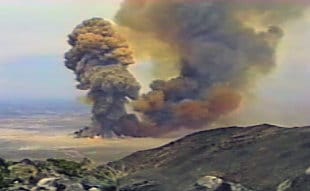
In 1988, a rocket fuel plant in Henderson exploded, causing an explosion equivalent to about one kiloton of TNT. The industrial site where the plant was located has since been developed into commercial property, and little evidence exists of it now.
Wheel of Misfortune
A street artist converted an old magnesium plant south of Lake Las Vegas into the “Wheel of Misfortune,” a giant parody of the wheel from Wheel of Fortune.
Lake Mead Islands
Lake Mead has lowered in the past 15 years due to drought. On the southern part of the lake, several islands are visible that were completely submerged in the year 2000: Big Boulder Island, Little Boulder Island and Rock Island. If you take the alternate route, you will be able to clearly see these islands when looking at Lake Mead.
Historic Railroad Tunnel Trail
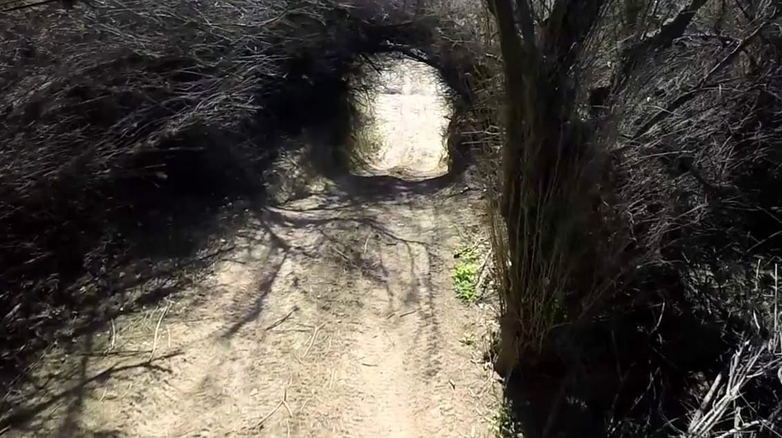
Along the alternate route is an old railroad that has been converted to a hiking trail. The trail is about 3.5 miles long and travels through several tunnels. The railroad was originally built to assist in building the Hoover Dam.
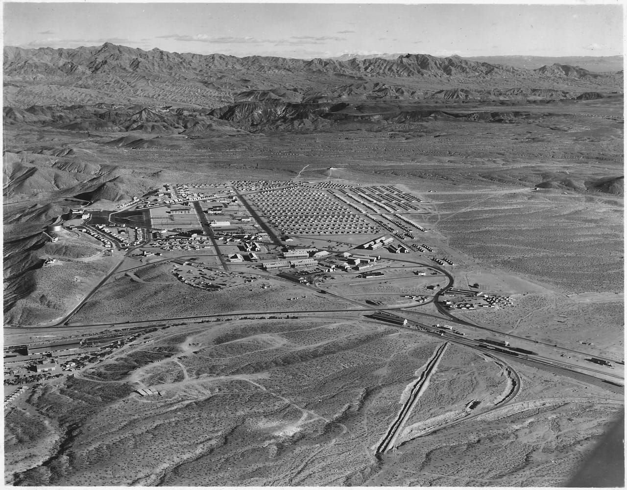
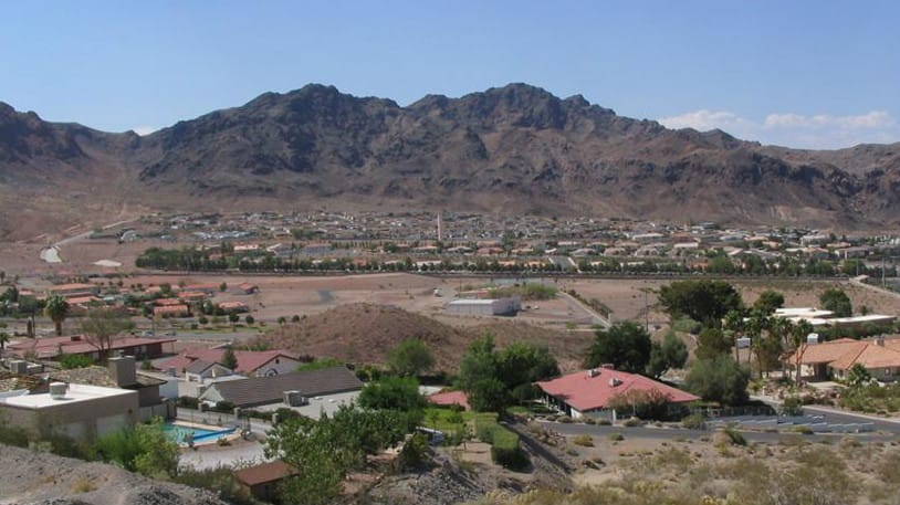
Boulder City
Boulder City was originally created by the government as a place to house the many workers who would be needed to build the Hoover Dam. Important employees had larger houses that were built on the hill, while manual laborers had smaller homes that were farther away from public buildings and parks.
Section 4: Boulder City to Loran Station Road (Camp 1)
| Section Mileage | Terrain |
|---|---|
| Approx. 62 Miles | Pavement, Sand Wash, Dirt Road |
GPS File Name: Section 4 Boulder NV to Loran Station Road
EZ BYPASS File Name: Section 4 BYPASS EZ Boulder NV to Loran Station Road
Boulder City
Next Gas Stop: 82 Miles in Laughlan
Boulder City is a great place to fuel up and restock any snacks and drinks you might need. There are also plenty of restaurants if you want to stop for a bite to eat. This is a good place to stock up as it is the last stop before camp.
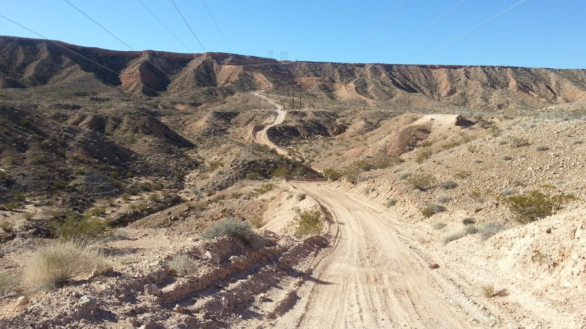
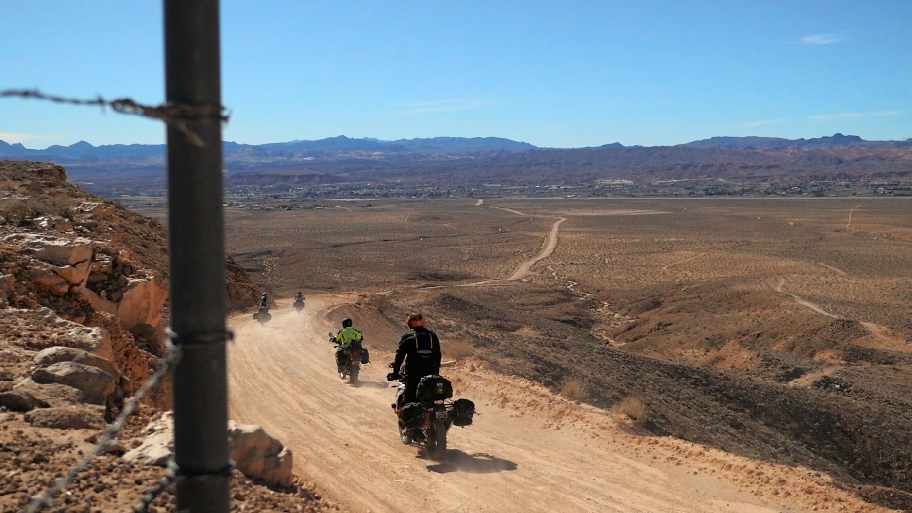
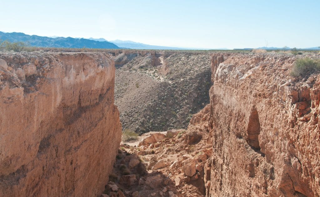
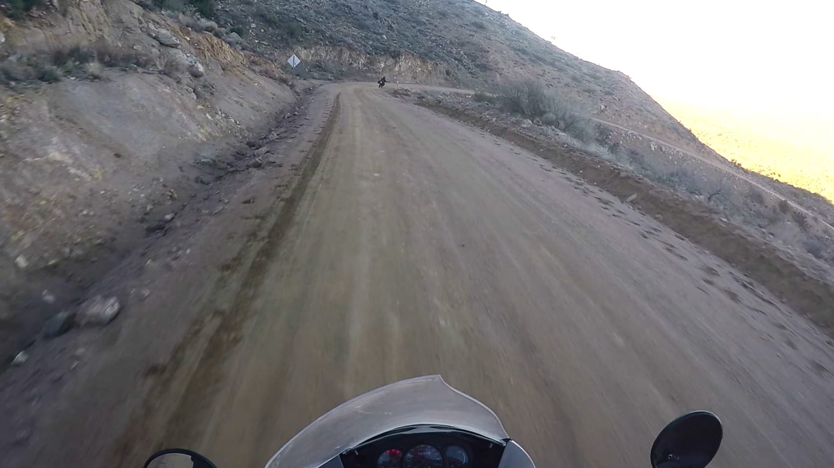
This is a long section. You’ll start by taking the pavement south down Highway 95 for roughly 25 miles until you get to Nelson Cutoff Road, where it’s right back to dirt. From there, you’ll turn and follow the powerline road (initially called Grandpa’s Road). This is a fun road that leads you up the hills where the trail tightens up. You’ll get into some awesome rock formations, and eventually you’ll ride alongside Lake Mohave.
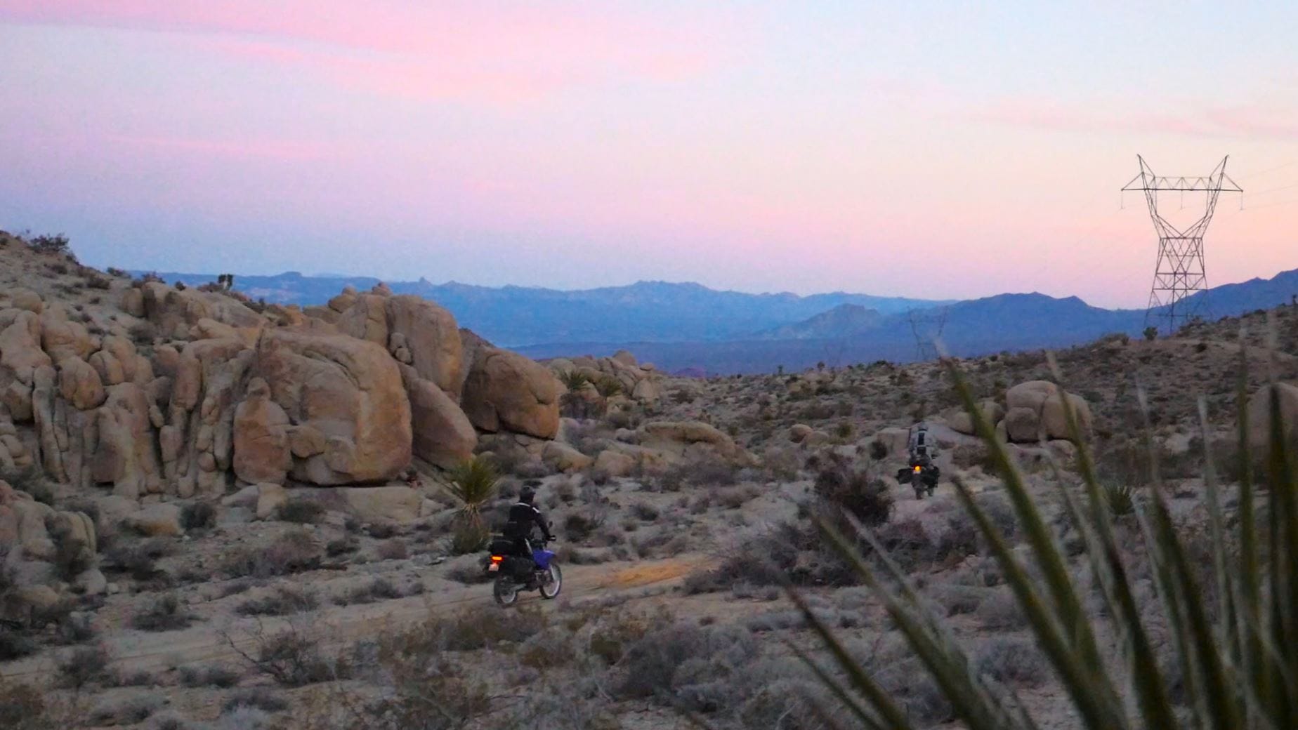
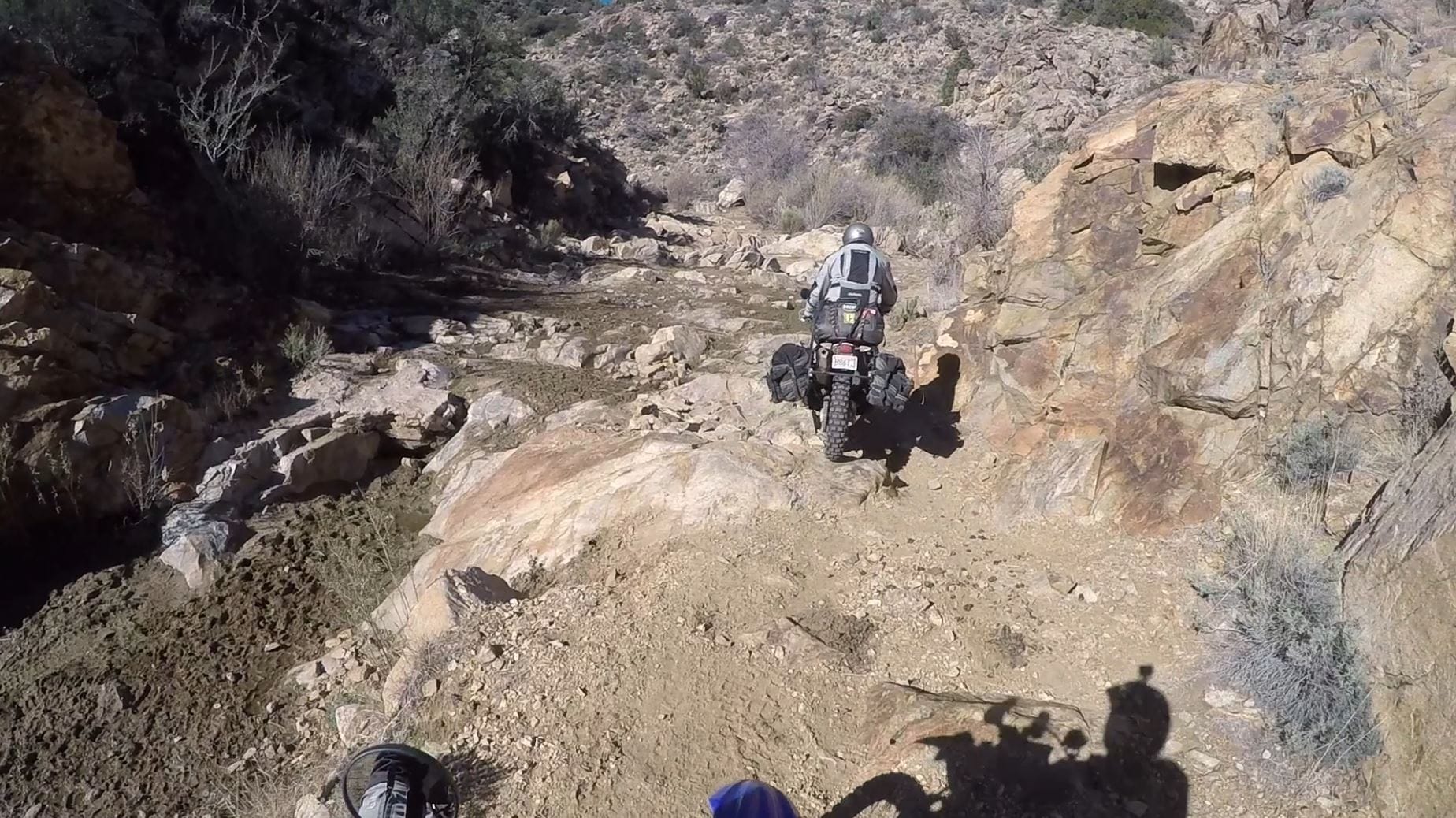
The road straightens out across the valley but slowly gets curvier as you head into the next mountain set. This is a fun dirt road – even in the dark! Eventually, the road comes to a “T,” and this is where you break away from the powerlines and head up the Roman Wash. This is a fun (but challenging) wash that is full of loose gravel and sand.
EZ BYPASS: The EZ BYPASS stays on the highway at Nelson Cutoff Road. It meets back up with the main route near camp 1. This goes right past the LORAN station.
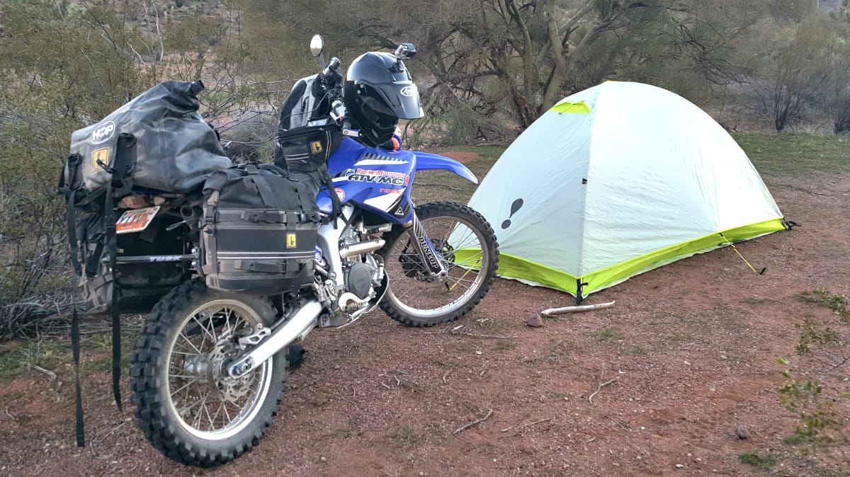
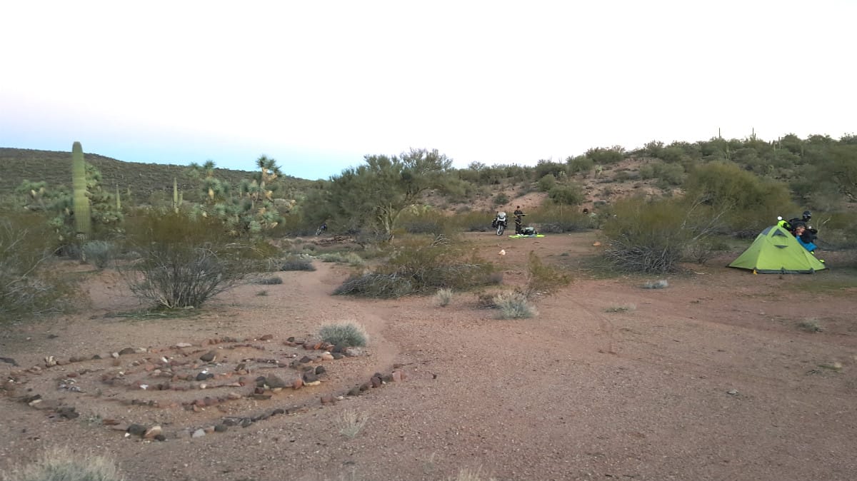
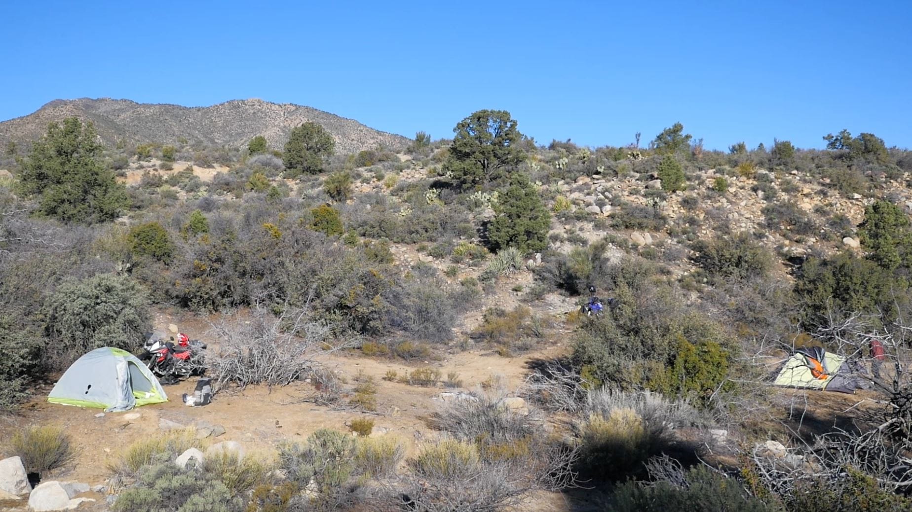
Camp 1 is at the top of Roman Wash at Loran Station Road, just under Spirit Mountain. This is a nice, secluded campsite with plenty of shelter from wind provided by the surrounding mountains. There are also plenty of flat areas for tents.
Interesting facts and trivia can be found below.
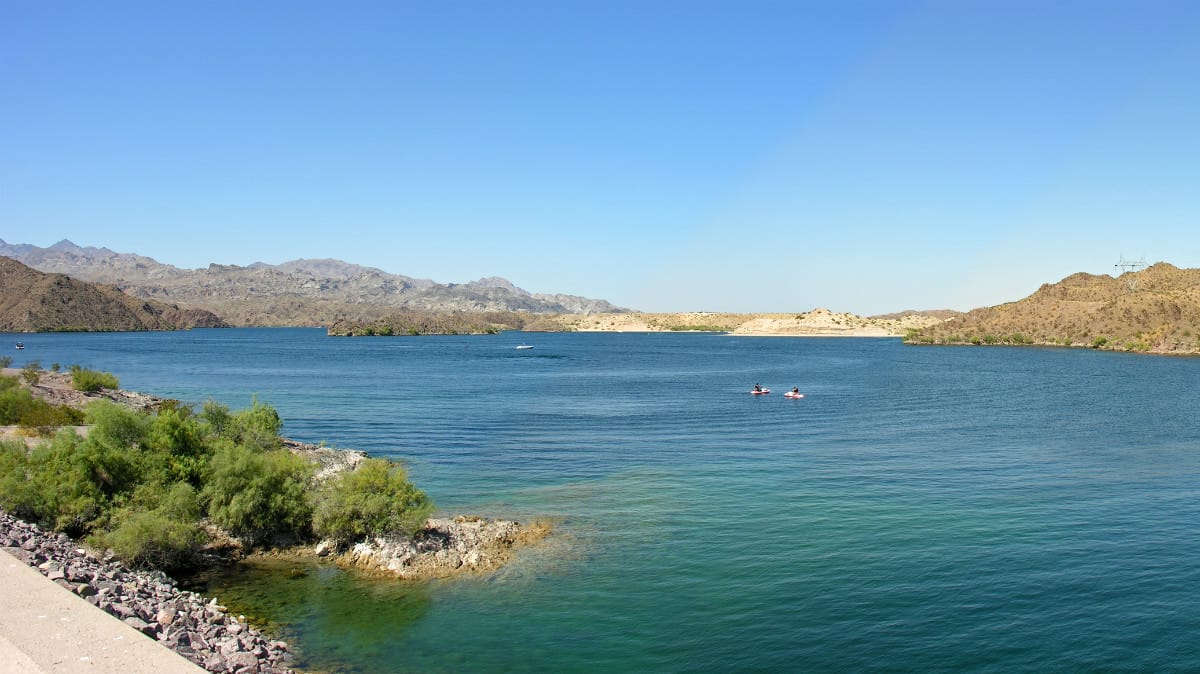
Lake Mohave
Lake Mohave was formed by the creation of the Davis Dam just north of Laughlin. The lake extends essentially from of the Hoover Dam to the Davis Dam, though it gets several miles wide just east of Searchlight. It is a popular recreational location and is also home to numerous fish species.
Loran Station Road
LORAN (long range navigation) was a radio navigation system developed by the military during World War II. It was widely utilized (including by civilians, such as fishermen) until it slowly fell out of use in favor of GPS.
Loran Station Road is named for an old LORAN-C station that operated near Cal-Nev-Ari, a small town built by Slim and Nancy Kidwell in the 1960s. The entire town went up for sale in 2016 for $8 million.
| Section Mileage | Terrain |
|---|---|
| Approx. 20 Miles | Dirt Two Track, Dirt Road, Pavement |
GPS File Name: Section 5 Loran Station Road to Laughlin
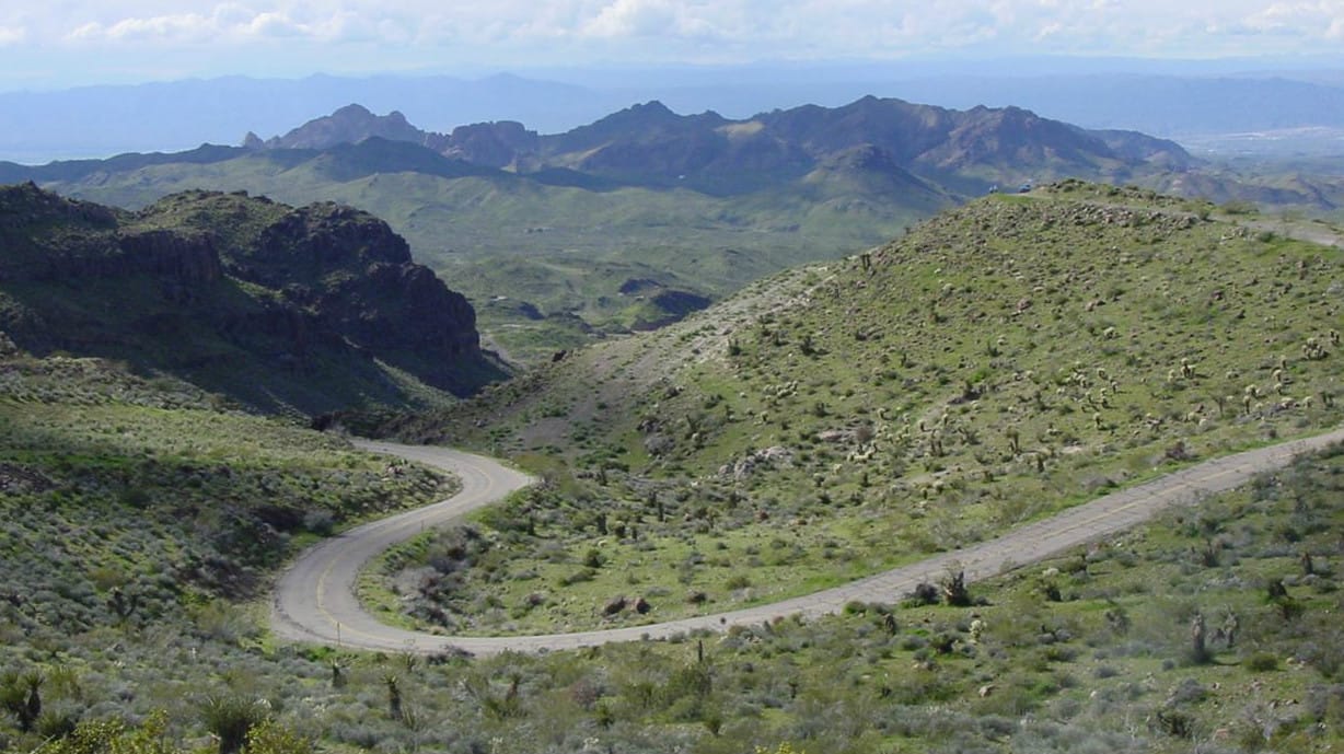
You’ll next head west out of the canyon on Loran Station Road. Near the base of the mountain, you’ll turn south and eventually hit Christmas Tree Pass. This is a cool canyon road that is lined with beautiful mountains, and the trees have been decorated with Christmas ornaments.
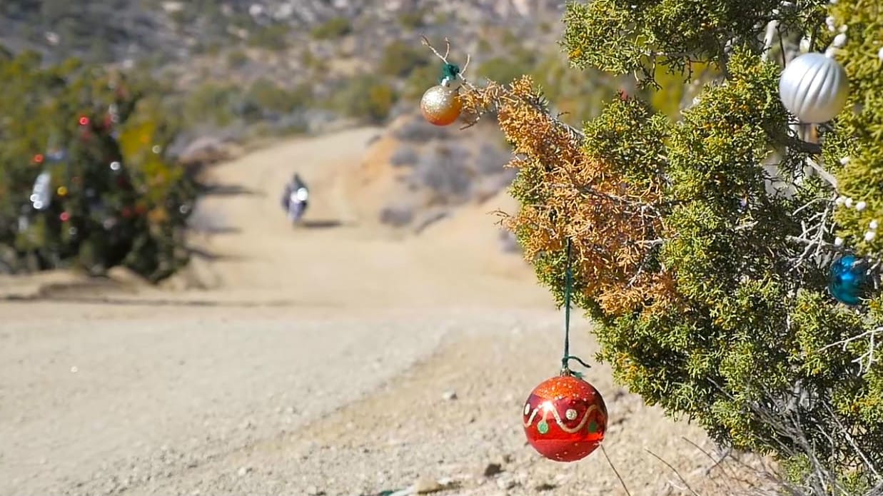
This is a fun two track that meets up with the bigger Christmas Tree Pass Road. It’s also a nice warm-up trail to get the day going. You’ll follow the pass all the way down until it meets up with the highway that’ll drop you right into Laughlin, where you can gas up and restock any supplies you need.
Interesting facts and trivia can be found below.
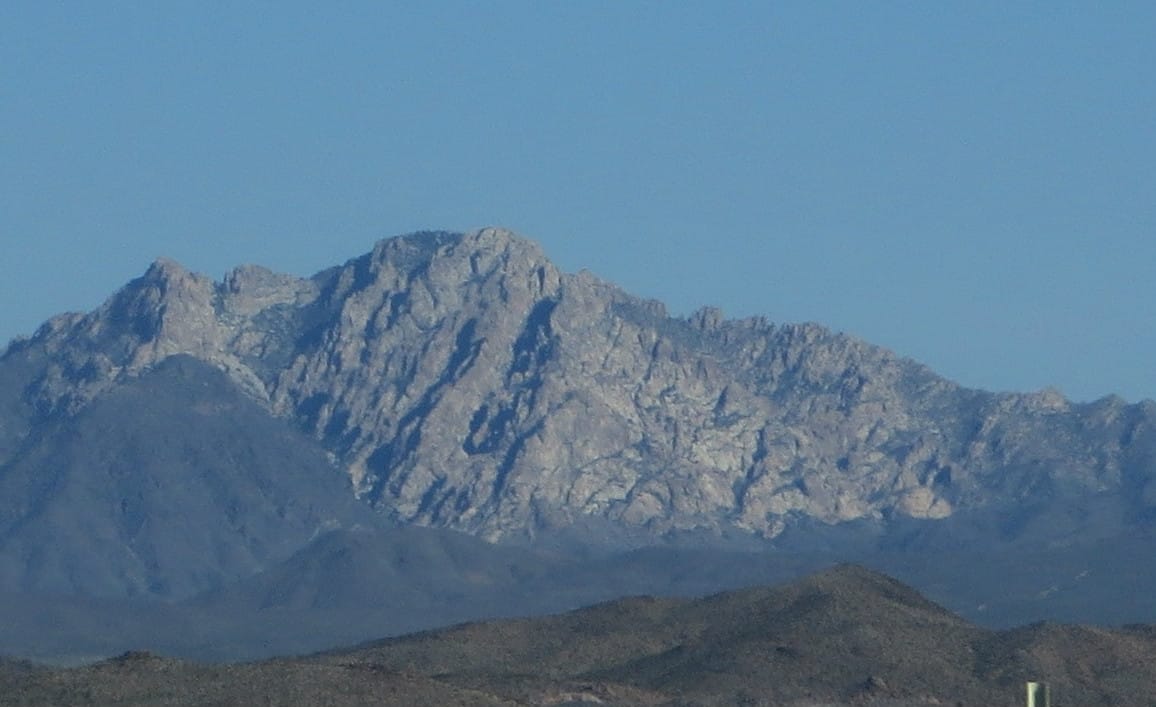
Spirit Mountain
The route wraps around Spirit Mountain, a sacred place for the Native American tribes of the area. According to their religion, Spirit Mountain is their spiritual birthplace. Spirit Mountain is the tallest peak in the Newberry Mountains.
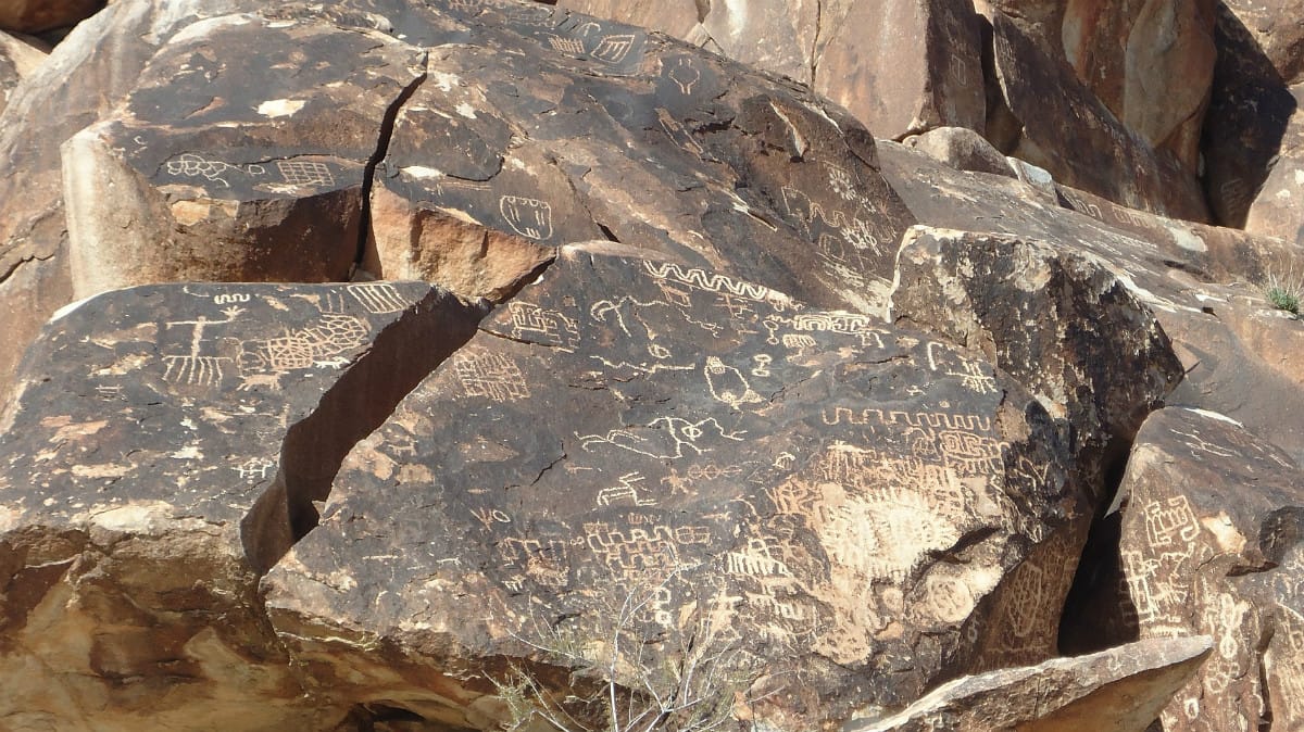
Grapevine Canyon
Grapevine Canyon is accessible off of Christmas Tree Pass Road. Petroglyphs are visible in numerous places in the canyon, but there are many that can be viewed near the entrance of the canyon.
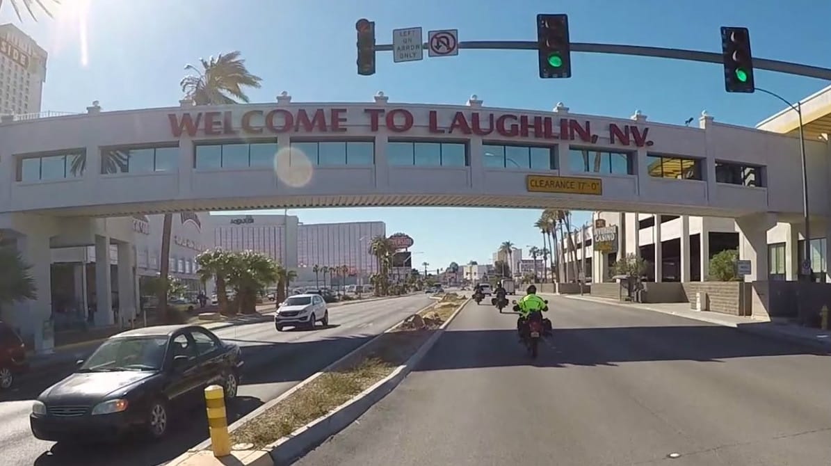
Laughlin
Laughlin is a popular tourist spot and casino destination. It was originally started by Don Laughlin who saw potential for the area. He subsequently built a motel and casino, and the town has grown from there.
Section 6: Laughlin to Oatman
| Section Mileage | Terrain |
|---|---|
| Approx. 22 Miles | Dirt Road, Pavement |
GPS File Name: Section 6 Laughlin to Oatman
Laughlin
Next Gas Stop: 46 Miles in Kingman
After leaving Laughlin, you’ll pass the bridge over the Colorado River into Bullhead and head south on Highway 95. Next, you’ll take the dirt roads through the mountains until you hit the historic Route 66. From there, you’ll head south a short distance until you roll into Oatman.
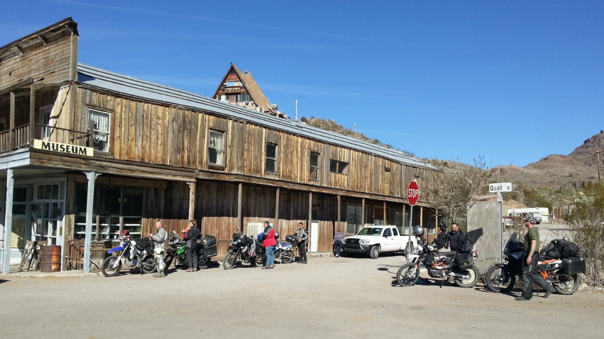
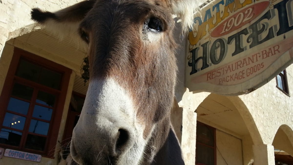
Oatman is an old mining town that grew rapidly after gold was found in 1915. When the mines shut down, the town was practically abandoned, but tourism has revived it in recent years. Wild burros (descended from pack animals that the miners released) roam free within the town. From antiques to old mining equipment, there are a lot of things to see in the gift shops that line Main Street. Gunfights are also reenacted in the town.
Interesting facts and trivia can be found below.
Bullhead City
Bullhead is on the Arizona side of the Colorado River, across from Laughlin. It originally existed as Hardyville, a small settlement named after William Hardy, who operated a ferry service and raised goats there in the 1800s. The town was later abandoned, but Bullhead City emerged in the same location about 50 years later when the Davis Dam was constructed nearby.

Oatman
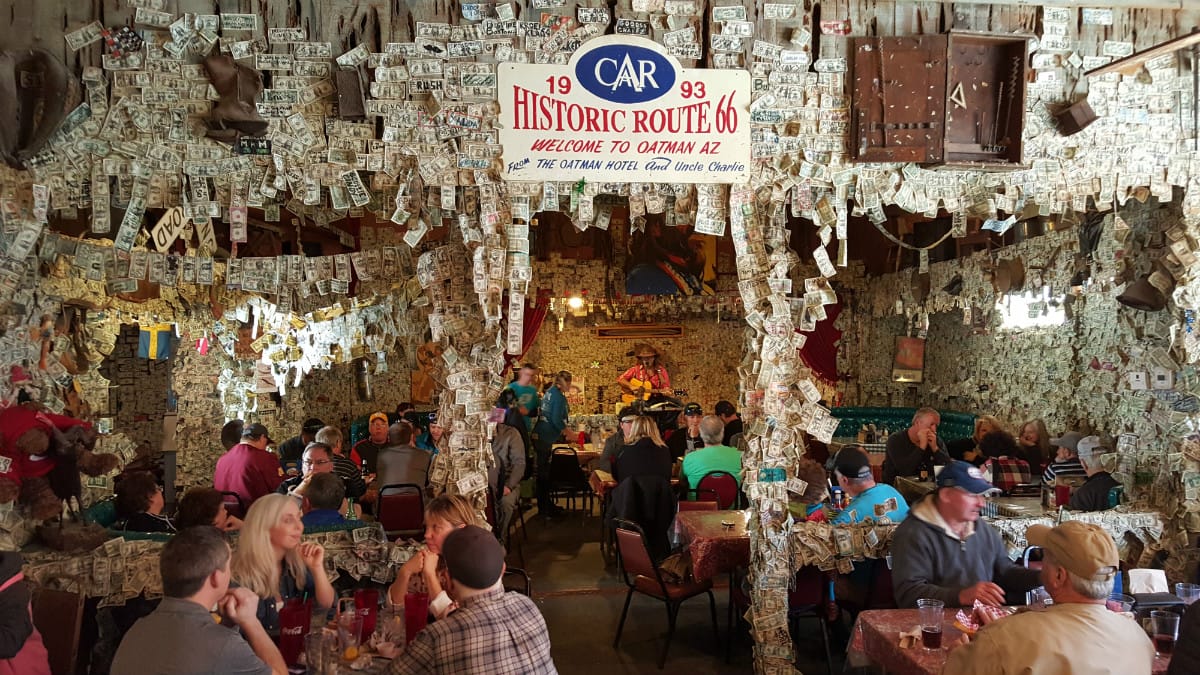
The Oatman Hotel is one of the main attractions of the town. Built in 1902, it is the oldest two-story adobe building in the county. Clark Gable and Carole Lombard honeymooned there in 1939, and their suite can be viewed as part of the building’s museum. Visitors frequently leave autographed dollar bills on the wall and ceiling, a practice that dates back to the Oatman’s mining days. The Oatman Hotel is also known for being haunted by “Oatie,” a friendly ghost.
Oatman was named after Olive Oatman, a young girl who was enslaved by a tribe of Native Americans after they slaughtered her family. She was later traded to the Mojave people, who improved her treatment and adopted her. She was released at the age of 19 near the location where the town of Oatman is located today.

Section 7: Oatman to Kingman
| Section Mileage | Terrain |
|---|---|
| Approx. 24 Miles | Pavement, Historic Route 66 |
GPS File Name: Section 7 Oatman to Kingman
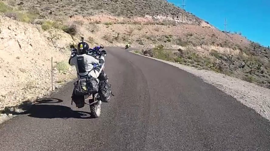
This is an all-road section. From Oatman, you’ll head up Route 66 (Oatman Highway). There are a lot of fun curves with some views of the old gold mines located throughout the mountain range. This road takes you to the freeway just south of Kingman. Stop here to fuel and restock as it will be the last fuel opportunity before camp.
Interesting facts and trivia can be found below.
Route 66
US Route 66 was established in 1926 from Illinois to California and eventually became one of the most famous roads in America. Of the nearly 2,500 miles of road on Route 66, the portion through the Black Mountains (now called the Oatman Highway) was notorious for being the most dangerous segment, and many travelers hired locals to drive that section for them.
There’s a real thrill about jumping on Route 66 out of Oatman. Maybe it’s the history. Maybe it’s the super curvy road. Regardless, you’ll be sure to “get your kicks” on this section.
Gold Road Mine
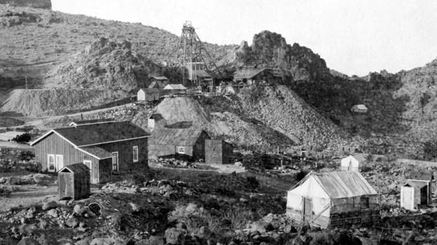
In 1900, a miner named Jose Jerez was looking for his lost burros when he accidentally discovered gold. He and his partner began digging a mine, which they later sold to a prospecting company. The settlement of Gold Road emerged. By 1950, it was a ghost town, but the mine was revived in 1995 and began producing again. After shutting down in 1998, the mine reopened again 10 years later.
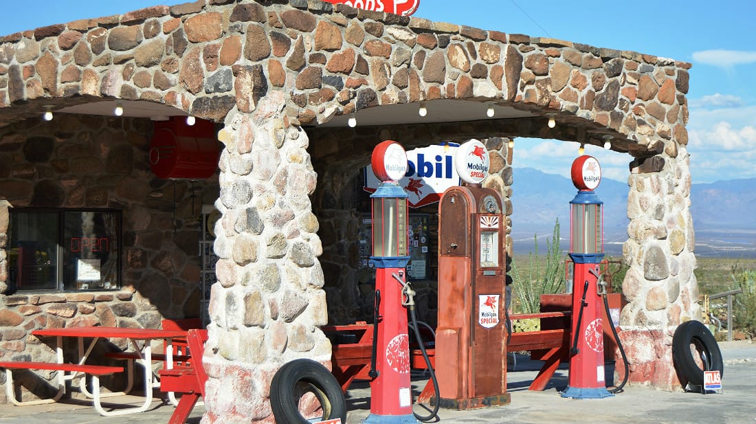
Cool Springs
Once a typical gas station along Route 66, Cool Springs fell into disrepair over time as traffic in the area decreased. Ned Leuchtner bought the building in the late 90s and fixed it up into a gift shop and museum.
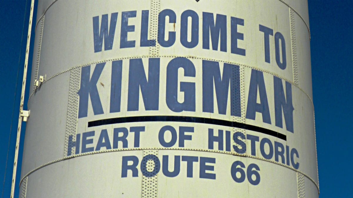
Kingman
Kingman emerged in 1882. Five years later, a disgruntled newspaper publisher based in Mineral Park threatened to move his paper and the county seat to Kingman. He made good on his promise and secretly moved county records to Kingman. An election later made the move official, and Kingman remains the county seat of Mojave County. Today, the town is known as the “Heart of Historic Route 66.”
Section 8: Kingman to Pre-Alamo Lake (Camp 2)
| Section Mileage | Terrain |
|---|---|
| Approx. 65 Miles | Pavement, Dirt Super Highway |
GPS File Name: Section 8 Kingman to Pre-Alamo Lake
EZ BYPASS File Name: Section 8 BYPASS EZ Chicken Springs skip Alamo Lake
Kingman
Next Gas Stop: 140 Miles in Wickenburg
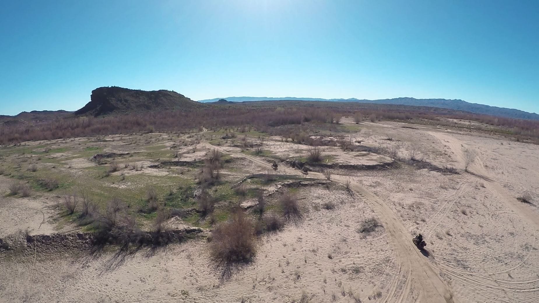
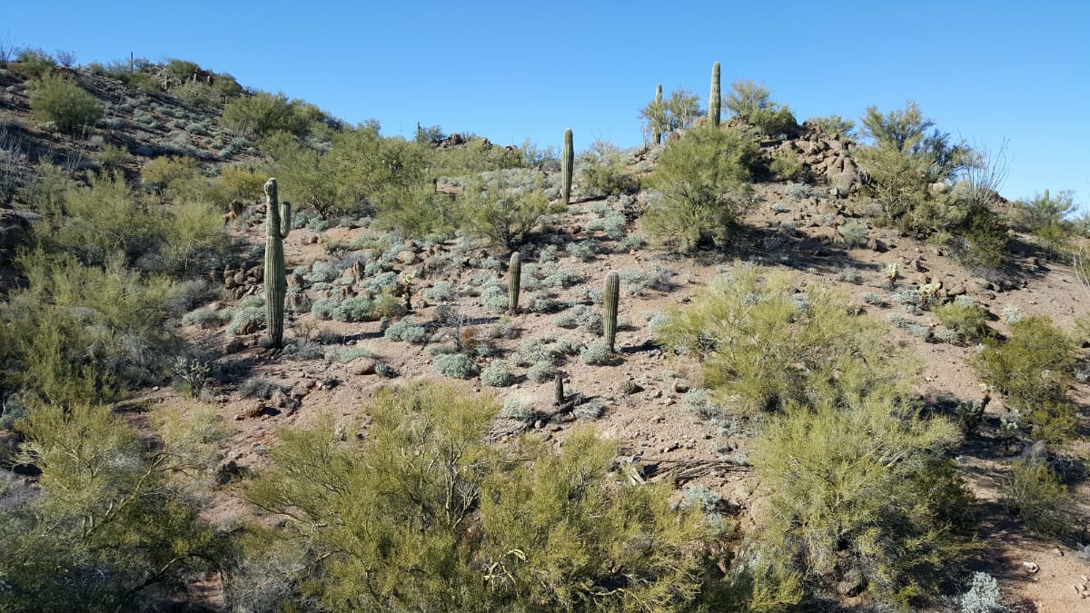
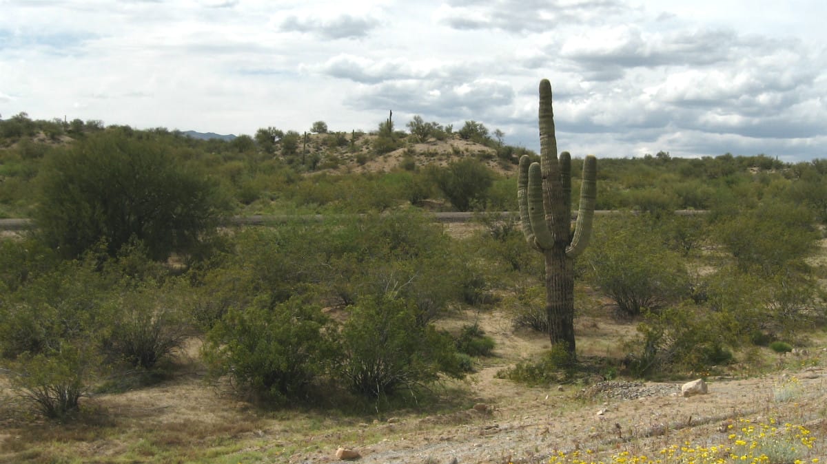
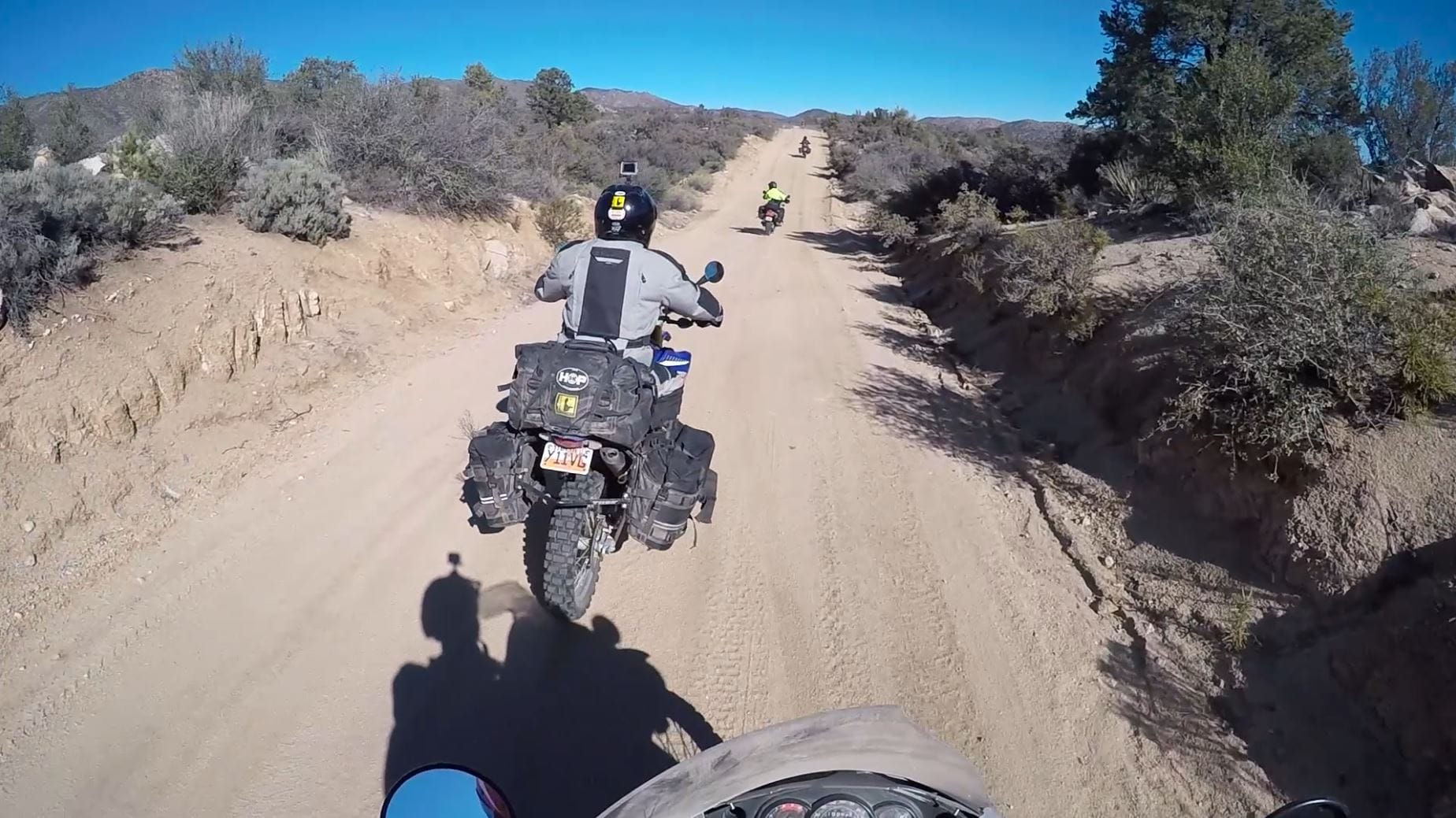
From Kingman, you’ll take the freeway down to Yucca. There isn’t much in Yucca, but it is home to the huge Chrysler Arizona Proving Grounds where they do a lot of their automotive testing. You’ll then turn down the frontage road for a moment before turning into what we like to call the “Dirt Super Highway.” This long stretch of dirt road is wide, smooth and fast. It slowly gets curvier as it makes its way into the hills. The road also starts to offer some amazing landscapes full of big saguaro cactuses spread throughout the rolling hills.
In previous years, we’ve set up camp near Alamo Lake. However, this year, we decided to camp up in the hills away from the cold breeze from the lake. We found a beautiful camping spot in the middle of a valley right along a wash. It is a sandy, flat area. The site is marked on our GPS files.
EZ BYPASS: If you’re looking to stay out of the sand and water that you’ll find on section 9, there is a nice alternate route you can start on section 8 which bypasses all of Alamo Lake. You’ll turn off Alamo Road onto Chicken Springs Road, which leads to Wikieup, where you can hop on Highway 93 and head south. This is a nice, maintained scenic mountain pass, and it encompasses more slab than the Alamo Lake option. You can still use camp 2, but it will just include some backtracking. The EZ BYPASS route is included in the GPS files.
Interesting facts and trivia can be found below.
Interstate 40
President Eisenhower championed the creation of the Interstate Highway System as a means to more efficiently transport troops across the country. I-40 was built along a similar path as Route 66, and while it was more efficient, it also bypassed many of the towns and sites that led to the latter’s charm. Charles Kuralt remarked, “It is now possible to travel across the country from coast to coast without seeing anything.”
| Section Mileage | Terrain |
|---|---|
| Approx. 135 Miles | Dirt Road, Rocky Hills, Sandy River Bottom, Two Track, Pavement |
GPS File Name: Section 9 Pre-Alamo Lake to Phoenix
EZ BYPASS File Name: Section 8 BYPASS EZ Chicken Springs skip Alamo Lake
Wickenburg
Next Gas Stop: 60 Miles in Phoenix
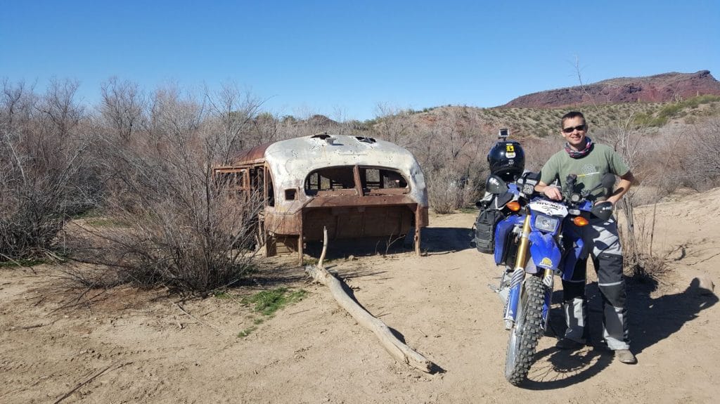
You’ll continue along the Dirt Super Highway until you get to Alamo Lake. Once down in the valley, the road slowly makes its way into the hills, where it gets rocky and technical with some steeper hills. An old, abandoned bus is in this area, and we usually stop to see it. This is a cool area full of loose sand and tamarisk tunnels that lead down over the Bill Williams River.
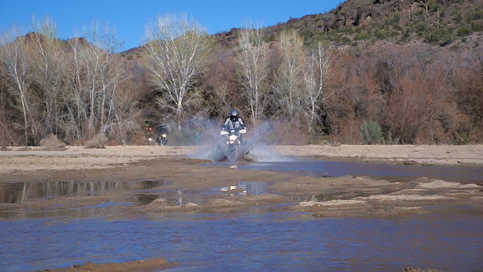
In past years, this river has been completely dried up and was just a long, sandy wash. However, we found a decent amount of flowing water in 2016, which made for a more exciting crossing. Be aware that depending on when you go, you might find water in the river – and if it’s the rainy season, you might not want to risk crossing it at all.
This section is always exciting because it is different every year. There is a little curve ball here. As you exit the wash, stay to the trail on the left. If you take the trail to the right, it goes quite a ways down the sandy wash to a dead end. Carnage will ensue. If you have gone farther than 100 yards on the deep sand, you are on the wrong trail.
The trail then leads through the tamarisk on a fun winding trail. This will lead you back to Wickenburg Road (another dirt super highway), which eventually turns into Alamo Road again. This is a nice, long, high-speed section; you just have to be wary of the cross washes along the road. Alamo Road will then take you to Highway 93.
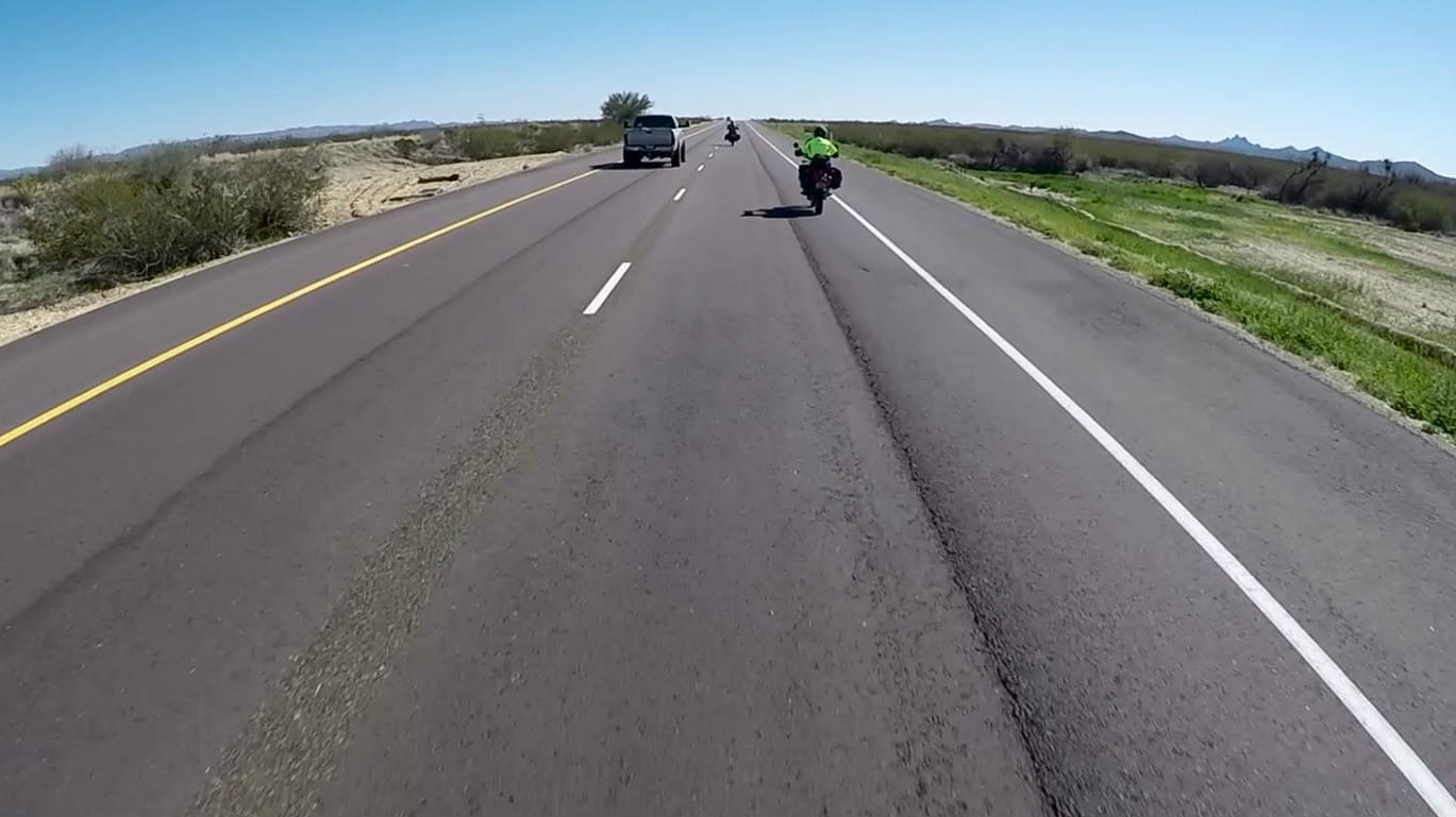
Once on Highway 93, you’ll head south until you hit your gas stop in Wickenburg. It’s also a great place to eat lunch. From there, you’ll continue south and take Highway 60 into Phoenix. We usually plan our HOP ride around the Phoenix round of supercross, but there is always something to do or see in the area, making it a great destination at many different times of the year. (It is too hot to make the HOP practical during the summer, however.)
Interesting facts and trivia can be found below.
Alamo Lake
The Alamo Dam was built in 1968 by the Army Corps of Engineers to help control flooding caused by heavy seasonal rains. Alamo Lake formed as a result. The lake is now part of the Alamo Lake State Park and is a popular camping and fishing location.
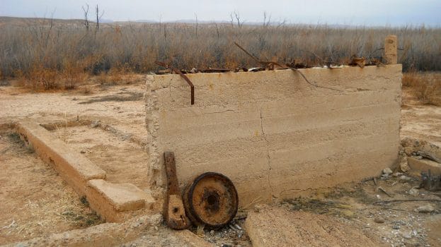
The abandoned bus in this area served as living quarters and was part of the Alamo Crossing community, a tiny town that used to exist in the area before the dam was built and submerged it under Alamo Lake. When the lake’s water level decreased in the 1980s, the bus became accessible by land again. However, the rest of the town is further south and still submerged.
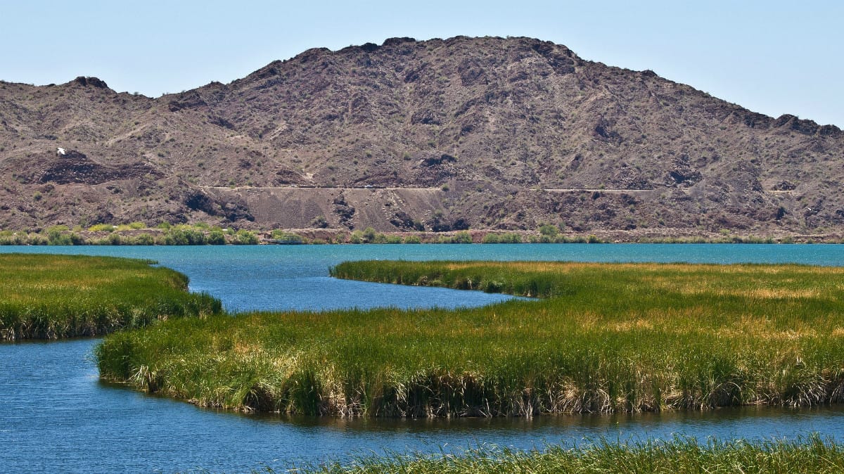
Bill William River
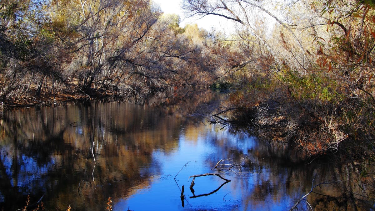
The Bill Williams River is over 45 miles long and feeds into Lake Havasu. The banks of the river are green and full of life, standing in stark contrast to the rest of the desert landscape. 80% of Arizona’s plant and wildlife species are found along rivers such as the Bill Williams.
The Wayside Oasis
The Wayside Oasis, a bar and grill as well as an RV park, is situated to the east of Alamo Lake. Despite its remoteness, it has become a popular destination for campers, off-road enthusiasts and local pilots.
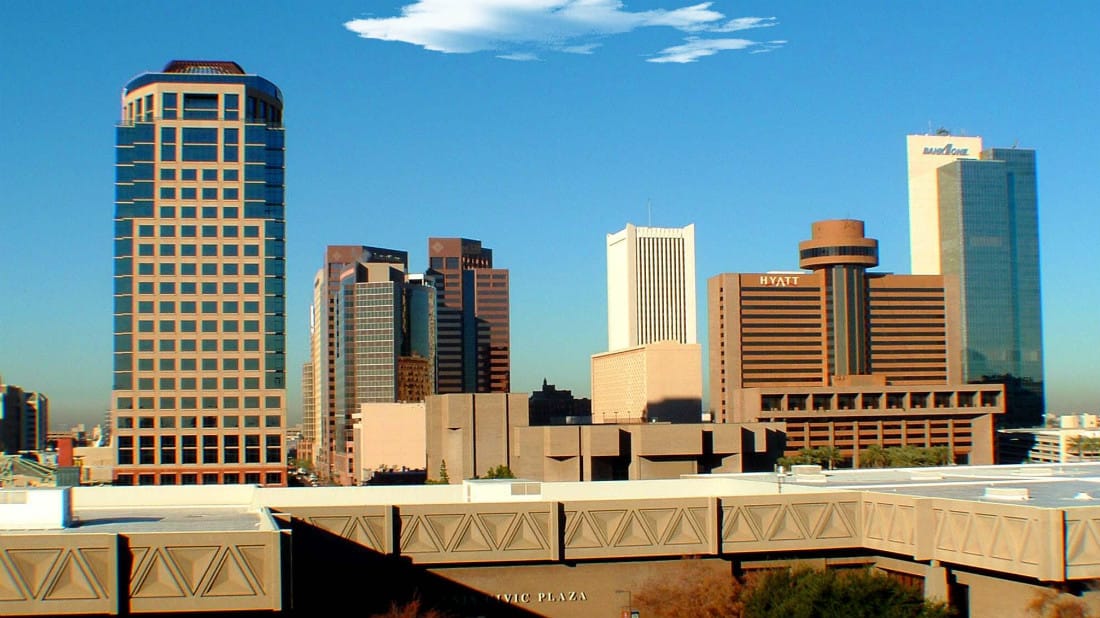
Phoenix
The Phoenix Metropolitan Area includes Phoenix, Mesa, Glendale, Chandler and many other cities, making it one of the largest metropolitan areas in the United States and the third largest west of Texas (after Los Angeles and San Francisco).
| Section Mileage | Terrain |
|---|---|
| Approx. 116 Miles | Pavement |
GPS File Name: Section 10 Phoenix to 17 Mile Road
Phoenix
Next Gas Stop: 60 Miles in Wickenburg
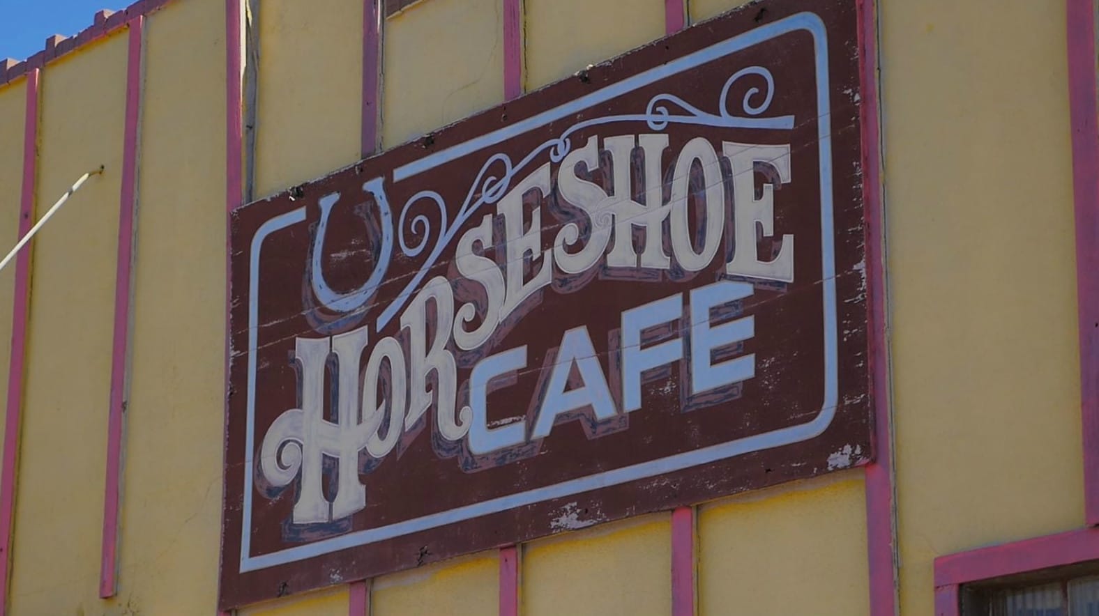
There are plenty of places to eat breakfast within the Phoenix area. However, in true adventure fashion, we chose to head back to Wickenburg, where we found a nice little local restaurant called Horseshoe Cafe. You might want to check it out yourself. The town of Wickenburg offers a lot of history of gold mining and lots of old western relics. It also has some great local restaurants.
Wickenburg
Next Gas Stop: 95 Miles in Wikieup
In Wickenburg, you’ll gas up and head out on Highway 93. This is a good stretch of road to put in your earbuds and enjoy your music. You’ll head north on the highway for about 56 miles until you get to a dirt turnoff at a mountain pass – 17 Mile Road.
Interesting facts and trivia can be found below.
Surprise
The city of Surprise was founded in 1938. The name came from its founder, Flora Mae Statler, who reportedly said that she would be surprised “if the town ever amounted to much.” It is now one of the fastest growing municipalities of the Phoenix area.
Morristown
Morristown is a small town that lies along Highway 60. It is notable for being the home of the internet-famous “Grumpy Cat.”

Hassayampa River
Highway 60 follows the Hassayampa River south outside of Wickenburg. For most of its 100-mile length, the Hassayampa is actually underground and only appears with flowing water above ground in a few locations year round, though more water is pushed to the surface at different times of the year. The river’s name comes from a Native American word meaning “the river that flows upside down.”
Local legend says that anyone who drinks from the river is doomed to never tell the truth again. This legend extends back to the 1800s and may have its roots in stories of the miners in the area who made exaggerated statements about their finds.
Wickenburg
Wickenburg was built through the cooperation of miners, ranchers and farmers. It was named after Henry Wickenburg, a prospector who discovered a prosperous mine in the area. Although the town suffered numerous challenges, including Indian wars, mine closures, drought and a flood, the community continued to grow and remains a vibrant city today.
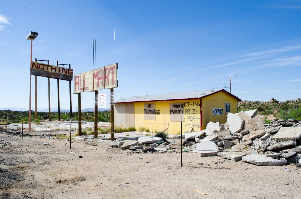
Nothing
The abandoned town of Nothing sits on Highway 93. The town sign read: “The staunch citizens of Nothing are full of Hope, Faith, and Believe in the work ethic. Thru-the-years-these dedicated people had faith in Nothing, hoped for Nothing, worked at Nothing, for Nothing.”
Section 11: 17 Mile Road to Coyote Wells Road
| Section Mileage | Terrain |
|---|---|
| Approx. 31 Miles | Maintained Dirt Road |
GPS File Name: Section 11 17 Mile Road to Coyote Wells Road
A Loop File Name: A Loop ALTERNATE Hardest
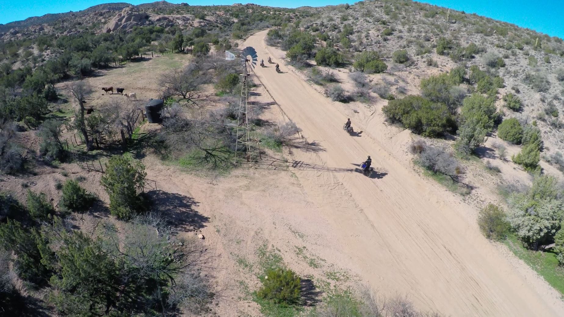
17 Mile Road is a well-maintained dirt road that offers some incredible views as well as fun twists and turns. The mountain pass is home to a variety of cactuses and other vegetation, making for some great pictures. This section is a great spot to take it easy and soak in everything the Arizona desert has to offer.
You’ll follow 17 Mile Road until you get to Signal Road. The ghost town of Greenwood is around this area and serves as a good place to take a break. You’ll then take Signal Road until you get to Coyote Wells Road. Be aware that you’ll cross the Big Sandy River wash when you first turn on Signal Road. In most years, it has been dry, but we did find water in it on our most recent ride through. You’ll turn on Coyote Wells Road until you hit Alamo Road.You’ll continue on Alamo Road for about five miles until you get to Chicken Springs Road.
A Loop: This is where the turnoff for an alternate loop is. We call it the “A Loop.” (This is how it is referred to in the GPS files as well.) This is for those who want a tougher challenge. It offers a lot of sand washes and steep rocky hills with rain ruts. Although it’s difficult, you’ll be rewarded with some great views and a fun (and curvy) two-track route back down the mountain. This trail will eventually make its way down and meet up with Alamo Road. From there, you’ll head north until Coyote Wells Road connects to Alamo Road and then on to Chicken Springs Road.
Interesting facts and trivia can be found below.
Ghost Towns
This route will take you through the ghost towns of Greenwood and Signal, both abandoned in the early 1900s. The only things left of these communities are some ruins and a few mentions in textbooks.
Section 12: Coyote Wells Road to Wikieup
| Section Mileage | Terrain |
|---|---|
| Approx.15 Miles | Maintained Dirt Road |
GPS File Name: Section 12 Coyote Wells Road to Wikieup
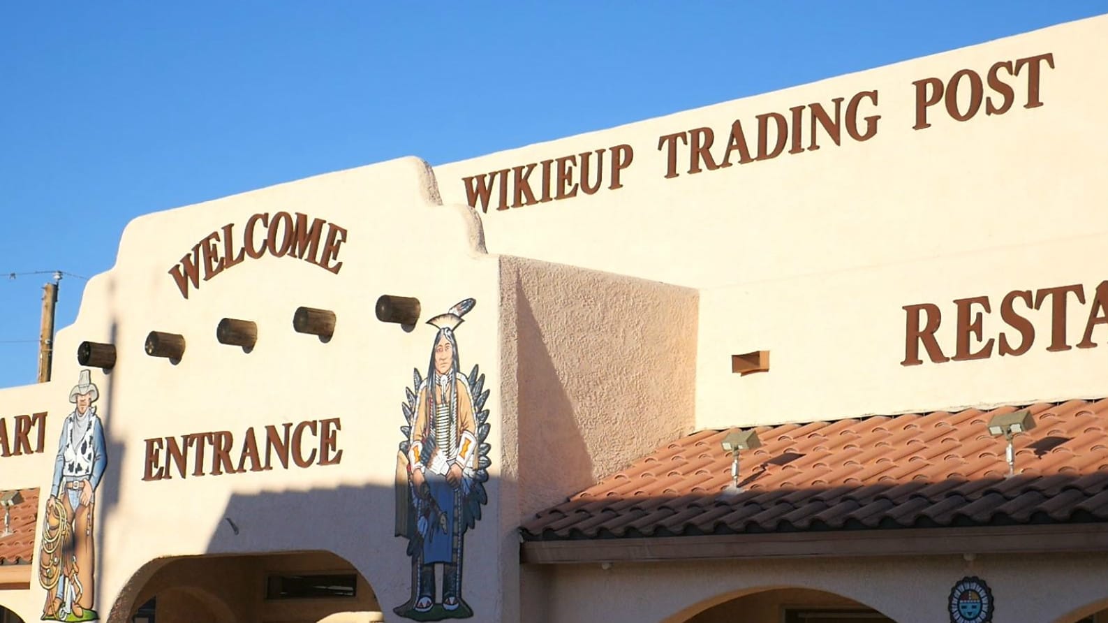
Chicken Springs Road is another scenic mountain pass that will drop you down into Wikieup, a small town with a cool trading post. It’s a great place to gas up and have some dinner. This is the last gas stop before camp.
Interesting facts and trivia can be found below.
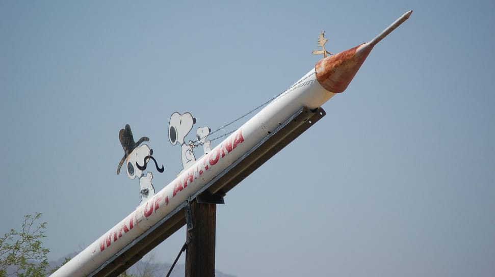
Wikieup
Wikieup gets its name from a Mojave word meaning “shelter” or “home.” A statue of a rocket with Snoopy characters is located at the north side of town. It was raised by seasonal visitors from Michigan in the 1990s. They left, but the rocket remains.
Section 13: Wikieup to Blake Ranch Road (Camp 3)
| Section Mileage | Terrain |
|---|---|
| Approx. 27 Miles | Pavement, Dirt Road |
GPS File Name: Section 13 Wikieup to Blake Ranch Road
Wikieup
Next Gas Stop: 145 Miles in Boulder City
From Wikieup, you’ll head north on Highway 93 for about 18 miles before turning off onto Blake Ranch Road. You’ll follow the well-maintained dirt road through the mountains just over 10 miles.
On Blake Ranch Road, there is a good spot to camp running alongside a sand wash. It is surrounded by hills, providing protection from the wind.
| Section Mileage | Terrain |
|---|---|
| Approx. 30 Miles | Maintained Dirt Road, Pavement |
GPS File Name: Section 14 Blake Ranch Road to Kingman
Gold King Mansion File Name: Gold King Mansion out and back
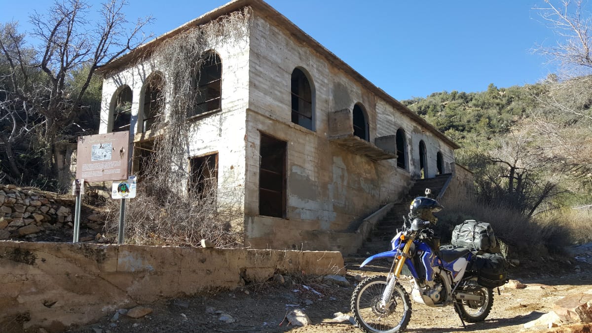
If you want to check out the Gold King Mine Mansion (highly recommended), you’ll head up Moss Wash Road. If you camp in the same spot we did, you might want to visit the mansion before you load your gear. It is a rocky and somewhat technical dirt road, and the turnoff is close to camp. The trip to the mansion and back is less than four miles and will only take you half an hour or less. Visiting the historic mining camp is a lot of fun and offers a little more flavor to the awesome ride. After you see the mansion, it’s back down to Blake Ranch Road again.
You’ll head north on Blake Ranch Road until you get to I-40. From there, you’ll take the freeway west into Kingman.
Interesting facts and trivia can be found below.
Gold King Mansion
The Gold King Mine was built in 1929, and a series of bunkhouses was planned to house the miners. The first was built, but it was soon determined that fewer workers would be needed than originally expected, so instead of building additional bunkhouses, the first one was expanded to roughly double its original size and became known as the Gold King Mansion. Ultimately, it was used to lodge prospective investors rather than the miners themselves.
Section 15: Kingman to Boulder City
| Section Mileage | Terrain |
|---|---|
| Approx. 78 Miles | Pavement |
GPS File Name: Section 15 Kingman to Boulder
Leaving Kingman, you’ll have your longest pavement section (78 miles) as you make your way to Boulder City. The Hoover Dam is en route and is a great place to stop, stretch and take pictures.
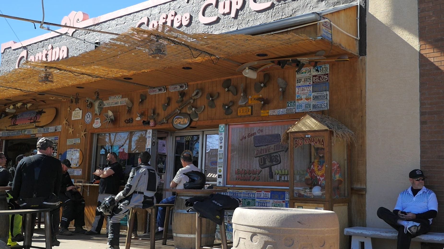
Boulder City is a good place to stop for lunch. The most recent time we rode the HOP, we ate lunch at the Coffee Cup (open 6 AM – 2 PM), where they serve great American food with a nice local style. Their Chili Verde Omelet was featured on Diners, Drive-Ins and Dives.
Interesting facts and trivia can be found below.
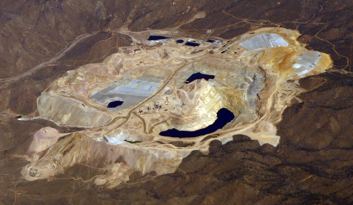
Mineral Park
Mineral Park is north of Kingman. It was the county seat at one point, before it was “stolen” by Kingman. Mineral Park was an important mining town at one point, but it began to decline in the late 1800s. The mines produced silver, gold, copper, lead and zinc, though Native Americans mined turquoise in the area before that. Although the area is private property, you can see evidence of the mine from the highway.
Chloride
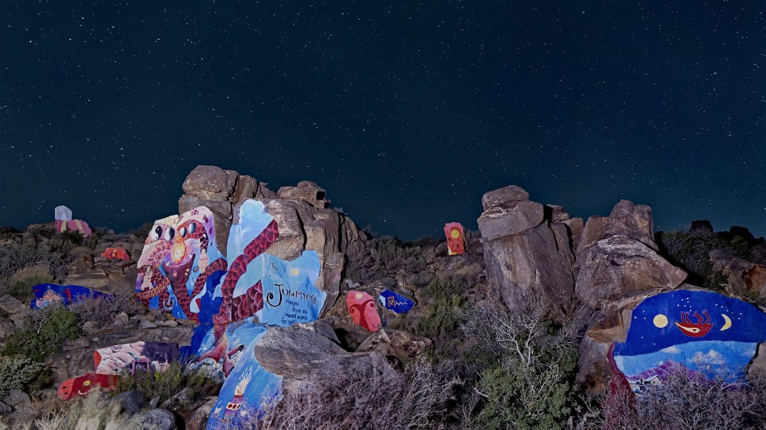
To the east of Grasshopper Junction is the old mining town of Chloride. Although it lies off the route we normally take, it has a few interesting things to see if you want a break. Many buildings are abandoned, and the town bills itself as “a ghost town that never really died.” It is notable for its yard art (or “junk art” as described by some). There are also rock murals painted in the hills above town.
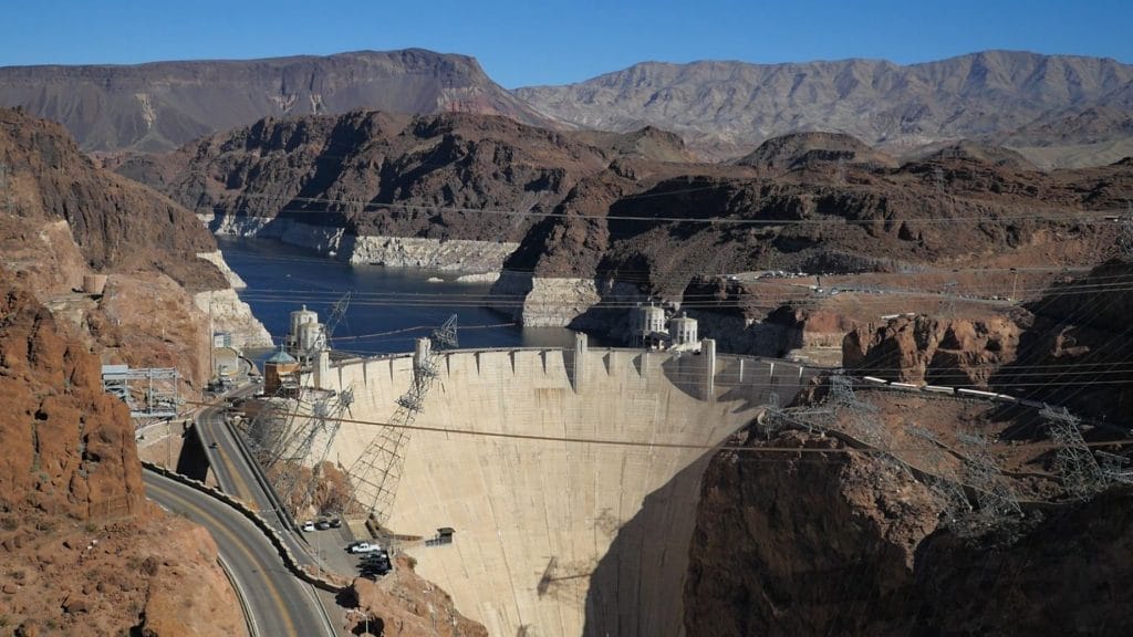
Hoover Dam
The Hoover Dam was built during the Great Depression to manage flooding and irrigating in the area as well as produce hydroelectric power. The dam was named after President Hoover. However, Hoover’s term ended before the dam’s completion, and President Roosevelt offered its dedication, referring to it only as “Boulder Dam.”
The Hoover Dam is an impressive structure, and we recommend checking it out. You can walk on the bridge, and there are tours available as well.
Section 16: Boulder City to Lake Las Vegas
| Section Mileage | Terrain |
|---|---|
| Approx. 20 Miles | Rocky Two Track, Loose Gravel, Sand |
GPS File Name: Section 3 and 16 HARDER Lake Las Vegas to Boulder
EZ BYPASS File Name: Section 3 and 16 EZ Lake Las Vegas to Boulder
Boulder City
Next Gas Stop: 110 Miles in Mesquite
At this point, you can reverse the first three sections of the ride, initially making your way back through the technical dirt to Lake Las Vegas.
EZ BYPASS: If time is short or you want a different view, you can take the alternate route next to Lake Mead. This is an easy-going, scenic ride on the pavement. The views of the lake and surrounding desert make the ride very enjoyable.
Conclusion
The Hooked on Phoenix ride has been a staple of our adventure riding every year, and now you can enjoy it too. With so many types of terrain and several alternate routes, it appeals to a variety of riding preferences. And true to any adventure ride, there’s plenty of interesting things to see along the way.
Don’t forget to subscribe to our YouTube channel to stay updated on future rides!
Disclaimer
Route information and GPS files are provided to you "as is". Rocky Mountain ATV/MC and RM Rides makes no warranty that the information contained therein is accurate or the information is fit for any particular use. Furthermore, Rocky Mountain ATV/MC and RM Rides disclaim all liability from any damages which may arise (directly or indirectly) from your access and use of the information or files. By accessing the route information or GPS files, you acknowledge that you take full responsibility for your actions (or lack of action) in relation to them. The information and details supplied are not a substitute for proper planning. Check with the official representatives of the agency or organization that governs or operates a particular riding location, gas station, campsite, or point of interest to determine current accessibility, special rules, hours of operation, or exact boundaries that are appropriate for powersport vehicle use.
Disclaimer
Riding any type of powersports vehicle can be a dangerous activity and is done at your own risk. The riding tips, techniques, videos, and photos that Rocky Mountain ATV/MC posts on this site feature both professional and experienced riders and may cause serious injury or even death. Riding at high speeds or participating in stunt riding is inherently dangerous. Rocky Mountain ATV/MC disclaims all liability from any and all losses, damages, injuries, paralysis, or death that may occur by trying any of the riding tips, techniques, stunts, photos, videos, or content found on this website, either posted by Rocky Mountain ATV/MC or visitors of the site. Furthermore, we recommend you always wear a helmet and the appropriate safety gear when riding and that you assess your own capabilities and skill level before attempting any rid, terrain, stunt, or technique. Some of the content, videos, and photos presented on this site have been sent to us by our customers. All information presented in the content, videos, and photos, including tricks, views, opinions, or positions of Rocky Mountain ATV/MC or their affiliates.