- MOUNTAIN TIME
- ¡Hablamos español!

H1 Heading Not Displayed
Disclaimer
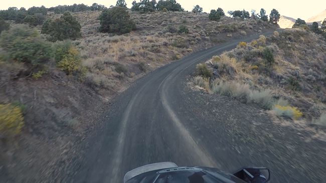
The difficulty of this ride ranges anywhere from paved roads to technical, rocky, steep terrain. If possible, the most difficult sections of these rides will have a bypass (which is indicated in our maps if they are available), but the availability of the less difficult bypass is not guaranteed, and on occasion, the only way forward may be through a difficult section. While we try to highlight the difficult sections in the videos, specific trail conditions vary from year to year and storm to storm. We recommend that anyone attempting these rides get the most up-to-date road and trail conditions from local state, county, or land use agencies where available. If you notice any trail conditions that are different from what is shown in these videos, please send those trail condition updates to [email protected].
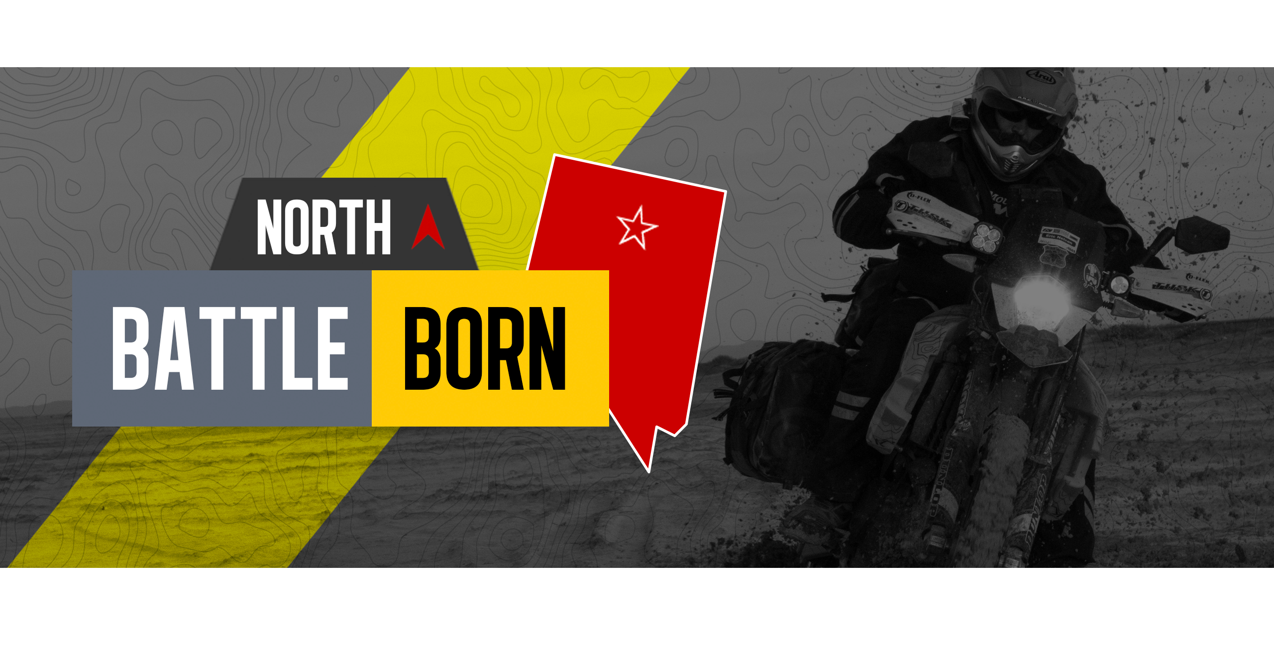
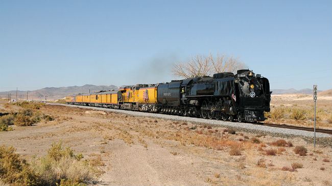
Battle Born North Nevada Adventure Motorcycle Ride
Admin // June 7, 2022
About
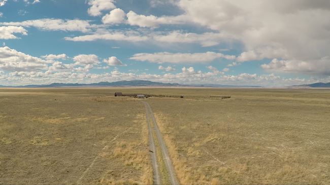
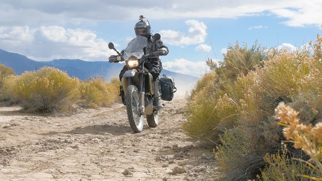
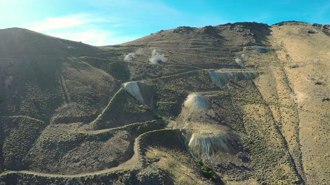
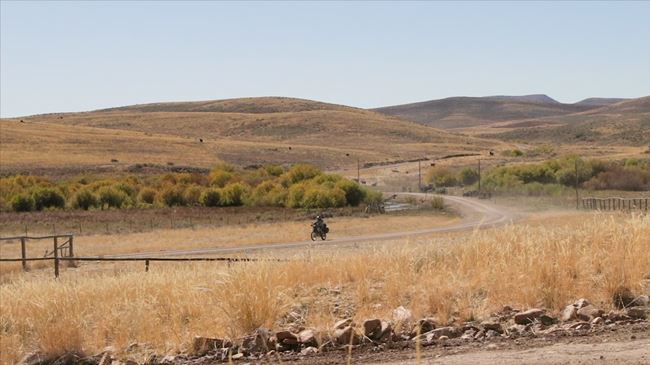
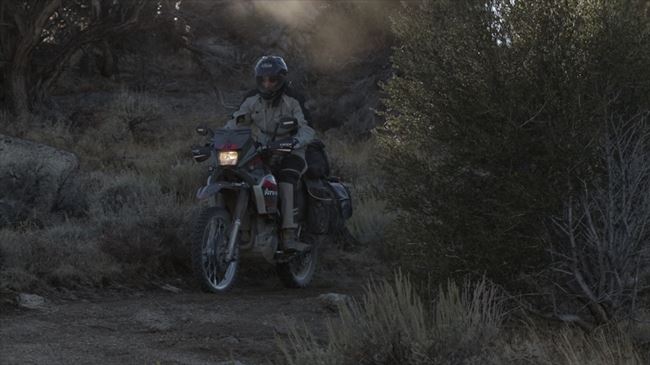
Traversing wide-open deserts, climbing numerous mountain trails, passing decrepit ranches, and exploring forgotten spaces of the American Old West – that’s what the Battle Born North adventure ride is all about.
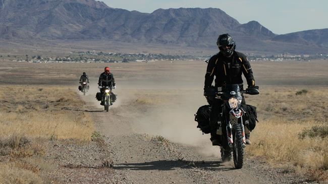
Over the last three years, we’ve put together an adventure route in the Nevada desert that shows the varied beauty the state has to offer. To make it more manageable, we’ve split it up into more than one ride. This is the north part of it – a route that travels past old mining communities, out to Battle Mountain, up to the Idaho border and back down to the Bonneville Salt Flats. It takes your breath away on multiple occasions. We call it the Battle Born North ride after Nevada’s nickname: the “Battle Born State.”
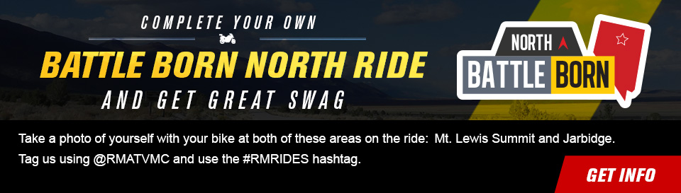
As part of our RM Rides series, we’ve documented the ride and put it together in a video series and companion blog post, making it easy for you to plan your own Battle Born North adventure with your friends. We’ve provided the GPS files below so you can follow our same route.
This article is designed as a resource to help you plan your own Battle Born North ride. It also includes interesting facts and trivia about locations you will pass through or nearby. By clicking on the subheading for each piece of trivia, you can open a drop-down to read more about it. Links are usually provided that can direct you to resources for even more information.
Preparation
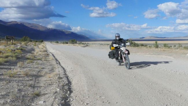
In preparation for any adventure ride, it is critical you take time to carefully plan. Not only do you need to plan routes, food and time, but you need to make sure that your bike is ready and that you have the right tools, riding gear, camping gear and emergency equipment.
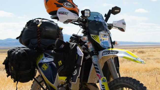
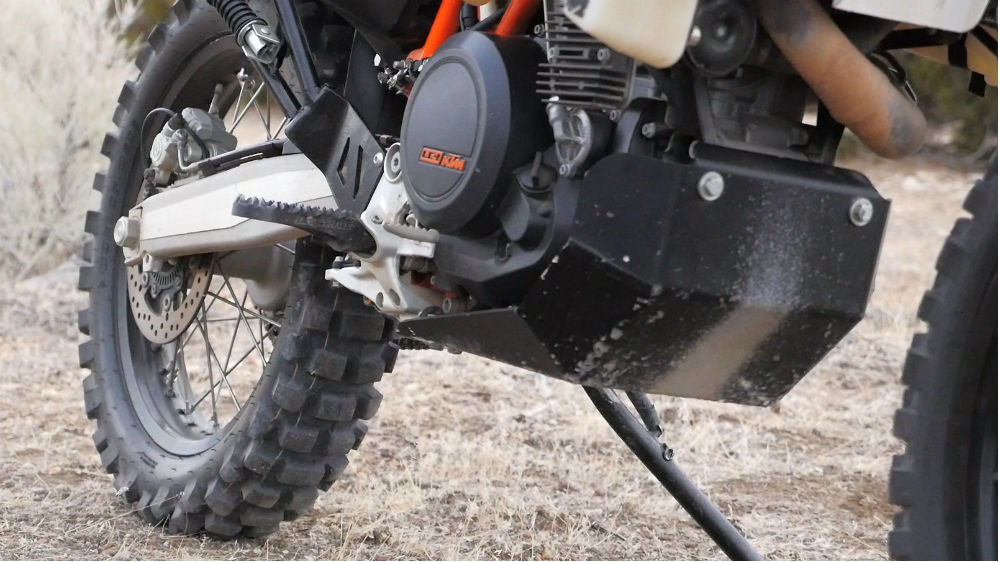
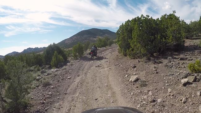
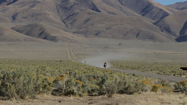
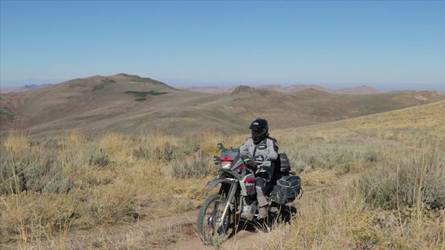
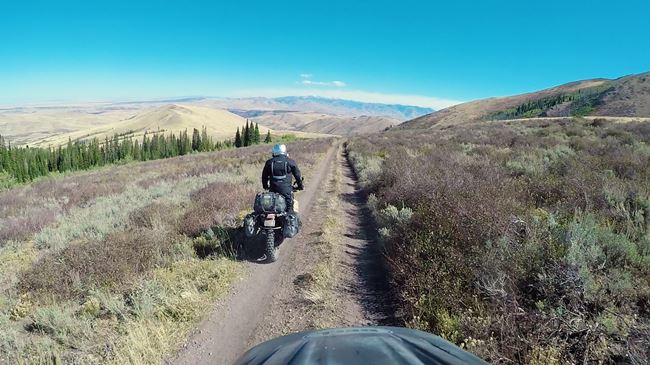
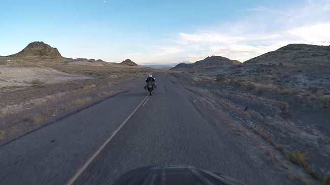
This ride hits all kinds of terrain. Some of it is slab; however, there is a lot of off-road riding on this route, including rocky technical sections. Because of this, it’s essential that your bike is set up for off-road. You’re going to want things like a skid plate and knobby tires. If you really want to enjoy this adventure ride, you need to be prepared for the technical sections.
There’s a lot to be concerned about when planning an adventure ride in Nevada. It’s a vast, open space without a lot of people. Because of that, it’s essential to pack plenty of food and water. Make sure you check the weather in advance as some sections of the route can become treacherous during a storm. Make sure that you adequately prepare for the ride. Do not travel the route by yourself.
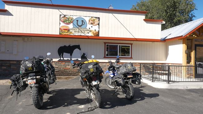
One of the main things you need to be aware of is fuel. Because the route traverses the Nevada wilderness, there aren’t a lot of gas stations along the way. We’ve set up the ride so that if you have a range of 200-220 miles, you should be fine. If your bike doesn’t have that kind of range yet, make sure to pick up a new fuel tank with more capacity (or just a portable fuel container you can take with you) before embarking on this ride.
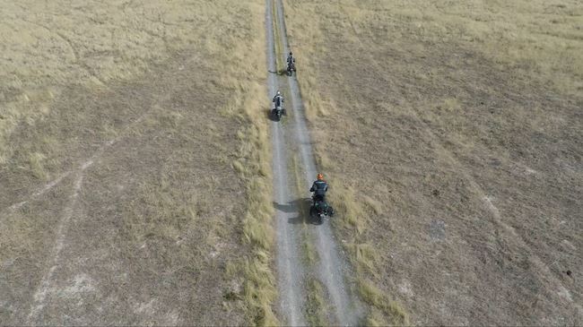
We’ve split the Battle Born North into four days. If you want, you can do the same sections on the same schedule that we’ve outlined here, but you don’t need to feel constrained to it if you want to move things around. You can also expand the trip, adding in additional stops or taking time to check out some of the things that you otherwise might only see in passing.
Once you have the right gear and planning in place, you are ready for adventure!
| Section Mileage | Elevation Range |
|---|---|
| Approx. 184 Miles | 4,288 ft - 8,616 ft |
GPS File Name: Wendover to Eureka
GPS File Name: EZ Bypass
GPS File Name: Things Get Real Bypass
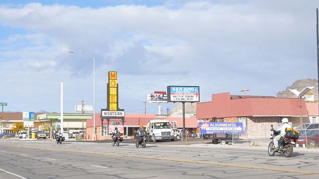
Wendover
Next Gas Stop: 191 Miles in Eureka.
Located right on the Utah–Nevada border, Wendover is the start and finish of this adventure ride loop. Many of the hotels will allow you to leave your truck and trailer in their parking lot during the ride. Just be sure to confirm this with them before you do so. Once you stock up with fuel and anything else you need at the gas station, it’s time to leave Wendover and head southwest.
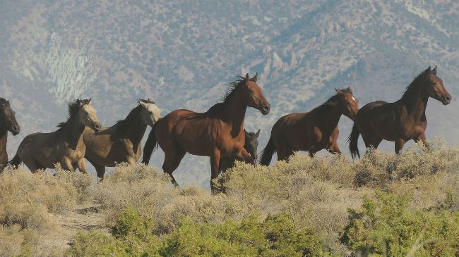
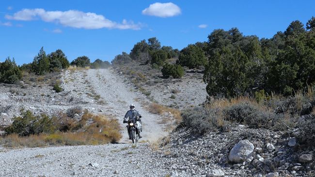
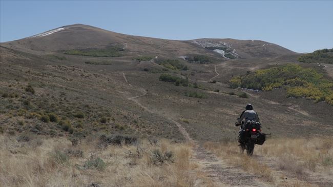
After only about two miles, the path switches from pavement to dirt. The first trail is a fun and flowy two-track dirt road which heads down to Goshute Peak. Watch for wild horses in this area. We see them around the base of the mountain every time we come through here.
Shoot straight for Morgan Pass as you begin your ascent. This is a good trail to measure your group’s riding ability. If you struggle here, there are a number of EZ bypass routes that we’ve marked in the GPS files. These bypass routes are especially good if you have a bigger bike or need a break from the adventure.
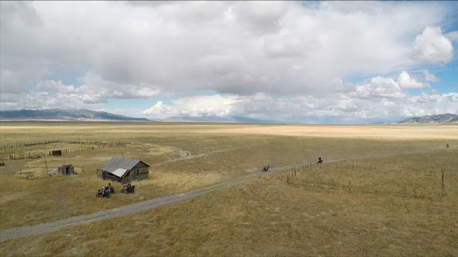
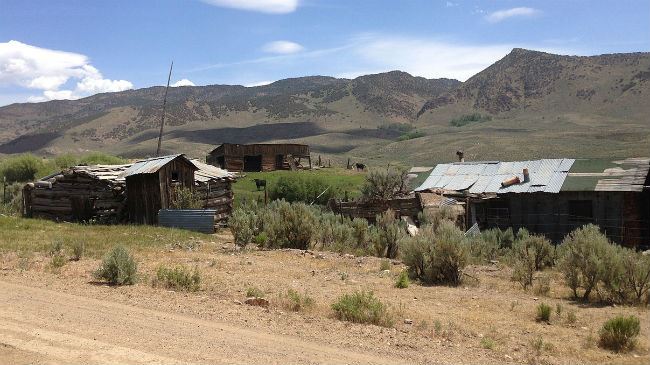
Once you’re over Morgan Pass, make your way down the canyon into the next valley. The canyon gets a little tighter, and it’s a fun ride down. At the base of the mountain, turn south and follow parallel with it for a few miles. You’ll pass a cool old ranch that sits right at the edge of the valley. It’s worth a quick stop to check out.
After leaving, ride west across the large valley. Be warned that this can be a scary place if you get caught in a storm here or cross right after one. The road is mostly clay, and it doesn’t make for good traveling when wet (especially for bigger bikes). Cross the valley over to Spruce Mountain. It’s covered in trails. Some are worse than others, but all are pretty challenging. It’s a good place to test your skills, but if you prefer to skip it altogether, you can take the EZ bypass south to Highway 93.
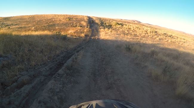
If you venture up the mountain, you’re rewarded with a fun and windy double-track trail. After cresting the pass, you get to a section of the trail that we call “Things Get Real.” You have to be on your A-game during this climb, but it doesn’t get any more fun that this! Keep your momentum up and stay out of the rocks. You might need a little help from a buddy to get going if you stall out or tip over. We used to take a different route up to this pass, but it was rockier and more difficult for heavier bikes.
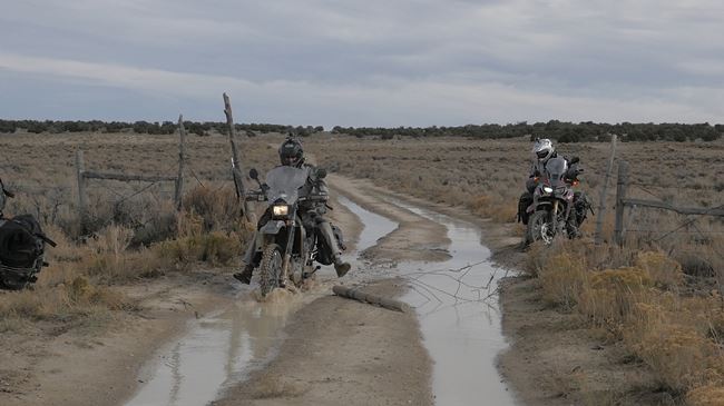
Once you get over the pass, head down and out of the canyon until you reach Highway 93. Cross over it to another dirt road. It’s quite a bit flatter and straighter than other roads travelled thus far, but you should still keep an eye out for sudden mud holes. After a few miles, turn south on a road we call the “dirt highway.”
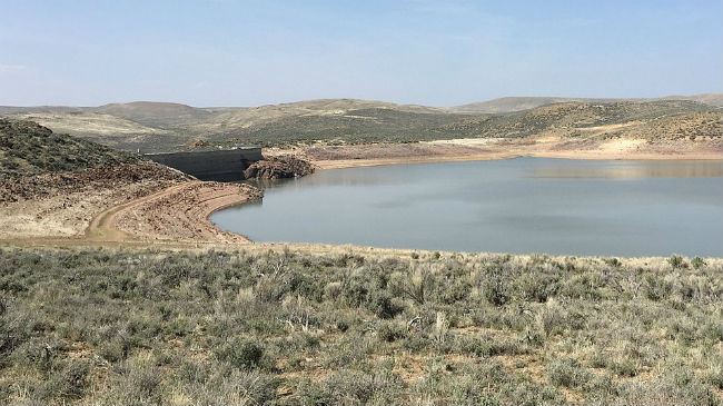
Once you’re on Ruby Valley Road, it’s an easy ride down the Ruby Lake National Wildlife Refuge and past Shantytown. At the south end of Ruby Lake is Fort Ruby, and this is where the route connects with our Battle Born South adventure ride. Just after Fort Ruby, turn west. This is a fun, fast and windy gravel road that’s a good time no matter what bike you’re on.
Once you connect with White Pine County Road 1, turn south and follow the road until it turns into pavement on Highway 892. Ride it down until the turnoff for camp 1. There are a few miles of windy dirt roads as you climb and crest the last peak of the day on your way toward Eureka. The camp spot is within the Diamond Mountains about seven miles outside of Eureka.
Did you know that herds of wild horses roam the Nevada desert and are descendants of ranchers’ horses released in the 1800s? Interesting facts and trivia below.
Wendover
Wendover began its existence over a century ago as a railroad station stop. In 1914, the first transcontinental phone line was completed at the town. The seed of the area’s current economic environment was planted in 1931 when Nevada legalized gambling. Bill Smith expanded a service station he’d built on the Nevada side of the border into a casino. Today, West Wendover, NV, has several casinos, resulting in higher tax revenue than the city of Wendover, UT, creating an economic rift between the neighboring communities.
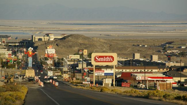
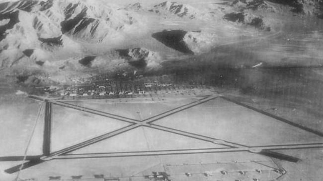
Wendover was the site of the largest airfield of World War II, causing the area to boom from a tiny population of barely 100 to more than 20,000 within only a few years. It is notable for being the location where the 509th Composite Group (which ran the missions to drop atomic bombs over Hiroshima and Nagasaki) was activated and trained. While the airfield hasn’t been operated by the military in many decades, a museum exists in memory of its important history.
Wild Horses
Many areas in Nevada are set up as Herd Management Areas by the BLM for wild horses. These herds descended from ranchers’ horses released in the late 1800s. In subsequent decades, these horses were often rounded up to be sold or slaughtered. In 1950, a woman from Reno named Velma Johnston became aware of the inhumane treatment many of these horses received, and she lobbied for legislation to protect the wild herds. She became known as Wild Horse Annie.
Old Ranch
The old ranch that the route passes carries a certain level of symbolism for ranching in Nevada. Once a vibrant industry in the area, ranching has declined since the 1950s due to lessening demand, rising costs and environmental regulation. One of the conflicts around the ranching industry concerns the use of public lands and how that was affected by several federal agencies’ changing policies, which led to the Sagebrush Rebellion in the 1970s and 1980s. Many ranches either disappeared or downsized.
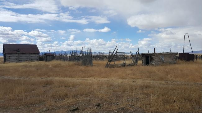
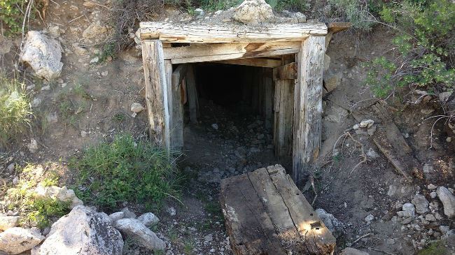
Old Mining Town
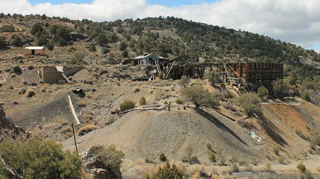
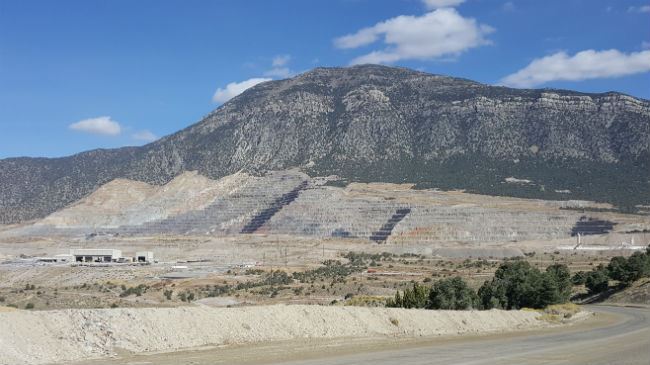
Nevada’s modern mining began in 1849 and has had significant booms and declines in its history since then. The Battle Born North route travels nearby several mine claims with visible remains, including the old ghost town of Jasper. The town was first established to support some of the mining operations on Spruce Mountain such as the Bullshead and Black Forest Mines. A large open mine can be seen at one point. This belongs to the Kille Mine. Opened in 1869, it was the first mine started on Spruce Mountain.
The abandoned Monarch Mine on Spruce Mountain, Nevada by Famartin (CC BY-SA 3.0)
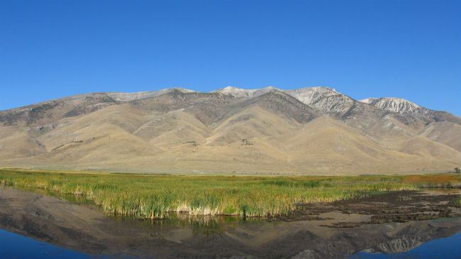
Ruby Mountains
The Battle Born North route passes alongside the Ruby Mountains, so named because of the garnets that early explorers found in the area. To the east of the mountains lies the Ruby Lake National Wildlife Refuge, which is an important biological hotspot for local wildlife. It’s a key nesting area for waterfowl in the Intermountain West.
Ruby Mountains by Chris M Morris (CC BY 2.0)
| Section Mileage | Elevation Range |
|---|---|
| Approx. 210 Miles | 4,511 ft - 9,606 ft |
GPS File Name: Eureka to Battle Mtn
GPS File Name: Battle Mtn EZ Bypass
GPS File Name: Battle Mtn to Jarbidge
GPS File Name: Rock Canyon EZ Bypass
Eureka
Next Gas Stop: 140 Miles in Battle Mountain.
Day 2 of the Battle Born North ride is filled with more adventure and plenty to see along the way. There’s just over 210 miles to cover in this section, and most of it is off-road. You start out by dropping down into the cool old town of Eureka. This is a good place to fuel up and get some breakfast before jumping on the Lincoln Highway.
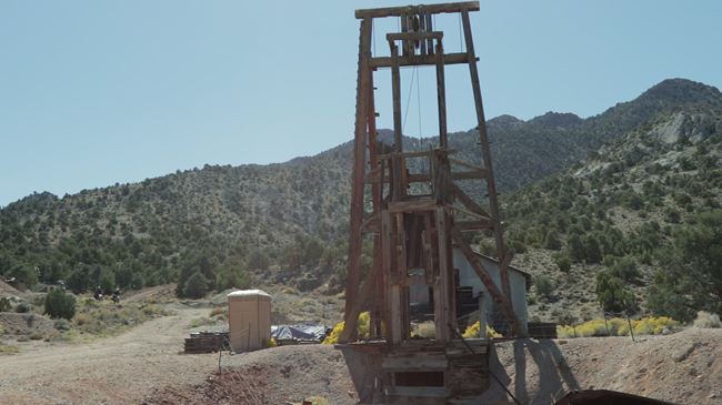
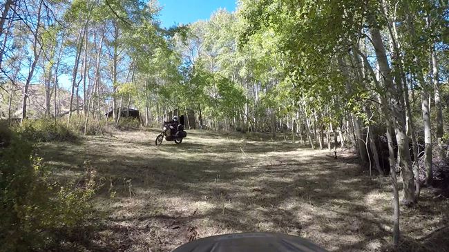
After about 10 miles, turn off the highway and onto Saddle Brown Road. This area has high speed dirt roads that can hide an occasional g-out or rain rut, so be careful. As the route approaches the base of Lone Mountain, the trail tightens up slightly and winds its way through an old mining area. There’s some cool old equipment that’s worth stopping to check out.
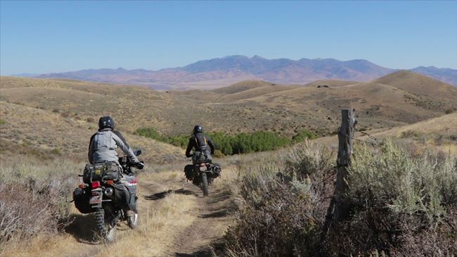
Drop from the base of the mountain down to the valley floor, and head north to the west side of Roberts Creek Mountain. This section is a lot of fun because the dirt is fluffy enough to hold your line but firm enough to be stable. Cross over the Pony Express Trail in the middle of this valley and head north on more fun and fast dirt roads.
The road passes through a ranch near Meadow Canyon and then hangs a left up to McClusky Pass. Eventually, this road tightens up, and you drop into Sage Hen Canyon. From there, hop on Cortez Crescent Road (a wide-open gravel road) and follow that up to the Cortez Hills gold mine. You know you’re getting close to the mine when a massive mountain of tailings comes into view. Cortez Hills is Nevada’s longest-running mine and largest gold-producing mine, with both open-pit and underground mining operations. They have the longest overland conveyor in Nevada at 10 miles long. It’s pretty amazing to see how much earth they’ve moved.
After leaving the Cortez Hills mine, travel through a twisting canyon on a hard-pack dirt road and drop down on the Cortez Gold Mine Road. This curvy road eventually runs you up onto Mill Creek Summit and into a beautiful canyon that parallels Mill Creek. Be cautious for rattlesnakes in the area.
Once you get to an intersection with an old shot-up stop sign, head northeast. About five miles down the road, turn right and start your way toward Battle Mountain. Be careful and ride with caution as you navigate this road – it has some sharp corners. From the base to the top, you’ll climb 4,500 feet in a very short period of time, but it offers a breathtaking view.
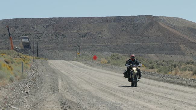
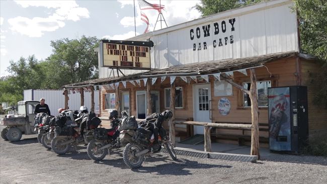
You can continue north down the mountain, but if you prefer an easier route, you can backtrack and get back on the dirt road you left before climbing the mountain. The route down the north side has an alternate campsite if you are planning your days a little differently than the layout we’ve put together in this article. Once down the mountain, head north to the town of Battle Mountain. Make sure to fill up with gas here as it’s the last fuel (and food) stop before Jarbidge at the end of day 3.
Eureka
Next Gas Stop: 194 Miles in Jarbidge.
Head north out of town and back into the desert. The slab quickly disappears for another fun gravel dirt road. This begins the section that we like to call “Badger Flats.” Numerous badger holes are in the area, so be careful and watch for them as you ride down this road.
The road drops off into another large valley. Follow the dirt road toward Squaw Valley, and eventually you meet up with Tuscarora County Road. If you have a bigger adventure-touring bike in your group, you can use this road as an EZ bypass and camp at Willow Creek Reservoir. Otherwise, head north up Toe Jam Creek to camp 2 in the flats below McCann Creek Mountain. Get a good night’s rest as the trails you’ll ride the next morning get pretty steep and technical. The regular route and the EZ bypass route meet up outside of Tuscarora on day 3.
Did you know that the town of Battle Mountain was awarded the title “Armpit of America” by the Washington Post in 2001? Interesting facts and trivia can be found below.
Eureka
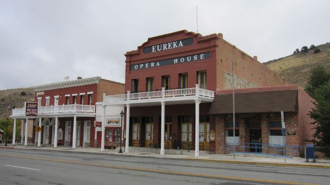
Prospectors discovered silver-lead ore on Prospect Peak in 1864 and settled in the area that soon became Eureka, named after the exclamation meaning “I found it,” which is often used at times of discovery. The mining town had grown to a population of 10,000 by 1878, but after the mines shut down in the 1890s, the population fizzled out. Today, just over 600 people reside in the community. One of the jewels of the town is the Eureka Opera House, which was built in 1880 and restored in 1993.
Ruby Hill
To the west of Eureka lies Ruby Hill, a mining community formed in 1869. The town was prosperous in its day – gaining a population of 2,500 – but never grew as large as Eureka. It suffered from starts and stops throughout the years before eventually becoming abandoned altogether.
Lone Mountain Mine
The route travels along the northern edge of Lone Mountain and passes part of the Lone Mountain Mine. The mine was active from 1942 to 1968 and produced zinc, lead and silver. Recent research suggests that it may continue to be an important mining operation in the future as well.
Pony Express
The Pony Express was started in April 1860 as a way to quickly deliver mail from Missouri to California, bridging the communication gap between the west and east coasts of the United States. Young men (often teenagers) who weighed less than 125 pounds rode for 10-hour shifts at top speed, switching horses at a station every 10 miles. Mail was delivered in only 10 days, compared to the normal 25 days by stagecoach, an unprecedented feat at the time (and something many had considered impossible). The initial price to send a half-ounce letter was $5 ($143 in today’s dollars after adjusting for inflation), making it a service that wasn’t affordable for most people. The opening of the transcontinental telegraph in October 1861 shut down the Pony Express only 18 months after it started. Although a financial failure, its memory has endured as an important part of the Old West.
Cortez Hills Mine
The Cortez Hills is a major gold mine, one of the largest (and lowest cost) in the world. Although it features a large open-pit mining operation, it also includes underground mining as well. The mine is owned by Barrick Nevada, a subsidiary of Barrick Gold (the largest gold mining company in the world).
Mount Tenabo
Mount Tenabo is an important part of the Western Shoshone religious tradition, a location where Western Shoshones still perform ceremonies and collect medicinal plants. It is also a prominent site in their creation stories. The nearby location of the Cortez Hills Mine and the exploitation of resources in an area that Western Shoshones consider rightfully and legally theirs has been the cause for a longstanding grievance against the United States government.
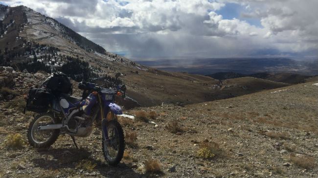
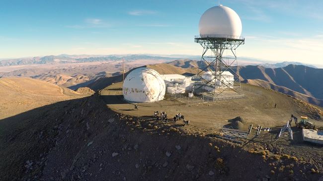
Mount Lewis
Part of the larger Battle Mountains of the Shoshone Range, Mount Lewis is the highest peak in the range. It is also the most topographically prominent peak in Lander County. The Battle Born North route travels to the summit, passing a Federal Aviation Administration Long Range Air Route Surveillance Radar station.
Lewis and Betty O'Neal Mine
The route travels nearby the remnants of Lewis, a ghost town that sprung up in part because of the discovery and subsequent operation of the Betty O’Neal Mine. A boiler exploded just months after the mine was opened, forcing it to close. After repairs were made, a fire destroyed the operation again two years later. The mine operated intermittently for years until it was finally shut down permanently in 1932.
Battle Mountain Town
Battle Mountain began in 1870 in support of the mining industry in the area, the specific site apparently chosen by the Central Pacific Railroad company. Over the years, the sleepy town was the home of personalities such as WJ Forbes, a famous newspaperman of the 1800s, and former Civil War general James Ledlie, whom Ulysses S. Grant called the “greatest coward of the war.” In 2001, the Washington Post bestowed the title “Armpit of America” on the town – a title which the Chamber of Commerce turned into an opportunity, starting the “Festival in the Pit” which was held annually for several years. Battle Mountain also hosts the “World Human Powered Speed Challenge” thanks to its long, flat stretch of highway outside of town.
Willow Creek Reservoir
If you take the EZ bypass route, the second day’s campsite is located at Willow Creek Reservoir, which was built in 1884. The reservoir had to be drained completely in 2007 due to a broken dam gate, and water levels suffered a few years later due to a drought. However, the reservoir remains a popular recreation spot, especially for fishing.
| Section Mileage | Elevation Range |
|---|---|
| Approx. 155 Miles | 4,876 ft - 8,487 ft |
GPS File Name: Battle Mtn to Jarbidge
GPS File Name: Rock Canyon EZ Bypass
GPS File Name: Alt EZR
GPS File Name: Jarbidge to Wendover
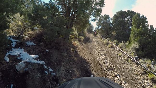
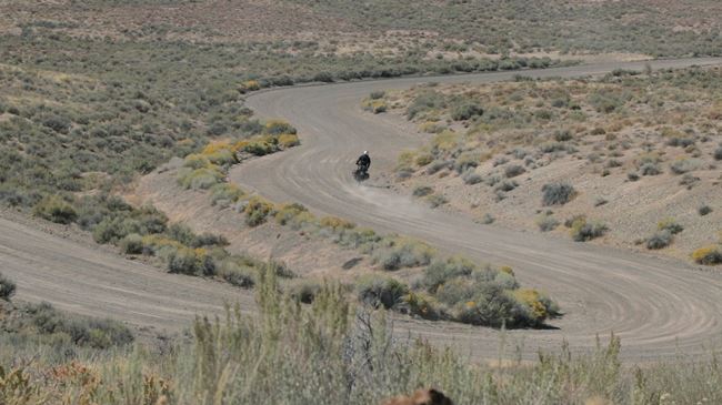
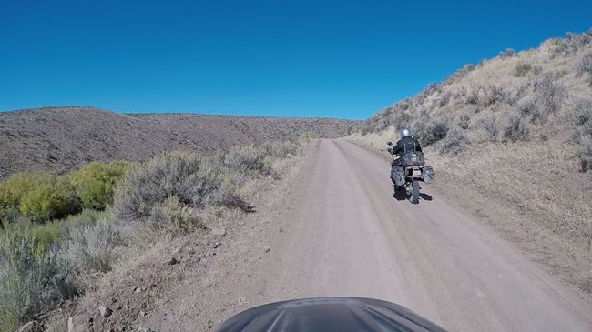
Day 3 is another action-packed day with some fun mountain two-track trails and wide-open places. As you leave camp 2, the canyon quickly closes into a tight trail with several creek crossings. The scenery is incredible in this stretch, and it just gets better and better!
Make your way up and around Dry Creek Mountain and over towards McCann Creek Mountain. This section of trail gets pretty rocky in places and makes for some fun practice avoiding the obstacles. The trails continue to climb, eventually reaching the summit of McCann Creek Mountain.
From there, begin your descent off the summit through more two-track trails. ADV mountain riding doesn’t get any better than this! As you drop down off the mountain, the trails start to open up to more views and fun riding. There are still some steeper downhill sections that can be a little harder with bigger bikes, so cover your brakes and be ready.
Keep dropping down until you reach the main dirt road east of Tuscarora. This is where the main route meets back up with the EZ bypass route from day 2. This road takes you out to the pavement on Highway 226. It runs into a fun, twisty canyon and follows Chicken Creek until the road splits. Take the right fork on Sheridan Gulch Road.
Continue on this road past Bull Run Reservoir, below Porter Peak and Pennsylvania Hill. The road winds through some aspens and eventually opens back up as you pass by a few ranches and meets back up with the slab. Follow Highway 225 north for about a mile before turning right onto Haystack Road towards Sunflower Flat and McDonald Creek.
This road goes about three and a half miles before reaching the next EZ bypass turnoff. The bypass takes you around the bottom side of Merritt Mountain, while the main route takes you up and over Merritt and Hicks Mountains on some steeper, more-challenging two-track mountain trails.
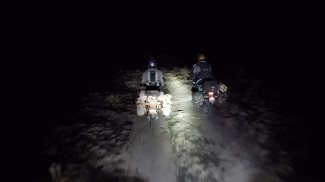
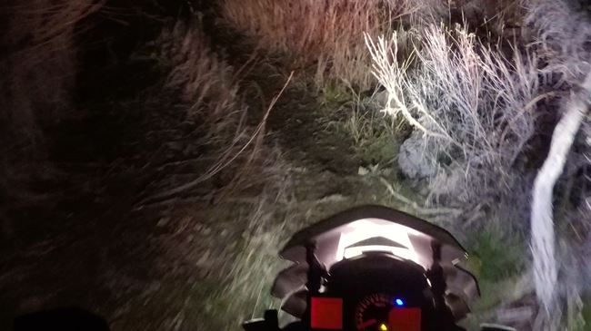
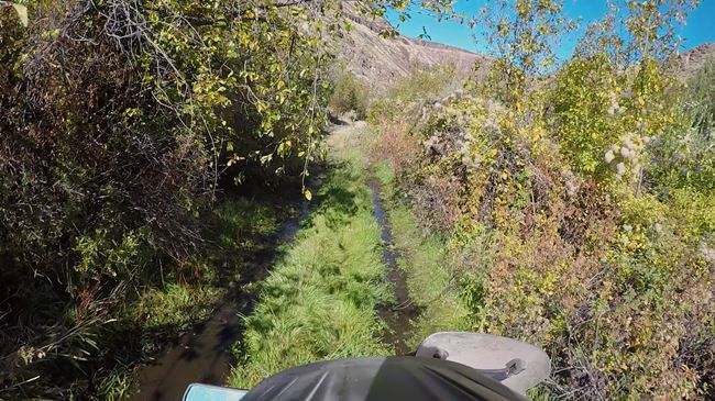
The main route goes through some cool canyons and past some crazy-looking rocks on fun and fast dirt roads. Up a little higher, the trail tightens through some trees as you climb up and around Hicks Mountain. Eventually, you make it above the pines on more epic two-track. The next section is McDonald Creek – aka “The Bat Cave,” a name we gave it several years ago when we ran this section in the dark while coming from the opposite direction.
As you work your way down into the canyon, the trail gets tougher and tighter with trees and water holes scattered along the way. Eventually, you meet back up with a more manageable dirt road. Travel parallel with the Bruneau River for a couple of miles through a cool rocky canyon; then climb up out of the canyon to meet back up with the EZ bypass route.
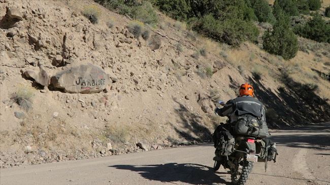
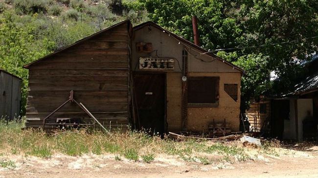
Jarbidge
Next Gas Stop: 137 Miles in Montello
Follow the road northeast, up around Bearpaw Mountain and just across the border into Idaho. Then follow the canyon south until you reach Jarbidge, which is a nice place to fuel up and grab a bite to eat. After leaving Jarbidge, climb up onto Deer Mountain through some cool forest roads until you reach camp 3.
Did you know that Jarbidge was the site of the last stagecoach robbery in the Old West? Interesting facts and trivia can be found below.
Tuscarora
Tuscarora got its start in 1867 when some brothers took several other prospectors and followed a rumor of gold. They found it and started mining in earnest, calling the new settlement Tuscarora after a Civil War ship. The town reached a population of 4,000-5,000 citizens in the late 1800s, and Chinese settlers (former railroad workers) represented about half of its residents. When the mines closed, the population dwindled to near ghost-town status. Despite its decline, Tuscarora continues to host a small number of residents to this day.
Aura
Aura was settled in 1905, named for the Latin word meaning gold. The town never had the huge boom that some other settlements had, but it did reach a population of 150 before its decline. Today, the only thing that remains of the entire town is the ruins of a saloon.
Aura
Patsville was founded in 1932 when the nearby Copper King Mine was discovered, and it really gained a footing thanks to the Rio Tinto Mine and the boom of the nearby Rio Tinto town. When the mine shut down in 1948, both settlements became ghost towns almost immediately. Rio Tinto is fenced off, but a few ruins of Patsville remain visible just off Highway 225.
Jarbidge
The route travels down Jarbidge Canyon. Due to a supervolcano eruption that occurred in the distant past, volcanic rock can be seen in the area. The town of Jarbidge is located at the bottom of the canyon and at the base of the Jarbidge Mountains. The town was formed in the early 1900s when gold was discovered in a nearby mine. It was one of the last gold rushes and boomtowns of the Old West, eventually gaining a population of 1,500. The town continues to exist today with a population of around 100. The area remains notable for its remoteness.
The last stagecoach robbery of the Old West took place in the area in 1916 when a stage wagon driver on his way to Jarbidge was ambushed and killed. The stolen $4,000 equates to over $85,000 in today’s dollars after adjustment for inflation. Ben Kuhl was arrested in relation to the incident, and a bloody palm print on an envelope resulted in his conviction – the first time palm prints were used to convict an American of murder. The money was never recovered and was rumored to have been buried somewhere in Jarbidge Canyon.
| Section Mileage | Elevation Range |
|---|---|
| Approx. 180 Miles | 4,219 ft - 8,004 ft |
GPS File Name: Jarbidge to Wendover
GPS File Name: EZ Bypass
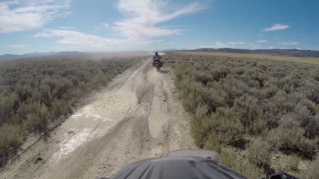
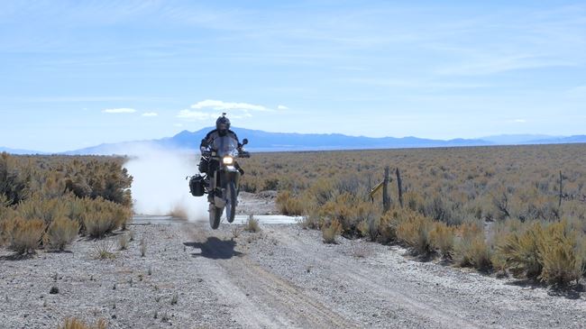
The last day begins by heading south, parallel with the Seventy-Six Creek down past Charleston. It’s about 16 miles on this dirt road before you change direction and head east. This runs you into a cool canyon and another fun two-track trail – a perfect route for adventure riding!
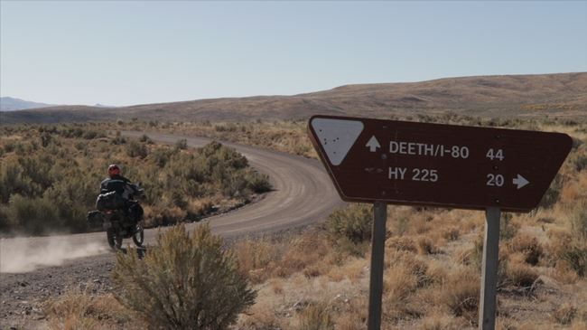
This road continues to wind up and down through the canyon, with the occasional rain rut and off-camber section. Eventually, you wind your way down to Mary’s River and cross the bridge over it. Make your way down to T Creek – one of several creek crossings you’ll navigate during the first half of the day. After crossing, the trail straightens out and opens up as you make your way over and connect to Deeth County Road.
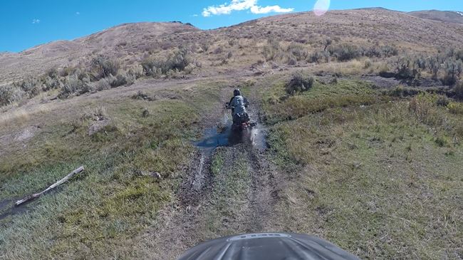
Stay on the road for only a couple of miles before taking a right and following the trail up another cool canyon. This grassy trail winds up past Fawn Basin and then on to West Fork Deer Creek. Be wary of this one – it can be deceptively deep.
From here, you begin your ascent on some fun mountain trails. These trails are fairly steep and may have a few rain ruts on the way up. Keep your momentum and speed up as you maneuver around the rocks and through the ruts. The trail smooths out into some faster trails that run up one hill and down another until you reach the top.
Drop off the mountain onto a two-track trail that is both fun and challenging. This takes you through some more trees and down into a small grove that houses a couple of older cabins. The road quickly gets back out into the open and onto a long straight road that leads to the Great Basin Highway.
Follow the highway south for about eight miles before taking a left towards Murdoch Mountain. This is a fun, open gravel road that tightens up a bit as you get closer to the mountain. The next section is made of fun and fast clay two-track that holds water well, so be careful when navigating it. Puddles and water-filled ruts can sneak up fast. The road takes you across the mountain through a winding canyon. Once on the other side, head south on the dirt super highway until you reach Montello.
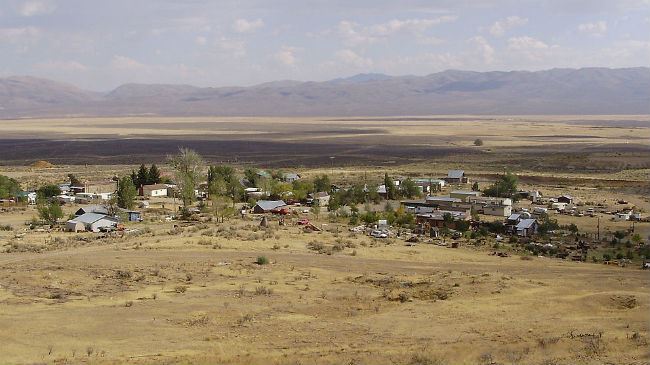
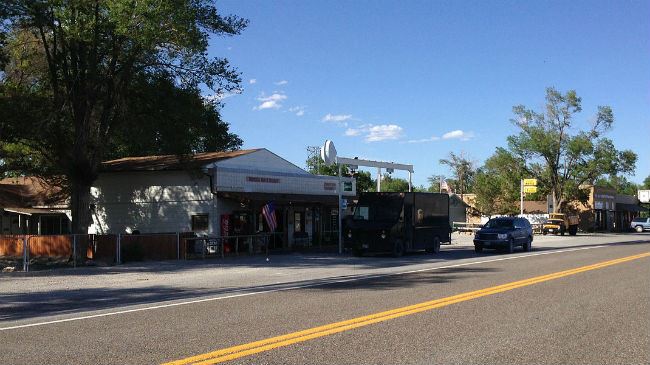
Montello
Next Gas Stop: 60 Miles in Wendover
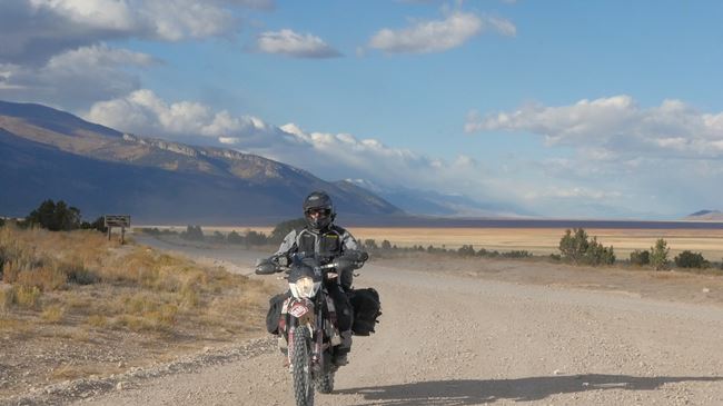
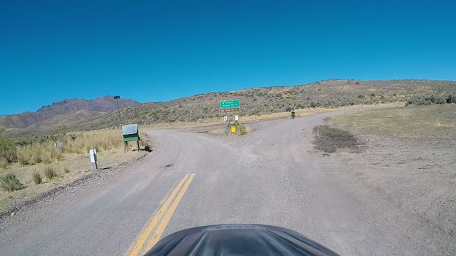
Montello is a cool little town near the Utah border. It’s your only gas stop of the day, and it’s a good place to get something to eat as well. Just outside of Montello is where the final EZ bypass comes into play. The bypass takes you up into Utah around the top of Bald Eagle Mountain. The normal route has a really steep and loose downhill section that could be too much for larger adventure bikes.
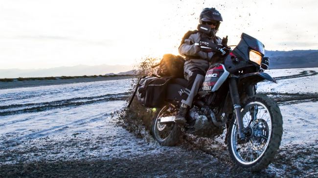
If you take the normal route, hop off the pavement back onto dirt, and follow the trail up the mountain. It gets rocky and washed out as you climb. At the top is a spectacular view of the salt flats. Then it’s time to begin the technical downhill section. Check your brakes before starting off as too much speed could quickly get you into trouble.
Continue to drop down off the mountain until you reach the flats where the route connects back up with the EZ bypass. From there, it’s a fast gravel road that winds into Nevada and back out again. The road meets back up with pavement and travels below Volcano Peak. Turn right to go back into Wendover. You can also turn left to check out the Bonneville Salt Flats.
Did you know that Lucin has a population of one person – a Czech inventor who flew over the iron curtain with a homemade glider and resettled in America? Interesting facts and trivia can be found below.
Charleston
Charleston was originally formed in 1876 as a settlement called Mardis, named after a local miner with a memorable face (as a mining accident had taken one eye and scarred half of his face). The town failed in 1883 but was revived as Bayard. The settlement shut down again but was revived a second time as Charleston in 1895. By 1900, it had a population of 40 and finally gained some stability with the arrival of the large Prunty family. The town lasted another 50 years, and many of the Prunty descendants still live in the area (albeit as ranchers, not miners).
Abandoned buildings along Elko County Route 746 (North Fork-Charleston Road) in Charleston, Nevada by Famartin (CC BY-SA 3.0)
Montello
Montello was formed in 1904. Unlike many of the other communities in the area, it was established as a support for the railroad and not as a result of mining activity. Its population eventually got up to around 800. It was crippled in the 1940s and 1950s as many of its railroad servicing purposes became obsolete when trains shifted from steam to diesel engines. Today, it has fewer than 100 residents.
Buildings along Nevada State Route 233 (Montello Road) in Montello, Nevada by Famartin (CC BY-SA 3.0)
Lucin
Lucin was established around the same time as Montello and for the same purpose. However, the town became a ghost town in the 1930s after it was abandoned. In recent years, Ivo Zdarsky – a man notable for escaping Czechoslovakia in 1984 during the Cold War by flying a homemade glider over the Iron Curtain to the Vienna airport – purchased the land and moved there, causing Lucin to now have a population of one person.
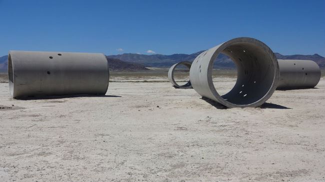
Sun Tunnels
About three miles off of one of the EZ bypass routes lies the Sun Tunnels, a massive piece art consisting of four separate concrete tunnels. The artwork was developed with the desert sun in mind, and it aligns with the sunrise and sunset on the summer and winter solstices, creating a particularly stunning effect as the sun’s image passes directly through the tunnels’ centers. They were created by Nancy Holt, an artist who was known for her land art and sculptures.
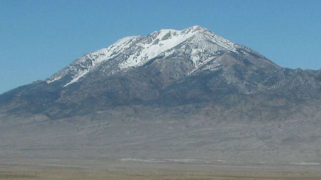
Pilot Range
The route crosses over the Pilot Mountain Range and travels near its base on the eastern side. The mountains are home to a variety of species, including the Pilot Range cinquefoil, which is only found on this and a few other nearby mountain ranges. The highest mountain in the range is known as Pilot Peak and was used as a landmark for travelers in the past, including explorer John C. Fremont and the ill-fated Donner Party.
Conclusion
Once you connect with White Pine County Road 1, turn south and follow the road until it turns into pavement on Highway 892. Ride it down until the turnoff for camp 1. There are a few miles of windy dirt roads as you climb and crest the last peak of the day on your way toward Eureka. The camp spot is within the Diamond Mountains about seven miles outside of Eureka.
Disclaimer
Route information and GPS files are provided to you "as is". Rocky Mountain ATV/MC and RM Rides makes no warranty that the information contained therein is accurate or the information is fit for any particular use. Furthermore, Rocky Mountain ATV/MC and RM Rides disclaim all liability from any damages which may arise (directly or indirectly) from your access and use of the information or files. By accessing the route information or GPS files, you acknowledge that you take full responsibility for your actions (or lack of action) in relation to them. The information and details supplied are not a substitute for proper planning. Check with the official representatives of the agency or organization that governs or operates a particular riding location, gas station, campsite, or point of interest to determine current accessibility, special rules, hours of operation, or exact boundaries that are appropriate for powersport vehicle use.
Disclaimer
Riding any type of powersports vehicle can be a dangerous activity and is done at your own risk. The riding tips, techniques, videos, and photos that Rocky Mountain ATV/MC posts on this site feature both professional and experienced riders and may cause serious injury or even death. Riding at high speeds or participating in stunt riding is inherently dangerous. Rocky Mountain ATV/MC disclaims all liability from any and all losses, damages, injuries, paralysis, or death that may occur by trying any of the riding tips, techniques, stunts, photos, videos, or content found on this website, either posted by Rocky Mountain ATV/MC or visitors of the site. Furthermore, we recommend you always wear a helmet and the appropriate safety gear when riding and that you assess your own capabilities and skill level before attempting any rid, terrain, stunt, or technique. Some of the content, videos, and photos presented on this site have been sent to us by our customers. All information presented in the content, videos, and photos, including tricks, views, opinions, or positions of Rocky Mountain ATV/MC or their affiliates.